

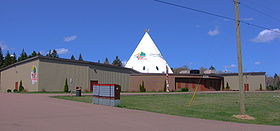
Fort Folly 1, New Brunswick
Encyclopedia
Indian reserve
In Canada, an Indian reserve is specified by the Indian Act as a "tract of land, the legal title to which is vested in Her Majesty, that has been set apart by Her Majesty for the use and benefit of a band." The Act also specifies that land reserved for the use and benefit of a band which is not...
located near Dorchester
Dorchester, New Brunswick
Dorchester is a Canadian village and shire town in Westmorland County, New Brunswick.It is located on the eastern side of the mouth of the lush Memramcook River valley near the river's discharge point into Shepody Bay...
in Westmorland County
Westmorland County, New Brunswick
Westmorland County is located in southeastern New Brunswick, Canada. The county contains the fast-growing commercial centre of Moncton as well as its northern and eastern suburbs...
, New Brunswick
New Brunswick
New Brunswick is one of Canada's three Maritime provinces and is the only province in the federation that is constitutionally bilingual . The provincial capital is Fredericton and Saint John is the most populous city. Greater Moncton is the largest Census Metropolitan Area...
, Canada
Canada
Canada is a North American country consisting of ten provinces and three territories. Located in the northern part of the continent, it extends from the Atlantic Ocean in the east to the Pacific Ocean in the west, and northward into the Arctic Ocean...
.
Background
Fort Folly 1 is the territory of the Fort Folly First NationFort Folly First Nation
The Fort Folly First Nation is a Mi'kmaq First Nation located near the village of Dorchester, New Brunswick, Canada.-Population:The First Nation had a total of 111 people registered as of October 2008, of which 29 lived on their own reserve.-Governance:...
. The reserve is home to the smallest Mi'kmaq community in the province. The First Nation had a total of 111 people registered as of October 2008, of which 29 lived on their own reserve, and remaining population live either on a different reserve or off the reserve.
The reserve has an area of 56.1 hectares (138.6 acre). This reserve came into existence in 1840, under the New Brunswick Indian Act. It has year-round road access. The reserve is located in the traditional territory of the people of Kwesawék Amlamkuk, which roughly translated from the Míkmaq language means "the delta where the multicoloured rivers meet". That description is based on the original location of the Fort Folly reserve at Beaumont
Memramcook, New Brunswick
Memramcook is a Canadian village in Westmorland County, New Brunswick. Located in south-eastern New Brunswick, the community is predominantly people of Acadian descent who speak the Chiac derivative of the French language....
on the Petitcodiac River
Petitcodiac River
The Petitcodiac River is a Canadian river in south-eastern New Brunswick. The river runs about through the province's Westmorland, Albert, and Kings counties, draining a watershed area of about . The region around the river features valleys, ridges, and rolling hills, and is home to a diverse...
.
External links
- Reserve/Settlement/Villages Detail: 06014—Fort Folly 1, Indian and Northern Affairs CanadaIndian and Northern Affairs CanadaThe Department of Aboriginal Affairs and Northern Development is the department of the government of Canada with responsibility for policies relating to Aboriginal peoples...
- Fort Folly History