
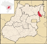
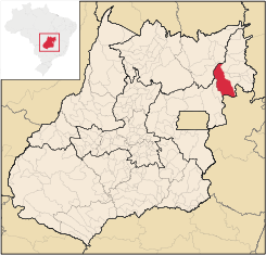
Flores de Goiás
Encyclopedia
| Flores de Goiás | |
|---|---|
| State | Goiás Goiás Goiás is a state of Brazil, located in the central part of the country. The name Goiás comes from the name of an indigenous community... |
| Geographical Coordinates: | 14°27′38"S 47°01′54"W |
| Area: | 3,709.4 km² |
| Population: | 10,382(IBGE 2007) |
| Elevation: | 440m |
| Postcode (CEP): | 73890-000 |
| IBGE statistical microregion: | 018 Vão do Paranã |
| Became a city: | 1853 |
| Mayor: | Maria dos Reis de Souza Ferreira Leal |
| Distance to Goiânia Goiânia -Climate:The city has a tropical wet and dry climate with an average temperature of . There's a wet season, from October to April, and a dry one, from May to September. Annual rainfall is around 1,520 mm.... : |
438 km. |
| Website: | n/a |
Town
A town is a human settlement larger than a village but smaller than a city. The size a settlement must be in order to be called a "town" varies considerably in different parts of the world, so that, for example, many American "small towns" seem to British people to be no more than villages, while...
and municipality
Municipality
A municipality is essentially an urban administrative division having corporate status and usually powers of self-government. It can also be used to mean the governing body of a municipality. A municipality is a general-purpose administrative subdivision, as opposed to a special-purpose district...
in northeastern Goiás
Goiás
Goiás is a state of Brazil, located in the central part of the country. The name Goiás comes from the name of an indigenous community...
state, Brazil
Brazil
Brazil , officially the Federative Republic of Brazil , is the largest country in South America. It is the world's fifth largest country, both by geographical area and by population with over 192 million people...
.
Geography
Located in the Vão do Paranã statistical micro-region, Flores has boundaries with BuritisBuritis
Buritis is a small city and municipality in northern Minas Gerais state, Brazil. It is located just south of the Urucuia River, which is a tributary of the São Francisco River.-Highway connections:...
, Sítio d'Abadia
Sítio d'Abadia
Sítio d'Abadia is a small town and municipality in eastern Goiás state, Brazil.-Location:Sítio d'Abadia is located in a corner of eastern Goiás, 14 kilometers north of the border with Minas Gerais. It is about 30 kilometers west of the border with Bahia...
, Vila Boa
Vila Boa, Goiás
Vila Boa is a small town and municipality in northeastern Goiás state, Brazil.-Location:Vila Boa is located on the extreme northeast limit of the Entorno de Brasília microregion. The nearest major population center is Formosa, which is 95 km. to the southeast...
, Alvorada do Norte
Alvorada do Norte
Alvorada do Norte is a small town and municipality in northeastern Goiás state, Brazil. It is an important commercial center on the Brasília-Salvador highway.-Location:...
, Iaciara
Iaciara
Iaciara is a small town and municipality in northeastern Goiás state, Brazil.-Geography:Iaciara is located in Vão do Paranã statistical micro-region, which borders the state of Bahia. The distance to the state capital of Goiânia is 548 kilometers...
, Nova Roma
Nova Roma
Nova Roma is an international Roman revivalist and reconstructionist organization created in 1998 by Joseph Bloch and William Bradford, later incorporated in Maine as a non-profit organization with an educational and religious mission...
, São João d'Aliança
São João d'Aliança
São João d'Aliança is a small town and municipality in northeastern Goiás state, Brazil. São João is a gateway to the Chapada dos Veadeiros National Park. The name is sometimes written as São João D'Aliança.-Location:...
, Formosa
Formosa, Goiás
Formosa is a city and municipality located in the state of Goiás, Brazil, approximately 80 kilometers east of Brasília. The population was 90,247 in a total area of 5,806.89 km² . Formosa is known for its waterfalls and natural beauty...
and Alto Paraíso de Goiás
Alto Paraíso de Goiás
Alto Paraíso de Goiás is a small town and a municipality in northeastern Goiás state, Brazil. It has become known for its ecological and New Age tourism.-Location:...
.
The distance to Goiânia
Goiânia
-Climate:The city has a tropical wet and dry climate with an average temperature of . There's a wet season, from October to April, and a dry one, from May to September. Annual rainfall is around 1,520 mm....
is 438 km. Highway connections with Goiânia
Goiânia
-Climate:The city has a tropical wet and dry climate with an average temperature of . There's a wet season, from October to April, and a dry one, from May to September. Annual rainfall is around 1,520 mm....
are made by BR-153 / Anápolis / GO-060 / Alexânia / Planaltina / Formosa / GO-020 / BR-030 / Vila Boa / GO-114.
The Rio Paranã supplies much of the water for irrigation of the crops and filling up of small dams for livestock raising. Other rivers of importance are: Macacos, Piripiri, Santa Maria, Corrente, Canabrava, Bonifácio, Gameleira and Macacão.
The relief is varied with a mixture of mountains, plains, and uplands. The main climate is semi-humid hot tropical, with four to five dry months. The vegetation still shows traces of native tropical forest.
Demographics
- Population density: 2.80 inhab/km²
- Total population in 1980: 3,888
- Total population in 2007: 10,382
- Urban population: 2,875
- Rural population: 7,507
- Population growth rate: 6.21%
Economy
The economy is still based on large ranch holdings. Cattle raising is the main occupation followed by swine, sheep and poultry raising. Cattle are sold in FormosaFormosa, Goiás
Formosa is a city and municipality located in the state of Goiás, Brazil, approximately 80 kilometers east of Brasília. The population was 90,247 in a total area of 5,806.89 km² . Formosa is known for its waterfalls and natural beauty...
, Brasília
Brasília
Brasília is the capital city of Brazil. The name is commonly spelled Brasilia in English. The city and its District are located in the Central-West region of the country, along a plateau known as Planalto Central. It has a population of about 2,557,000 as of the 2008 IBGE estimate, making it the...
, and São Paulo
São Paulo
São Paulo is the largest city in Brazil, the largest city in the southern hemisphere and South America, and the world's seventh largest city by population. The metropolis is anchor to the São Paulo metropolitan area, ranked as the second-most populous metropolitan area in the Americas and among...
. Most of the big cattle ranchers as well as the planters are from the south of the country. They are either Gaúchos or Parananeses. Almost all of the cattle raised are Nelore
Nelore
Nelore or Nellore beef cattle originated from Ongole cattle originally brought to Brazil from India. They are named for the district of Nellore in Andhra Pradesh. The Nelore has a distinct large hump over the top of the shoulder and neck. They have long legs which help them to walk in water and...
. They raise cattle to fatten them and then they sell them in large auctions in Formosa. Other farmers from the south have planted irrigated rice, soybeans, and corn, but Flores is still known as cattle country.
Economic Data
- Industrial establishments: 0
- Retail commercial establishments: 42
- Motor vehicles (automobiles and pickup trucks): 240 (2007)
- Inhabitants per motor vehicle: 43.2 (2007)
Main agricultural production in planted area
- Rice: 5,300 ha.
- Banana: 16 ha.
- Sugarcane: 14 ha.
- Beans: 300 ha.
- Manioc: 80 ha.
- Corn: 5.000 ha.
- Soybeans: 2,500
Agricultural data 2006
- Farms: 1,625
- Total area: 199,700 ha.
- Area of permanent crops: 1,112 ha.
- Area of perennial crops: 15,413 ha.
- Area of natural pasture: 119,373 ha.
- Area of woodland and forests: 48,951 ha.
- Persons dependent on farming: 2,000
- Cattle herd: 186,109
Health and education
- Municipal Human Development IndexHuman Development IndexThe Human Development Index is a composite statistic used to rank countries by level of "human development" and separate "very high human development", "high human development", "medium human development", and "low human development" countries...
: 0.642 - State ranking: 236 (out of 242 municipalities in 2000)
- National ranking: 3,888 (out of 5,507 municipalities in 2000) (All data are from 2000.)
- Hospitals: 1 with 7 beds (4 public health clinics)
- Schools: 21 with 3,290 students
History
Flores began in 1838 as a district of the now extinct municipality of Forte. In 1907 the district was transferred to the municipality of Sítio d'AbadiaSítio d'Abadia
Sítio d'Abadia is a small town and municipality in eastern Goiás state, Brazil.-Location:Sítio d'Abadia is located in a corner of eastern Goiás, 14 kilometers north of the border with Minas Gerais. It is about 30 kilometers west of the border with Bahia...
. In 1953 the name was changed to Urutagua and finally in 1963 the name was changed again to Flores de Goiás and it became its own municipality.
Notes