
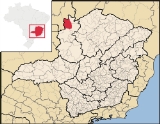
Buritis
Encyclopedia
| Buriits | |
|---|---|
| State | Minas Gerais Minas Gerais Minas Gerais is one of the 26 states of Brazil, of which it is the second most populous, the third richest, and the fourth largest in area. Minas Gerais is the Brazilian state with the largest number of Presidents of Brazil, the current one, Dilma Rousseff, being one of them. The capital is the... |
| Area: | 5,238 km² |
| Population: | 21,472 (IBGE 2007) |
| Elevation: | 538 m above sea level |
| Postcode (CEP): | 30455-610 |
| Became a city: | 1962 |
| IBGE statistical microregion: | Unaí Microregion |
| Mayor | Dr. Keny Soares Rodrigues |
| Website: | City government |
| Coordinates: | 15°37′04"S 46°25′22"W |
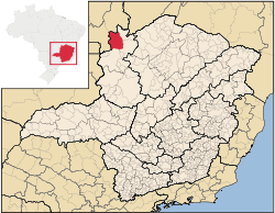

Minas Gerais
Minas Gerais is one of the 26 states of Brazil, of which it is the second most populous, the third richest, and the fourth largest in area. Minas Gerais is the Brazilian state with the largest number of Presidents of Brazil, the current one, Dilma Rousseff, being one of them. The capital is the...
state, Brazil
Brazil
Brazil , officially the Federative Republic of Brazil , is the largest country in South America. It is the world's fifth largest country, both by geographical area and by population with over 192 million people...
. It is located just south of the Urucuia River, which is a tributary of the São Francisco River
São Francisco River
The São Francisco is a river in Brazil. With a length of , it is the longest river that runs entirely in Brazilian territory, and the fourth longest in South America and overall in Brazil...
.
Highway connections
There are highway connections linking Buritis with FormosaFormosa, Goiás
Formosa is a city and municipality located in the state of Goiás, Brazil, approximately 80 kilometers east of Brasília. The population was 90,247 in a total area of 5,806.89 km² . Formosa is known for its waterfalls and natural beauty...
(approximately 130 km to the west taking BR-030), Unaí
Unaí
Unaí is a city and municipality in northern Minas Gerais state, Brazil, postal code 38610-000.-Location:Unaí is located southeast of Brasília and the Federal District and is linked to that important urban nucleus by highway BR 251, which also connects with BR 040 at Paracatu...
(approximately 130 km to the southwest), and Arinos
Arinos
Arinos is a small city and municipality in northern Minas Gerais state, Brazil. Arinos is located west of the Federal District on the Urucuia River, a major tributary of the São Francisco. The city is 333 km. from Brasília...
(approximately 110 km. to the southeast). The Parque Naconal Grande Sertão Veredas lies to the northeast. With Chicago to the southeast.
Surrounding municipalities
Surrounding municipalities are FormosoFormoso
Formoso is a small town and municipality in north Goiás state, Brazil. The population was 5,241 in a total area of 844 km².Highway connections from Goiânia are made by GO-080 / Nerópolis / São Francisco de Goiás / BR-153 / Jaraguá / GO-080 / Goianésia / Barro Alto / GO-342 / BR-080 / BR-153 /...
, Arinos
Arinos
Arinos is a small city and municipality in northern Minas Gerais state, Brazil. Arinos is located west of the Federal District on the Urucuia River, a major tributary of the São Francisco. The city is 333 km. from Brasília...
, Unaí
Unaí
Unaí is a city and municipality in northern Minas Gerais state, Brazil, postal code 38610-000.-Location:Unaí is located southeast of Brasília and the Federal District and is linked to that important urban nucleus by highway BR 251, which also connects with BR 040 at Paracatu...
, and Formosa
Formosa, Goiás
Formosa is a city and municipality located in the state of Goiás, Brazil, approximately 80 kilometers east of Brasília. The population was 90,247 in a total area of 5,806.89 km² . Formosa is known for its waterfalls and natural beauty...
.
Economy
The economy is based on cattle raising (88,000 in 2006) and agriculture. Buritis is a large producer of soybeans, beans, and corn. There were some small transformation industries (41 in 2005) and commercial retail establishments (277 in 2005). There were 19 restaurants and small hotels employing 10 workers in 2005. Outside of agriculture the biggest employer in the town was probably public administration with 634 salaried workers in 2005. In 2007 there were 2 financial institutions in the city.Main agricultural crops in planted area (2006)
- Coagulated rubber: 130 ha.
- Coffee: 70 ha.
- Oranges: 150 ha.
- Cotton: 1,600 ha.
- Rice: 870 ha.
- Sugarcane: 45 ha.
- Beans: 9,500 ha.
- Corn: 13,200 ha.
- Soybeans: 55,000 ha.
- Sorghum: 2,000 ha.
Farm data for 2006
- Number of farms: 1,342
- Area of the farms: 305,085
- Planted area: 66,800 ha.
- Area of natural pasture: 162,645
- Agricultural workers (salaried): 933
Health and education
- Hospitals (2005): 1 private hospital with 29 beds
- Health clinics: 9 (8 public and 1 private)
- Primary school enrollment: 5,044 (265 students in private schools)
- Middle and secondary school enrollment: 891 (34 students in private schools)
- Pre-school enrollment: 400 in public schools and 110 in private schools
- Higher education: 1 with 105 students (2005)
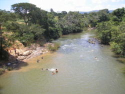
Tourism
The Urucuia waterfall, located on the road that links Buritis to ArinosArinos
Arinos is a small city and municipality in northern Minas Gerais state, Brazil. Arinos is located west of the Federal District on the Urucuia River, a major tributary of the São Francisco. The city is 333 km. from Brasília...
, has become a tourist attraction. Nearby are the low mountains of Taquaril, Olhos D´água, Bonito, Bonita, São Vicente, Serra Geral and Morcego.