Faridkot District
Encyclopedia

Government body
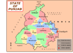
Prior to independence large part of the district was under the princely rule of Sikh Maharaja of Faridkot and later it became part of the Patiala & East Punjab States Union (PEPSU ) in 1948. Faridkot was carved out as a separate district on 7 August 1972 out of the areas of Bathinda District (Faridkot Tehsil) and Ferozepur District (Moga and Muktsar Tehsils). However in November 1995, the Faridkot District was trifurcated when two of its sub divisions viz Muktsar and Moga were given the status of independent districts.Faridkot district is surrounded by district Ferozepur in the North-West, Muktsar in the South-West, Bathinda in the South and Moga in the West. The District covers an area of 1469 km2. which is 2.92% of the total area of the State and accommodates a population of 552,466, which is 2.27% of the total population of the State. It has two Sub divisions/ Tehsils namely Faridkot and Jaito and two Sub Tehsils namely Kotkapura and Sadiq comprising a total of 171 villages. Faridkot District has two development blocks namely Faridkot and Kotkapura.
Overview
The Faridkot district contains a number of small towns. More than 7 villages are quite notable in Faridkot area. Faridkot is a hub for premier educational institutions. North India's only Medical University, also named after Baba Farid is in Faridkot besides Medical, Engineering and Dental Colleges. Faridkot majority population is dominated by Jatts.Demographics
According to the 2011 census2011 census of India
The 15th Indian National census was conducted in two phases, houselisting and population enumeration. Houselisting phase began on April 1, 2010 and involved collection of information about all buildings...
Faridkot district has a population
Demographics of India
The demographics of India are inclusive of the second most populous country in the world, with over 1.21 billion people , more than a sixth of the world's population. Already containing 17.5% of the world's population, India is projected to be the world's most populous country by 2025, surpassing...
of 618,008, roughly equal to the nation of Solomon Islands
Solomon Islands
Solomon Islands is a sovereign state in Oceania, east of Papua New Guinea, consisting of nearly one thousand islands. It covers a land mass of . The capital, Honiara, is located on the island of Guadalcanal...
or the US state of Vermont
Vermont
Vermont is a state in the New England region of the northeastern United States of America. The state ranks 43rd in land area, , and 45th in total area. Its population according to the 2010 census, 630,337, is the second smallest in the country, larger only than Wyoming. It is the only New England...
. This gives it a ranking of 519th in India (out of a total of 640
Districts of India
A district is an administrative division of an Indian state or territory. Districts are further subdivided, in some cases into Sub-Divisions, and otherwise directly into tehsils or talukas.District officials include:...
).
The district has a population density of 424 PD/sqkm . Its population growth rate
Family planning in India
Family planning in India is based on efforts largely sponsored by the Indian government. In the 1965-2009 period, contraceptive usage has more than tripled and the fertility rate has more than halved , but the national fertility rate is still high enough to cause long-term population growth...
over the decade 2001-2011 was 12.18 %. Faridkot has a sex ratio
Sex ratio
Sex ratio is the ratio of males to females in a population. The primary sex ratio is the ratio at the time of conception, secondary sex ratio is the ratio at time of birth, and tertiary sex ratio is the ratio of mature organisms....
of 889 females
Women in India
The status of women in India has been subject to many great changes over the past few millennia. From equal status with men in ancient times through the low points of the medieval period, to the promotion of equal rights by many reformers, the history of women in India has been eventful...
for every 1000 males, and a literacy rate
Literacy in India
Literacy in India is key for socio-economic progress, and the Indian literacy rate grew to 74.04% in 2011 from 12% at the end of British rule in 1947. Although this was a greater than sixfold improvement, the level is well below the world average literacy rate of 84%, and India currently has the...
of 70.6 %.

