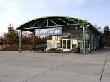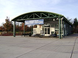
Eltingville Transit Center
Encyclopedia
| Eltingville Transit Center |
|
|---|---|
 |
|
| Opening date: | 2004 |
| Number of routes: | 7 local bus routes 9 express bus routes |
| Operated by: | MTA Metropolitan Transportation Authority (New York) The Metropolitan Transportation Authority of the State of New York is a public benefit corporation responsible for public transportation in the U.S... and New York State Department of Transportation New York State Department of Transportation The New York State Department of Transportation is responsible for the development and operation of highways, railroads, mass transit systems, ports, waterways and aviation facilities in the U.S... |
| Services: | Ticket Vending Machines, Restrooms, Snack vending machines |
The Eltingville Transit Center is a park and ride
Park and ride
Park and ride facilities are car parks with connections to public transport that allow commuters and other people wishing to travel into city centres to leave their vehicles and transfer to a bus, rail system , or carpool for the rest of their trip...
transit center that is located in Eltingville, Staten Island
Eltingville, Staten Island
Eltingville is the name of a neighborhood on Staten Island, one of the five boroughs of New York City, USA. It is on the island's South Shore, immediately to the south of Great Kills and north of Annadale...
. It is located at the intersection of Arthur Kill Road and Richmond Avenue, near the end of the Korean War Veterans Parkway
Korean War Veterans Parkway
The Richmond Parkway is a Parkway that traverses the South Shore of Staten Island, New York, USA from southwest to northeast...
. The transit center was completed in 2004. Amenities include free parking, and vending machines for soda, snacks, and MetroCards. The center is halfway between the Eltingville Staten Island Railway
Eltingville (Staten Island Railway station)
Eltingville is an elevated Staten Island Railway station in the neighborhood of Eltingville, Staten Island, New York. It is located at Richmond Avenue on the main line. It contains two side platforms, orange canopies and walls, and staircases at the western end only that lead to Richmond Avenue...
station and the Staten Island Mall
Staten Island Mall
Staten Island Mall is a shopping mall in the Staten Island borough of New York City, United States. It is the only indoor shopping mall in the borough. It is the largest retail center on the island and is the site of the island's second largest public transit hub after the St...
, another (albeit unofficial) transit center, including the adjacent Yukon Depot.
Local/Limited
- S55: Staten Island MallStaten Island MallStaten Island Mall is a shopping mall in the Staten Island borough of New York City, United States. It is the only indoor shopping mall in the borough. It is the largest retail center on the island and is the site of the island's second largest public transit hub after the St...
to Arthur Kill Correctional FacilityArthur Kill Correctional FacilityArthur Kill Correctional Facility is a medium security correctional facility opened in 1976 operated by the New York State Department of Correctional Services. Arthur Kill is located in New York City in the Borough of Staten Island...
via Annadale Road - S56: Staten Island MallStaten Island MallStaten Island Mall is a shopping mall in the Staten Island borough of New York City, United States. It is the only indoor shopping mall in the borough. It is the largest retail center on the island and is the site of the island's second largest public transit hub after the St...
to Tottenville High SchoolTottenville High SchoolTottenville High School is located at 100 Luten Avenue, in Huguenot, Staten Island, New York. It is within walking distance of the Huguenot train station of the Staten Island Railway system. Tottenville H.S. is in administrative district 31. The school’s current principal is John P. Tuminaro...
via Arden Avenue - S59: Port RichmondPort Richmond, Staten IslandPort Richmond is a neighborhood situated on the North Shore of Staten Island, one of the five boroughs of New York City, United States. It is along the waterfront of the Kill Van Kull, with the southern terminus of the Bayonne Bridge serving as the boundary between it and Mariners Harbor, the...
to EltingvilleEltingville, Staten IslandEltingville is the name of a neighborhood on Staten Island, one of the five boroughs of New York City, USA. It is on the island's South Shore, immediately to the south of Great Kills and north of Annadale...
(with a peak extension to TottenvilleTottenville, Staten IslandTottenville with an area of approx. , is the southernmost neighborhood of Staten Island, New York City and New York State. Originally named Bentley Manor by one of its first settlers, Captain Christopher Billop , after a small ship he owned named the Bentley, the district was renamed Tottenville in...
) - S74/S84: St. GeorgeSt. George, Staten IslandSt. George is a neighborhood on the northeastern tip of Staten Island in New York City, where the Kill Van Kull enters Upper New York Bay. It is the most densely developed neighborhood on Staten Island, and the location of the administrative center for the borough and for the coterminous Richmond...
Ferry Terminal to Tottenville via Richmond and Arthur Kill Roads - S79: Staten Island Mall to Bay RidgeBay Ridge, BrooklynBay Ridge is a neighborhood in the southwest corner of the New York City borough of Brooklyn, USA. It is bounded by Sunset Park on the north, Seventh Avenue and Dyker Heights on the east, The Narrows Strait, which partially houses the Belt Parkway, on the west and 86th Street and Fort Hamilton on...
via Hylan BoulevardHylan BoulevardHylan Boulevard is a major northeast-southwest boulevard in the New York City borough of Staten Island. It is approximately long , and runs from the North Shore neighborhood of Rosebank to the South Shore neighborhood of Tottenville.... - S89: 34th Street34th Street (HBLR station)34th Street is a station on the Hudson-Bergen Light Rail located at Avenue E and East 34th Street in Bayonne, New Jersey.The station opened on April 22, 2000. Northbound service from the station is available to Hoboken Terminal...
HBLR station to Eltingville via Richmond Avenue
Express
- X1: Hylan Boulevard to Midtown, ManhattanMidtown ManhattanMidtown Manhattan, or simply Midtown, is an area of Manhattan, New York City home to world-famous commercial zones such as Rockefeller Center, Broadway, and Times Square...
via Church Street and 6 Avenue - X4: World Financial CenterWorld Financial CenterThe World Financial Center is a complex of buildings across West Street from the World Trade Center site in Lower Manhattan in New York City, overlooking the Hudson River. This complex is home to offices of companies including Merrill Lynch, RBC Capital Markets, Nomura Group, the Wall Street...
via Church Street - X5: Midtown Manhattan via Madison Avenue
- X7: Midtown Manhattan via West Street and Sixth Avenue
- X8/X15: Lower ManhattanLower ManhattanLower Manhattan is the southernmost part of the island of Manhattan, the main island and center of business and government of the City of New York...
Downtown Loop - X17A: Lower Manhattan via Church Street
- X17C: Midtown Manhattan via Church Street, 6 Avenue, and Madison Avenue
- X17J: Midtown Manhattan via the New Jersey TurnpikeNew Jersey TurnpikeThe New Jersey Turnpike is a toll road in New Jersey, maintained by the New Jersey Turnpike Authority. According to the International Bridge, Tunnel and Turnpike Association, the Turnpike is the nation's sixth-busiest toll road and is among one of the most heavily traveled highways in the United...
- X31: Midtown Manhattan via West Street and Madison Avenue

