
Hylan Boulevard
Encyclopedia

Staten Island
Staten Island is a borough of New York City, New York, United States, located in the southwest part of the city. Staten Island is separated from New Jersey by the Arthur Kill and the Kill Van Kull, and from the rest of New York by New York Bay...
. It is approximately 14 miles (22.5 km) long (22.53 kilometers), and runs from the North Shore
North Shore, Staten Island
The term North Shore is frequently applied to a series of neighborhoods within New York City's borough of Staten Island, USA.- Boundaries :...
neighborhood of Rosebank
Rosebank, Staten Island
Rosebank is a neighborhood in the northeastern part of Staten Island, one of the five boroughs of New York City.Originally called Peterstown, the name "Rosebank" appears to have been first used to denote the neighborhood around 1880...
to the South Shore
South Shore, Staten Island
The South Shore is a geographical term applied to the area in the New York City borough of Staten Island, south and east of the island's ridge of hills along the waterfront and adjacent areas from the Narrows to the mouth of the Arthur Kill, although many observers prefer to restrict its scope to...
neighborhood of Tottenville
Tottenville, Staten Island
Tottenville with an area of approx. , is the southernmost neighborhood of Staten Island, New York City and New York State. Originally named Bentley Manor by one of its first settlers, Captain Christopher Billop , after a small ship he owned named the Bentley, the district was renamed Tottenville in...
.
It is named for former New York City
New York City
New York is the most populous city in the United States and the center of the New York Metropolitan Area, one of the most populous metropolitan areas in the world. New York exerts a significant impact upon global commerce, finance, media, art, fashion, research, technology, education, and...
mayor John F. Hylan, before which it was known as Southfield Avenue. It is often misunderstood to be read as Hyland or Highland Boulevard.
Route description
Hylan Boulevard begins at Alice Austen HouseAlice Austen House
The Alice Austen House, also known as Clear Comfort, is located at 2 Hylan Boulevard in the Rosebank section of Staten Island, New York City, New York. It was home of Alice Austen, a photographer, for most of her lifetime, and is now a museum and a member of the Historic House Trust...
at the southeast end of Edgewater Street in Rosebank
Rosebank, Staten Island
Rosebank is a neighborhood in the northeastern part of Staten Island, one of the five boroughs of New York City.Originally called Peterstown, the name "Rosebank" appears to have been first used to denote the neighborhood around 1880...
, its first major intersection coming at 0.2 mile (0.321868 km), with Bay Street. It becomes divided by street markings at Tompkins Avenue
Tompkins Avenue
Tompkins Avenue is a mostly residential yet primary east-west artery that runs through the Fort Wadsworth, Rosebank, Shore Acres, Clifton, and Stapleton neighborhoods of New York City, in the borough of Staten Island, New York.-History and Nature of Route:...
, but then splits at 0.8 miles (1.3 km) and crosses the Staten Island Expressway over two separate overpasses.(one northbound, one southbound) Upon merging again, it becomes Steuben Street
Steuben Street
Steuben Street is a mostly residential yet important east-west boulevard that runs through the Grasmere, Rosebank, Concord, Park Hill, and Grymes Hill neighborhoods of New York City, in the borough of Staten Island, New York....
, and Hylan Boulevard continues east of there, snaking further through the neighborhood of Arrochar
Arrochar, Staten Island
Arrochar is a neighborhood in northeastern Staten Island in New York City in the United States. It is located directly inland of Fort Wadsworth and South Beach, on the east side of Hylan Boulevard south of the Staten Island Expressway; the community of Grasmere borders it on the west...
. Steuben meets Hylan again at 2 miles (3.2 km). Half a mile later, it intersects with Old Town Road and Quintard Street, at which point it begins a predominantly straight southward run. Major intersections following include Seaview Avenue
Seaview Avenue
Seaview Avenue is a secondary east-west avenue in the Dongan Hills and Ocean Breeze neighborhoods of New York City, in the borough of Staten Island, New York....
(3.2 miles) and Midland Avenue (4.0 miles). At 4.6 miles (7.4 km), Hylan intersects with New Dorp Lane
New Dorp Lane
New Dorp Lane is a northwest - southeast street in New York City in the neighborhood of New Dorp in Staten Island, New York. While it is not an especially long or wide avenue , the segment west of Hylan Boulevard is one of the densest, busiest commercial districts on the island, comparable to parts...
at what is known to be one of Staten Island's worst intersections in the way of traffic and traffic collisions. Continuing southwest from there, it reverse-curves at approximately 5.6 miles (9 km), and then continues straight southwest again. Major intersections include Tysens Lane (5.2 miles), Buffalo Street (6.1 miles) and Nelson Avenue (7.5 miles). At 8.2 miles (13.2 km), it intersects with Richmond Avenue
Richmond Avenue
Richmond Avenue is an integral north-south thoroughfare on Staten Island. Measuring approximately 7.0 miles , the road runs from the community of Graniteville to the south shore community of Eltingville.- Street description :...
, another major Island thoroughfare. Continuing, the last portion of divided roadway ends at Arden Avenue (8.7 miles), and the boulevard continues westward through the neighborhoods of the South Shore, ending at Satterlee Street in Tottenville.
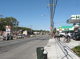
Attractions
As an integral artery of Staten Island, Hylan Boulevard is a major commercial corridor and a heavily trafficked roadway. At the northernmost end is Buono BeachBuono Beach
Buono Beach is a shoreline-public park in the New York City borough of Staten Island, in the neighborhood of Rosebank, at the foot of Hylan Boulevard. Buono Beach borders New York Harbor.-History:...
, a small park offering spectacular views of New York Harbor, as well as the Alice Austen House
Alice Austen House
The Alice Austen House, also known as Clear Comfort, is located at 2 Hylan Boulevard in the Rosebank section of Staten Island, New York City, New York. It was home of Alice Austen, a photographer, for most of her lifetime, and is now a museum and a member of the Historic House Trust...
(address: 2 Hylan Blvd.), the historical home of native Island photographer Alice Austen
Alice Austen
Elizabeth Alice Austen was a Staten Island photographer.-Early years:Alice's father abandoned the family before she was born, and she was baptized under the name Elizabeth Alice Munn on May 23, 1866, in St. John's Church on Staten Island...
.
Commercial establishments of all kinds line the boulevard's north-central stretch, with larger shopping centers in and around the New Dorp
New Dorp, Staten Island
New Dorp – an anglicization of Nieuwe Dorp, Dutch for New Village – is a neighborhood in Staten Island, one of the five boroughs of New York City, United States. The community lies near the foot of Todt Hill, with Grant City immediately to its north, Oakwood bordering to the south, and...
neighborhood. At Buffalo Street is the entrance to Great Kills Park
Great Kills Park
Great Kills Park in Great Kills, Staten Island is a part of the Staten Island unit of Gateway National Recreation Area, part of the National Park System it covers an area of approximately of salt marsh, beach and woodlands stretching along two miles of Staten Island's south shore.Great Kills...
, part of the larger Gateway National Recreation Area
Gateway National Recreation Area
Gateway National Recreation Area is a National Recreation Area in the Port of New York and New Jersey. Scattered over Brooklyn, Queens, and Staten Island, New York and Monmouth County, New Jersey, it provides recreational opportunities that are rare for a dense urban environment, including ocean...
. In the neighborhood of Great Kills
Great Kills, Staten Island
Great Kills is a neighborhood within New York City's borough of Staten Island. It is located on the island's South Shore, and according to many local geographers, it is the South Shore's northernmost community...
there are more businesses, but south of Richmond Avenue
Richmond Avenue
Richmond Avenue is an integral north-south thoroughfare on Staten Island. Measuring approximately 7.0 miles , the road runs from the community of Graniteville to the south shore community of Eltingville.- Street description :...
, the boulevard is almost entirely residential.
Transportation
While the Staten Island RailwayStaten Island Railway
The Staten Island Rapid Transit Operating Authority, publicly known as MTA Staten Island Railway or SIR, is the operator of the lone rapid transit line in the borough of Staten Island, New York City, USA...
never crosses Hylan's path, it largely pararells the boulevard, and many stations along the line are half a mile to a mile and a half (one or two km) away at higher elevation with the closest being the Old Town station
Old Town (Staten Island Railway station)
Old Town is a Staten Island Railway station in the neighborhood of Old Town, Staten Island, New York. It is located on an embankment at Railroad Avenue on the main line. It has two side platforms, and metal orange canopies and walls...
. The former South Beach line of the railway did cross the boulevard just East of the Rosebank station
Rosebank (Staten Island Railway station)
Rosebank is a demolished station in the Rosebank neighborhood along the abandoned South Beach Branch of the Staten Island Railway. It had two tracks and two side platforms. It closed on March 31, 1953....
.
Hylan Blvd is served by the following MTA NYCT and NYC DOT buses:
- The S51 from Midland AvenueMidland AvenueMidland Avenue is a primary east-west avenue in the Grant City and Midland Beach neighborhoods of New York City, in the borough of Staten Island, New York....
to Lincoln Avenue. - The S52 from Fingerboard RoadFingerboard RoadFingerboard Road is a primary north-south artery in the Shore Acres, Rosebank, Arrochar, and Grasmere neighborhoods of Staten Island, New York.Landmarks include the Mount Manresa Jesuit Retreat House, as well as the Hills of Grasmere housing development....
to Sand LaneSand LaneSand Lane is an important east-west artery in the South Beach, Arrochar, and Grasmere neighborhoods in Staten Island, New York.Landmarks include the southern border of St...
. - The S53 from Sand LaneSand LaneSand Lane is an important east-west artery in the South Beach, Arrochar, and Grasmere neighborhoods in Staten Island, New York.Landmarks include the southern border of St...
to Clove RoadClove RoadClove Road is a north-south road in Staten Island. It runs from Richmond Terrace in the West New Brighton neighborhood to Hylan Blvd in the Grasmere neighborhood. It is served by the S53 local bus south of Broadway and the X14 express bus south of Martling Avenue...
. - The S54 from Nelson Avenue to Richmond AvenueRichmond AvenueRichmond Avenue is an integral north-south thoroughfare on Staten Island. Measuring approximately 7.0 miles , the road runs from the community of Graniteville to the south shore community of Eltingville.- Street description :...
. - The S55 from Luten Avenue to Seguine Avenue.
- The S56 from Luten Avenue to Bayview Avenue.
- The S57 from Ebbitts Street to Guyon AvenueGuyon AvenueGuyon Avenue is a primary east-west avenue in the Oakwood and Oakwood Beach neighborhoods of New York City, in the borough of Staten Island, New York. Guyon Avenue is two-way, two-lane avenue....
. - The S59 from Richmond Avenue to Craig Avenue.
- The S78, for nearly the entire length
- The S79 from Narrows Road to Richmond AvenueRichmond AvenueRichmond Avenue is an integral north-south thoroughfare on Staten Island. Measuring approximately 7.0 miles , the road runs from the community of Graniteville to the south shore community of Eltingville.- Street description :...
. - The X1 from Steuben StreetSteuben StreetSteuben Street is a mostly residential yet important east-west boulevard that runs through the Grasmere, Rosebank, Concord, Park Hill, and Grymes Hill neighborhoods of New York City, in the borough of Staten Island, New York....
to Richmond Avenue. - The X2, X3, and X9 from Steuben Street to Tysens Lane.
- The X4 and X5 from Midland AvenueMidland AvenueMidland Avenue is a primary east-west avenue in the Grant City and Midland Beach neighborhoods of New York City, in the borough of Staten Island, New York....
to Richmond Avenue. - The X7 and x8 from Midland Avenue to Nelson Avenue.
- The X22 from Page Avenue to Craig Avenue.
- The X23 from Luten Avenue to Seguine Avenue.
- The X24 from Tysens Lane to Arden AvenueArden AvenueArden Avenue is a major east-west artery in southern Staten Island, New York City. It is approximately long, and runs through the neighborhoods of Annadale, Arden Heights, and Huguenot....
.
Former routes include:
- The X6 from Midland Avenue to Richmond Avenue.
- The X18 from Bay StreetBay Street (Staten Island)Bay Street runs north-south through the Fort Wadsworth, Rosebank, Shore Acres, Stapleton, Tompkinsville, and St. George neighborhoods of New York City, in the borough of Staten Island, New York....
to Tompkins Avenue. - The X20 from Fingerboard Road to Narrows Road.
- The X21 from Arden AvenueArden AvenueArden Avenue is a major east-west artery in southern Staten Island, New York City. It is approximately long, and runs through the neighborhoods of Annadale, Arden Heights, and Huguenot....
to Huguenot Avenue.