

El Paso, Santa Cruz de Tenerife
Encyclopedia
| El Paso | |
| Map | |
|---|---|
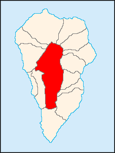 |
|
| Statistics | |
| Autonomous region: | Canary Islands Canary Islands The Canary Islands , also known as the Canaries , is a Spanish archipelago located just off the northwest coast of mainland Africa, 100 km west of the border between Morocco and the Western Sahara. The Canaries are a Spanish autonomous community and an outermost region of the European Union... |
| Province: | Santa Cruz de Tenerife Santa Cruz de Tenerife (province) Province of Santa Cruz de Tenerife also Province of Santa Cruz is a province of Spain, consisting of the western part of the autonomous community of the Canary Islands. It consists of about half of the Atlantic archipelago, including the islands of Tenerife, La Gomera, El Hierro, and La Palma, and... |
| Island: | La Palma La Palma La Palma is the most north-westerly of the Canary Islands. La Palma has an area of 706 km2 making it the fifth largest of the seven main Canary Islands... |
| Area Area Area is a quantity that expresses the extent of a two-dimensional surface or shape in the plane. Area can be understood as the amount of material with a given thickness that would be necessary to fashion a model of the shape, or the amount of paint necessary to cover the surface with a single coat... : |
135.92 km², some reads 134.64 km² |
| Population Population A population is all the organisms that both belong to the same group or species and live in the same geographical area. The area that is used to define a sexual population is such that inter-breeding is possible between any pair within the area and more probable than cross-breeding with individuals... : |
7,218 (2004) |
| Population density Population density Population density is a measurement of population per unit area or unit volume. It is frequently applied to living organisms, and particularly to humans... : |
53.61/km² |
| Length of coastline | none, landlocked |
| Elevation Elevation The elevation of a geographic location is its height above a fixed reference point, most commonly a reference geoid, a mathematical model of the Earth's sea level as an equipotential gravitational surface .... : Lowest: Centre: Highest: |
400 m 630 m 2426 m near Caldera de Taburiente (north) |
| Postal code: | E-38789 |
| Location Geographic coordinate system A geographic coordinate system is a coordinate system that enables every location on the Earth to be specified by a set of numbers. The coordinates are often chosen such that one of the numbers represent vertical position, and two or three of the numbers represent horizontal position... : |
28.65/28°39' N lat. 17.8667/17°52' W long. |
| Municipal code: | E-38027 |
| Car designation: | TF |
El Paso (Spanish
Spanish language
Spanish , also known as Castilian , is a Romance language in the Ibero-Romance group that evolved from several languages and dialects in central-northern Iberia around the 9th century and gradually spread with the expansion of the Kingdom of Castile into central and southern Iberia during the...
for the passage) is a municipality in the Canary Islands
Canary Islands
The Canary Islands , also known as the Canaries , is a Spanish archipelago located just off the northwest coast of mainland Africa, 100 km west of the border between Morocco and the Western Sahara. The Canaries are a Spanish autonomous community and an outermost region of the European Union...
in the province of Santa Cruz de Tenerife
Santa Cruz de Tenerife (province)
Province of Santa Cruz de Tenerife also Province of Santa Cruz is a province of Spain, consisting of the western part of the autonomous community of the Canary Islands. It consists of about half of the Atlantic archipelago, including the islands of Tenerife, La Gomera, El Hierro, and La Palma, and...
.
El Paso is the largest municipality on the island of La Palma after Garafía and along with only a handful of other municipalities in the Canaries including Gran Canaria and Tenerife, El Paso is landlocked and is unique in this respect on the island. El Paso borders on every municipality in the island of La Palma except Tazacorte. It is situated on the central part of the island. El Paso is linked by road to Tijarafe
Tijarafe
Tijarafe is a municipality in the Canary Islands in the province of Santa Cruz de Tenerife. It is situated on the west-northwestern coast of the island of La Palma...
and Santa Cruz de La Palma
Santa Cruz de La Palma
Santa Cruz de la Palma is located on the eastern part of the island of La Palma in the province of Santa Cruz de Tenerife of the Canary Islands. Santa Cruz de la Palma is the second largest city and is the capital of the island...
.
The population is 1,708 (2004) http://www.gobiernodecanarias.org/istac/, its density is 54.91/km² and the area is 31.1 km²/3,110 ha. The mean elevation is 600 m.
Farmlands dominate the central part, while the south and north are covered in forest or grassland. The Caldera de Taburiente, a giant caldera constituting a national park filled with pine forests and characterised by many valleys, lies to the north and part of the Teneguía
Teneguía
Teneguía is a cinder cone volcano situated on the island of La Palma, one of the Canary Islands.-1971 Eruption:This volcano is the source of the last volcanic eruption on Spanish soil –from October 26 to November 28, 1971. Earthquakes preceded the eruption...
range lies to the south. The majority of the population is rural.
History
Many footpaths already crisscrossed La Palma before the Spanish conquest. A number of mountain passes east of present-day El Paso enabled cross-island communications. One of these was Ajerjo Pass by which the island's Spanish discoverer, Alonso Fernandez de LugoAlonso Fernández de Lugo
Javier Alonso Luis Fernández de Lugo was a Spanish military man, conquistador, city founder, and administrator. He conquered the islands of La Palma and Tenerife for the Castilian Crown; they were the last of the Canary Islands to be conquered by Europeans. He was also the founder of the towns...
, attempted to enter the Caldera de Taburiente, hence its local name the Captain's Pass (Paso del Capitán). The village of El Paso was named after this mountain pass by association.
On 3 May 1492 the mentioned Fernandez de Lugo finishes the conquest of the island of La Palma by the Spanish when conquering the last remaining stronghold of the native Guanches
Guanches
Guanches is the name given to the aboriginal Berber inhabitants of the Canary Islands. It is believed that they migrated to the archipelago sometime between 1000 BCE and 100 BCE or perhaps earlier...
, the kingdom of Aceró
Acero
Acero is an Italian restaurant located in Maplewood, Missouri at 7266 Manchester Road, in suburban St. Louis. It is owned by chef Jim Fiala and the Executive Chef is Adam Karl Gnau. James Fiala also owns The Crossing in Clayton, Missouri and Liluma in St...
. To this goal, Fernandez deceitfully invited its king Tanausú
Tanausu
Tanausu was the Guanche ruler of Aceró, on the island of La Palma , whose defeat by the Castilians marked the final conquest of that island. The island of Tenerife, conquered in 1495, was the last of the Canary Islands to fall under European control...
to an interview, to have him imprisoned on appearance. The island was made directly subject to the Spanish Crown, a situation which would last until 1812. In this year the new Spanish Constitution
Spanish Constitution of 1812
The Spanish Constitution of 1812 was promulgated 19 March 1812 by the Cádiz Cortes, the national legislative assembly of Spain, while in refuge from the Peninsular War...
paved the way for decentralisation of the Canary Islands
Canary Islands
The Canary Islands , also known as the Canaries , is a Spanish archipelago located just off the northwest coast of mainland Africa, 100 km west of the border between Morocco and the Western Sahara. The Canaries are a Spanish autonomous community and an outermost region of the European Union...
and subdivision into municipalities
Municipality
A municipality is essentially an urban administrative division having corporate status and usually powers of self-government. It can also be used to mean the governing body of a municipality. A municipality is a general-purpose administrative subdivision, as opposed to a special-purpose district...
.http://www.ayuntamientodeelpaso.org/municipio/historia.html
Historical population
| Year | Population | Change | Density |
|---|---|---|---|
| 1991 | 7,010 | - | - |
| 1996 | 7,006 | - | - |
| 2001 | 6,764 | - | 54.03/km² |
| 2002 | 7,438 | - | - |
| 2003 | 7,544 | - | 55.50/km² |
| 2004 | 7,218 | - | 53.61/km² |
The population decreased between 1991 and 2001, but then recovered, surpassing the 1991 level in 2002. Since then the population has been gradually decreasing.
Other
El Paso sports a number of primary schools, a lyceum, a gymnasium, churches, a post office and a few plazaPlaza
Plaza is a Spanish word related to "field" which describes an open urban public space, such as a city square. All through Spanish America, the plaza mayor of each center of administration held three closely related institutions: the cathedral, the cabildo or administrative center, which might be...
s.
External links
- Map and aerial photos
- Street map: Street map from Mapquest, MapPoint or Google
- Satellite images: Google
- Coordinates: 28°39′0"N 17°52′0"W
- El Paso Municipality Website
See also
- La PalmaLa PalmaLa Palma is the most north-westerly of the Canary Islands. La Palma has an area of 706 km2 making it the fifth largest of the seven main Canary Islands...
- List of municipalities in Santa Cruz de Tenerife