
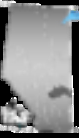
Division No. 7, Alberta
Encyclopedia
Division No. 7 is a census division
in Alberta
, Canada
. It is located in the southeast corner of central Alberta
and its largest urban community is the Town of Wainwright
.
, a 1.2% decrease from 2001. The census division has a land area of 19209.51 km² (7,416.8 sq mi) and a population density
of 2.1 inhabitants per square kilometre.
Census division
Census division is an official term in Canada and the United States. The census divisions of Canada are second-level census geographic unit, below provinces and territories, and above "census subdivisions" and "dissemination areas". In provinces where they exist, the census division may correspond...
in Alberta
Alberta
Alberta is a province of Canada. It had an estimated population of 3.7 million in 2010 making it the most populous of Canada's three prairie provinces...
, Canada
Canada
Canada is a North American country consisting of ten provinces and three territories. Located in the northern part of the continent, it extends from the Atlantic Ocean in the east to the Pacific Ocean in the west, and northward into the Arctic Ocean...
. It is located in the southeast corner of central Alberta
Central Alberta
Central Alberta is a region located in the Canadian province of Alberta.Central Alberta is the most densely populated rural area in the province...
and its largest urban community is the Town of Wainwright
Wainwright, Alberta
Wainwright is a town on the prairies of east-central Alberta, Canada.It is located on the north side of the Canadian National Railway, with CFB Wainwright located on the southwest side. The town lies south of Vermilion, in the Battle River valley, along Highway 41, called the Buffalo Trail....
.
Census subdivisions
The following census subdivisions (municipalities or municipal equivalents) are located within Alberta's Division No. 7.- Towns
- CastorCastor, AlbertaCastor is a town in the Canadian province of Alberta. It is intersected by Highway 12 and Highway 861, east of the city of Red Deer, at an elevation .It was incorporated July 13, 1910...
- CoronationCoronation, AlbertaCoronation is a small town in east-central Alberta, Canada. It is located at the intersection of Highway 12 and Highway 872, approximately west of the Saskatchewan border. The economy is supported primarily by farming, ranching, and the oil patch...
- Daysland
- HardistyHardisty, AlbertaHardisty, Alberta is a town in Flagstaff County in Alberta, Canada. It is located in east-central Alberta, from the Saskatchewan border, near the crossroads of Highway 13 and Highway 881, in the Battle River Valley.- History :...
- KillamKillam, AlbertaKillam is a town in central Alberta, Canada. It is located in Flagstaff County, east of Camrose at the junction of Highway 13 and Veterans Memorial Highway, Highway 36. The mayor of Killam is Bud James.- Demographics :...
- ProvostProvost, AlbertaProvost is a town in central Alberta, Canada. It is located at the junction of Highway 13 and Highway 899, west of the Alberta-Saskatchewan border....
- SedgewickSedgewick, AlbertaSedgewick is a town in central Alberta, Canada. It is located east of Camrose at the junction of Highway 13 and Highway 869. The Canadian Pacific Railway runs through the town.-Demographics:...
- StettlerStettler, AlbertaStettler is a town in Alberta, Canada. It is located east of Red Deer at the junction of Highway 12 and Highway 56. The town is located in the eastern region of central Alberta and nicknamed "The Heart of Alberta."- History :...
- WainwrightWainwright, AlbertaWainwright is a town on the prairies of east-central Alberta, Canada.It is located on the north side of the Canadian National Railway, with CFB Wainwright located on the southwest side. The town lies south of Vermilion, in the Battle River valley, along Highway 41, called the Buffalo Trail....
- Castor
- Villages
- AllianceAlliance, AlbertaAlliance is a village in central Alberta, Canada. Established as a station on a Canadian National line in 1916, Alliance became a village in 1918. It is located on Highway 602, approximately east of Red Deer...
- AmiskAmisk, AlbertaAmisk is a village in east central Alberta, Canada.The name comes from amisk , the Cree word for "beaver".The site was surveyed by the Canadian Pacific Railway in 1906. That same year settlers from the United States, Scandinavia and Great Britain arrived. The first general store was built in 1907,...
- Big ValleyBig Valley, AlbertaBig Valley is a village in central Alberta south east of Red Deer. It is located south of Stettler and north of Drumheller on Highway 56 in the County of Stettler.- Ranching era :...
- BothaBotha, AlbertaBotha is a village in central Alberta, Canada. It is located east of Stettler.-Demographics:In 2006, Botha had a population of 185 living in 75 dwellings, a 0.5% decrease from 2001. The Village has an area of and a population density of 169.9 inhabitants per square kilometer.-External links:*...
- ChauvinChauvin, AlbertaChauvin is a village in east central Alberta, Canada. It is located east of Wainwright, and west of the Saskatchewan border. It is also the home of Susie the Softball, the worlds largest softball.-Demographics:...
- CzarCzar, AlbertaCzar is a village in central Alberta. It is located west of the Saskatchewan border, at the intersection of Highway 13, Buffalo Trail and the CPR tracks.-Demographics:...
- Donalda
- EdgertonEdgerton, AlbertaEdgerton is a village in central Alberta, Canada. it is located east of Wainwright.-Demographics:The population of the Village of Edgerton according to its 2007 municipal census is 393....
- ForestburgForestburg, Alberta- External links :*...
- GadsbyGadsby, AlbertaGadsby is a small village in central Alberta, Canada, located east of Red Deer. Gadsby is officially the smallest village in Alberta. It was incorporated in 1909.-Name:...
- Galahad
- HalkirkHalkirk, AlbertaHalkirk is a village in central Alberta, Canada within the County of Paintearth No. 18. It is located east of Red Deer at the intersection of Highway 12 and Highway 855. Founded in 1912, Halkirk was named after Halkirk, Scotland.- Demographics :...
- HeislerHeisler, AlbertaHeisler is a village in central Alberta, Canada. It is located 23 km south of Daysland and 20 km north of Forestburg.- Demographics :The population of the Village of Heisler according to its 2010 municipal census is 150....
- HughendenHughenden, AlbertaHughenden is a village in central Alberta, Canada. It is located 49 km south of Wainwright, in the Municipal District of Provost, along Highway 13.-Demographics:The population of the Village of Hughenden according to its 2008 municipal census is 266....
- IrmaIrma, AlbertaIrma is a village in central Alberta, Canada. It is located northwest of Wainwright and 178 km southeast of Edmonton along Highway 14 and Highway 881.-History:...
- LougheedLougheed, AlbertaLougheed is a village in central Alberta, Canada. It is located 94 km south-east of Camrose, along Highway 13.- Demographics :The population of the Village of Lougheed according to its 2010 municipal census is 254, a 5.8% increase over its 2009 municipal census population of 240.In 2006,...
- StromeStrome, AlbertaStrome is a village in East Central Alberta, Canada. It is located 58 km east of the city of Camrose, along Highway 13.- Demographics :In 2006, Strome had a population of 252 living in 114 dwellings, a 7.7% decrease from 2001...
- Alliance
- Summer villages
- Rochon Sands
- White SandsWhite Sands, AlbertaWhite Sands is a summer village in Alberta, Canada. It is located on the southeast shore of Buffalo Lake, northwest from the Town of Stettler and east of the Summer Village of Rochon Sands and Rochon Sands Provincial Park....
- Municipal districts
- Flagstaff CountyFlagstaff County, AlbertaFlagstaff County is a municipal district in east central Alberta, Canada.It is located in Census Division 7. The county was incorporated in the current boundaries in 1944 as Municipal District of Killam No. 390, name changed a year later to Municipal District of Flagstaff No. 62. It was established...
- Paintearth CountyPaintearth County No. 18, AlbertaThe County of Paintearth No. 18 is a municipal district in east central Alberta, Canada.It is located in Census Division 7. Incorporated in the current boundaries in 1944 as the Municipal District of Paintearth No. 334, it was established as a county in 1962. The municipal seat is in the Town of...
- Provost No. 52, M.D. ofProvost No. 52, AlbertaThe Municipal District of Provost No. 52 is a municipal district in east-central Alberta, Canada, on the Alberta/Saskatchewan border.It is located in Census Division 12. The municipal district was established in the current boundaries in 1943, through the amalgamation of the Municipal Districts of...
- Stettler CountyStettler County No. 6, AlbertaThe County of Stettler No. 6 is a municipal district in central Alberta, Canada.-Demographics:In 2006, the County of Stettler No. 6 had a population of 5,216 living in 1,846 dwellings, a 2.6% decrease from 2001. The county has a land area of and a population density of .In 2001, the population...
- Wainwright No. 61, M.D. ofWainwright No. 61, AlbertaThe Municipal District of Wainwright No. 61 is a municipal district in eastern Alberta, Canada.It is located in Census Division 7. The seat of the municipality is set in the Town of Wainwright. The district is bisected north-south by the Buffalo Trail and east-west by the Poundmaker...
- Flagstaff County
Demographics
In 2006, Division No. 7 had a population of 39,909 living in 16,606 dwellingsHouse
A house is a building or structure that has the ability to be occupied for dwelling by human beings or other creatures. The term house includes many kinds of different dwellings ranging from rudimentary huts of nomadic tribes to free standing individual structures...
, a 1.2% decrease from 2001. The census division has a land area of 19209.51 km² (7,416.8 sq mi) and a population density
Population density
Population density is a measurement of population per unit area or unit volume. It is frequently applied to living organisms, and particularly to humans...
of 2.1 inhabitants per square kilometre.