
Stettler County No. 6, Alberta
Encyclopedia
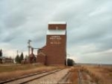
The County of Stettler No. 6 is a municipal district in central Alberta
Alberta
Alberta is a province of Canada. It had an estimated population of 3.7 million in 2010 making it the most populous of Canada's three prairie provinces...
, Canada
Canada
Canada is a North American country consisting of ten provinces and three territories. Located in the northern part of the continent, it extends from the Atlantic Ocean in the east to the Pacific Ocean in the west, and northward into the Arctic Ocean...
.
Demographics
In 2006, the County of Stettler No. 6 had a population of 5,216 living in 1,846 dwellingsHouse
A house is a building or structure that has the ability to be occupied for dwelling by human beings or other creatures. The term house includes many kinds of different dwellings ranging from rudimentary huts of nomadic tribes to free standing individual structures...
, a 2.6% decrease from 2001. The county has a land area of 4008.72 km² (1,547.8 sq mi) and a population density
Population density
Population density is a measurement of population per unit area or unit volume. It is frequently applied to living organisms, and particularly to humans...
of 1.3 /km2.
In 2001, the population was 5,357.
Communities
The County of Stettler No. 6 includes the following communities:Towns
- StettlerStettler, AlbertaStettler is a town in Alberta, Canada. It is located east of Red Deer at the junction of Highway 12 and Highway 56. The town is located in the eastern region of central Alberta and nicknamed "The Heart of Alberta."- History :...
Villages
- Big ValleyBig Valley, AlbertaBig Valley is a village in central Alberta south east of Red Deer. It is located south of Stettler and north of Drumheller on Highway 56 in the County of Stettler.- Ranching era :...
- BothaBotha, AlbertaBotha is a village in central Alberta, Canada. It is located east of Stettler.-Demographics:In 2006, Botha had a population of 185 living in 75 dwellings, a 0.5% decrease from 2001. The Village has an area of and a population density of 169.9 inhabitants per square kilometer.-External links:*...
- Donalda
- GadsbyGadsby, AlbertaGadsby is a small village in central Alberta, Canada, located east of Red Deer. Gadsby is officially the smallest village in Alberta. It was incorporated in 1909.-Name:...
Summer villages
- Rochon Sands
- White SandsWhite Sands, AlbertaWhite Sands is a summer village in Alberta, Canada. It is located on the southeast shore of Buffalo Lake, northwest from the Town of Stettler and east of the Summer Village of Rochon Sands and Rochon Sands Provincial Park....
Hamlets
- Byemoor
- EndiangEndiang, AlbertaEndiang, Alberta is a hamlet in Alberta, Canada within the County of Stettler No. 6. It is located approximately southeast of Stettler, Alberta....
- ErskineErskine, AlbertaErskine is a hamlet in Alberta, Canada within the County of Stettler No. 6. It is located approximately west of Stettler, south of Rochon Sands and east of Red Deer...
- NevisNevis, AlbertaNevis is a hamlet in central Alberta, Canada within the County of Stettler No. 6. It is located on Highway 12, approximately southeast Alix and west of Erskine. It has an elevation of ....
- Red WillowRed Willow, AlbertaRed Willow is a hamlet in central Alberta, Canada within the County of Stettler No. 6. It is located on Highway 850, approximately northeast of Stettler and south of Donalda. It has an elevation of ....
External links
- County of Stettler (Official site)
- Heart of Alberta