

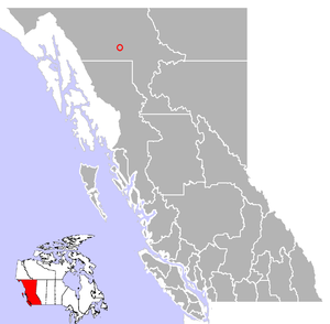
Dease Lake, British Columbia
Encyclopedia
- This article is about the community. For the lake see Dease Lake (British Columbia)Dease Lake (British Columbia)Dease Lake is a lake in the Stikine Plateau of the Northern Interior of British Columbia, Canada, located at the head of the Dease River, which flows north then northeast from the lake to join the Liard River...
.
Cassiar Country
The Cassiar Country, also referred to simply as the Cassiar, is one of the historical geographic regions of the Canadian province of British Columbia...
of the Northern Interior of British Columbia
British Columbia Interior
The British Columbia Interior or BC Interior or Interior of British Columbia, usually referred to only as the Interior, is one of the three main regions of the Canadian province of British Columbia, the other two being the Lower Mainland, which comprises the overlapping areas of Greater Vancouver...
, Canada
Canada
Canada is a North American country consisting of ten provinces and three territories. Located in the northern part of the continent, it extends from the Atlantic Ocean in the east to the Pacific Ocean in the west, and northward into the Arctic Ocean...
. Located only a few hours south of the Yukon border, it is located on Highway 37 at the south end of the lake of the same name
Dease Lake (British Columbia)
Dease Lake is a lake in the Stikine Plateau of the Northern Interior of British Columbia, Canada, located at the head of the Dease River, which flows north then northeast from the lake to join the Liard River...
. Dease Lake is the last major centre before the Alaska Highway
Alaska Highway
The Alaska Highway was constructed during World War II for the purpose of connecting the contiguous U.S. to Alaska through Canada. It begins at the junction with several Canadian highways in Dawson Creek, British Columbia and runs to Delta Junction, Alaska, via Whitehorse, Yukon...
, and also the junction to Telegraph Creek and the Grand Canyon of the Stikine
Grand Canyon of the Stikine
The Grand Canyon of the Stikine is a 45 mile stretch of the Stikine River in northern British Columbia, Canada. It has been compared to the Grand Canyon of the Colorado in scale and was called the "Yosemite of the North" by naturalist John Muir. The canyon is home to a large population of...
. Dease Lake Indian Reserve No. 9 is located nearby and is under the governance of the Tahltan First Nation
Tahltan First Nation
The Tahltan First Nation, also known as the Tahltan Indian Band, is a band government of the Tahltan people. Their main community and reserves are located at Telegraph Creek, British Columbia. Their language is the Tahltan language, which is an Athabaskan language also known as Nahanni, is...
band government.
The town sits astride a pass separating the basins of the Dease River
Dease River
The Dease River flows through northwestern British Columbia, Canada and is a tributary of the Liard River. The river descends from Dease Lake, though its ultimate origin is in the headwater of Little Dease Creek at Snow Peak, approximately 50 km to the west of the lake...
(N) from that of the Tanzilla (S), a tributary of the Stikine
Stikine River
The Stikine River is a river, historically also the Stickeen River, approximately 610 km long, in northwestern British Columbia in Canada and southeastern Alaska in the United States...
. The pass is part of Continental Divide and is a division point between drainage to the Pacific Ocean
Pacific Ocean
The Pacific Ocean is the largest of the Earth's oceanic divisions. It extends from the Arctic in the north to the Southern Ocean in the south, bounded by Asia and Australia in the west, and the Americas in the east.At 165.2 million square kilometres in area, this largest division of the World...
, via the Stikine, and the Arctic Ocean, via the Liard
Liard River
The Liard River flows through Yukon, British Columbia and the Northwest Territories, Canada. Rising in the Saint Cyr Range of the Pelly Mountains in southeastern Yukon, it flows southeast through British Columbia, marking the northern end of the Rocky Mountains and then curving northeast back...
and Mackenzie River
Mackenzie River
The Mackenzie River is the largest river system in Canada. It flows through a vast, isolated region of forest and tundra entirely within the country's Northwest Territories, although its many tributaries reach into four other Canadian provinces and territories...
s.
Partly due to the closing of the asbestos mine in Cassiar
Cassiar, British Columbia
Cassiar is a ghost town in British Columbia, Canada. It was a small company-owned asbestos mining town located in the Cassiar Mountains of Northern British Columbia north of Dease Lake. After forty years of operation, starting in 1952, the mine was unexpectedly forced to close in 1992...
, Dease Lake's population continues to grow. The town has a school
School
A school is an institution designed for the teaching of students under the direction of teachers. Most countries have systems of formal education, which is commonly compulsory. In these systems, students progress through a series of schools...
, various stores, fuel and service stations, hotels, a restaurant, a Northern Lights College
Northern Lights College
Northern Lights College is an institution that provides post-secondary education to residents of Northern British Columbia. It currently has offices in eight communities, and a working agreement with the University of Northern British Columbia. The college president is D. Jean Valgardson.- List of...
campus, and local pub. The town sees a large influx of visitors during the summer months from tourists on their way to the Alaska Highway
Alaska Highway
The Alaska Highway was constructed during World War II for the purpose of connecting the contiguous U.S. to Alaska through Canada. It begins at the junction with several Canadian highways in Dawson Creek, British Columbia and runs to Delta Junction, Alaska, via Whitehorse, Yukon...
. A majority of these tourists are from Canada
Canada
Canada is a North American country consisting of ten provinces and three territories. Located in the northern part of the continent, it extends from the Atlantic Ocean in the east to the Pacific Ocean in the west, and northward into the Arctic Ocean...
or the United States
United States
The United States of America is a federal constitutional republic comprising fifty states and a federal district...
. Dease Lake is also a destination for hunting and other wilderness activities.
History
In 1837 a Hudson's Bay CompanyHudson's Bay Company
The Hudson's Bay Company , abbreviated HBC, or "The Bay" is the oldest commercial corporation in North America and one of the oldest in the world. A fur trading business for much of its existence, today Hudson's Bay Company owns and operates retail stores throughout Canada...
post, known as Lake House
Lake House
Lake House is an Elizabethan country house dating from 1578, in Wilsford-cum-Lake in Wiltshire, England. It is a Grade I listed building. The gardens are Grade II listed in the English Heritage Register of Parks and Gardens of Special Historic Interest....
, was created by Robert Campbell
Robert Campbell (fur trader)
Robert Campbell was a Hudson's Bay Company fur trader and explorer. He explored a large part of the southern Yukon and established Fort Frances, Yukon on Frances Lake in the Liard River basin and Fort Selkirk, Yukon at the juncture of the Yukon River and the Pelly River. He was for a time in...
on the shore of Dease Lake about 50 km North of the Stikine River
Stikine River
The Stikine River is a river, historically also the Stickeen River, approximately 610 km long, in northwestern British Columbia in Canada and southeastern Alaska in the United States...
and 150 km south of where the present day Alaska Highway
Alaska Highway
The Alaska Highway was constructed during World War II for the purpose of connecting the contiguous U.S. to Alaska through Canada. It begins at the junction with several Canadian highways in Dawson Creek, British Columbia and runs to Delta Junction, Alaska, via Whitehorse, Yukon...
passes. The Lake had been named in 1834 for Chief Factor Peter Warren Dease
Peter Warren Dease
Peter Warren Dease was a Canadian fur trader and arctic explorer.-Early life:Peter Warren Dease was born at Michilimackinac on January 1, 1788, the fourth son of Dr. John Dease, captain and deputy agent of Indian Affairs, and Jane French, Catholic Mohawk from Caughnawaga...
, and would become a major junction for miners traveling to the gold rush in Cassiar
Cassiar, British Columbia
Cassiar is a ghost town in British Columbia, Canada. It was a small company-owned asbestos mining town located in the Cassiar Mountains of Northern British Columbia north of Dease Lake. After forty years of operation, starting in 1952, the mine was unexpectedly forced to close in 1992...
(later an asbestos mine). Although the fort was abandoned soon after, the town based around the fort lived on, and was renamed Dease Lake in 1934 by then-Chief Trader John McLeod.
During the 1960s and 1970s, BC Rail started to build an extension of their line towards Dease Lake, but construction was halted. Grading was completed all the way, and can still be seen from the air.58°3′N 129°49′W
Geography
North of Dease Lake is Good Hope Lake, British ColumbiaGood Hope Lake, British Columbia
Good Hope Lake is a First Nations community in northwestern British Columbia, Canada, located on Highway 37 not far south of the border with the Yukon and located east of the semi-abandoned mining town of Cassiar, British Columbia. As of the 2006 Census, there are 41 people living in Good Hope...
(138 km) and the Alaska Highway
Alaska Highway
The Alaska Highway was constructed during World War II for the purpose of connecting the contiguous U.S. to Alaska through Canada. It begins at the junction with several Canadian highways in Dawson Creek, British Columbia and runs to Delta Junction, Alaska, via Whitehorse, Yukon...
(235 km). South of Dease Lake is Iskut, British Columbia
Iskut, British Columbia
Iskut is a small, mostly aboriginal community in the Stikine Country of northwestern British Columbia. It is located on Highway 37, at the north end of Eddontenajon Lake just south of Dease Lake and the crossing of the Stikine River...
(65 km), Stewart, British Columbia
Stewart, British Columbia
Stewart is a small town, incorporated as a district municipality at the head of the Portland Canal in northwestern British Columbia, Canada. In 2006, its population was about 496.-History:...
(398 km), and Kitwanga, British Columbia
Kitwanga, British Columbia
Kitwanga or Gitwangax is located where the Kitwanga River runs into the Skeena River in British Columbia. A long-standing village before Contact, the village is within Gitwangak Indian Reserve No...
(489 km).