

Cassiar Country
Encyclopedia
Province
A province is a territorial unit, almost always an administrative division, within a country or state.-Etymology:The English word "province" is attested since about 1330 and derives from the 13th-century Old French "province," which itself comes from the Latin word "provincia," which referred to...
of British Columbia
British Columbia
British Columbia is the westernmost of Canada's provinces and is known for its natural beauty, as reflected in its Latin motto, Splendor sine occasu . Its name was chosen by Queen Victoria in 1858...
. The Cassiar is located in the northwest portion of British Columbia, just to the northeast of the Stikine Country
Stikine Country
The Stikine Country, also referred to as the Stikine District or simply "the Stikine" , is one of the historical geographic regions of the Canadian province of British Columbia, located inland from the central Alaska Panhandle and comprising the basin of the Stikine River and its tributaries...
, while to the south is the Omineca Country
Omineca Country
The Omineca Country, also called the Omineca District or the Omineca, is a historical geographic region of the Northern Interior of British Columbia, roughly defined by the basin of the Omineca River but including areas to the south which allowed access to the region during the Omineca Gold Rush of...
.
Collins Telegraph Line
In the early 1860s, Perry CollinsPerry Collins
Perry McDonough Collins was the visionary behind the Russian American Telegraph of 1865-1867. The failed venture aimed to connect America to Europe by telegraph via the Bering Strait.-The early years:...
obtained financing from Western Union
Western Union
The Western Union Company is a financial services and communications company based in the United States. Its North American headquarters is in Englewood, Colorado. Up until 2006, Western Union was the best-known U.S...
Telegraph to build a telegraph line from San Francisco through British Columbia and Alaska
Alaska
Alaska is the largest state in the United States by area. It is situated in the northwest extremity of the North American continent, with Canada to the east, the Arctic Ocean to the north, and the Pacific Ocean to the west and south, with Russia further west across the Bering Strait...
and across the Bering Strait
Bering Strait
The Bering Strait , known to natives as Imakpik, is a sea strait between Cape Dezhnev, Chukotka Autonomous Okrug, Russia, the easternmost point of the Asian continent and Cape Prince of Wales, Alaska, USA, the westernmost point of the North American continent, with latitude of about 65°40'N,...
to Russia
Russia
Russia or , officially known as both Russia and the Russian Federation , is a country in northern Eurasia. It is a federal semi-presidential republic, comprising 83 federal subjects...
and ultimately Europe
Europe
Europe is, by convention, one of the world's seven continents. Comprising the westernmost peninsula of Eurasia, Europe is generally 'divided' from Asia to its east by the watershed divides of the Ural and Caucasus Mountains, the Ural River, the Caspian and Black Seas, and the waterways connecting...
.
The line was begun in 1865 at New Westminster
New Westminster, British Columbia
New Westminster is an historically important city in the Lower Mainland region of British Columbia, Canada, and is a member municipality of the Greater Vancouver Regional District. It was founded as the capital of the Colony of British Columbia ....
, and continued as far as the Skeena River
Skeena River
The Skeena River is the second longest river entirely within British Columbia, Canada . The Skeena is an important transportation artery, particularly for the Tsimshian and the Gitxsan - whose names mean "inside the Skeena River" and "people of the Skeena River" respectively, and also during the...
in 1866, but then the project was abandoned as the transatlantic line
Transatlantic telegraph cable
The transatlantic telegraph cable was the first cable used for telegraph communications laid across the floor of the Atlantic Ocean. It crossed from , Foilhommerum Bay, Valentia Island, in western Ireland to Heart's Content in eastern Newfoundland. The transatlantic cable connected North America...
was built first, making the Collins line redundant. Despite the fact that the Collins line wouldn’t be completed, surveyors had created a primitive route from Quesnel
Quesnel, British Columbia
-Demographics:Quesnel had a population of 9,326 people in 2006, which was a decrease of 7.1% from the 2001 census count. The median household income in 2005 for Quesnel was $54,044, which is slightly above the British Columbia provincial average of $52,709....
to the newly established settlement of Telegraph Creek, thus opening up the northern districts of British Columbia for determined and hardy travelers.
Cassiar Gold Rush
In the 1870s a gold rush occurred in the region, based at McDame CreekMcDame Creek
McDame Creek is a creek located in the Cassiar Land District of British Columbia. The creek flows southeast into Dease River and is south of Good Hope Lake. The creek was discovered in 1874 by a prospector named Henry McDame. McDame Creek was mined for gold in the 1800s...
and at Thibert Creek
Thibert Creek
Thibert Creek is a creek located in the Cassiar Country region of British Columbia. The is creek flows into Dease Lake at the north end. Thibert Creek lies on the western side of Dease Lake. The creek was discovered in April, 1873 by Henry Thibert and several French Canadians. Thibert was the...
, a tributary of Dease Creek
Dease Creek
Dease Creek is a creek located in the Cassiar Country region of British Columbia. This creek flows into the west side of Dease Lake. Dease Creek was first staked for gold in 1873 by the Moores. The creek was staked for 16 miles and in 1874 supported 700 miners. Mining companies such as Three to...
. In 1874, more than a million dollars worth of gold was taken from the region and in 1877, one prospector found the largest nugget ever recorded in British Columbia: a 72 ounce gold nugget, mined from McDame Creek.
Much as the Stikine Country had been affected by the rush on the Stikine River
Stikine River
The Stikine River is a river, historically also the Stickeen River, approximately 610 km long, in northwestern British Columbia in Canada and southeastern Alaska in the United States...
, the Cassiar Gold Rush caused the government to show an interest in the area and John R Adams was appointed as government agent for the Cassiar region in 1873, and was followed by Judge J.H. Sullivan who became the region's gold commissioner
Gold Commissioner
Gold Commissioner was an important regional administrative post in the Colony of British Columbia.In the 1860s, Governor Douglas had three priorities to protect the two colonies he governed: to protect the boundaries, to uphold law and order and to provide access to the gold fields...
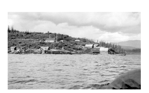
. Laketon
Laketon, British Columbia
Laketon is a locality and former mining camp on the west shore of Dease Lake in the Cassiar Country of far northern British Columbia, Canada. located at the mouth of Dease Creek. Gold was first found on Dease Creek in 1873, with...
, also known as Dease Town became the unofficial capital of the Cassiar and at the height of the rush it had five stores, four hotels, two cafes and its own newspaper. Other gold rush towns were Porter Landing and Defot. However by the 1880s most of the gold had been recovered and nearly all of the miners left the area, while only few merchants and Chinese
Chinese people
The term Chinese people may refer to any of the following:*People with Han Chinese ethnicity ....
miners remained behind. The region was also affected by the Klondike Gold Rush
Klondike Gold Rush
The Klondike Gold Rush, also called the Yukon Gold Rush, the Alaska Gold Rush and the Last Great Gold Rush, was an attempt by an estimated 100,000 people to travel to the Klondike region the Yukon in north-western Canada between 1897 and 1899 in the hope of successfully prospecting for gold...
when in 1897-1898, 5000 miners went to the Yukon via the all Canadian route, up the Stikine River to Telegraph Creek and overland to the Teslin River
Teslin River
The Teslin River is a river in southern Yukon Territory and northwestern British Columbia, Canada, that flows 393 miles from its source south of Teslin Lake to its confluence with the Yukon River....
.
Later years
After the excitement of the gold rushes, the Cassiar was nearly forgotten until the early 1940s when the American militaryMilitary
A military is an organization authorized by its greater society to use lethal force, usually including use of weapons, in defending its country by combating actual or perceived threats. The military may have additional functions of use to its greater society, such as advancing a political agenda e.g...
built the Alaska Highway
Alaska Highway
The Alaska Highway was constructed during World War II for the purpose of connecting the contiguous U.S. to Alaska through Canada. It begins at the junction with several Canadian highways in Dawson Creek, British Columbia and runs to Delta Junction, Alaska, via Whitehorse, Yukon...
from Dawson Creek, British Columbia
Dawson Creek, British Columbia
Dawson Creek is a small city in northeastern British Columbia, Canada. The municipality of had a population of 11,529 in 2009. Dawson Creek derives its name from the creek of the same name that runs through the community. The creek was named after George Mercer Dawson by a member of his land...
to Fairbanks, Alaska
Fairbanks, Alaska
Fairbanks is a home rule city in and the borough seat of the Fairbanks North Star Borough in the U.S. state of Alaska.Fairbanks is the largest city in the Interior region of Alaska, and second largest in the state behind Anchorage...
, thus further opening up the area and providing ease of transportation like never before. Small companies began gold mining with heavy equipment. Then, most notably, the early 1950s brought the Cassiar Asbestos Mine, which operated from 1953 until 1992 and produced the company town of Cassiar
Cassiar, British Columbia
Cassiar is a ghost town in British Columbia, Canada. It was a small company-owned asbestos mining town located in the Cassiar Mountains of Northern British Columbia north of Dease Lake. After forty years of operation, starting in 1952, the mine was unexpectedly forced to close in 1992...
.
See also
- Cassiar MountainsCassiar MountainsThe Cassiar Mountains are the most northerly group of the Northern Interior Mountains in the Canadian province of British Columbia and the Yukon Territory. They lie north and west of the Omineca Mountains, west of the northernmost Rockies and the Rocky Mountain Trench, north of the Hazelton...
- Stewart-Cassiar Highway
- Cassiar (electoral district)
- Nellie CashmanNellie CashmanEllen Cashman , better known as Nellie Cashman, was a native of County Cork, Ireland, who became famous across the American and Canadian west as a nurse and gold prospector.-Early years:...
"Angel of the Cassiar"