

Dargaville
Encyclopedia
Dargaville is a town in the North Island
of New Zealand
. It is situated on the bank of the Northern Wairoa River
in the Northland region. The town is located 55 kilometres southwest of Whangarei
.
The population was 4455 in the 2006 Census, a decrease of 78 from 2001.
It is noted for the high proportion of residents of Dalmatia
n descent. The area around it is one of the chief regions in the country for cultivating kumara (sweet potato
) and so Dargaville is known by many locals as the Kumara Capital of New Zealand.
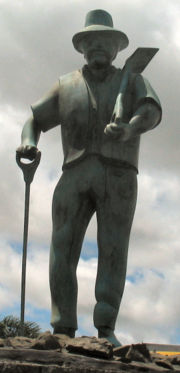 The town is named after timber merchant and politician Joseph McMullen Dargaville (1837-1896). It was founded during the 19th century kauri gum and timber trade, and briefly had New Zealand's largest population.
The area became known for a thriving industry that included gum digging
and kauri logging, which was based mainly at Te Kopuru
, several kilometres south of Dargaville on the banks of the Northern Wairoa river. The river was used to transport the huge logs downstream to shipbuilders and as a primary means of transport to Auckland.
One of the town's most notable former residents is musician, arranger, composer and music producer Mike Perjanik
, who has enjoyed a distinguished musical career in Australia over the last forty years.
Dargaville is also the gateway to the mighty Waipoua Forest
, now a protected national park and home of the biggest specimens of Kauri tree in New Zealand. Tane Mahuta
(Maori, meaning "Lord of the Forest") being chief amongst them.
.
North of the town, the Donnelly's Crossing Section
railway was established to provide access to other logging activities. The first portion of this line was opened in 1889, it reached its greatest extent in 1923, and after operating isolated from the national rail network
for decades, it was connected with the North Auckland Line by the Dargaville Branch
in 1940. The Donnelly's Crossing Section closed in 1959, but the Dargaville Branch continues to operate today as a freight-only line, though its future is less than certain.
The area around Dargaville is now predominantly a farming region and supports extensive dairy, beef, and sheep farms, as well as a thriving plantation forest industry.
Other attractions are the Kai Iwi lakes some 25 kilometres north of the town, and Pouto Peninsula
. Baylys Beach is the local beach, just 13 kilometres from the township, and offers over 90 kilometres of rugged west coast surf.
of 3.
Dargaville Primary School
and Selwyn Park School are contributing primary (years 1-6) schools with rolls of 401 and 128, respectively. Dargaville Primary was established by 1877. In 1879, it had a roll of 16, which grew to 155 in 1899. It has a decile rating of 4. Selwyn Park celebrates its 50th Jubilee in 2008. It has a decile rating of 1.
St Joseph's School is a full primary (years 1-8) school with a decile rating of 3 and a roll of 114. It is a state integrated Catholic school.
All these schools are coeducational.
NorthTec
polytechnic also has a campus in Dargaville.
North Island
The North Island is one of the two main islands of New Zealand, separated from the much less populous South Island by Cook Strait. The island is in area, making it the world's 14th-largest island...
of New Zealand
New Zealand
New Zealand is an island country in the south-western Pacific Ocean comprising two main landmasses and numerous smaller islands. The country is situated some east of Australia across the Tasman Sea, and roughly south of the Pacific island nations of New Caledonia, Fiji, and Tonga...
. It is situated on the bank of the Northern Wairoa River
Wairoa River, Northland
New Zealand's longest Wairoa River runs for 150 kilometres through the northern part of the North Auckland Peninsula. In the upper reaches, the river is formed from two separate rivers, the Manganui River and - confusingly - the Wairua River. The two streams meet to the northeast of Dargaville,...
in the Northland region. The town is located 55 kilometres southwest of Whangarei
Whangarei
Whangarei, pronounced , is the northernmost city in New Zealand and the regional capital of Northland Region. Although commonly classified as a city, it is officially part of the Whangarei District, administered by the Whangarei District Council a local body created in 1989 to administer both the...
.
The population was 4455 in the 2006 Census, a decrease of 78 from 2001.
It is noted for the high proportion of residents of Dalmatia
Dalmatia
Dalmatia is a historical region on the eastern coast of the Adriatic Sea. It stretches from the island of Rab in the northwest to the Bay of Kotor in the southeast. The hinterland, the Dalmatian Zagora, ranges from fifty kilometers in width in the north to just a few kilometers in the south....
n descent. The area around it is one of the chief regions in the country for cultivating kumara (sweet potato
Sweet potato
The sweet potato is a dicotyledonous plant that belongs to the family Convolvulaceae. Its large, starchy, sweet-tasting, tuberous roots are an important root vegetable. The young leaves and shoots are sometimes eaten as greens. Of the approximately 50 genera and more than 1,000 species of...
) and so Dargaville is known by many locals as the Kumara Capital of New Zealand.
History
The area became known for a thriving industry that included gum digging
Gum-digger
Kauri gum, a fossilized resin detracted from kauri trees, is used for chewing or tattooing, and often is made into jewellery. The gum comes from kauri trees found in Agathis australis forests. The trees once covered much of the New Zealand North Island, before Māori and European settlers caused...
and kauri logging, which was based mainly at Te Kopuru
Te Kopuru
Te Kopuru is the largest community on the Pouto Peninsula in Northland, New Zealand. The Wairoa River separates the peninsula at this point from the main North Auckland Peninsula to the east...
, several kilometres south of Dargaville on the banks of the Northern Wairoa river. The river was used to transport the huge logs downstream to shipbuilders and as a primary means of transport to Auckland.
One of the town's most notable former residents is musician, arranger, composer and music producer Mike Perjanik
Mike Perjanik
Mike Perjanik is a New Zealand-born musician, record producer, composer, arranger and bandleader who became well known in Australia from the late 1960s for his work on pop and rock recordings, and as a composer, arranger, bandleader and producer of music for film, television and advertising.-New...
, who has enjoyed a distinguished musical career in Australia over the last forty years.
Geography
Dargaville also has one of the longest unbroken stretches of sand beach in New Zealand, and is largely drivable from one end to the other. This beach is home of the famous local shellfish delicacy called the toheroa, a large and very tasty species, which was over-harvested in the 1950s and 1960s causing the population of the shellfish to decline so alarmingly that public gathering of the shellfish is now prohibited.Dargaville is also the gateway to the mighty Waipoua Forest
Waipoua Forest
Waipoua Forest preserves some of the best examples of kauri forest remaining in New Zealand. It is notable for having two of the largest living kauri trees, Tane Mahuta and Te Matua Ngahere.The forest was declared a sanctuary in 1952....
, now a protected national park and home of the biggest specimens of Kauri tree in New Zealand. Tane Mahuta
Tane Mahuta
Tāne Mahuta is a giant kauri tree in the Waipoua Forest of Northland Region, New Zealand. Its age is unknown but is estimated to be between 1,250 and 2,500 years old. It is the largest kauri known to stand today...
(Maori, meaning "Lord of the Forest") being chief amongst them.
Transport
Dargaville is on the junction of State Highways 12 and 14New Zealand State Highway network
The New Zealand State Highway network is the major national highway network in New Zealand. Just under 100 roads in both the North and South Islands are State Highways...
.
North of the town, the Donnelly's Crossing Section
Donnelly's Crossing Section
The Donnellys Crossing Section , also known as the Kaihu Valley Railway, was a railway line in Northland, New Zealand. Initially an isolated line, it became a branch line when the Dargaville Branch was opened and connected it with the North Auckland Line and the rest of the national rail network...
railway was established to provide access to other logging activities. The first portion of this line was opened in 1889, it reached its greatest extent in 1923, and after operating isolated from the national rail network
Rail transport in New Zealand
Rail transport in New Zealand consists of a network of gauge railway lines in both the North and South Islands. Rail services are focused primarily on freight, particularly bulk freight, with limited passenger services on some lines...
for decades, it was connected with the North Auckland Line by the Dargaville Branch
Dargaville Branch
The Dargaville Branch is a branch line railway that leaves the North Auckland Line not far south of Whangarei and runs westward to Dargaville. Construction of this relatively short line took approximately two decades, and when it was completed, it linked the now closed Donnelly's Crossing Section...
in 1940. The Donnelly's Crossing Section closed in 1959, but the Dargaville Branch continues to operate today as a freight-only line, though its future is less than certain.
The area around Dargaville is now predominantly a farming region and supports extensive dairy, beef, and sheep farms, as well as a thriving plantation forest industry.
Other attractions are the Kai Iwi lakes some 25 kilometres north of the town, and Pouto Peninsula
Pouto Peninsula
The Pouto Peninsula is a landform on the northern Kaipara Harbour in Northland, New Zealand. The Peninsula runs in the north west to south east direction and is approximately 55 km long. The width varies from about 5.4 km to about 14 km, with the widest part of the peninsula near its...
. Baylys Beach is the local beach, just 13 kilometres from the township, and offers over 90 kilometres of rugged west coast surf.
Education
Dargaville High School is a secondary (years 9-13) school with a roll of 528. The school opened in 1921, but was destroyed by fire in 1937 and rebuilt the following year. Dargaville Intermediate is an intermediate (years 7-8) school with a roll of 166. Both schools have a decile ratingSocio-Economic Decile
Decile, Socio-Economic Decile or Socio-Economic Decile Band is a widely used measure in education in New Zealand used to target funding and support to more needy schools....
of 3.
Dargaville Primary School
Dargaville Primary School
Dargaville Primary School is the largest primary school in the town of Dargaville, New Zealand. It is situated in the Dargaville Central Business District . The school takes students from the age of five up to eleven....
and Selwyn Park School are contributing primary (years 1-6) schools with rolls of 401 and 128, respectively. Dargaville Primary was established by 1877. In 1879, it had a roll of 16, which grew to 155 in 1899. It has a decile rating of 4. Selwyn Park celebrates its 50th Jubilee in 2008. It has a decile rating of 1.
St Joseph's School is a full primary (years 1-8) school with a decile rating of 3 and a roll of 114. It is a state integrated Catholic school.
All these schools are coeducational.
NorthTec
NorthTec
NorthTec is the largest tertiary education provider in northern New Zealand. NorthTec is the only Northland-based Tertiary Education Institute that provides programmes ranging from foundation, certificate, diploma and degree levels....
polytechnic also has a campus in Dargaville.