
Cuyamaca Peak
Encyclopedia
Cuyamaca Peak is a mountain in San Diego County roughly 40 miles (64.4 km) from the Pacific Ocean
, in Cuyamaca Rancho State Park
east of San Diego and southwest of Julian
. At 6512 feet (1,984.9 m), its summit is the second highest point in San Diego County.
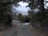
A popular 3.5 miles (5.6 km) year round hike to the summit of Cuyamaca leads from the Paso Picacho Campground, starting at about 5000 feet (1,524 m).
In October 2003, the Cedar Fire
, the largest fire in recorded California history, burned the once abundant White Fir, Incense Cedar
, Jeffrey Pine
, Coulter Pine
, Sugar Pine
, and Black oak that once lined the mountain.
Snows in winter are common above 5000 feet (1,524 m) and surrounding regions in Cuyamaca Rancho State Park. During summer, Bracken
Ferns, a variety of wildflowers and grasses dominate mountain meadows and the forest floor. Prior to the Cedar Fire
Fall Black oaks once lit up the mountain; limited displays can still be seen. Small seedlings of new White fir, Sugar Pine
, Coulter Pine, Jeffrey Pine, and Incense Cedar were seen within a year of the Cedar Fire, and were thriving as saplings by 2007.
of Mexico
, the coast line of San Diego County, Viejas Mountain, and El Cajon Mountain can be seen. Looking north, one can see 6140 feet (1,871.5 m) Palomar Mountain among the ridge of Palomar Mountain
s. On very clear days 8716 feet (2,656.6 m) Toro Peak
in the Santa Rosas
and the San Jacintos
are visible. Closer yet is Volcan Mountain slightly to the northeast, the former gold rush town of Julian lying in front. Directly north are the closest summits, Middle and North Peaks. Directly east is the Anza Borrego Desert
and the Laguna Mountains
, including Whale Peak. Far beyond is the Salton Sea
. To the south are Lyons Peak and Lawson Peak; further yet and to the southeast are Mexican border mountains such as Table Top Mountain and the Sierra Juarez
.
Pacific Ocean
The Pacific Ocean is the largest of the Earth's oceanic divisions. It extends from the Arctic in the north to the Southern Ocean in the south, bounded by Asia and Australia in the west, and the Americas in the east.At 165.2 million square kilometres in area, this largest division of the World...
, in Cuyamaca Rancho State Park
Cuyamaca Rancho State Park
Cuyamaca Rancho State Park is a state park located forty miles east of San Diego, California in the Laguna Mountains of the Peninsular Ranges. The park's 26,000 acres feature pine, fir, and oak forests, with meadows and streams that exist due to the relatively high elevation of the area compared...
east of San Diego and southwest of Julian
Julian, California
Julian is a census-designated place in San Diego County, California, in the United States. As of the 2010 census, the population was 1,502, down from 1,621 at the 2000 census.Julian is an official California Historical Landmark No. 412...
. At 6512 feet (1,984.9 m), its summit is the second highest point in San Diego County.
A popular 3.5 miles (5.6 km) year round hike to the summit of Cuyamaca leads from the Paso Picacho Campground, starting at about 5000 feet (1,524 m).
In October 2003, the Cedar Fire
Cedar Fire
The Cedar Fire was a human-caused wildfire that burned out of control through a large area of San Diego County, in Southern California, in October 2003...
, the largest fire in recorded California history, burned the once abundant White Fir, Incense Cedar
Calocedrus decurrens
Calocedrus decurrens is a species of conifer native to western North America, with the bulk of the range in the United States, from central western Oregon through most of California and the extreme west of Nevada, and also a short distance into northwest Mexico in northern Baja California...
, Jeffrey Pine
Jeffrey Pine
The Jeffrey Pine, Pinus jeffreyi, named in honor of its botanist documenter John Jeffrey, is a North American pine related to Ponderosa Pine.-Distribution and habitat:...
, Coulter Pine
Coulter Pine
The Coulter Pine or Big-cone Pine is a native of the coastal mountains of southern California and northern Baja California . Isolated groves are found as far north as the San Francisco Bay Area in Mt. Diablo State Park and Black Diamond Mines Regional Preserve...
, Sugar Pine
Sugar Pine
Pinus lambertiana, commonly known as the sugar pine or sugar cone pine, is the tallest and most massive pine, with the longest cones of any conifer...
, and Black oak that once lined the mountain.
Snows in winter are common above 5000 feet (1,524 m) and surrounding regions in Cuyamaca Rancho State Park. During summer, Bracken
Bracken
Bracken are several species of large, coarse ferns of the genus Pteridium. Ferns are vascular plants that have alternating generations, large plants that produce spores and small plants that produce sex cells . Brackens are in the family Dennstaedtiaceae, which are noted for their large, highly...
Ferns, a variety of wildflowers and grasses dominate mountain meadows and the forest floor. Prior to the Cedar Fire
Cedar Fire
The Cedar Fire was a human-caused wildfire that burned out of control through a large area of San Diego County, in Southern California, in October 2003...
Fall Black oaks once lit up the mountain; limited displays can still be seen. Small seedlings of new White fir, Sugar Pine
Sugar Pine
Pinus lambertiana, commonly known as the sugar pine or sugar cone pine, is the tallest and most massive pine, with the longest cones of any conifer...
, Coulter Pine, Jeffrey Pine, and Incense Cedar were seen within a year of the Cedar Fire, and were thriving as saplings by 2007.
Views
On clear days visibility from the summit of Cuyamaca ranges from 60–100 miles in nearly every direction. To the west, the Pacific Ocean, the Coronado IslandsCoronado Islands
The Coronado Islands are a group of four islands off the northwest coast of the Mexican state of Baja California. Battered by the wind and waves, they are largely infertile and uninhabited except for a small military detachment and a few lighthouse keepers...
of Mexico
Mexico
The United Mexican States , commonly known as Mexico , is a federal constitutional republic in North America. It is bordered on the north by the United States; on the south and west by the Pacific Ocean; on the southeast by Guatemala, Belize, and the Caribbean Sea; and on the east by the Gulf of...
, the coast line of San Diego County, Viejas Mountain, and El Cajon Mountain can be seen. Looking north, one can see 6140 feet (1,871.5 m) Palomar Mountain among the ridge of Palomar Mountain
Palomar Mountain
Palomar Mountain is a mountain in the Peninsular Ranges in northern San Diego County. It is famous as the location of the Palomar Observatory and Hale Telescope, and known for the Palomar Mountain State Park.-History:...
s. On very clear days 8716 feet (2,656.6 m) Toro Peak
Toro Peak
Toro Peak is a mountain in Southern California in the Santa Rosa Mountains.South of Palm Springs, west of the Salton Sea, east of Temecula, California.It is the highest mountain in the Santa Rosa Mountains, part of the mountain is administered...
in the Santa Rosas
Santa Rosa Mountains
Santa Rosa Mountains may refer to the following mountains in the United States of America:*Santa Rosa Mountains *Santa Rosa Mountains Other similar names include*The Santa Rosa Range in northern Nevada...
and the San Jacintos
San Jacinto Mountains
The San Jacinto Mountains are a mountain range east of Los Angeles in southern California in the United States. The mountains are named for Saint Hyacinth . The Pacific Crest Trail runs along the spine of the range.The range extends for approximately from the San Bernardino Mountains southeast to...
are visible. Closer yet is Volcan Mountain slightly to the northeast, the former gold rush town of Julian lying in front. Directly north are the closest summits, Middle and North Peaks. Directly east is the Anza Borrego Desert
Anza-Borrego Desert State Park
Anza-Borrego Desert State Park is a state park located within the Colorado Desert of Southern California. The park takes its name from 18th century, Spanish explorer Juan Bautista de Anza and borrego, the Spanish word for bighorn sheep...
and the Laguna Mountains
Laguna Mountains
The Laguna Mountains are a section of the Peninsular Ranges in eastern San Diego County, California. The mountains run in a northwest/southeast alignment for approximately ....
, including Whale Peak. Far beyond is the Salton Sea
Salton Sea
The Salton Sea is a shallow, saline, endorheic rift lake located directly on the San Andreas Fault, predominantly in California's Imperial Valley. The lake occupies the lowest elevations of the Salton Sink in the Colorado Desert of Imperial and Riverside counties in Southern California. Like Death...
. To the south are Lyons Peak and Lawson Peak; further yet and to the southeast are Mexican border mountains such as Table Top Mountain and the Sierra Juarez
Sierra Juárez
Sierra de Juárez is a mountain range on the Baja California Peninsula, of Baja California, Mexico. It is part of the Peninsular Ranges. The Laguna Mountains of California lie to the north and the Sierra San Pedro Mártir lies to the south....
.