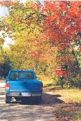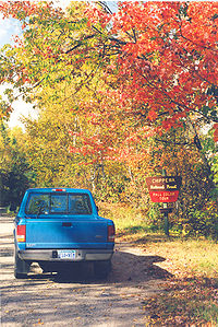
Cut Foot Sioux Trail
Encyclopedia

Chippewa National Forest
Chippewa National Forest is a National Forest located in northcentral Minnesota, United States, in the counties of Itasca, Cass, and Beltrami. Forest headquarters are located in Cass Lake, Minnesota. There are local ranger district offices in Blackduck, Deer River, and Walker.-History and...
of Minnesota
Minnesota
Minnesota is a U.S. state located in the Midwestern United States. The twelfth largest state of the U.S., it is the twenty-first most populous, with 5.3 million residents. Minnesota was carved out of the eastern half of the Minnesota Territory and admitted to the Union as the thirty-second state...
, USA. It follows gravel and sand forestry roads that are now used for hiking, biking, cross-country skiing and horse back riding. The trail passes by several lakes.
The trail starts at the Cut Foot Sioux Visitor Information Center on Minnesota State Highway 46
Minnesota State Highway 46
Minnesota State Highway 46 is a highway in north-central Minnesota, which runs from its intersection with U.S. Highway 2 near Deer River and continues northwest to its northern terminus at its intersection with State Highway 1 in Northome.Highway 46 is in length.-Route description:Highway 46...
in west-central Itasca County
Itasca County, Minnesota
Itasca County is a county located in the U.S. state of Minnesota. It is named after Lake Itasca, which is in turn a shortened version the Latin words veritas caput, meaning 'truth' and 'head', a reference to the source of the Mississippi River. As of 2010, the population was 45,058. Its county seat...
. The Center, on the Leech Lake Indian Reservation
Leech Lake Indian Reservation
The Leech Lake Indian Reservation or Gaa-zagaskwaajimekaag in the Ojibwe language, is an Native American reservation located in the north-central Minnesota counties of Cass, Itasca, Beltrami, and Hubbard. It is the land-base for the Leech Lake Band of Ojibwe...
, offers interpretive programs and a fishing pier. From the Center the trail runs west through wooded country past several lakes, including Cut Foot Sioux Lake, then turns north and slopes gradually up to Farley Tower, an old lookout. Turning east, the trail runs along the Continental Divide
Continental Divide
The Continental Divide of the Americas, or merely the Continental Gulf of Division or Great Divide, is the name given to the principal, and largely mountainous, hydrological divide of the Americas that separates the watersheds that drain into the Pacific Ocean from those river systems that drain...
, then drops down to the Bowstring river before heading south back to the Visitor center.
The trail connects with Simpson Creek Trail, a 13 miles (20.9 km) trail system through large red pine
Red Pine
Pinus resinosa, commonly known as the red pine or Norway pine, is pine native to North America. The Red Pine occurs from Newfoundland west to Manitoba, and south to Pennsylvania, with several smaller, disjunct populations occurring in the Appalachian Mountains in Virginia and West Virginia, as well...
s on a peninsula that extends into Lake Winnibigoshish
Lake Winnibigoshish
Lake Winnibigoshish is a body of water in north central Minnesota, in the Chippewa National Forest. Its name comes from the Ojibwe language Wiinibiigoozhish...
, and passes through the Cut Foot Experimental Forest, used for studying pine forest management. Walkers may see eagle
Eagle
Eagles are members of the bird family Accipitridae, and belong to several genera which are not necessarily closely related to each other. Most of the more than 60 species occur in Eurasia and Africa. Outside this area, just two species can be found in the United States and Canada, nine more in...
s, osprey
Osprey
The Osprey , sometimes known as the sea hawk or fish eagle, is a diurnal, fish-eating bird of prey. It is a large raptor, reaching more than in length and across the wings...
and loons on the lakes.
The Cut Foot Sioux Ranger Station, near Lake Winnibigoshish, is the oldest remaining ranger station building in the Forest Service's
United States Forest Service
The United States Forest Service is an agency of the United States Department of Agriculture that administers the nation's 155 national forests and 20 national grasslands, which encompass...
Eastern Region. A log cabin, it was built in 1904 and abandoned in 1918, but has been restored and is in good condition as of 2008.
US Forest Service Map

