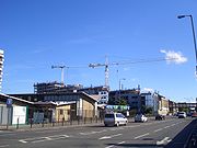
Commercial Road
Encyclopedia

London Borough of Tower Hamlets
The London Borough of Tower Hamlets is a London borough to the east of the City of London and north of the River Thames. It is in the eastern part of London and covers much of the traditional East End. It also includes much of the redeveloped Docklands region of London, including West India Docks...
in the East End of London
East End of London
The East End of London, also known simply as the East End, is the area of London, England, United Kingdom, east of the medieval walled City of London and north of the River Thames. Although not defined by universally accepted formal boundaries, the River Lea can be considered another boundary...
. It runs from "Gardener's Corner" (on which stands Aldgate East tube station
Aldgate East tube station
Aldgate East is a London Underground station located between Aldgate and Whitechapel in the London Borough of Tower Hamlets.The station is in Travelcard Zone 1...
), through Stepney
Stepney
Stepney is a district of the London Borough of Tower Hamlets in London's East End that grew out of a medieval village around St Dunstan's church and the 15th century ribbon development of Mile End Road...
to the junction with Burdett Road (A1205), Limehouse
Limehouse
Limehouse is a place in the London Borough of Tower Hamlets. It is on the northern bank of the River Thames opposite Rotherhithe and between Ratcliff to the west and Millwall to the east....
from which point the route becomes the East India Dock Road. The straightness of the route suggests a Roman road
Roman road
The Roman roads were a vital part of the development of the Roman state, from about 500 BC through the expansion during the Roman Republic and the Roman Empire. Roman roads enabled the Romans to move armies and trade goods and to communicate. The Roman road system spanned more than 400,000 km...
, although it was built by the East India Company
British East India Company
The East India Company was an early English joint-stock company that was formed initially for pursuing trade with the East Indies, but that ended up trading mainly with the Indian subcontinent and China...
in the early nineteenth century as part of the development of London Docklands.
Commercial is an important artery connecting the traditional City of London with the more recently developed financial district at Canary Wharf.
Buildings en route include:
- Limehouse Town HallLimehouse Town HallLimehouse Town Hall is a former town hall building on Commercial Road, in Limehouse, in the London Borough of Tower Hamlets.-History:Limehouse Town Hall was built in 1879, designed by A. & C. Harston, as the vestry hall of the Limehouse District. The building consists of a number of offices, below...
- St Anne's LimehouseSt Anne's LimehouseSt Anne's Limehouse is a Hawksmoor Anglican Church in Limehouse, in the London Borough of Tower Hamlets. It was consecrated in 1730, one of the twelve churches built through the 1711 Act of Parliament.-History:...
Other neaby roads:
- Cable StreetCable StreetCable Street is a mile-long road in the East End of London, with several historic landmarks nearby, made famous by "the Battle of Cable Street" of 1936.-Location:Cable Street runs between the edge of The City and Limehouse:...
- Narrow StreetNarrow StreetNarrow Street is a narrow street running parallel to the River Thames through the Limehouse area of east London.- History :A combination of tides and currents made this point on the Thames a natural landfall for ships, the first wharf being completed in 1348...
- The HighwayThe HighwayThe Highway, formerly known as the Ratcliffe Highway, is a mile-long road in the East End of London, with several historic landmarks nearby. The route dates back to Roman times. In the 19th century it had a very notorious reputation for vice and crime and was the site of the infamous Ratcliff...
- Myrdle Street
See also
- Siege of Sidney StreetSiege of Sidney StreetThe Siege of Sidney Street, popularly known as the "Battle of Stepney", was a notorious gunfight in London's East End on the 2nd of January 1911. Preceded by the Houndsditch Murders, it ended with the deaths of two members of a supposedly politically-motivated gang of burglars supposedly led by...
- Stepney Historical Trust

