

Coleman Station Historic District
Encyclopedia
The Coleman Station Historic District is located around the former New York Central Railroad
Coleman's
station in the Town of North East
, New York, United States, a short distance south of the village of Millerton
. It is a rural area including several large farms in the southeastern corner of the town. At almost three square miles (1812 acres (7.3 km²)), it is the largest historic district
entirely within Dutchess County
and the second largest in the county.
Nine farms were established in the current district by emigrants from New England
in the late 18th century. Those farms have since been subdivided and recombined under later owners, but their original boundaries were used to establish the district, a small valley along Webutuck Creek. Over the course of the 19th century they evolved from farms that primarily raised a diverse group of livestock for local and regional markets to dairy farms that used the station and the railroad line that ran through the middle of the district to sell raw milk to New York City. By the middle of the 20th century a corporate farm
in the district had become one of the city's largest milk providers.
At the end of the 19th century residents of the city began to make country retreats in and around the district. A century later some of them lobbied to create the district and list it on the National Register of Historic Places
in 1993. One local farm's resistance to that effort went as far as federal appeals court after lower state and federal courts had negated the creation of the district. Since then some newer farms in the district have used its historic buildings and farms for coffee roasting
and low-impact sheep farming, among other.
Many of the buildings in the district were erected in the 18th and 19th centuries, with little modification since then. They reflect, in many instances, different phases of agricultural development in the district. Five of these contributing properties
are listed on the National Register of Historic Places
.
. The US 44
/NY 22
highway is its westernmost extent, with a stretch of a half-mile (1 km) in either direction from the Coleman Station Road intersection serving as the southwestern corner line, with the exception of a small newer farm on the east side of the road near the southern end. From there the boundary runs due east to the rail trail, and turns south.
After following the rail trail for a thousand feet (300 m), it turns east again and follows lot lines first between fields and then through a large woodlot
to Sheffield Hill Road. It turns south and then east, taking in another farm, and then follows the Connecticut
state line, following it north to a dirt road along Webutuck Creek.
It then follows the creek itself, excluding a large farm along the state line to the east. At Taylor Road it follows the road briefly, then a lot line straight east back to the state line. Just at the southwestern corner of Indian Lake, it follows another lot line east, then north, and then east again at the rear lines of modern houses along Red Cedar Lane. It then curves north along Indian Lake Road to another property line which it then follows west, at the district's northernmost corner. The boundary turns to the south along this line after roughly 1200 feet (365.8 m), then returns to its due-west heading for another half-mile, crossing the rail trail and Mill Road at their junction. It turns south at a cleared field in the middle of the woods, then follows lot lines back to routes 22 and 44.
Topographically
, the 1812 acres (733.3 ha) inside this boundary is a bowl through which the creek flows, formed by ridges and plateaus of as high as 900 feet (274.3 m) in elevation, and breached by valleys of the Webutuck's tributaries
in the area, and the Webutuck itself at the north end, near the lake. The station area that gave the district its name lies at the low point, around 580 feet (176.8 m). Most of the land is used for agricultural purposes, as fields or pasture
, with some areas remaining as woodlot
s. Because of the clearing, it offers scenic views in every direction, particularly of the Taconic Mountains
to the north and east.
The nearest settlement to the district is Sharon Valley, Connecticut
, one mile to the southeast. Downtown Sharon
is just east of Sharon Valley. The nearest New York neighbors are the village of Millerton
, four miles (3 km) north, and the hamlet of Amenia
three miles (6.4 km) south, along routes 22 and 44.
There are a total of 85 buildings, 23 sites and 9 structures within the district, most of them used for farming. Of these 117 resources, all but 29 are contributing properties
to its historic character. Four of the farms and one former estate have been individually listed on the National Register.
due to land disputes between the colonies of New York and Connecticut. The current boundary was resolved in 1732. Even after settlement began, the pace was slowed by war. In the early 19th century farming finally developed, moving from a diverse pre-industrial agriculture to a more specialized focus on milk production after the railroad and industrialization.
Farming survived the decline of the railroads in the late 20th century. Newcomers to the region saw its historic value and fought a precedent-setting court battle in the last years of the century to publicly recognize and preserve it. Since then agriculture in the district has once again begun to diversify.
before European settlers arrived. That took later than usual due to the land dispute between the colonies of New York and Connecticut. Few settlers built homes in the 150 square miles (388.5 km²) borderland known as the Oblong until the 1730s, when the two colonies agreed that the Panhandle
, where Greenwich
, Stamford
and New Canaan
are now, would be part of Connecticut while New York got the Oblong.
The agreement allowed for Connecticut landowners to continue to hold title in the Oblong, in order that they would have an incentive to pay for an overdue survey
of the land. Even with these issues resolved, and land apportioned, sold and subdivided, there was still little settlement of the area throughout the mid-18th century. Indians, who had found the area a desirable place to settle while its legal status was unclear, established villages in the area, giving Indian Lake its name. Their presence in the area is recorded as late as the 1750s.
Most areas of the Harlem Valley were difficult places to establish farms due to the minimal amount of arable land. The area later to become Coleman Station was an exception. Settlers coming west from New England
found its alluvial soil ideal for farming. One family, Nathan Wheeler and his son Elijah, of New Marlborough, Massachusetts
, bought over 200 acres (80.9 ha), the first of two families by that name to establish themselves in the district, in the early 1760s. Another family, the Collinses, had already settled nearby but bought land in the district to give to their children.
The oldest surviving buildings in the district, the farmhouse and barn at the Wheeler-Collins Farm on Coleman Station Road, have been dated to about 1771, shortly after land-transaction records start being kept regularly. Thomas Wheeler of Woodbury, Connecticut
, arrived right before the war, the other Wheeler to establish his family there. The other farms were established following independence. By the early 19th century four large farms existed, all linked to Wheelers.
for export. In Dutchess County, they began raising a mix of livestock
and cash crop
s for local and regional consumption, building farms that reflected this with buildings and spaces dedicated to different species. They supplemented their farm income with the extraction of raw material
s for early industrial production like iron, limestone
and peat
, from nearby hillsides and bogs.
The 1850 census
contains the first record of farm production in the district. The farms, about 150 – each, averaged 5–6 cows for milking, with twice that number slaughtered for meat. The former produced 300 – of butter and 150 – of cheese. Sheep were more numerous, about a hundred per farm on average, yielding 200 – of wool each year. They were joined by 20–30 pigs, oxen used as beasts of burden
and horses for personal transportation. Most improved land on the farms was used as pasture
; cropland was used mostly for animal feed, hay and potatoes.
Ten years later, the 1860 census
shows a dramatic change in animals raised. Cow herds have gained at the expense of pigs and sheep, and the number of milking cows increased to 10–20, with no change in the crops grown. This reflects the 1852 advent of the New York and Harlem Railroad
, the state's first, into the area, and with it a milk-processing plant in Wassaic
to the south. Farmers could now get their milk and products
to the growing New York City
market, making dairy farming much more profitable.
The 1870 census
for the first time recorded fluid milk production, with the Coleman Station farmers' herds putting out 10000 – annually. Farms still produced their own butter in quantity, but left cheese production and its enormous fluid milk requirements to the processing plant. It was the beginning of a shift from the diverse animal farming which had characterized the district earlier in the century to almost exclusively dairy farming, as it is today. Barns grew bigger to accommodate the larger cattle herds and more land was given over to pasture and feed crops.
and give it to the area. He and Oliver Barrett convinced what was by then the New York Central
that a separate stop less than two miles (3 km) north of its Sharon station
would help it better serve both the vacationers headed for that town
across the state line and the farmers. The station spurred the development of a small commercial center around it, almost vanished today. Indian Lake Road was rerouted to the east side of the line (the original roadbed is still visible near the current overpass) and a rock cut
created through the Wheeler-Bassett Farm. In the Great Blizzard of 1888
a five-locomotive plowing team was utterly wrecked when it crashed into snow that had accumulated in the cut. Five members of the train crew were killed.
The railroad's presence led to an old farmhouse, today known as Mutton Hill, at the southeast corner of the district, being renovated for use as country house. It was the only one in the district until 1903 when Thomas Hidden, a recently retired New York City industrialist, bought portions of four of the old farms on Sheffield Hill Road to create his Hiddenhurst
estate
. He may have chosen the Coleman Station area over the more popular Sharon area to the south since he was interested in raising horses on the property. He built a large stable and indoor training course, neither extant. The ornate neo-Georgian
main house is considered to be the most architecturally distinctive property in the district.
Two years after Hidden's death in 1918, his estate was purchased by the Sheffield Milk Company, which combined his property with others it had acquired nearby and established a large corporate farm
. It demolished Hidden's stable and training facility and erected a large dairy complex on its site along with housing for its workers. A new owner of the Wheeler Farm on Taylor Road around this time renovated its house to attract summer boarders, and distributed a brochure promoting it through the railroad. They may not have been the only ones. The transition of the district from an insular farming community, where agriculture defined residents socially as well as economically, to one in which it was purely a business was now complete.
Penn Central, ended passenger service along the railroad north of Dover Plains
. Freight service continued for another decade, after which the tracks were removed. In 1985 the Ezra Clark House
became the first property in Coleman Station to be listed on the National Register. The owners of Hiddenhurst demolished a remaining brick house and carriage house from one of the original farms a few years later, prior to that property's 1991 listing.
Around that time owners of weekend homes
and other residents of the area began working for the creation of a historic district
around Coleman Station, forming the advocacy group Friends of Coleman Station. Many of them were also concerned about the large-scale compost
ing activities of McEnroe Farms, one of the largest organic farms
in the state, which they felt threatened the watershed with potentially toxic runoff from its manure piles and which fouled the air with strong odors. The farm owners and operator feared that historic designation would bring with it local zoning
regulations that would limit their activities to an extent that the farm would become less profitable.
After the listing on the New York State Register of Historic Places in 1993, the Keeper of the Register
at the National Park Service
followed with a listing on the National Register two months later. McEnroe successfully petitioned a state court to have the district's creation overturned on the grounds that it was not of sufficient historic importance and that notice of the state designation had been neither timely nor accompanied with written support as required by regulations of the state's Historic Preservation Office
.
The farm also persuaded Judge Robert W. Sweet
of the Southern District of New York
to void the federal listing as well, alleging violation of the Administrative Procedure Act
. A year later, a three-judge panel of the Second Circuit Court of Appeals
reversed Sweet. Judge John M. Walker, Jr.
wrote for a three-judge panel that both the National Historic Preservation Act
and a similar Hawaii case from 1979 gave the Keeper of the Register the authority to act on a listing independently of a state or local body regardless of whether procedural flaws existed in the state process. Nor were McEnroe's due process
rights violated since the National Register listing's only direct effect is to constrain the actions of federal agencies that might affect the listed property.
. A new agricultural product was added to the district in 1999, when the owners of the Manhattan coffeehouse
71 Irving Place opened a roasting
facility in a former carriage house on Reagan Road. They cited the area's preserved
historic character as a major reason for locating there. Since then what is now known as the Irving Farm Coffee Company has expanded both at its original site and to other locations near Millerton. A mother-daughter team has also brought sheep farming back to the district at Dashing Star Farm, the renamed Stephen Wheeler Farm.
In the 21st century, the railroad corridor came into use again when the Harlem Valley Rail Trail
was created. Metro-North Railroad
restored Harlem Line passenger service to a new Wassaic station
, at the rail trail's southern end. It continues through the district to the old Millerton station
. The former Coleman's station site is now used as parking for the bicyclists and walkers who use the trail.
Friends of Coleman Station continues to be active in preserving and promoting the district. It works out of a small headquarters on Indian Lake Road with research materials that is open to the public by appointment. It maintains the small Coleman Station Burying Ground and the Diana K. Temple Memorial Garden along the rail trail, with native plants, trees and shrubs. Every year it hosts an annual cleanup of the district, with the occasional house and district tour.
New York Central Railroad
The New York Central Railroad , known simply as the New York Central in its publicity, was a railroad operating in the Northeastern United States...
Coleman's
Coleman's (NYCRR station)
Colemans was a former NYCRR train station that served the residents of North East, New York.Colemans operated primarily as a freight stop, but began accepting passengers by the late 1950s. Today it is located along the Harlem Valley Rail Trail in the middle of the Coleman Station Historic District....
station in the Town of North East
North East, New York
North East is a town in Dutchess County, New York, United States. The population was 3,002 at the 2000 census.The Town of North East is in the northeastern part of the county...
, New York, United States, a short distance south of the village of Millerton
Millerton, New York
Millerton is a village in Dutchess County, New York, United States. The population was 925 at the 2000 census. It is part of the Poughkeepsie–Newburgh–Middletown, NY Metropolitan Statistical Area as well as the larger New York–Newark–Bridgeport, NY-NJ-CT-PA Combined...
. It is a rural area including several large farms in the southeastern corner of the town. At almost three square miles (1812 acres (7.3 km²)), it is the largest historic district
Historic district (United States)
In the United States, a historic district is a group of buildings, properties, or sites that have been designated by one of several entities on different levels as historically or architecturally significant. Buildings, structures, objects and sites within a historic district are normally divided...
entirely within Dutchess County
Dutchess County, New York
Dutchess County is a county located in the U.S. state of New York, in the state's Mid-Hudson Region of the Hudson Valley. The 2010 census lists the population as 297,488...
and the second largest in the county.
Nine farms were established in the current district by emigrants from New England
New England
New England is a region in the northeastern corner of the United States consisting of the six states of Maine, New Hampshire, Vermont, Massachusetts, Rhode Island, and Connecticut...
in the late 18th century. Those farms have since been subdivided and recombined under later owners, but their original boundaries were used to establish the district, a small valley along Webutuck Creek. Over the course of the 19th century they evolved from farms that primarily raised a diverse group of livestock for local and regional markets to dairy farms that used the station and the railroad line that ran through the middle of the district to sell raw milk to New York City. By the middle of the 20th century a corporate farm
Corporate farming
Corporate farming is a term that describes the business of agriculture, specifically, what is seen by some as the practices of would-be megacorporations involved in food production on a very large scale...
in the district had become one of the city's largest milk providers.
At the end of the 19th century residents of the city began to make country retreats in and around the district. A century later some of them lobbied to create the district and list it on the National Register of Historic Places
National Register of Historic Places
The National Register of Historic Places is the United States government's official list of districts, sites, buildings, structures, and objects deemed worthy of preservation...
in 1993. One local farm's resistance to that effort went as far as federal appeals court after lower state and federal courts had negated the creation of the district. Since then some newer farms in the district have used its historic buildings and farms for coffee roasting
Coffee roasting
Roasting coffee transforms the chemical and physical properties of green coffee beans into roasted coffee products. The roasting process is what produces the characteristic flavor of coffee by causing the green coffee beans to expand and to change in color, taste, smell, and density...
and low-impact sheep farming, among other.
Many of the buildings in the district were erected in the 18th and 19th centuries, with little modification since then. They reflect, in many instances, different phases of agricultural development in the district. Five of these contributing properties
Contributing property
In the law regulating historic districts in the United States, a contributing resource or contributing property is any building, structure, or object which adds to the historical integrity or architectural qualities that make the historic district, listed locally or federally, significant...
are listed on the National Register of Historic Places
National Register of Historic Places
The National Register of Historic Places is the United States government's official list of districts, sites, buildings, structures, and objects deemed worthy of preservation...
.
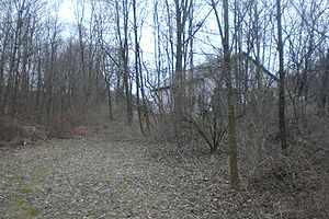
Geography
The district is an irregularly shaped area whose boundaries follow either lot lines or the roads in the area. It is bisected by the former railroad right-of-way, now a portion of the Harlem Valley Rail TrailHarlem Valley Rail Trail
The Harlem Valley Rail Trail is a paved rail trail on an abandoned portion of the New York and Harlem Railroad, north of the Metro-North Railroad Harlem Line terminus in Wassaic. It is owned by the New York State Office of Parks, Recreation and Historic Preservation...
. The US 44
U.S. Route 44 in New York
U.S. Route 44 in the state of New York is a major east–west thoroughfare in the Hudson Valley region of the state. Its entire length is maintained by the New York State Department of Transportation, with the exception of the Mid-Hudson Bridge, which is maintained by the New York State Bridge...
/NY 22
New York State Route 22
New York State Route 22 is a north–south state highway in eastern New York in the United States. It runs parallel to the state's eastern edge from the outskirts of New York City to a short distance south of the Canadian border. At , it is the state's longest north–south route and...
highway is its westernmost extent, with a stretch of a half-mile (1 km) in either direction from the Coleman Station Road intersection serving as the southwestern corner line, with the exception of a small newer farm on the east side of the road near the southern end. From there the boundary runs due east to the rail trail, and turns south.
After following the rail trail for a thousand feet (300 m), it turns east again and follows lot lines first between fields and then through a large woodlot
Woodlot
A woodlot is a term used in North America to refer to a segment of a woodland or forest capable of small-scale production of forest products such as wood fuel, sap for maple syrup, sawlogs, as well as recreational uses like bird watching, bushwalking, and wildflower appreciation...
to Sheffield Hill Road. It turns south and then east, taking in another farm, and then follows the Connecticut
Connecticut
Connecticut is a state in the New England region of the northeastern United States. It is bordered by Rhode Island to the east, Massachusetts to the north, and the state of New York to the west and the south .Connecticut is named for the Connecticut River, the major U.S. river that approximately...
state line, following it north to a dirt road along Webutuck Creek.
It then follows the creek itself, excluding a large farm along the state line to the east. At Taylor Road it follows the road briefly, then a lot line straight east back to the state line. Just at the southwestern corner of Indian Lake, it follows another lot line east, then north, and then east again at the rear lines of modern houses along Red Cedar Lane. It then curves north along Indian Lake Road to another property line which it then follows west, at the district's northernmost corner. The boundary turns to the south along this line after roughly 1200 feet (365.8 m), then returns to its due-west heading for another half-mile, crossing the rail trail and Mill Road at their junction. It turns south at a cleared field in the middle of the woods, then follows lot lines back to routes 22 and 44.
Topographically
Topography
Topography is the study of Earth's surface shape and features or those ofplanets, moons, and asteroids...
, the 1812 acres (733.3 ha) inside this boundary is a bowl through which the creek flows, formed by ridges and plateaus of as high as 900 feet (274.3 m) in elevation, and breached by valleys of the Webutuck's tributaries
Tributary
A tributary or affluent is a stream or river that flows into a main stem river or a lake. A tributary does not flow directly into a sea or ocean...
in the area, and the Webutuck itself at the north end, near the lake. The station area that gave the district its name lies at the low point, around 580 feet (176.8 m). Most of the land is used for agricultural purposes, as fields or pasture
Pasture
Pasture is land used for grazing. Pasture lands in the narrow sense are enclosed tracts of farmland, grazed by domesticated livestock, such as horses, cattle, sheep or swine. The vegetation of tended pasture, forage, consists mainly of grasses, with an interspersion of legumes and other forbs...
, with some areas remaining as woodlot
Woodlot
A woodlot is a term used in North America to refer to a segment of a woodland or forest capable of small-scale production of forest products such as wood fuel, sap for maple syrup, sawlogs, as well as recreational uses like bird watching, bushwalking, and wildflower appreciation...
s. Because of the clearing, it offers scenic views in every direction, particularly of the Taconic Mountains
Taconic Mountains
The Taconic Mountains or Taconic Range are a physiographic section of the larger New England province and part of the Appalachian Mountains, running along the eastern border of New York State and adjacent New England from northwest Connecticut to western Massachusetts, north to central western...
to the north and east.
The nearest settlement to the district is Sharon Valley, Connecticut
Sharon Valley Historic District
The Sharon Valley Historic District is located around the junction of Kings Hill, Sharon Valley and Sharon Station roads in Sharon, Connecticut, United States. It is a small community that grew up around an iron mining and refining operation during the late 19th century, the first industry in...
, one mile to the southeast. Downtown Sharon
Sharon, Connecticut
Sharon is a town located in Litchfield County, Connecticut, in the northwest corner of the state. It is bounded on the north by Salisbury, on the east by the Housatonic River, on the south by Kent, and on the west by Dutchess County, New York...
is just east of Sharon Valley. The nearest New York neighbors are the village of Millerton
Millerton, New York
Millerton is a village in Dutchess County, New York, United States. The population was 925 at the 2000 census. It is part of the Poughkeepsie–Newburgh–Middletown, NY Metropolitan Statistical Area as well as the larger New York–Newark–Bridgeport, NY-NJ-CT-PA Combined...
, four miles (3 km) north, and the hamlet of Amenia
Amenia (CDP), New York
Amenia is a hamlet in Dutchess County, New York, United States. The population was 1,115 at the 2000 census. It is part of the Poughkeepsie–Newburgh–Middletown, NY Metropolitan Statistical Area as well as the larger New York–Newark–Bridgeport, NY-NJ-CT-PA Combined...
three miles (6.4 km) south, along routes 22 and 44.
There are a total of 85 buildings, 23 sites and 9 structures within the district, most of them used for farming. Of these 117 resources, all but 29 are contributing properties
Contributing property
In the law regulating historic districts in the United States, a contributing resource or contributing property is any building, structure, or object which adds to the historical integrity or architectural qualities that make the historic district, listed locally or federally, significant...
to its historic character. Four of the farms and one former estate have been individually listed on the National Register.
History
What would become Coleman Station took a long time for Europeans to settleEuropean colonization of the Americas
The start of the European colonization of the Americas is typically dated to 1492. The first Europeans to reach the Americas were the Vikings during the 11th century, who established several colonies in Greenland and one short-lived settlement in present day Newfoundland...
due to land disputes between the colonies of New York and Connecticut. The current boundary was resolved in 1732. Even after settlement began, the pace was slowed by war. In the early 19th century farming finally developed, moving from a diverse pre-industrial agriculture to a more specialized focus on milk production after the railroad and industrialization.
Farming survived the decline of the railroads in the late 20th century. Newcomers to the region saw its historic value and fought a precedent-setting court battle in the last years of the century to publicly recognize and preserve it. Since then agriculture in the district has once again begun to diversify.
1731–1771: Early settlement
Tradition has it that the area, like much of the Harlem Valley in eastern Dutchess County, was thoroughly cleared and cultivated by Native AmericansNative Americans in the United States
Native Americans in the United States are the indigenous peoples in North America within the boundaries of the present-day continental United States, parts of Alaska, and the island state of Hawaii. They are composed of numerous, distinct tribes, states, and ethnic groups, many of which survive as...
before European settlers arrived. That took later than usual due to the land dispute between the colonies of New York and Connecticut. Few settlers built homes in the 150 square miles (388.5 km²) borderland known as the Oblong until the 1730s, when the two colonies agreed that the Panhandle
Connecticut Panhandle
The Connecticut Panhandle, informally known to locals as the Tail, is in southwestern Connecticut, where it abuts New York State. It is contained entirely in Fairfield County and includes all of Greenwich, Stamford, New Canaan, and Darien, as well as part of Norwalk and containing some of the most...
, where Greenwich
Greenwich, Connecticut
Greenwich is a town in Fairfield County, Connecticut, United States. As of the 2010 census, the town had a total population of 61,171. It is home to many hedge funds and other financial service companies. Greenwich is the southernmost and westernmost municipality in Connecticut and is 38+ minutes ...
, Stamford
Stamford, Connecticut
Stamford is a city in Fairfield County, Connecticut, United States. According to the 2010 census, the population of the city is 122,643, making it the fourth largest city in the state and the eighth largest city in New England...
and New Canaan
New Canaan, Connecticut
New Canaan is a town in Fairfield County, Connecticut, United States, northeast of Stamford, on the Fivemile River. The population was 19,738 according to the 2010 census.The town is one of the most affluent communities in the United States...
are now, would be part of Connecticut while New York got the Oblong.
The agreement allowed for Connecticut landowners to continue to hold title in the Oblong, in order that they would have an incentive to pay for an overdue survey
Surveying
See Also: Public Land Survey SystemSurveying or land surveying is the technique, profession, and science of accurately determining the terrestrial or three-dimensional position of points and the distances and angles between them...
of the land. Even with these issues resolved, and land apportioned, sold and subdivided, there was still little settlement of the area throughout the mid-18th century. Indians, who had found the area a desirable place to settle while its legal status was unclear, established villages in the area, giving Indian Lake its name. Their presence in the area is recorded as late as the 1750s.
Most areas of the Harlem Valley were difficult places to establish farms due to the minimal amount of arable land. The area later to become Coleman Station was an exception. Settlers coming west from New England
New England
New England is a region in the northeastern corner of the United States consisting of the six states of Maine, New Hampshire, Vermont, Massachusetts, Rhode Island, and Connecticut...
found its alluvial soil ideal for farming. One family, Nathan Wheeler and his son Elijah, of New Marlborough, Massachusetts
New Marlborough, Massachusetts
New Marlborough is a town in Berkshire County, Massachusetts, United States. It is part of the Pittsfield, Massachusetts Metropolitan Statistical Area. The population was 1,494 at the 2000 census...
, bought over 200 acres (80.9 ha), the first of two families by that name to establish themselves in the district, in the early 1760s. Another family, the Collinses, had already settled nearby but bought land in the district to give to their children.
The oldest surviving buildings in the district, the farmhouse and barn at the Wheeler-Collins Farm on Coleman Station Road, have been dated to about 1771, shortly after land-transaction records start being kept regularly. Thomas Wheeler of Woodbury, Connecticut
Woodbury, Connecticut
Woodbury is a town in Litchfield County, Connecticut, United States. The population was 9,198 at the 2000 census. The town center is also designated by the U.S. Census Bureau as a census-designated place . Woodbury was founded in 1672....
, arrived right before the war, the other Wheeler to establish his family there. The other farms were established following independence. By the early 19th century four large farms existed, all linked to Wheelers.
1771–1870: Animal farming
As the New England farmers settled in their new home, under their new flag, their agricultural practices changed. In their home states, under British rule, they had primarily grown wheatWheat
Wheat is a cereal grain, originally from the Levant region of the Near East, but now cultivated worldwide. In 2007 world production of wheat was 607 million tons, making it the third most-produced cereal after maize and rice...
for export. In Dutchess County, they began raising a mix of livestock
Livestock
Livestock refers to one or more domesticated animals raised in an agricultural setting to produce commodities such as food, fiber and labor. The term "livestock" as used in this article does not include poultry or farmed fish; however the inclusion of these, especially poultry, within the meaning...
and cash crop
Cash crop
In agriculture, a cash crop is a crop which is grown for profit.The term is used to differentiate from subsistence crops, which are those fed to the producer's own livestock or grown as food for the producer's family...
s for local and regional consumption, building farms that reflected this with buildings and spaces dedicated to different species. They supplemented their farm income with the extraction of raw material
Raw material
A raw material or feedstock is the basic material from which a product is manufactured or made, frequently used with an extended meaning. For example, the term is used to denote material that came from nature and is in an unprocessed or minimally processed state. Latex, iron ore, logs, and crude...
s for early industrial production like iron, limestone
Limestone
Limestone is a sedimentary rock composed largely of the minerals calcite and aragonite, which are different crystal forms of calcium carbonate . Many limestones are composed from skeletal fragments of marine organisms such as coral or foraminifera....
and peat
Peat
Peat is an accumulation of partially decayed vegetation matter or histosol. Peat forms in wetland bogs, moors, muskegs, pocosins, mires, and peat swamp forests. Peat is harvested as an important source of fuel in certain parts of the world...
, from nearby hillsides and bogs.
The 1850 census
United States Census, 1850
The United States Census of 1850 was the seventh census of the United States. Conducted by the Bureau of the Census on June 1, 1850, it determined the resident population of the United States to be 23,191,876 — an increase of 35.9 percent over the 17,069,453 persons enumerated during the 1840...
contains the first record of farm production in the district. The farms, about 150 – each, averaged 5–6 cows for milking, with twice that number slaughtered for meat. The former produced 300 – of butter and 150 – of cheese. Sheep were more numerous, about a hundred per farm on average, yielding 200 – of wool each year. They were joined by 20–30 pigs, oxen used as beasts of burden
Working animal
A working animal is an animal, usually domesticated, that is kept by humans and trained to perform tasks. They may be close members of the family, such as guide or service dogs, or they may be animals trained strictly to perform a job, such as logging elephants. They may also be used for milk, a...
and horses for personal transportation. Most improved land on the farms was used as pasture
Pasture
Pasture is land used for grazing. Pasture lands in the narrow sense are enclosed tracts of farmland, grazed by domesticated livestock, such as horses, cattle, sheep or swine. The vegetation of tended pasture, forage, consists mainly of grasses, with an interspersion of legumes and other forbs...
; cropland was used mostly for animal feed, hay and potatoes.
Ten years later, the 1860 census
United States Census, 1860
The United States Census of 1860 was the eighth Census conducted in the United States. It determined the population of the United States to be 31,443,321 — an increase of 35.4 percent over the 23,191,875 persons enumerated during the 1850 Census...
shows a dramatic change in animals raised. Cow herds have gained at the expense of pigs and sheep, and the number of milking cows increased to 10–20, with no change in the crops grown. This reflects the 1852 advent of the New York and Harlem Railroad
New York and Harlem Railroad
The New York and Harlem Railroad was one of the first railroads in the United States, and possibly also the world's first street railway. Designed by John Stephenson, it was opened in stages between 1832 and 1852 between Lower Manhattan to and beyond Harlem...
, the state's first, into the area, and with it a milk-processing plant in Wassaic
Wassaic, New York
Wassaic is a hamlet in the Town of Amenia, Dutchess County, New York in the United States.Wassaic is located in southeast New York State and surrounded by the East and West Mountains and along the Tenmile River....
to the south. Farmers could now get their milk and products
Dairy product
Dairy products are generally defined as foods produced from cow's or domestic buffalo's milk. They are usually high-energy-yielding food products. A production plant for such processing is called a dairy or a dairy factory. Raw milk for processing comes mainly from cows, and, to a lesser extent,...
to the growing New York City
New York City
New York is the most populous city in the United States and the center of the New York Metropolitan Area, one of the most populous metropolitan areas in the world. New York exerts a significant impact upon global commerce, finance, media, art, fashion, research, technology, education, and...
market, making dairy farming much more profitable.
The 1870 census
United States Census, 1870
The United State Census of 1870 was the ninth United States Census. Conducted by the Census Bureau in June 1870, the 1870 Census was the first census to provide detailed information on the black population, only years after the culmination of the Civil War when slaves were granted freedom. The...
for the first time recorded fluid milk production, with the Coleman Station farmers' herds putting out 10000 – annually. Farms still produced their own butter in quantity, but left cheese production and its enormous fluid milk requirements to the processing plant. It was the beginning of a shift from the diverse animal farming which had characterized the district earlier in the century to almost exclusively dairy farming, as it is today. Barns grew bigger to accommodate the larger cattle herds and more land was given over to pasture and feed crops.
1850–1923: Conversion to dairy farming and tourism
With the coming of the railroad, local entrpreneur Amasa Coleman lobbied for the construction of the station that would take its name from himColeman's (NYCRR station)
Colemans was a former NYCRR train station that served the residents of North East, New York.Colemans operated primarily as a freight stop, but began accepting passengers by the late 1950s. Today it is located along the Harlem Valley Rail Trail in the middle of the Coleman Station Historic District....
and give it to the area. He and Oliver Barrett convinced what was by then the New York Central
New York Central Railroad
The New York Central Railroad , known simply as the New York Central in its publicity, was a railroad operating in the Northeastern United States...
that a separate stop less than two miles (3 km) north of its Sharon station
Sharon (NYCRR station)
Sharon is a former NYCRR train station that served the residents of Amenia, New York.-History:This station served the nearby town of Sharon, Connecticut. Despite its name, Sharon Station is not actually located in Sharon, Connecticut but is located over the state border and catered to the residents...
would help it better serve both the vacationers headed for that town
Sharon, Connecticut
Sharon is a town located in Litchfield County, Connecticut, in the northwest corner of the state. It is bounded on the north by Salisbury, on the east by the Housatonic River, on the south by Kent, and on the west by Dutchess County, New York...
across the state line and the farmers. The station spurred the development of a small commercial center around it, almost vanished today. Indian Lake Road was rerouted to the east side of the line (the original roadbed is still visible near the current overpass) and a rock cut
Cut and fill
In earthmoving, cut and fill is the process of constructing a railway, road or canal whereby the amount of material from cuts roughly matches the amount of fill needed to make nearby embankments, so minimizing the amount of construction labor...
created through the Wheeler-Bassett Farm. In the Great Blizzard of 1888
Great Blizzard of 1888
The Great Blizzard of 1888 or Great Blizzard of '88 was one of the most severe blizzards in United States' recorded history. Snowfalls of 40-50 inches fell in parts of New Jersey, New York, Massachusetts and Connecticut, and sustained winds of over produced snowdrifts in excess of...
a five-locomotive plowing team was utterly wrecked when it crashed into snow that had accumulated in the cut. Five members of the train crew were killed.
The railroad's presence led to an old farmhouse, today known as Mutton Hill, at the southeast corner of the district, being renovated for use as country house. It was the only one in the district until 1903 when Thomas Hidden, a recently retired New York City industrialist, bought portions of four of the old farms on Sheffield Hill Road to create his Hiddenhurst
Hiddenhurst
Hiddenhurst is the former estate of businessman Thomas Hidden, on Sheffield Hill Road in the Town of North East, New York, United States, south of the village of Millerton. It is an elaborate frame house built at the beginning of the 20th century in the neo-Georgian architectural style.Hidden...
estate
Estate (house)
An estate comprises the houses and outbuildings and supporting farmland and woods that surround the gardens and grounds of a very large property, such as a country house or mansion. It is the modern term for a manor, but lacks the latter's now abolished jurisdictional authority...
. He may have chosen the Coleman Station area over the more popular Sharon area to the south since he was interested in raising horses on the property. He built a large stable and indoor training course, neither extant. The ornate neo-Georgian
Georgian architecture
Georgian architecture is the name given in most English-speaking countries to the set of architectural styles current between 1720 and 1840. It is eponymous for the first four British monarchs of the House of Hanover—George I of Great Britain, George II of Great Britain, George III of the United...
main house is considered to be the most architecturally distinctive property in the district.
Two years after Hidden's death in 1918, his estate was purchased by the Sheffield Milk Company, which combined his property with others it had acquired nearby and established a large corporate farm
Corporate farming
Corporate farming is a term that describes the business of agriculture, specifically, what is seen by some as the practices of would-be megacorporations involved in food production on a very large scale...
. It demolished Hidden's stable and training facility and erected a large dairy complex on its site along with housing for its workers. A new owner of the Wheeler Farm on Taylor Road around this time renovated its house to attract summer boarders, and distributed a brochure promoting it through the railroad. They may not have been the only ones. The transition of the district from an insular farming community, where agriculture defined residents socially as well as economically, to one in which it was purely a business was now complete.
1923–2000: Preservation and litigation
Change would continue. In the 1950s Sheffield, now one of the largest milk suppliers to New York City, was bought out by the Sealtest conglomerate. Two decades later the railroad, by now the nearly bankruptBankruptcy in the United States
Bankruptcy in the United States is governed under the United States Constitution which authorizes Congress to enact "uniform Laws on the subject of Bankruptcies throughout the United States." Congress has exercised this authority several times since 1801, most recently by adopting the Bankruptcy...
Penn Central, ended passenger service along the railroad north of Dover Plains
Dover Plains (Metro-North station)
The Dover Plains Metro-North Railroad station serves the residents of Dover Plains, New York via the Harlem Line. Trains leave for New York City every two hours, and about every 30 minutes during rush hour...
. Freight service continued for another decade, after which the tracks were removed. In 1985 the Ezra Clark House
Ezra Clark House
The Ezra Clark House is located on Mill Road in the Town of North East, New York, United States. It is a brick house built in the late 18th century....
became the first property in Coleman Station to be listed on the National Register. The owners of Hiddenhurst demolished a remaining brick house and carriage house from one of the original farms a few years later, prior to that property's 1991 listing.
Around that time owners of weekend homes
Cottage
__toc__In modern usage, a cottage is usually a modest, often cozy dwelling, typically in a rural or semi-rural location. However there are cottage-style dwellings in cities, and in places such as Canada the term exists with no connotations of size at all...
and other residents of the area began working for the creation of a historic district
Historic district (United States)
In the United States, a historic district is a group of buildings, properties, or sites that have been designated by one of several entities on different levels as historically or architecturally significant. Buildings, structures, objects and sites within a historic district are normally divided...
around Coleman Station, forming the advocacy group Friends of Coleman Station. Many of them were also concerned about the large-scale compost
Compost
Compost is organic matter that has been decomposed and recycled as a fertilizer and soil amendment. Compost is a key ingredient in organic farming. At its most essential, the process of composting requires simply piling up waste outdoors and waiting for the materials to break down from anywhere...
ing activities of McEnroe Farms, one of the largest organic farms
Organic farming
Organic farming is the form of agriculture that relies on techniques such as crop rotation, green manure, compost and biological pest control to maintain soil productivity and control pests on a farm...
in the state, which they felt threatened the watershed with potentially toxic runoff from its manure piles and which fouled the air with strong odors. The farm owners and operator feared that historic designation would bring with it local zoning
Zoning in the United States
Zoning in the United States comprise land use state laws falling under the police power rights that State governments and local governments have the authority to exercise over privately owned real property.-Origins and history:...
regulations that would limit their activities to an extent that the farm would become less profitable.
After the listing on the New York State Register of Historic Places in 1993, the Keeper of the Register
Keeper of the Register
The Keeper of the Register is a National Park Service official, responsible for deciding on the eligibility of historic properties for inclusion on the U.S. National Register of Historic Places . The Keeper's authority may be delegated as he or she sees fit...
at the National Park Service
National Park Service
The National Park Service is the U.S. federal agency that manages all national parks, many national monuments, and other conservation and historical properties with various title designations...
followed with a listing on the National Register two months later. McEnroe successfully petitioned a state court to have the district's creation overturned on the grounds that it was not of sufficient historic importance and that notice of the state designation had been neither timely nor accompanied with written support as required by regulations of the state's Historic Preservation Office
New York State Office of Parks, Recreation and Historic Preservation
The New York State Office of Parks, Recreation and Historic Preservation operates :*168 state parks*35 state historic sites*76 developed beaches*53 water recreational facilities*27 golf courses*39 full service cottages*818 cabins...
.
The farm also persuaded Judge Robert W. Sweet
Robert W. Sweet
Robert Workman Sweet is an American jurist and currently a senior United States federal judge serving on the United States District Court for the Southern District of New York.-Early life and career:...
of the Southern District of New York
United States District Court for the Southern District of New York
The United States District Court for the Southern District of New York is a federal district court. Appeals from the Southern District of New York are taken to the United States Court of Appeals for the Second Circuit The United States District Court for the Southern District of New York (in case...
to void the federal listing as well, alleging violation of the Administrative Procedure Act
Administrative Procedure Act
The Administrative Procedure Act , , is the United States federal law that governs the way in which administrative agencies of the federal government of the United States may propose and establish regulations. The APA also sets up a process for the United States federal courts to directly review...
. A year later, a three-judge panel of the Second Circuit Court of Appeals
United States Court of Appeals for the Second Circuit
The United States Court of Appeals for the Second Circuit is one of the thirteen United States Courts of Appeals...
reversed Sweet. Judge John M. Walker, Jr.
John M. Walker, Jr.
John Mercer Walker, Jr. is a judge of the United States Court of Appeals for the Second Circuit and a cousin of U.S. Presidents George H. W. Bush and George W. Bush...
wrote for a three-judge panel that both the National Historic Preservation Act
National Historic Preservation Act of 1966
The National Historic Preservation Act is legislation intended to preserve historical and archaeological sites in the United States of America...
and a similar Hawaii case from 1979 gave the Keeper of the Register the authority to act on a listing independently of a state or local body regardless of whether procedural flaws existed in the state process. Nor were McEnroe's due process
Due process
Due process is the legal code that the state must venerate all of the legal rights that are owed to a person under the principle. Due process balances the power of the state law of the land and thus protects individual persons from it...
rights violated since the National Register listing's only direct effect is to constrain the actions of federal agencies that might affect the listed property.
2000-present: Revitalization
After the creation of the district, Sealtest itself became a brand name of the Canadian conglomerate AgropurAgropur
Agropur is a Canadian Agricultural cooperative headquartered in Longueuil, Quebec, Canada.Founded in 1938, the Agropur cooperative is the Canadian dairy industry leader, with $3 billion in annualized sales...
. A new agricultural product was added to the district in 1999, when the owners of the Manhattan coffeehouse
Coffeehouse
A coffeehouse or coffee shop is an establishment which primarily serves prepared coffee or other hot beverages. It shares some of the characteristics of a bar, and some of the characteristics of a restaurant, but it is different from a cafeteria. As the name suggests, coffeehouses focus on...
71 Irving Place opened a roasting
Coffee roasting
Roasting coffee transforms the chemical and physical properties of green coffee beans into roasted coffee products. The roasting process is what produces the characteristic flavor of coffee by causing the green coffee beans to expand and to change in color, taste, smell, and density...
facility in a former carriage house on Reagan Road. They cited the area's preserved
Historic preservation
Historic preservation is an endeavor that seeks to preserve, conserve and protect buildings, objects, landscapes or other artifacts of historical significance...
historic character as a major reason for locating there. Since then what is now known as the Irving Farm Coffee Company has expanded both at its original site and to other locations near Millerton. A mother-daughter team has also brought sheep farming back to the district at Dashing Star Farm, the renamed Stephen Wheeler Farm.
In the 21st century, the railroad corridor came into use again when the Harlem Valley Rail Trail
Harlem Valley Rail Trail
The Harlem Valley Rail Trail is a paved rail trail on an abandoned portion of the New York and Harlem Railroad, north of the Metro-North Railroad Harlem Line terminus in Wassaic. It is owned by the New York State Office of Parks, Recreation and Historic Preservation...
was created. Metro-North Railroad
Metro-North Railroad
The Metro-North Commuter Railroad , trading as MTA Metro-North Railroad, or, more commonly, Metro-North, is a suburban commuter rail service that is run and managed by the Metropolitan Transportation Authority , an authority of New York State. It is the busiest commuter railroad in the United...
restored Harlem Line passenger service to a new Wassaic station
Wassaic (Metro-North station)
The Wassaic Metro-North Railroad station serves the residents of Wassaic, New York as the northern terminal of the Harlem Line. Trains leave for New York City every two hours, and about every 30 minutes during rush hour...
, at the rail trail's southern end. It continues through the district to the old Millerton station
Millerton (NYCRR station)
Millerton was a former New York Central Railroad train station that served the residents of Millerton, New York.-Platform and track configuration:...
. The former Coleman's station site is now used as parking for the bicyclists and walkers who use the trail.
Friends of Coleman Station continues to be active in preserving and promoting the district. It works out of a small headquarters on Indian Lake Road with research materials that is open to the public by appointment. It maintains the small Coleman Station Burying Ground and the Diana K. Temple Memorial Garden along the rail trail, with native plants, trees and shrubs. Every year it hosts an annual cleanup of the district, with the occasional house and district tour.
Significant contributing properties
Five properties within the district, all farms or former farms, are listed on the Register in their own right. Some other properties not yet judged historically significant to warrant listings of their own are significant enough to merit special mention within the district.National Register properties
- Oliver Barrett HouseOliver Barrett HouseThe Oliver Barrett House is located on Reagan Road in the Town of North East, New York, United States, south of the village of Millerton. It is a frame farmhouse built in the mid-19th century, possibly on the site or with materials from another, older house. In the early 20th century it underwent...
, Regan and Sheffield Hill roads. Probably built in 1853, perhaps with material from an older house, this frame house near the former station site was remodeled in a late Victorian style, particularly inside, in 1915. It i - Ezra Clark HouseEzra Clark HouseThe Ezra Clark House is located on Mill Road in the Town of North East, New York, United States. It is a brick house built in the late 18th century....
, Mill Road. The only brick farmhouse in the district follows New England building traditions despite the local DutchDutch colonization of the AmericasDutch trading posts and plantations in the Americas precede the much wider known colonization activities of the Dutch in Asia. Whereas the first Dutch fort in Asia was built in 1600 , the first forts and settlements on the Essequibo river in Guyana and on the Amazon date from the 1590s...
influence suggested by the material. - Dakin-Coleman FarmDakin-Coleman FarmThe Dakin-Coleman Farm is located on Coleman Station Road in the Town of North East, New York, United States. Its large wooden farmhouse was built shortly before the Revolution....
, Coleman Station Road. This early 19th century farmhouse at one point divided down the middle and shared by two generations. - HiddenhurstHiddenhurstHiddenhurst is the former estate of businessman Thomas Hidden, on Sheffield Hill Road in the Town of North East, New York, United States, south of the village of Millerton. It is an elaborate frame house built at the beginning of the 20th century in the neo-Georgian architectural style.Hidden...
, Sheffield Hill Road. Retired paint mogul Thomas Hidden built this ornate neo-GeorgianGeorgian architectureGeorgian architecture is the name given in most English-speaking countries to the set of architectural styles current between 1720 and 1840. It is eponymous for the first four British monarchs of the House of Hanover—George I of Great Britain, George II of Great Britain, George III of the United...
house for his retirement. It is considered the most architecturally distinctive building in the district. - Thomas N. Wheeler FarmThomas N. Wheeler FarmThe Thomas N. Wheeler Farm is located on Indian Lake Road in the Town of North East, New York, United States, south of the village of Millerton. It is a frame house built at the beginning of the 19th century in the Federal style....
, Indian Lake and Taylor roads. Another original 19th century farmhouse, this was later remodeled into more of a village house due to its proximity to the station.
Other properties
- Coleman Station Burying Ground, also Oblong Rural Cemetery, Coleman Station Road. Most early residents of the area were buried here. There are approximately 144 stones with the oldest one dating to 1749.
- Coleman Station siteColeman's (NYCRR station)Colemans was a former NYCRR train station that served the residents of North East, New York.Colemans operated primarily as a freight stop, but began accepting passengers by the late 1950s. Today it is located along the Harlem Valley Rail Trail in the middle of the Coleman Station Historic District....
. Southeast corner of Coleman Station Road and Harlem Valley Rail TrailHarlem Valley Rail TrailThe Harlem Valley Rail Trail is a paved rail trail on an abandoned portion of the New York and Harlem Railroad, north of the Metro-North Railroad Harlem Line terminus in Wassaic. It is owned by the New York State Office of Parks, Recreation and Historic Preservation...
. Now used as parking for rail-trail users. - Mutton Hill, Sharon Station Road. In 1865 this former farmhouse became the first country house in the future district.
- Old Indian Lake Road, along east side of rail trail between Coleman Station Road and present junction of Indian Lake and Taylor roads. The remaining roadbed of the original route prior to the construction of the railroad.
- Wheeler-Collins Farm, Coleman Station Road. Among the ten contributing resources here is the 1771 English barn that is the district's oldest building.
See also
- National Register of Historic Places listings in Dutchess County, New York