
Closed London Underground stations
Encyclopedia
London Underground
The London Underground is a rapid transit system serving a large part of Greater London and some parts of Buckinghamshire, Hertfordshire and Essex in England...
is a metro system
Rapid transit
A rapid transit, underground, subway, elevated railway, metro or metropolitan railway system is an electric passenger railway in an urban area with a high capacity and frequency, and grade separation from other traffic. Rapid transit systems are typically located either in underground tunnels or on...
in the United Kingdom that serves Greater London
Greater London
Greater London is the top-level administrative division of England covering London. It was created in 1965 and spans the City of London, including Middle Temple and Inner Temple, and the 32 London boroughs. This territory is coterminate with the London Government Office Region and the London...
and adjacent counties of Essex
Essex
Essex is a ceremonial and non-metropolitan county in the East region of England, and one of the home counties. It is located to the northeast of Greater London. It borders with Cambridgeshire and Suffolk to the north, Hertfordshire to the west, Kent to the South and London to the south west...
, Hertfordshire
Hertfordshire
Hertfordshire is a ceremonial and non-metropolitan county in the East region of England. The county town is Hertford.The county is one of the Home Counties and lies inland, bordered by Greater London , Buckinghamshire , Bedfordshire , Cambridgeshire and...
and Buckinghamshire
Buckinghamshire
Buckinghamshire is a ceremonial and non-metropolitan home county in South East England. The county town is Aylesbury, the largest town in the ceremonial county is Milton Keynes and largest town in the non-metropolitan county is High Wycombe....
. The system has many former stations, while others were planned but not opened. Services to some former stations ended when they were closed because they had too few passengers to make their retention worthwhile; some stations became redundant after lines were rerouted or replacements were constructed; others are no longer served by the Underground, but remain open to National Rail
National Rail
National Rail is a title used by the Association of Train Operating Companies as a generic term to define the passenger rail services operated in Great Britain...
main line services. Many stations were planned as parts of new lines or extensions to existing ones, but were later abandoned without having been opened.
Some closed stations retain their original station building, converted for other uses or abandoned, while others have been demolished and their sites redeveloped. A number of stations, while still open, have closed platforms or sections, such as the Jubilee Line
Jubilee Line
The Jubilee line is a line on the London Underground , in the United Kingdom. It was built in two major sections—initially to Charing Cross, in central London, and later extended, in 1999, to Stratford, in east London. The later stations are larger and have special safety features, both aspects...
platforms at Charing Cross
Charing Cross tube station
Charing Cross tube station is a London Underground station at Charing Cross in the City of Westminster with entrances located in Trafalgar Square and The Strand. The station is served by the Northern and Bakerloo lines and provides an interchange with the National Rail network at station...
. The interiors and platforms of closed stations are among parts of the London Underground available for filming purposes.
Former stations
The following stations were once served by a London Underground line or by one of the organisation's predecessor companies, but are no longer served. Many are permanently closed, but some continue to be served by National RailNational Rail
National Rail is a title used by the Association of Train Operating Companies as a generic term to define the passenger rail services operated in Great Britain...
operators.
| Station | Line | Closed | Type of closure | Current condition | Details |
|---|---|---|---|---|---|
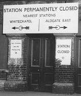
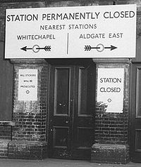
| Aldgate East Aldgate East tube station Aldgate East is a London Underground station located between Aldgate and Whitechapel in the London Borough of Tower Hamlets.The station is in Travelcard Zone 1... |
District District Line The District line is a line of the London Underground, coloured green on the Tube map. It is a "sub-surface" line, running through the central area in shallow cut-and-cover tunnels. It is the busiest of the sub-surface lines. Out of the 60 stations served, 25 are underground... |
Station resited | Demolished | Closed when the current station was opened a short distance to the east to enable the Aldgate junction to be rebuilt | |
| Aldwych Aldwych tube station Aldwych is a closed London Underground station in the City of Westminster, originally opened as Strand in 1907. It was the terminus and only station on the short Piccadilly line branch from Holborn that was a relic of the merger of two railway schemes. The disused station building is close to the... |
Piccadilly Piccadilly Line The Piccadilly line is a line of the London Underground, coloured dark blue on the Tube map. It is the fifth busiest line on the Underground network judged by the number of passengers transported per year. It is mainly a deep-level line, running from the north to the west of London via Zone 1, with... |
Station and route closed | Building remains and platforms sometimes used for cinematic purposes | Terminus of Piccadilly line branch line from Holborn Holborn tube station Holborn is a station of the London Underground in Holborn in London, located at the junction of High Holborn and Kingsway. Situated on the Piccadilly Line and on the Central Line , it is the only station common to the two lines, although the two lines cross each other three times elsewhere... ; closed due to low passenger numbers and cost of replacing lifts |
|
| Aylesbury Aylesbury railway station Aylesbury railway station is a railway station in Aylesbury, Buckinghamshire, England and is a major stop on the London to Aylesbury Line from Marylebone station via Amersham. It is 37.75 miles from Aylesbury Station to Marylebone Station... |
Metropolitan Metropolitan Line The Metropolitan line is part of the London Underground. It is coloured in Transport for London's Corporate Magenta on the Tube map and in other branding. It was the first underground railway in the world, opening as the Metropolitan Railway on 10 January 1863... |
Service withdrawn | Operated by National Rail | The service was cut back to Amersham when electric locomotive-hauled trains were replaced with A60 Stock London Underground A60 Stock The A Stock is the type of train used on the Metropolitan Line of the London Underground. It was built in two batches by Cravens of Sheffield in the early 1960s. The trains replaced all the previous stock then used on the Metropolitan Line... trains. |
|
| Blake Hall Blake Hall tube station Blake Hall station is a disused station in Essex, formerly on the Central Line of the London Underground between North Weald and Ongar. It was named after Blake Hall, a country house located a mile or so to the north east of the station in the village of Bobbingworth, and inhabited by a family of... |
Central Central Line The Central line is a London Underground line, coloured red on the tube map. It is a deep-level "tube" line, running east-west across London, and, at , has the greatest total length of track of any line on the Underground. Of the 49 stations served, 20 are below ground... |
Station and route closed | Building remains | Closed due to low passenger numbers | |
| Brill Brill railway station Brill railway station was the terminus of a small railway line in Buckinghamshire, England, known as the Brill Tramway. Built and owned by the Duke of Buckingham, it was later operated by London's Metropolitan Railway, and in 1933 briefly became one of the two north-western termini of the London... |
Metropolitan Metropolitan Line The Metropolitan line is part of the London Underground. It is coloured in Transport for London's Corporate Magenta on the Tube map and in other branding. It was the first underground railway in the world, opening as the Metropolitan Railway on 10 January 1863... |
Station and route closed | Demolished | Closed when Brill branch Brill Tramway The Brill Tramway, also known as the Quainton Tramway, Wotton Tramway, Oxford & Aylesbury Tramroad and Metropolitan Railway Brill Branch, was a six-mile rail line in the Aylesbury Vale, Buckinghamshire, England... was closed due to very low passenger numbers |
|
| British Museum British Museum tube station British Museum tube station was a station on the London Underground's Central Line, located on Bury Place, close to the British Museum in central London, England.-History:... |
Central Central Line The Central line is a London Underground line, coloured red on the tube map. It is a deep-level "tube" line, running east-west across London, and, at , has the greatest total length of track of any line on the Underground. Of the 49 stations served, 20 are below ground... |
Station closed | Demolished | Closed when Central line platforms were opened at Holborn Holborn tube station Holborn is a station of the London Underground in Holborn in London, located at the junction of High Holborn and Kingsway. Situated on the Piccadilly Line and on the Central Line , it is the only station common to the two lines, although the two lines cross each other three times elsewhere... |
|
| Brompton Road Brompton Road tube station Brompton Road tube station is a disused station on the Piccadilly Line of the London Underground. It is located between Knightsbridge and South Kensington.-History:... |
Piccadilly Piccadilly Line The Piccadilly line is a line of the London Underground, coloured dark blue on the Tube map. It is the fifth busiest line on the Underground network judged by the number of passengers transported per year. It is mainly a deep-level line, running from the north to the west of London via Zone 1, with... |
Station closed | Mostly demolished, side elevation remains | Closed due to low passenger numbers and creation of a new entrance to Knightsbridge station Knightsbridge tube station Knightsbridge tube station is a London Underground station in Knightsbridge , The Royal Borough of Kensington and Chelsea. It is on the Piccadilly Line between South Kensington and Hyde Park Corner, and is in Travelcard Zone 1.-History:... |
|
| Bushey Bushey railway station Bushey railway station serves the towns of Bushey and Oxhey and is situated on the Watford DC Line, north of Harrow & Wealdstone. The station was renamed from "Bushey & Oxhey" to "Bushey" on 6 May 1974, even though it is actually sited in the neighbouring town of Oxhey, and the nearest part of... |
Bakerloo Bakerloo Line The Bakerloo line is a line of the London Underground, coloured brown on the Tube map. It runs partly on the surface and partly at deep level, from Elephant and Castle in the south-east to Harrow & Wealdstone in the north-west of London. The line serves 25 stations, of which 15 are underground... |
Service withdrawn | Operated by National Rail | Former peak hours only service withdrawn to save money following cancellation of Greater London Council Greater London Council The Greater London Council was the top-tier local government administrative body for Greater London from 1965 to 1986. It replaced the earlier London County Council which had covered a much smaller area... 's Fares Fair policy |
|
| Carpenders Park Carpenders Park railway station Carpenders Park railway station is in between the Hertfordshire suburb of Carpenders Park and the South Oxhey housing estate. It is south of Watford Junction on the Watford DC Line.... |
Bakerloo Bakerloo Line The Bakerloo line is a line of the London Underground, coloured brown on the Tube map. It runs partly on the surface and partly at deep level, from Elephant and Castle in the south-east to Harrow & Wealdstone in the north-west of London. The line serves 25 stations, of which 15 are underground... |
Service withdrawn | Operated by National Rail | Former peak hours only service withdrawn to save money following cancellation of Greater London Council Greater London Council The Greater London Council was the top-tier local government administrative body for Greater London from 1965 to 1986. It replaced the earlier London County Council which had covered a much smaller area... 's Fares Fair policy |
|
| Castle Hill (Ealing Dean) West Ealing railway station West Ealing railway station was opened in 1871 as "Castle Hill and Ealing Dene" on the Great Western Railway, which was constructed from Paddington through Ealing to Bristol in 1836-8.... |
District District Line The District line is a line of the London Underground, coloured green on the Tube map. It is a "sub-surface" line, running through the central area in shallow cut-and-cover tunnels. It is the busiest of the sub-surface lines. Out of the 60 stations served, 25 are underground... |
Service withdrawn | Operated by National Rail | The Windsor service was cut back to Ealing Broadway Ealing Broadway station Ealing Broadway is an east-west National Rail and London Underground station in Ealing in west London. The station is located in Haven Green , at the termination of The Broadway, and is in Travelcard Zone 3.-Services:... due to low passenger numbers. It is now West Ealing station. |
|
| Charing Cross Charing Cross tube station Charing Cross tube station is a London Underground station at Charing Cross in the City of Westminster with entrances located in Trafalgar Square and The Strand. The station is served by the Northern and Bakerloo lines and provides an interchange with the National Rail network at station... |
Jubilee Jubilee Line The Jubilee line is a line on the London Underground , in the United Kingdom. It was built in two major sections—initially to Charing Cross, in central London, and later extended, in 1999, to Stratford, in east London. The later stations are larger and have special safety features, both aspects... |
Partial | Remainder of station in use | Two platforms are still functional but were removed from public-use when the Jubilee Line Extension Jubilee Line Extension The Jubilee Line Extension is the extension of the London Underground Jubilee line from to through south and east London. An eastward extension of the Jubilee line was first proposed in the 1970s and a modified route was constructed during the 1990s... to Stratford Stratford station Stratford station is a large multilevel railway station in Stratford, east London. The station is served by the National Rail services National Express East Anglia, London Overground and c2c, by London Underground's Central and Jubilee lines, and by the Docklands Light Railway . Stratford is in... was opened in 1999. |
|
| City Road City Road tube station City Road is a disused London Underground station in Islington. It was one of the stations built when the City & South London Railway opened its extension from Moorgate to Angel on 17 November 1901... |
Northern Northern Line The Northern line is a London Underground line. It is coloured black on the Tube map.For most of its length it is a deep-level tube line. The line carries 206,734,000 passengers per year. This is the highest number of any line on the London Underground system, but the Northern line is unique in... |
Station closed | Mostly demolished, ventilation tower remains | Closed due to low passenger numbers | |
| Down Street Down Street tube station Down Street, also known as Down Street , is a disused station of the London Underground's Piccadilly line which closed in 1932. During World War II it was used as an air-raid shelter, notably by Winston Churchill and his War Cabinet.-History:... |
Piccadilly Piccadilly Line The Piccadilly line is a line of the London Underground, coloured dark blue on the Tube map. It is the fifth busiest line on the Underground network judged by the number of passengers transported per year. It is mainly a deep-level line, running from the north to the west of London via Zone 1, with... |
Station closed | Building remains | Closed due to low passenger numbers when entrances to Green Park Green Park tube station Green Park tube station is a London Underground station located on the north side of Green Park, close to the intersection of Piccadilly and the pedestrian Queen's Walk... and Hyde Park Corner Hyde Park Corner tube station Hyde Park Corner is a London Underground station near Hyde Park Corner in Hyde Park. It is in Travelcard Zone 1, between Knightsbridge and Green Park on the Piccadilly Line.-History:... were moved closer to its location |
|
| Drayton Park Drayton Park railway station Drayton Park railway station is on the Network Rail Northern City Line which carries First Capital Connect services between Moorgate and Welwyn Garden City or Hertford via Finsbury Park... |
Northern Northern Line The Northern line is a London Underground line. It is coloured black on the Tube map.For most of its length it is a deep-level tube line. The line carries 206,734,000 passengers per year. This is the highest number of any line on the London Underground system, but the Northern line is unique in... |
Service withdrawn, transferred to National Rail | Operated by National Rail | Former Northern line Highbury Branch between Moorgate Moorgate station Moorgate station is a central London railway terminus and London Underground station on Moorgate in the City of London; it provides National Rail services by First Capital Connect for Hertford, Welwyn Garden City and Letchworth and also serves the Circle, Hammersmith & City, Metropolitan Lines and... and Finsbury Park Finsbury Park station Finsbury Park Station is a busy transport interchange in North London. The interchange consists of an interconnected National Rail station, London Underground station and two bus stations. The main entrances are by the eastern bus station on Station Place... converted to main line operation |
|
| Earl's Court Earl's Court tube station Earl's Court tube station is a London Underground station in Earls Court. The station is located between Earls Court Road and Warwick Road . It is on the boundary of Travelcard Zone 1 and 2 and is in both zones.... |
District District Line The District line is a line of the London Underground, coloured green on the Tube map. It is a "sub-surface" line, running through the central area in shallow cut-and-cover tunnels. It is the busiest of the sub-surface lines. Out of the 60 stations served, 25 are underground... |
Station resited | Demolished | Original station closed when the current station opened to the west | |
| Essex Road Essex Road station Essex Road railway station is a National Rail station in Islington. It is on the Northern City Line between and and is in Travelcard Zone 2. The station is located at the junction of Essex Road, Canonbury Road and New North Road, with the present entrance on Canonbury Road. It is the only deep... |
Northern Northern Line The Northern line is a London Underground line. It is coloured black on the Tube map.For most of its length it is a deep-level tube line. The line carries 206,734,000 passengers per year. This is the highest number of any line on the London Underground system, but the Northern line is unique in... |
Service withdrawn, transferred to National Rail | Operated by National Rail | Former Northern line Highbury Branch between Moorgate Moorgate station Moorgate station is a central London railway terminus and London Underground station on Moorgate in the City of London; it provides National Rail services by First Capital Connect for Hertford, Welwyn Garden City and Letchworth and also serves the Circle, Hammersmith & City, Metropolitan Lines and... and Finsbury Park Finsbury Park station Finsbury Park Station is a busy transport interchange in North London. The interchange consists of an interconnected National Rail station, London Underground station and two bus stations. The main entrances are by the eastern bus station on Station Place... converted to main line operation |
|
| Granborough Road Granborough Road railway station Granborough Road railway station was a station serving the village of Granborough, to the north of Quainton in Buckinghamshire, England.-History:The station was first served in 1868 and closed in 1936.... |
Metropolitan Metropolitan Line The Metropolitan line is part of the London Underground. It is coloured in Transport for London's Corporate Magenta on the Tube map and in other branding. It was the first underground railway in the world, opening as the Metropolitan Railway on 10 January 1863... |
Station and route closed | Demolished | Closed when Verney Junction Verney Junction railway station Verney Junction was a railway station at a junction serving four directions between 1868 and 1968 and from where excursions as far as Ramsgate could be booked... service was cut back to Aylesbury Aylesbury railway station Aylesbury railway station is a railway station in Aylesbury, Buckinghamshire, England and is a major stop on the London to Aylesbury Line from Marylebone station via Amersham. It is 37.75 miles from Aylesbury Station to Marylebone Station... due to low passenger numbers |
|
| Great Missenden Great Missenden railway station Great Missenden railway station serves the large village of Great Missenden in Buckinghamshire, as well as the villages of Prestwood, Little Hampden and Little Missenden. The station lies on the London Marylebone-Aylesbury line and is served by Chiltern Railways trains... |
Metropolitan Metropolitan Line The Metropolitan line is part of the London Underground. It is coloured in Transport for London's Corporate Magenta on the Tube map and in other branding. It was the first underground railway in the world, opening as the Metropolitan Railway on 10 January 1863... |
Service withdrawn | Operated by National Rail | The service was cut back to Amersham when electric locomotive-hauled trains were replaced with A60 Stock London Underground A60 Stock The A Stock is the type of train used on the Metropolitan Line of the London Underground. It was built in two batches by Cravens of Sheffield in the early 1960s. The trains replaced all the previous stock then used on the Metropolitan Line... trains. |
|
| Grove Road (Hammersmith) | Metropolitan Metropolitan Line The Metropolitan line is part of the London Underground. It is coloured in Transport for London's Corporate Magenta on the Tube map and in other branding. It was the first underground railway in the world, opening as the Metropolitan Railway on 10 January 1863... |
Service withdrawn | Service withdrawn due to low passenger numbers; station was closed in 1916 by London and South Western Railway London and South Western Railway The London and South Western Railway was a railway company in England from 1838 to 1922. Its network extended from London to Plymouth via Salisbury and Exeter, with branches to Ilfracombe and Padstow and via Southampton to Bournemouth and Weymouth. It also had many routes connecting towns in... |
||
| Hanwell Hanwell railway station Hanwell railway station is a railway station in Hanwell in the London Borough of Ealing. The station is managed by First Great Western but served by local services operated by Heathrow Connect from London to Heathrow Airport.-History:... |
District District Line The District line is a line of the London Underground, coloured green on the Tube map. It is a "sub-surface" line, running through the central area in shallow cut-and-cover tunnels. It is the busiest of the sub-surface lines. Out of the 60 stations served, 25 are underground... |
Service withdrawn | Operated by National Rail | The Windsor service was cut back to Ealing Broadway Ealing Broadway station Ealing Broadway is an east-west National Rail and London Underground station in Ealing in west London. The station is located in Haven Green , at the termination of The Broadway, and is in Travelcard Zone 3.-Services:... due to low passenger numbers. |
|
| Hatch End Hatch End railway station Hatch End railway station is in the London Borough of Harrow, in north London, and in Travelcard Zone 6.It is located at .The station has two platforms. The northbound platform is on the side of the ticket office and cafe. The southbound platform is reached via a footbridge... |
Bakerloo Bakerloo Line The Bakerloo line is a line of the London Underground, coloured brown on the Tube map. It runs partly on the surface and partly at deep level, from Elephant and Castle in the south-east to Harrow & Wealdstone in the north-west of London. The line serves 25 stations, of which 15 are underground... |
Service withdrawn | Operated by National Rail | Former peak hours only service withdrawn to save money following cancellation of Greater London Council Greater London Council The Greater London Council was the top-tier local government administrative body for Greater London from 1965 to 1986. It replaced the earlier London County Council which had covered a much smaller area... 's Fares Fair policy |
|
| Hayes | District District Line The District line is a line of the London Underground, coloured green on the Tube map. It is a "sub-surface" line, running through the central area in shallow cut-and-cover tunnels. It is the busiest of the sub-surface lines. Out of the 60 stations served, 25 are underground... |
Service withdrawn | Operated by National Rail | The Windsor service was cut back to Ealing Broadway Ealing Broadway station Ealing Broadway is an east-west National Rail and London Underground station in Ealing in west London. The station is located in Haven Green , at the termination of The Broadway, and is in Travelcard Zone 3.-Services:... due to low passenger numbers. It is now Hayes & Harlington station. |
|
| Headstone Lane Headstone Lane railway station Headstone Lane is a railway station near Headstone, in the London Borough of Harrow. The station is in Travelcard Zone 5.-Services:The typical off-peak service is three trains per hour to London Euston, and three trains per hour to Watford Junction, calling at all stations... |
Bakerloo Bakerloo Line The Bakerloo line is a line of the London Underground, coloured brown on the Tube map. It runs partly on the surface and partly at deep level, from Elephant and Castle in the south-east to Harrow & Wealdstone in the north-west of London. The line serves 25 stations, of which 15 are underground... |
Service withdrawn | Operated by National Rail | Former peak hours only service withdrawn to save money following cancellation of Greater London Council Greater London Council The Greater London Council was the top-tier local government administrative body for Greater London from 1965 to 1986. It replaced the earlier London County Council which had covered a much smaller area... 's Fares Fair policy |
|
| Hillingdon Hillingdon tube station Hillingdon tube station is a London Underground station in North Hillingdon in the London Borough of Hillingdon, west London.The station is on the Uxbridge branch of both the Metropolitan line and Piccadilly line, between Ickenham and Uxbridge stations and in Travelcard Zone 6.-History:The... |
Metropolitan Metropolitan Line The Metropolitan line is part of the London Underground. It is coloured in Transport for London's Corporate Magenta on the Tube map and in other branding. It was the first underground railway in the world, opening as the Metropolitan Railway on 10 January 1863... , Piccadilly Piccadilly Line The Piccadilly line is a line of the London Underground, coloured dark blue on the Tube map. It is the fifth busiest line on the Underground network judged by the number of passengers transported per year. It is mainly a deep-level line, running from the north to the west of London via Zone 1, with... |
Station resited | Demolished | The original station was to the east of current station and was closed to allow widening of the A40 road A40 road The A40 is a major trunk road connecting London to Fishguard, Wales and officially called The London to Fishguard Trunk Road in all legal documents and Acts... . |
|
| Holborn Holborn tube station Holborn is a station of the London Underground in Holborn in London, located at the junction of High Holborn and Kingsway. Situated on the Piccadilly Line and on the Central Line , it is the only station common to the two lines, although the two lines cross each other three times elsewhere... |
Piccadilly Piccadilly Line The Piccadilly line is a line of the London Underground, coloured dark blue on the Tube map. It is the fifth busiest line on the Underground network judged by the number of passengers transported per year. It is mainly a deep-level line, running from the north to the west of London via Zone 1, with... |
Partial | Remainder of station in use | The station has two disused platforms that served the Aldwych Aldwych Aldwych is a place and road in the City of Westminster in London, England.-Description:Aldwych, the road, is a crescent, connected to the Strand at both ends. At its centre, it meets the Kingsway... branch; one was taken out of use in 1917. |
|
| Hounslow Town Hounslow Town tube station Hounslow Town was a London Underground station in Hounslow in west London. The station was at the east end of Hounslow High Street at the junction with Kingsley Road... |
District District Line The District line is a line of the London Underground, coloured green on the Tube map. It is a "sub-surface" line, running through the central area in shallow cut-and-cover tunnels. It is the busiest of the sub-surface lines. Out of the 60 stations served, 25 are underground... |
Station and route closed, station resited | Demolished | On a now-closed branch of the Metropolitan District Railway Metropolitan District Railway The Metropolitan District Railway was the predecessor of the District line of the London Underground. Set up on 29 July 1864, at first to complete the "Inner Circle" railway around central London, it was gradually extended into the suburbs... , from what is now the Piccadilly line near Hounslow East Hounslow East tube station Hounslow East is a London Underground station in Hounslow in west London designed by Acanthus LW Architects.The station is on the Heathrow branch of the Piccadilly Line, between Hounslow Central and Osterley. The station is located on Kingsley Road about 400m north of Hounslow High Street. Hounslow... , it was closed when Hounslow East station was opened. |
|
| King's Cross St. Pancras King's Cross St. Pancras tube station King's Cross St. Pancras is a tube station in the London Borough of Camden, on the London Underground network, serving both King's Cross and main line stations. It is in Travelcard Zone 1. It is the fourth busiest station on the system and serves more lines than any other... |
Metropolitan Metropolitan Line The Metropolitan line is part of the London Underground. It is coloured in Transport for London's Corporate Magenta on the Tube map and in other branding. It was the first underground railway in the world, opening as the Metropolitan Railway on 10 January 1863... |
Station resited | Building remains | The original platforms were to the east of the current ones; the station was moved to make interchange with main line station easier. | |
| King William Street King William Street tube station King William Street was the original but short-lived northern terminus of the City & South London Railway , the first deep tube underground railway in London and one of the component parts of the London Underground's Northern Line. It was in the City of London, on King William Street, just south... |
Northern Northern Line The Northern line is a London Underground line. It is coloured black on the Tube map.For most of its length it is a deep-level tube line. The line carries 206,734,000 passengers per year. This is the highest number of any line on the London Underground system, but the Northern line is unique in... |
Station and route closed | Demolished | The original terminus of the City & South London Railway City & South London Railway The City and South London Railway was the first deep-level underground "tube" railway in the world, and the first major railway to use electric traction... , which was closed when the line was extended on a new alignment to Bank |
|
| Langley Langley railway station Langley railway station is a railway station in Langley, a suburb of Slough, Berkshire, England.The station is served by local services operated by First Great Western west of towards... |
District District Line The District line is a line of the London Underground, coloured green on the Tube map. It is a "sub-surface" line, running through the central area in shallow cut-and-cover tunnels. It is the busiest of the sub-surface lines. Out of the 60 stations served, 25 are underground... |
Service withdrawn | Operated by National Rail | The Windsor service was cut back to Ealing Broadway Ealing Broadway station Ealing Broadway is an east-west National Rail and London Underground station in Ealing in west London. The station is located in Haven Green , at the termination of The Broadway, and is in Travelcard Zone 3.-Services:... due to low passenger numbers. |
|
| Leigh-on-Sea Leigh-on-Sea railway station Leigh-on-Sea railway station serves the town of Leigh-on-Sea near Southend. This station serves as a park and ride facility. The station is run and served solely by c2c.- History :... |
District District Line The District line is a line of the London Underground, coloured green on the Tube map. It is a "sub-surface" line, running through the central area in shallow cut-and-cover tunnels. It is the busiest of the sub-surface lines. Out of the 60 stations served, 25 are underground... |
Service withdrawn | Operated by National Rail | Limited excursion service withdrawn as a wartime measure and not restarted | |
| Lord's Lord's tube station Lord's is a disused London Underground station. It was opened in 1868 as St. John's Wood Road on the Metropolitan & St. John's Wood Railway, the first northward branch extension from Baker Street of the Metropolitan Railway .... |
Metropolitan Metropolitan Line The Metropolitan line is part of the London Underground. It is coloured in Transport for London's Corporate Magenta on the Tube map and in other branding. It was the first underground railway in the world, opening as the Metropolitan Railway on 10 January 1863... |
Station closed | Demolished | Closed to increase capacity on Metropolitan line, following opening of nearby St John's Wood St John's Wood tube station St John's Wood tube station is a London Underground station at St John's Wood. It is on the Jubilee Line, between Swiss Cottage and Baker Street. It is in Travelcard Zone 2... station on the Bakerloo line Bakerloo Line The Bakerloo line is a line of the London Underground, coloured brown on the Tube map. It runs partly on the surface and partly at deep level, from Elephant and Castle in the south-east to Harrow & Wealdstone in the north-west of London. The line serves 25 stations, of which 15 are underground... . |
|
| Mark Lane Mark Lane tube station Mark Lane tube station is a disused station on the Circle and District Lines of the London Underground, west of the modern Tower Hill station.... |
District District Line The District line is a line of the London Underground, coloured green on the Tube map. It is a "sub-surface" line, running through the central area in shallow cut-and-cover tunnels. It is the busiest of the sub-surface lines. Out of the 60 stations served, 25 are underground... , Circle |
Station resited | Building remains | Closed when current Tower Hill Tower Hill tube station Tower Hill is a London Underground station at Tower Hill in the London Borough of Tower Hamlets.The station is in Travelcard Zone 1 and near the Tower of London... station to the east was built to a provide better interchange with mainline services at Fenchurch Street Fenchurch Street railway station Fenchurch Street railway station, also known as London Fenchurch Street, is a central London railway terminus in the south eastern corner of the City of London, England. The station is one of the smallest terminals in London in terms of platforms and one of the most intensively operated... |
|
| Marlborough Road Marlborough Road tube station Marlborough Road is a disused London Underground station. It was opened in 1868 on the Metropolitan & St. John's Wood Railway, the first northward branch extension from Baker Street of the Metropolitan Railway... |
Metropolitan Metropolitan Line The Metropolitan line is part of the London Underground. It is coloured in Transport for London's Corporate Magenta on the Tube map and in other branding. It was the first underground railway in the world, opening as the Metropolitan Railway on 10 January 1863... |
Station closed | Building remains | Closed to increase capacity on Metropolitan line, following opening of nearby St John's Wood St John's Wood tube station St John's Wood tube station is a London Underground station at St John's Wood. It is on the Jubilee Line, between Swiss Cottage and Baker Street. It is in Travelcard Zone 2... station on the Bakerloo line Bakerloo Line The Bakerloo line is a line of the London Underground, coloured brown on the Tube map. It runs partly on the surface and partly at deep level, from Elephant and Castle in the south-east to Harrow & Wealdstone in the north-west of London. The line serves 25 stations, of which 15 are underground... |
|
| New Cross New Cross station New Cross railway station is a railway station in New Cross, London. It is in Zone 2, on the East London Line. Closed in late 2007, the station was refurbished and re-opened as part of the London Overground network on 27 April 2010 for preview services... |
East London East London Line The East London Line is a London Overground line which runs north to south through the East End, Docklands and South areas of London.Built in 1869 by the East London Railway Company, which reused the Thames Tunnel, originally intended for horse-drawn carriages, the line became part of the London... |
Service withdrawn | Operated by National Rail | Now operated by London Overground London Overground London Overground is a suburban rail network in London and Hertfordshire. It has been operated by London Overground Rail Operations since 2007 as part of the National Rail network, under the franchise control and branding of Transport for London... |
|
| New Cross Gate New Cross Gate station New Cross Gate station is a railway station in New Cross, London, on the Brighton Main Line. It is about 600 metres west of station. It is in Travelcard Zone 2, on the East London Line. The station is operated by London Overground.-History:... |
East London East London Line The East London Line is a London Overground line which runs north to south through the East End, Docklands and South areas of London.Built in 1869 by the East London Railway Company, which reused the Thames Tunnel, originally intended for horse-drawn carriages, the line became part of the London... |
Service withdrawn | Operated by National Rail | Now operated by London Overground London Overground London Overground is a suburban rail network in London and Hertfordshire. It has been operated by London Overground Rail Operations since 2007 as part of the National Rail network, under the franchise control and branding of Transport for London... |
|
| Northfields & Little Ealing Northfields tube station Northfields is a London Underground station in Northfields, west London. The station is on the Heathrow branch of the Piccadilly Line, between Boston Manor and South Ealing stations... |
Piccadilly Piccadilly Line The Piccadilly line is a line of the London Underground, coloured dark blue on the Tube map. It is the fifth busiest line on the Underground network judged by the number of passengers transported per year. It is mainly a deep-level line, running from the north to the west of London via Zone 1, with... |
Station resited | Demolished | Moved to allow access into new depot at Northfields built for Piccadilly line Piccadilly Line The Piccadilly line is a line of the London Underground, coloured dark blue on the Tube map. It is the fifth busiest line on the Underground network judged by the number of passengers transported per year. It is mainly a deep-level line, running from the north to the west of London via Zone 1, with... trains; when open, this station was served by the District line. |
|
| North Weald North Weald tube station North Weald tube station is a former London Underground station in Essex, England. Located between Epping and Blake Hall stations on the Central line the station is part of the Epping Ongar Railway... |
Central Central Line The Central line is a London Underground line, coloured red on the tube map. It is a deep-level "tube" line, running east-west across London, and, at , has the greatest total length of track of any line on the Underground. Of the 49 stations served, 20 are below ground... |
Station and route closed | Building remains | Closed due to low passenger numbers; reopened in 2004 as part of the Epping Ongar Railway Epping Ongar Railway The Epping Ongar Railway operates on a preserved railway along the final section of the old Great Eastern Railway and London Underground Central Line branch line between Epping and Ongar, with an intermediate station at North Weald... . |
|
| Ongar Ongar tube station Ongar tube station is a former London Underground station in the town of Chipping Ongar, Essex. Until its closure in 1994, it was the easternmost point of the Central line, and from 1961 until closure, it held the distinction of being the London Underground station farthest from Central... |
Central Central Line The Central line is a London Underground line, coloured red on the tube map. It is a deep-level "tube" line, running east-west across London, and, at , has the greatest total length of track of any line on the Underground. Of the 49 stations served, 20 are below ground... |
Station and route closed | Building remains | Closed due to low passenger numbers; reopened in 2004 as part of the Epping Ongar Railway Epping Ongar Railway The Epping Ongar Railway operates on a preserved railway along the final section of the old Great Eastern Railway and London Underground Central Line branch line between Epping and Ongar, with an intermediate station at North Weald... . |
|
| Osterley & Spring Grove Osterley tube station Osterley is a London Underground station in Osterley in west London. The station is on the Heathrow branch of the Piccadilly Line, between Boston Manor and Hounslow East. The station is located on Great West Road close to the National Trust-owned Osterley Park. It is in Travelcard Zone 4... |
Piccadilly Piccadilly Line The Piccadilly line is a line of the London Underground, coloured dark blue on the Tube map. It is the fifth busiest line on the Underground network judged by the number of passengers transported per year. It is mainly a deep-level line, running from the north to the west of London via Zone 1, with... |
Station resited | Building remains | Closed when new Osterley station Osterley tube station Osterley is a London Underground station in Osterley in west London. The station is on the Heathrow branch of the Piccadilly Line, between Boston Manor and Hounslow East. The station is located on Great West Road close to the National Trust-owned Osterley Park. It is in Travelcard Zone 4... was opened to the south-west, to provide additional capacity |
|
| Park Royal & Twyford Abbey Park Royal & Twyford Abbey tube station Park Royal & Twyford Abbey is a closed station on the route of the Piccadilly Line of the London Underground. It was located near Twyford Abbey Road a short distance north of the current Park Royal station which replaced it on 6 July 1931.... |
Piccadilly Piccadilly Line The Piccadilly line is a line of the London Underground, coloured dark blue on the Tube map. It is the fifth busiest line on the Underground network judged by the number of passengers transported per year. It is mainly a deep-level line, running from the north to the west of London via Zone 1, with... |
Station resited | Demolished | Closed when station was relocated to Park Royal Park Royal tube station Park Royal is a station on the Piccadilly Line of the London Underground. It is between and and is in Travelcard Zone 3. It is situated on the south side of the east-west Western Avenue , surrounded by residential Ealing and industrial Park Royal... to provide more convenient access from Western Avenue; when open, this station was served by the District line. |
|
| Preston Road Preston Road tube station Preston Road tube station is a station on the Metropolitan Line in London. It is in Zone 4, and lies between Northwick Park tube station and Wembley Park.... |
Metropolitan Metropolitan Line The Metropolitan line is part of the London Underground. It is coloured in Transport for London's Corporate Magenta on the Tube map and in other branding. It was the first underground railway in the world, opening as the Metropolitan Railway on 10 January 1863... |
Station resited | Demolished | A small halt station was reconstructed to the west when the number of tracks through the station was increased from two to four. | |
| Quainton Road Quainton Road railway station Quainton Road railway station was opened in 1868 in undeveloped countryside near Quainton, Buckinghamshire, from London. Built by the Aylesbury and Buckingham Railway, it was the result of pressure from the 3rd Duke of Buckingham to route the railway near his home at Wotton House and to open a... |
Metropolitan Metropolitan Line The Metropolitan line is part of the London Underground. It is coloured in Transport for London's Corporate Magenta on the Tube map and in other branding. It was the first underground railway in the world, opening as the Metropolitan Railway on 10 January 1863... |
Station closed | Building remains | Closed when Verney Junction Verney Junction railway station Verney Junction was a railway station at a junction serving four directions between 1868 and 1968 and from where excursions as far as Ramsgate could be booked... service was cut back to Aylesbury Aylesbury railway station Aylesbury railway station is a railway station in Aylesbury, Buckinghamshire, England and is a major stop on the London to Aylesbury Line from Marylebone station via Amersham. It is 37.75 miles from Aylesbury Station to Marylebone Station... due to low passenger numbers; temporarily reopened for war time operations between 1943 and 1948; the station is the home of the Buckinghamshire Railway Centre Buckinghamshire Railway Centre Buckinghamshire Railway Centre is a railway museum operated by the Quainton Railway Society Ltd. at Quainton Road railway station, in the far depths of "Metro-land", about 5 miles west of Aylesbury in Buckinghamshire. The site is divided into two halves which are joined by two foot-bridges, one of... and is used for occasional special services from Aylesbury. |
|
| Rotherhithe Rotherhithe tube station Rotherhithe railway station is a railway station on the southern bank of the river Thames at Rotherhithe, London, England. It is on London Overground's East London Line, between and , and is in Zone 2... |
East London East London Line The East London Line is a London Overground line which runs north to south through the East End, Docklands and South areas of London.Built in 1869 by the East London Railway Company, which reused the Thames Tunnel, originally intended for horse-drawn carriages, the line became part of the London... |
Service withdrawn, transferred to National Rail | Operated by National Rail | Now operated by London Overground London Overground London Overground is a suburban rail network in London and Hertfordshire. It has been operated by London Overground Rail Operations since 2007 as part of the National Rail network, under the franchise control and branding of Transport for London... |
|
| St Mary's (Whitechapel Road) St Mary's tube station St Mary's was a station on London Underground's District line located between the present-day stations at Whitechapel and Aldgate East.-History:... |
District District Line The District line is a line of the London Underground, coloured green on the Tube map. It is a "sub-surface" line, running through the central area in shallow cut-and-cover tunnels. It is the busiest of the sub-surface lines. Out of the 60 stations served, 25 are underground... |
Station closed | Closed when Aldgate East Aldgate East tube station Aldgate East is a London Underground station located between Aldgate and Whitechapel in the London Borough of Tower Hamlets.The station is in Travelcard Zone 1... was rebuilt closer to its location; converted for use as an air-raid shelter during the war |
||
| Shadwell Shadwell tube station Shadwell railway station is on the East London Line of London Overground, between to the north and to the south. It is located near to Shadwell DLR station. The station is in Zone 2.-London Underground:... |
East London East London Line The East London Line is a London Overground line which runs north to south through the East End, Docklands and South areas of London.Built in 1869 by the East London Railway Company, which reused the Thames Tunnel, originally intended for horse-drawn carriages, the line became part of the London... |
Service withdrawn, transferred to National Rail | Operated by National Rail | Now operated by London Overground London Overground London Overground is a suburban rail network in London and Hertfordshire. It has been operated by London Overground Rail Operations since 2007 as part of the National Rail network, under the franchise control and branding of Transport for London... |
|
| Shepherd's Bush | Hammersmith & City Hammersmith & City Line The Hammersmith & City line is a subsurface London Underground line. It connects Hammersmith in the west with Barking in the east, running through the northern part of central London. It is coloured salmon pink on the Tube map... |
Station resited | Demolished | Station replaced by Shepherd's Bush (now Shepherd's Bush Market) to the north and Goldhawk Road Goldhawk Road tube station Goldhawk Road station is a London Underground station located in the London Borough of Hammersmith and Fulham, on the south side of Goldhawk Road, about 250m west of Shepherd's Bush Green... to the south |
|
| Shoeburyness Shoeburyness railway station Shoeburyness is a railway station located in the small town of Shoeburyness in the borough and unitary district of Southend-on-Sea in Essex, England. The station serves as the eastern terminus of the London, Tilbury and Southend Railway from Fenchurch Street railway station in the City of London,... |
District District Line The District line is a line of the London Underground, coloured green on the Tube map. It is a "sub-surface" line, running through the central area in shallow cut-and-cover tunnels. It is the busiest of the sub-surface lines. Out of the 60 stations served, 25 are underground... |
Service withdrawn | Operated by National Rail | Limited excursion service withdrawn as a wartime measure and not restarted | |
| Shoreditch Shoreditch tube station Shoreditch tube station was a London Underground station in the London Borough of Tower Hamlets in east London. It was in Travelcard Zone 2. The station closed permanently at the end of traffic on 9 June 2006.... |
East London East London Line The East London Line is a London Overground line which runs north to south through the East End, Docklands and South areas of London.Built in 1869 by the East London Railway Company, which reused the Thames Tunnel, originally intended for horse-drawn carriages, the line became part of the London... |
Station and route closed | Building remains | Closed to allow extension of East London Line on new alignment across site Replaced by London Overground London Overground London Overground is a suburban rail network in London and Hertfordshire. It has been operated by London Overground Rail Operations since 2007 as part of the National Rail network, under the franchise control and branding of Transport for London... station Shoreditch High Street Shoreditch High Street railway station Shoreditch High Street is a railway station in Shoreditch, London. The station is located on Bethnal Green Road close to Shoreditch High Street and is served by London Overground services running on the extended East London Line under the control of the London Rail division of Transport for London... . |
|
| Slough Slough railway station Slough railway station, in Slough, Berkshire, England, is served by local services operated by First Great Western from to and intercity services on the Great Western Main Line, the original line of the Great Western Railway... |
District District Line The District line is a line of the London Underground, coloured green on the Tube map. It is a "sub-surface" line, running through the central area in shallow cut-and-cover tunnels. It is the busiest of the sub-surface lines. Out of the 60 stations served, 25 are underground... |
Service withdrawn | Operated by National Rail | The Windsor service was cut back to Ealing Broadway Ealing Broadway station Ealing Broadway is an east-west National Rail and London Underground station in Ealing in west London. The station is located in Haven Green , at the termination of The Broadway, and is in Travelcard Zone 3.-Services:... due to low passenger numbers. |
|
| South Acton South Acton railway station South Acton railway station is in the London Borough of Ealing in South Acton, west London. It is on the North London Line, and the station and all trains serving it are operated by London Overground. It is in Travelcard Zone 3... |
District District Line The District line is a line of the London Underground, coloured green on the Tube map. It is a "sub-surface" line, running through the central area in shallow cut-and-cover tunnels. It is the busiest of the sub-surface lines. Out of the 60 stations served, 25 are underground... |
Station and route closed | Demolished | On a short branch of the District Line from Acton Town Acton Town tube station Acton Town is a London Underground station in Acton, west London, served by the Piccadilly and District lines. The station is at the junction of Gunnersbury Lane and Bollo Lane and is in Travelcard Zone 3.-Services:... , it was closed due to low passenger numbers. |
|
| Southend Central Southend Central railway station Southend Central is a railway station on the London, Tilbury and Southend Railway. Train services are provided by the National Express Group train operating company c2c... |
District District Line The District line is a line of the London Underground, coloured green on the Tube map. It is a "sub-surface" line, running through the central area in shallow cut-and-cover tunnels. It is the busiest of the sub-surface lines. Out of the 60 stations served, 25 are underground... |
Service withdrawn | Operated by National Rail | Limited excursion service withdrawn as a wartime measure and not restarted | |
| Southall Southall railway station Southall railway station, is in Southall in west London, England. The station is in Travelcard Zone 4 and passenger services are provided by First Great Western from London to , and , and by Heathrow Connect from Paddington to Heathrow Airport.... |
District District Line The District line is a line of the London Underground, coloured green on the Tube map. It is a "sub-surface" line, running through the central area in shallow cut-and-cover tunnels. It is the busiest of the sub-surface lines. Out of the 60 stations served, 25 are underground... |
Service withdrawn | Operated by National Rail | The Windsor service was cut back to Ealing Broadway Ealing Broadway station Ealing Broadway is an east-west National Rail and London Underground station in Ealing in west London. The station is located in Haven Green , at the termination of The Broadway, and is in Travelcard Zone 3.-Services:... due to low passenger numbers. |
|
| South Harrow South Harrow tube station South Harrow is a London Underground station on the Uxbridge branch of the Piccadilly Line. The station is between Sudbury Hill and Rayners Lane. It is located on Northolt Road . The station is in Travelcard Zone 5... |
Piccadilly Piccadilly Line The Piccadilly line is a line of the London Underground, coloured dark blue on the Tube map. It is the fifth busiest line on the Underground network judged by the number of passengers transported per year. It is mainly a deep-level line, running from the north to the west of London via Zone 1, with... |
Station resited | Building remains | Closed when station was relocated a short distance to the north | |
| South Kentish Town South Kentish Town tube station South Kentish Town tube station is a disused London Underground station which was on the Northern Line between Camden Town and Kentish Town. The surface building still exists on Kentish Town Road, close to the junction with Castle Road, and is currently a retail unit occupied by the Cash Converters... |
Northern Northern Line The Northern line is a London Underground line. It is coloured black on the Tube map.For most of its length it is a deep-level tube line. The line carries 206,734,000 passengers per year. This is the highest number of any line on the London Underground system, but the Northern line is unique in... |
Station closed | Building remains | Closed due to a strike at the Underground's Lots Road Power Station Lots Road Power Station Lots Road Power Station is a disused coal and later oil-fired power station on the River Thames at Lots Road in Chelsea, London in the south-west of The Royal Borough of Kensington and Chelsea, which supplied electricity to the London Underground system... and never reopened due to low passenger numbers |
|
| Stoke Mandeville Stoke Mandeville railway station Stoke Mandeville railway station serves the village of Stoke Mandeville, to the south of Aylesbury in Buckinghamshire. The station lies on the London -Aylesbury line and is served by Chiltern Railways trains... |
Metropolitan Metropolitan Line The Metropolitan line is part of the London Underground. It is coloured in Transport for London's Corporate Magenta on the Tube map and in other branding. It was the first underground railway in the world, opening as the Metropolitan Railway on 10 January 1863... |
Service withdrawn | Operated by National Rail | The service was cut back to Amersham when electric locomotive-hauled trains were replaced with A60 Stock London Underground A60 Stock The A Stock is the type of train used on the Metropolitan Line of the London Underground. It was built in two batches by Cravens of Sheffield in the early 1960s. The trains replaced all the previous stock then used on the Metropolitan Line... trains. |
|
| Surrey Quays Surrey Quays tube station Surrey Quays railway station is a railway station in Rotherhithe near Southwark Park. It is in Zone 2, on the East London Line. The next station to the north is , and to the south it splits into branches to and... |
East London East London Line The East London Line is a London Overground line which runs north to south through the East End, Docklands and South areas of London.Built in 1869 by the East London Railway Company, which reused the Thames Tunnel, originally intended for horse-drawn carriages, the line became part of the London... |
Service withdrawn, transferred to National Rail | Operated by National Rail | Now operated by London Overground London Overground London Overground is a suburban rail network in London and Hertfordshire. It has been operated by London Overground Rail Operations since 2007 as part of the National Rail network, under the franchise control and branding of Transport for London... |
|
| Swiss Cottage Swiss Cottage (Metropolitan Line) tube station Swiss Cottage is a disused London Underground station. It was opened in 1868 as the northern terminus of the Metropolitan and St John's Wood Railway, the first northward branch extension from Baker Street of the Metropolitan Railway... |
Metropolitan Metropolitan Line The Metropolitan line is part of the London Underground. It is coloured in Transport for London's Corporate Magenta on the Tube map and in other branding. It was the first underground railway in the world, opening as the Metropolitan Railway on 10 January 1863... |
Station closed | Demolished | Closed as a wartime measure and not reopened; the adjacent Bakerloo line Bakerloo Line The Bakerloo line is a line of the London Underground, coloured brown on the Tube map. It runs partly on the surface and partly at deep level, from Elephant and Castle in the south-east to Harrow & Wealdstone in the north-west of London. The line serves 25 stations, of which 15 are underground... (now Jubilee line Jubilee Line The Jubilee line is a line on the London Underground , in the United Kingdom. It was built in two major sections—initially to Charing Cross, in central London, and later extended, in 1999, to Stratford, in east London. The later stations are larger and have special safety features, both aspects... ) station briefly operated as an interchange |
|
| Tower of London Tower of London tube station Tower of London tube station was a station in London situated where Tower Hill station is located today.It was opened in 1882 during the construction of the Metropolitan Railway to the north... |
District District Line The District line is a line of the London Underground, coloured green on the Tube map. It is a "sub-surface" line, running through the central area in shallow cut-and-cover tunnels. It is the busiest of the sub-surface lines. Out of the 60 stations served, 25 are underground... , Circle |
Station resited | Demolished | A short-lived station on the site of the present Tower Hill station Tower Hill tube station Tower Hill is a London Underground station at Tower Hill in the London Borough of Tower Hamlets.The station is in Travelcard Zone 1 and near the Tower of London... , which was closed when Mark Lane Mark Lane tube station Mark Lane tube station is a disused station on the Circle and District Lines of the London Underground, west of the modern Tower Hill station.... (also now closed) was opened |
|
| Uxbridge Uxbridge tube station Uxbridge is a London Underground station in Uxbridge in the London Borough of Hillingdon, north-west London. The station is the terminus of the Uxbridge branches of both the Metropolitan Line and the Piccadilly Line. The next station towards London is Hillingdon. The station is 15.5 miles west of... |
Metropolitan Metropolitan Line The Metropolitan line is part of the London Underground. It is coloured in Transport for London's Corporate Magenta on the Tube map and in other branding. It was the first underground railway in the world, opening as the Metropolitan Railway on 10 January 1863... , Piccadilly Piccadilly Line The Piccadilly line is a line of the London Underground, coloured dark blue on the Tube map. It is the fifth busiest line on the Underground network judged by the number of passengers transported per year. It is mainly a deep-level line, running from the north to the west of London via Zone 1, with... |
Station resited | Demolished | Closed when the current station was opened on a new alignment closer to Uxbridge town centre | |
| Uxbridge Road Uxbridge Road tube station Uxbridge Road was a London Underground station on a branch of the Metropolitan Line. It was located at the eastern end of the Uxbridge Road in Shepherd's Bush, west London, UK, just before the start of Holland Park Avenue, a short distance from Shepherd's Bush station on the Central Line... |
Metropolitan Metropolitan Line The Metropolitan line is part of the London Underground. It is coloured in Transport for London's Corporate Magenta on the Tube map and in other branding. It was the first underground railway in the world, opening as the Metropolitan Railway on 10 January 1863... |
Station closed | Demolished | Closed after bombing of the line during World War II World War II World War II, or the Second World War , was a global conflict lasting from 1939 to 1945, involving most of the world's nations—including all of the great powers—eventually forming two opposing military alliances: the Allies and the Axis... , due to low passenger numbers; National Rail services on the line continue, and Shepherd's Bush Shepherd's Bush railway station Shepherd's Bush station is a railway station located in the district of Shepherd's Bush in west London, England, UK. It opened in 2008 on the West London Line and is served by London Overground and Southern rail services... station is a short distance to the north. |
|
| Verney Junction Verney Junction railway station Verney Junction was a railway station at a junction serving four directions between 1868 and 1968 and from where excursions as far as Ramsgate could be booked... |
Metropolitan Metropolitan Line The Metropolitan line is part of the London Underground. It is coloured in Transport for London's Corporate Magenta on the Tube map and in other branding. It was the first underground railway in the world, opening as the Metropolitan Railway on 10 January 1863... |
Station and route closed | Demolished | Closed when service was cut back to Aylesbury Aylesbury railway station Aylesbury railway station is a railway station in Aylesbury, Buckinghamshire, England and is a major stop on the London to Aylesbury Line from Marylebone station via Amersham. It is 37.75 miles from Aylesbury Station to Marylebone Station... due to low passenger numbers |
|
| Waddesdon Waddesdon railway station Waddesdon is a closed station that served the village of Waddesdon and its manor, to the north of Aylesbury in Buckinghamshire, England. The station is not to be confused with Waddesdon Road railway station at the other end of the Waddesdon Manor estate on the Brill Tramway.-History:The station was... |
Metropolitan Metropolitan Line The Metropolitan line is part of the London Underground. It is coloured in Transport for London's Corporate Magenta on the Tube map and in other branding. It was the first underground railway in the world, opening as the Metropolitan Railway on 10 January 1863... |
Station and route closed | Demolished | Closed when Verney Junction Verney Junction railway station Verney Junction was a railway station at a junction serving four directions between 1868 and 1968 and from where excursions as far as Ramsgate could be booked... service was cut back to Aylesbury Aylesbury railway station Aylesbury railway station is a railway station in Aylesbury, Buckinghamshire, England and is a major stop on the London to Aylesbury Line from Marylebone station via Amersham. It is 37.75 miles from Aylesbury Station to Marylebone Station... due to low passenger numbers |
|
| Waddesdon Road Waddesdon Road railway station Waddesdon Road railway station, called Waddesdon railway station before 1922, was a small halt in open countryside in Buckinghamshire, England... |
Metropolitan Metropolitan Line The Metropolitan line is part of the London Underground. It is coloured in Transport for London's Corporate Magenta on the Tube map and in other branding. It was the first underground railway in the world, opening as the Metropolitan Railway on 10 January 1863... |
Station and route closed | Demolished | Closed when Brill branch Brill Tramway The Brill Tramway, also known as the Quainton Tramway, Wotton Tramway, Oxford & Aylesbury Tramroad and Metropolitan Railway Brill Branch, was a six-mile rail line in the Aylesbury Vale, Buckinghamshire, England... was closed due to very low passenger numbers |
|
| Wapping Wapping tube station Wapping railway station is on the northern bank of the river Thames in Wapping, East London, England. It is in Zone 2, and on the East London Line of London Overground between and .... |
East London East London Line The East London Line is a London Overground line which runs north to south through the East End, Docklands and South areas of London.Built in 1869 by the East London Railway Company, which reused the Thames Tunnel, originally intended for horse-drawn carriages, the line became part of the London... |
Service withdrawn, transferred to National Rail | Operated by National Rail | Now operated by London Overground London Overground London Overground is a suburban rail network in London and Hertfordshire. It has been operated by London Overground Rail Operations since 2007 as part of the National Rail network, under the franchise control and branding of Transport for London... |
|
| Watford High Street Watford High Street railway station Watford High Street railway station is a railway station in Watford, Hertfordshire, United Kingdom. It is served by the Watford DC Line on the London Overground network.-Location:... |
Bakerloo Bakerloo Line The Bakerloo line is a line of the London Underground, coloured brown on the Tube map. It runs partly on the surface and partly at deep level, from Elephant and Castle in the south-east to Harrow & Wealdstone in the north-west of London. The line serves 25 stations, of which 15 are underground... |
Service withdrawn | Operated by National Rail | Former peak hours only service withdrawn to save money following cancellation of Greater London Council Greater London Council The Greater London Council was the top-tier local government administrative body for Greater London from 1965 to 1986. It replaced the earlier London County Council which had covered a much smaller area... 's Fares Fair policy |
|
| Watford Junction Watford Junction railway station On 23 January 1975, an express train from Manchester to Euston derailed just south of Watford Junction after striking some stillages that had fallen on to the track. It then collided with a sleeper service from Euston to Glasgow. The driver of the Manchester train was killed, and eight passengers... |
Bakerloo Bakerloo Line The Bakerloo line is a line of the London Underground, coloured brown on the Tube map. It runs partly on the surface and partly at deep level, from Elephant and Castle in the south-east to Harrow & Wealdstone in the north-west of London. The line serves 25 stations, of which 15 are underground... |
Service withdrawn | Operated by National Rail | Former peak hours only service withdrawn to save money following cancellation of Greater London Council Greater London Council The Greater London Council was the top-tier local government administrative body for Greater London from 1965 to 1986. It replaced the earlier London County Council which had covered a much smaller area... 's Fares Fair policy |
|
| Wendover Wendover railway station Wendover railway station serves the town of Wendover in Buckinghamshire, as well as the villages of Ellesborough and Wendover Dean, amongst others. The station lies on the London Marylebone-Aylesbury line and is served by Chiltern Railways trains... |
Metropolitan Metropolitan Line The Metropolitan line is part of the London Underground. It is coloured in Transport for London's Corporate Magenta on the Tube map and in other branding. It was the first underground railway in the world, opening as the Metropolitan Railway on 10 January 1863... |
Service withdrawn | Operated by National Rail | The service was cut back to Amersham when electric locomotive-hauled trains were replaced with A60 Stock London Underground A60 Stock The A Stock is the type of train used on the Metropolitan Line of the London Underground. It was built in two batches by Cravens of Sheffield in the early 1960s. The trains replaced all the previous stock then used on the Metropolitan Line... trains. |
|
| Westbourne Park Westbourne Park tube station Westbourne Park is a London Underground station on the Circle and Hammersmith and City lines, between Ladbroke Grove and Royal Oak stations, and in Travelcard Zone 2 in The Royal Borough of Kensington and Chelsea . Although the Metropolitan Railway had been extended to Notting Hill and Hammersmith... |
Metropolitan Metropolitan Line The Metropolitan line is part of the London Underground. It is coloured in Transport for London's Corporate Magenta on the Tube map and in other branding. It was the first underground railway in the world, opening as the Metropolitan Railway on 10 January 1863... |
Station resited | Demolished | Closed when current station was opened in 1871 | |
| Westcott Westcott railway station Westcott railway station was a small station built to serve the village of Westcott, Buckinghamshire and nearby buildings attached to Baron Ferdinand de Rothschild's estate at Waddesdon Manor... |
Metropolitan Metropolitan Line The Metropolitan line is part of the London Underground. It is coloured in Transport for London's Corporate Magenta on the Tube map and in other branding. It was the first underground railway in the world, opening as the Metropolitan Railway on 10 January 1863... |
Station and route closed | Building remains | Closed when Brill branch Brill Tramway The Brill Tramway, also known as the Quainton Tramway, Wotton Tramway, Oxford & Aylesbury Tramroad and Metropolitan Railway Brill Branch, was a six-mile rail line in the Aylesbury Vale, Buckinghamshire, England... was closed due to very low passenger numbers |
|
| West Drayton West Drayton railway station West Drayton railway station is a railway station serving West Drayton, a western suburb of London, England. The station is served by local services operated by First Great Western from to stations.-History:... |
District District Line The District line is a line of the London Underground, coloured green on the Tube map. It is a "sub-surface" line, running through the central area in shallow cut-and-cover tunnels. It is the busiest of the sub-surface lines. Out of the 60 stations served, 25 are underground... |
Service withdrawn | Operated by National Rail | The Windsor service was cut back to Ealing Broadway Ealing Broadway station Ealing Broadway is an east-west National Rail and London Underground station in Ealing in west London. The station is located in Haven Green , at the termination of The Broadway, and is in Travelcard Zone 3.-Services:... due to low passenger numbers. |
|
| Windsor | District District Line The District line is a line of the London Underground, coloured green on the Tube map. It is a "sub-surface" line, running through the central area in shallow cut-and-cover tunnels. It is the busiest of the sub-surface lines. Out of the 60 stations served, 25 are underground... |
Service withdrawn | Operated by National Rail | The Windsor service was cut back to Ealing Broadway Ealing Broadway station Ealing Broadway is an east-west National Rail and London Underground station in Ealing in west London. The station is located in Haven Green , at the termination of The Broadway, and is in Travelcard Zone 3.-Services:... due to low passenger numbers. The station is now Windsor & Eton Central. |
|
| Winslow Road Winslow Road railway station Winslow Road railway station was a station serving the village of East Claydon , to the north of Quainton in Buckinghamshire, England... |
Metropolitan Metropolitan Line The Metropolitan line is part of the London Underground. It is coloured in Transport for London's Corporate Magenta on the Tube map and in other branding. It was the first underground railway in the world, opening as the Metropolitan Railway on 10 January 1863... |
Station and route closed | Demolished | Closed when Verney Junction Verney Junction railway station Verney Junction was a railway station at a junction serving four directions between 1868 and 1968 and from where excursions as far as Ramsgate could be booked... service was cut back to Aylesbury Aylesbury railway station Aylesbury railway station is a railway station in Aylesbury, Buckinghamshire, England and is a major stop on the London to Aylesbury Line from Marylebone station via Amersham. It is 37.75 miles from Aylesbury Station to Marylebone Station... due to low passenger numbers |
|
| White City Wood Lane (Metropolitan Line) tube station Wood Lane was a station in west London on the Hammersmith branch of the Metropolitan Railway . It was located on the Hammersmith & City line viaduct adjacent to the bridge over Wood Lane and close to a similarly named station on the Central London Railway... |
Hammersmith & City Hammersmith & City Line The Hammersmith & City line is a subsurface London Underground line. It connects Hammersmith in the west with Barking in the east, running through the northern part of central London. It is coloured salmon pink on the Tube map... |
Station closed | Demolished | This station closed following a fire. Wood Lane Wood Lane tube station Wood Lane is a London Underground station, located in the White City area of west London, England, UK. It is on the Circle and Hammersmith & City Lines, between Latimer Road and Shepherd's Bush Market stations. The station lies in Travelcard Zone 2.... station is close to its location. |
|
| Wood Lane Wood Lane (Central Line) tube station Wood Lane tube station is a disused station on the Central Line of the London Underground. It was built to serve the Franco-British Exhibition of 1908 and the 1908 Summer Olympics.... |
Central Central Line The Central line is a London Underground line, coloured red on the tube map. It is a deep-level "tube" line, running east-west across London, and, at , has the greatest total length of track of any line on the Underground. Of the 49 stations served, 20 are below ground... |
Station resited | Demolished | This awkwardly arranged station was closed when its replacement, White City White City tube station White City tube station is a London Underground station situated on Wood Lane in White City in west London. The station is on the Central Line, between Shepherds Bush and East Acton stations, in Travelcard Zone 2.-History:... , opened to the north. |
|
| Wood Siding Wood Siding railway station Wood Siding railway station was a small halt in Bernwood Forest, Buckinghamshire, England. It was opened in 1871 as a terminus of a short horse-drawn tramway built to assist the transport of goods from and around the Duke of Buckingham's extensive estates in Buckinghamshire and to connect the... |
Metropolitan Metropolitan Line The Metropolitan line is part of the London Underground. It is coloured in Transport for London's Corporate Magenta on the Tube map and in other branding. It was the first underground railway in the world, opening as the Metropolitan Railway on 10 January 1863... |
Station and route closed | Demolished | Closed when Brill branch Brill Tramway The Brill Tramway, also known as the Quainton Tramway, Wotton Tramway, Oxford & Aylesbury Tramroad and Metropolitan Railway Brill Branch, was a six-mile rail line in the Aylesbury Vale, Buckinghamshire, England... was closed due to very low passenger numbers |
|
| Wotton Wotton railway station Wotton railway station was a small station in Buckinghamshire, England, built by the Duke of Buckinghamshire in 1871. Part of a private horse-drawn tramway designed to carry freight from and around his lands in Buckinghamshire, Wotton station was intended to serve the Duke's home at Wotton House... |
Metropolitan Metropolitan Line The Metropolitan line is part of the London Underground. It is coloured in Transport for London's Corporate Magenta on the Tube map and in other branding. It was the first underground railway in the world, opening as the Metropolitan Railway on 10 January 1863... |
Station and route closed | Demolished | Closed when Brill branch Brill Tramway The Brill Tramway, also known as the Quainton Tramway, Wotton Tramway, Oxford & Aylesbury Tramroad and Metropolitan Railway Brill Branch, was a six-mile rail line in the Aylesbury Vale, Buckinghamshire, England... was closed due to very low passenger numbers |
|
| York Road York Road tube station York Road tube station is a disused station on the London Underground. It opened on 15 December 1906 and was one of the original stations on the Great Northern, Piccadilly and Brompton Railway , now the Piccadilly line.... |
Piccadilly Piccadilly Line The Piccadilly line is a line of the London Underground, coloured dark blue on the Tube map. It is the fifth busiest line on the Underground network judged by the number of passengers transported per year. It is mainly a deep-level line, running from the north to the west of London via Zone 1, with... |
Station closed | Building remains and platforms visible between King's Cross and Caledonian Road | Closed due to low passenger numbers |
Unopened stations
The following stations were once planned by the London Underground or one of the early independent underground railway companies and were granted parliamentary approval. Subsequent changes of plans or shortages of funds led to these stations being cancelled before they opened, and, in most cases, before any construction work was carried out.| Station | Line | Planned | Cancelled | Proposal | Details |
|---|---|---|---|---|---|
| Alexandra Palace Alexandra Palace railway station (Muswell Hill branch) Alexandra Palace railway station is a former station in the grounds of Alexandra Palace in the Muswell Hill area of north London... |
Northern Northern Line The Northern line is a London Underground line. It is coloured black on the Tube map.For most of its length it is a deep-level tube line. The line carries 206,734,000 passengers per year. This is the highest number of any line on the London Underground system, but the Northern line is unique in... |
Transfer from LNER London and North Eastern Railway The London and North Eastern Railway was the second-largest of the "Big Four" railway companies created by the Railways Act 1921 in Britain... |
Abandoned part of Northern Heights Project | ||
| Brixton | City & Brixton Railway | New station on new route | Company failed to raise funds and permissions expired | ||
| Brockley Hill Brockley Hill tube station Brockley Hill tube station is an unbuilt London Underground station in the Brockley Hill area of north London. The planned location was close to Edgwarebury Park and the north side of the junction of the A41 and the A410 roads.-History:... |
Northern Northern Line The Northern line is a London Underground line. It is coloured black on the Tube map.For most of its length it is a deep-level tube line. The line carries 206,734,000 passengers per year. This is the highest number of any line on the London Underground system, but the Northern line is unique in... |
New station on new route | Partly built; an abandoned part of Northern Heights Project | ||
| Brondesbury | North West London Railway | New station on new route | Company failed to raise funds and permissions expired | ||
| Bushey Heath Bushey Heath tube station Bushey Heath tube station was an unbuilt London Underground station in Bushey Heath, Hertfordshire. The planned location of the station was at the junction of the A41 and A411 roads.-History:... |
Northern Northern Line The Northern line is a London Underground line. It is coloured black on the Tube map.For most of its length it is a deep-level tube line. The line carries 206,734,000 passengers per year. This is the highest number of any line on the London Underground system, but the Northern line is unique in... |
New station on new route | Abandoned part of Northern Heights Project | ||
| Camberwell | Bakerloo Bakerloo Line The Bakerloo line is a line of the London Underground, coloured brown on the Tube map. It runs partly on the surface and partly at deep level, from Elephant and Castle in the south-east to Harrow & Wealdstone in the north-west of London. The line serves 25 stations, of which 15 are underground... |
New station on new route | Part of abandoned extension to Camberwell Bakerloo line extension to Camberwell The Bakerloo line extension to Camberwell is a proposed extension of the London Underground to Camberwell in South London by extending the Bakerloo line to Camberwell from . It was due to be built in the late 1940s, but the project was cancelled... |
||
| Charing Cross Embankment tube station Embankment is a London Underground station in the City of Westminster, known by various names during its history. It is served by the Circle, District, Northern and Bakerloo lines. On the Northern and Bakerloo lines, the station is between Waterloo and Charing Cross stations; on the Circle and... |
Metropolitan District Railway Metropolitan District Railway The Metropolitan District Railway was the predecessor of the District line of the London Underground. Set up on 29 July 1864, at first to complete the "Inner Circle" railway around central London, it was gradually extended into the suburbs... |
New station on new route | The only intermediate station on a cancelled deep-level express route running under the south side of the Circle line from Gloucester Road Gloucester Road tube station -Deep-level station:By the beginning of the 20th century, the MDR had been extended to Richmond, Ealing Broadway, Hounslow West and Wimbledon in the west and to New Cross Gate in the east... to Mansion House Mansion House tube station Mansion House is a London Underground station in the City of London, near Mansion House . It is a sub-surface station served by trains on the Circle and District Lines. It is between Blackfriars and Cannon Street stations. The station is located at the junction of Queen Victoria Street and Cannon... , it would have had an interchange with the MDR's sub-surface station (now Embankment Embankment tube station Embankment is a London Underground station in the City of Westminster, known by various names during its history. It is served by the Circle, District, Northern and Bakerloo lines. On the Northern and Bakerloo lines, the station is between Waterloo and Charing Cross stations; on the Circle and... ). |
||
| Cranley Gardens Cranley Gardens railway station Cranley Gardens railway station was a station in the Muswell Hill area of north London. It was located between Highgate station and Muswell Hill station at the junction of Muswell Hill Road and Cranley Gardens... |
Northern Northern Line The Northern line is a London Underground line. It is coloured black on the Tube map.For most of its length it is a deep-level tube line. The line carries 206,734,000 passengers per year. This is the highest number of any line on the London Underground system, but the Northern line is unique in... |
Transfer from LNER London and North Eastern Railway The London and North Eastern Railway was the second-largest of the "Big Four" railway companies created by the Railways Act 1921 in Britain... |
Abandoned part of Northern Heights Project | ||
| Cricklewood | North West London Railway | New station on new route | Company failed to raise funds and permissions expired | ||
| Crouch End Crouch End railway station Crouch End railway station is a former station in the Crouch End area of north London. It was located between Stroud Green station and Highgate station on Crouch End Hill just north of its junction with Hornsey Lane... |
Northern Northern Line The Northern line is a London Underground line. It is coloured black on the Tube map.For most of its length it is a deep-level tube line. The line carries 206,734,000 passengers per year. This is the highest number of any line on the London Underground system, but the Northern line is unique in... |
Transfer from LNER London and North Eastern Railway The London and North Eastern Railway was the second-largest of the "Big Four" railway companies created by the Railways Act 1921 in Britain... |
Abandoned part of Northern Heights Project | ||
| Denham Denham railway station Denham railway station is in Buckinghamshire, England, on the Chiltern Main Line north west of Marylebone towards High Wycombe.-History:The station was built just to the north of Denham village as part of the Great Western and Great Central Joint Railway from Grendon Underwood junction to... |
Central Central Line The Central line is a London Underground line, coloured red on the tube map. It is a deep-level "tube" line, running east-west across London, and, at , has the greatest total length of track of any line on the Underground. Of the 49 stations served, 20 are below ground... |
Service extension | Cancelled part of Central line extension beyond West Ruislip West Ruislip station West Ruislip is a Network Rail station located on Ickenham Road between Ickenham and Ruislip in western Greater London; it is served by both London Underground and National Rail trains on independent platforms.... , due to the introduction of Metropolitan Green Belt Metropolitan Green Belt The Metropolitan Green Belt is a statutory green belt around London, England. It includes designated parts of Greater London and the surrounding counties of Bedfordshire, Berkshire, Buckinghamshire, Essex, Hertfordshire, Kent and Surrey in the South East and East of England regions.-History:The... ; National Rail National Rail National Rail is a title used by the Association of Train Operating Companies as a generic term to define the passenger rail services operated in Great Britain... services continue |
||
| Elstree South Elstree South tube station Elstree South tube station was an unbuilt London Underground station in Elstree, Hertfordshire. It was designed by Charles Holden... |
Northern Northern Line The Northern line is a London Underground line. It is coloured black on the Tube map.For most of its length it is a deep-level tube line. The line carries 206,734,000 passengers per year. This is the highest number of any line on the London Underground system, but the Northern line is unique in... |
New station on new route | Abandoned part of Northern Heights Project | ||
| Emlyn Road | Central Central Line The Central line is a London Underground line, coloured red on the tube map. It is a deep-level "tube" line, running east-west across London, and, at , has the greatest total length of track of any line on the Underground. Of the 49 stations served, 20 are below ground... |
New station on new route | Abandoned proposal for an extension to Richmond Richmond station (London) Richmond station is a National Rail and London Underground station in the London Borough of Richmond upon Thames in south west London which is managed by South West Trains.... |
||
| Fenchurch Street Fenchurch Street railway station Fenchurch Street railway station, also known as London Fenchurch Street, is a central London railway terminus in the south eastern corner of the City of London, England. The station is one of the smallest terminals in London in terms of platforms and one of the most intensively operated... |
Jubilee line Jubilee Line The Jubilee line is a line on the London Underground , in the United Kingdom. It was built in two major sections—initially to Charing Cross, in central London, and later extended, in 1999, to Stratford, in east London. The later stations are larger and have special safety features, both aspects... |
New station on new route | Part of the cancelled phase 2 of the original Jubilee line plans | ||
| Hammersmith Grove | Central Central Line The Central line is a London Underground line, coloured red on the tube map. It is a deep-level "tube" line, running east-west across London, and, at , has the greatest total length of track of any line on the Underground. Of the 49 stations served, 20 are below ground... |
New station on new route | Abandoned proposal for an extension to Richmond Richmond station (London) Richmond station is a National Rail and London Underground station in the London Borough of Richmond upon Thames in south west London which is managed by South West Trains.... , on an alternative route from the 1913 plan |
||
| Harefield Road Harefield Road tube station Harefield Road tube station was a proposed London Underground station on the western extension of the Central line beyond its current terminus at West Ruislip.... |
Central Central Line The Central line is a London Underground line, coloured red on the tube map. It is a deep-level "tube" line, running east-west across London, and, at , has the greatest total length of track of any line on the Underground. Of the 49 stations served, 20 are below ground... |
New station on existing Great Western Railway Great Western Railway The Great Western Railway was a British railway company that linked London with the south-west and west of England and most of Wales. It was founded in 1833, received its enabling Act of Parliament in 1835 and ran its first trains in 1838... route |
Cancelled part of Central line extension beyond West Ruislip West Ruislip station West Ruislip is a Network Rail station located on Ickenham Road between Ickenham and Ruislip in western Greater London; it is served by both London Underground and National Rail trains on independent platforms.... , due to introduction of Metropolitan Green Belt Metropolitan Green Belt The Metropolitan Green Belt is a statutory green belt around London, England. It includes designated parts of Greater London and the surrounding counties of Bedfordshire, Berkshire, Buckinghamshire, Essex, Hertfordshire, Kent and Surrey in the South East and East of England regions.-History:The... |
||
| Harringay Harringay railway station Harringay railway station is a railway station located off Wightman Road in Harringay, North London. It is on the East Coast Main Line between Finsbury Park and Hornsey and opened on 1 May 1885... |
Great Northern & Strand Railway | New station on new route | Part of a section of the Great Northern & Strand Railway running beneath the Great Northern Railway Great Northern Railway (Great Britain) The Great Northern Railway was a British railway company established by the Great Northern Railway Act of 1846. On 1 January 1923 the company lost its identity as a constituent of the newly formed London and North Eastern Railway.... north of Finsbury Park Finsbury Park station Finsbury Park Station is a busy transport interchange in North London. The interchange consists of an interconnected National Rail station, London Underground station and two bus stations. The main entrances are by the eastern bus station on Station Place... , which was cancelled when the line was merged with the Brompton & Piccadilly Circus Railway (now the Piccadilly line Piccadilly Line The Piccadilly line is a line of the London Underground, coloured dark blue on the Tube map. It is the fifth busiest line on the Underground network judged by the number of passengers transported per year. It is mainly a deep-level line, running from the north to the west of London via Zone 1, with... ); it would have had an interchange with the GNR's Harringay station Harringay railway station Harringay railway station is a railway station located off Wightman Road in Harringay, North London. It is on the East Coast Main Line between Finsbury Park and Hornsey and opened on 1 May 1885... . |
||
| Harrow Road | North West London Railway | New station on new route | Company failed to raise funds and permissions expired | ||
| Heathfield Terrace | Central Central Line The Central line is a London Underground line, coloured red on the tube map. It is a deep-level "tube" line, running east-west across London, and, at , has the greatest total length of track of any line on the Underground. Of the 49 stations served, 20 are below ground... |
New station on new route | Abandoned proposal for an extension to Richmond Richmond station (London) Richmond station is a National Rail and London Underground station in the London Borough of Richmond upon Thames in south west London which is managed by South West Trains.... |
||
| Highgate (High-level) | Northern Northern Line The Northern line is a London Underground line. It is coloured black on the Tube map.For most of its length it is a deep-level tube line. The line carries 206,734,000 passengers per year. This is the highest number of any line on the London Underground system, but the Northern line is unique in... |
Transfer from LNER London and North Eastern Railway The London and North Eastern Railway was the second-largest of the "Big Four" railway companies created by the Railways Act 1921 in Britain... |
LNER station rebuilt but transfer cancelled; abandoned part of Northern Heights Project; the deep-level station built to interchange with the original high-level station remains in use. | ||
| Hornsey Hornsey railway station Hornsey railway station is a suburban railway station located in Haringey, north London. It is in Travelcard Zone 3. The station is operated by First Capital Connect on behalf of Network Rail, and is situated next to the Hornsey train depot.... |
Great Northern & Strand Railway | New station on new route | Part of a section of the Great Northern & Strand Railway running beneath the Great Northern Railway Great Northern Railway (Great Britain) The Great Northern Railway was a British railway company established by the Great Northern Railway Act of 1846. On 1 January 1923 the company lost its identity as a constituent of the newly formed London and North Eastern Railway.... north of Finsbury Park Finsbury Park station Finsbury Park Station is a busy transport interchange in North London. The interchange consists of an interconnected National Rail station, London Underground station and two bus stations. The main entrances are by the eastern bus station on Station Place... ; cancelled when the line was merged with the Brompton & Piccadilly Circus Railway (now the Piccadilly line Piccadilly Line The Piccadilly line is a line of the London Underground, coloured dark blue on the Tube map. It is the fifth busiest line on the Underground network judged by the number of passengers transported per year. It is mainly a deep-level line, running from the north to the west of London via Zone 1, with... ); it would have had an interchange with the GNR's Hornsey station Hornsey railway station Hornsey railway station is a suburban railway station located in Haringey, north London. It is in Travelcard Zone 3. The station is operated by First Capital Connect on behalf of Network Rail, and is situated next to the Hornsey train depot.... . |
||
| Hyde Park Corner | North West London Railway | New station on new route | A connection was planned to Piccadilly line station Hyde Park Corner tube station Hyde Park Corner is a London Underground station near Hyde Park Corner in Hyde Park. It is in Travelcard Zone 1, between Knightsbridge and Green Park on the Piccadilly Line.-History:... . |
||
| Kennington Cross | City & Brixton Railway | New station on new route | Company failed to raise funds and permissions expired | ||
| Kilburn | North West London Railway | New station on new route | Company failed to raise funds and permissions expired; a separate station to the Jubilee line station Kilburn tube station Kilburn tube station is a London Underground station at Kilburn in north-west London. It is on the Jubilee Line, situated between Willesden Green and West Hampstead tube stations. It is in Travelcard Zone 2... of the same name |
||
| Lambeth Road | City & Brixton Railway | New station on new route | Company failed to raise funds and permissions expired | ||
| London Bridge | City & Brixton Railway | New station on new route | Company failed to raise funds and permissions expired; a separate station to the Northern line station London Bridge station London Bridge railway station is a central London railway terminus and London Underground complex in the London Borough of Southwark, occupying a large area on two levels immediately south-east of London Bridge and 1.6 miles east of Charing Cross. It is one of the oldest railway stations in the... of the same name |
||
| Lorn Road | City & Brixton Railway | New station on new route | Company failed to raise funds and permissions expired | ||
| Lothbury | Great Northern & City Railway | New station on new route | Superseded by an alternative plan which did not need the station, which was not carried out either | ||
| Ludgate Circus Ludgate Circus tube station Ludgate Circus tube station was planned in the 1970s to be built as part of phase two of the London Underground's Jubilee line near Ludgate Circus. Preliminary preparation work was begun before the plan was postponed due to lack of funds... |
Jubilee line Jubilee Line The Jubilee line is a line on the London Underground , in the United Kingdom. It was built in two major sections—initially to Charing Cross, in central London, and later extended, in 1999, to Stratford, in east London. The later stations are larger and have special safety features, both aspects... |
New station on new route | Part of the cancelled phase 2 of the original Jubilee line plans | ||
| Maida Vale | North West London Railway | New station on new route | Company failed to raise funds and permissions expired; a separate station to the Bakerloo line station Maida Vale tube station Maida Vale tube station is a London Underground station in Maida Vale in inner north-west London. The station is on the Bakerloo Line, between Kilburn Park and Warwick Avenue stations, and is in Travelcard Zone 2.... of the same name, which was planned later. |
||
| Mansion House Mansion House tube station Mansion House is a London Underground station in the City of London, near Mansion House . It is a sub-surface station served by trains on the Circle and District Lines. It is between Blackfriars and Cannon Street stations. The station is located at the junction of Queen Victoria Street and Cannon... |
Metropolitan District Railway Metropolitan District Railway The Metropolitan District Railway was the predecessor of the District line of the London Underground. Set up on 29 July 1864, at first to complete the "Inner Circle" railway around central London, it was gradually extended into the suburbs... |
New station on new route | The terminus of a cancelled deep-level express route running under the south side of the Circle line from Gloucester Road Gloucester Road tube station -Deep-level station:By the beginning of the 20th century, the MDR had been extended to Richmond, Ealing Broadway, Hounslow West and Wimbledon in the west and to New Cross Gate in the east... , it would have had an interchange with the MDR's sub-surface station. |
||
| Marble Arch | North West London Railway | New station on new route | Company failed to raise funds and permissions expired; a connection was planned to the Central line station Marble Arch tube station Marble Arch is a London Underground station in the City of Westminster. The station is between Lancaster Gate and Bond Street stations on the Central line, and is in Travelcard Zone 1.-History:... . |
||
| Mill Hill (The Hale) Mill Hill (The Hale) railway station Mill Hill railway station was a station in Mill Hill, London NW7 on the now-removed railway between Mill Hill East station and Edgware railway station... |
Northern Northern Line The Northern line is a London Underground line. It is coloured black on the Tube map.For most of its length it is a deep-level tube line. The line carries 206,734,000 passengers per year. This is the highest number of any line on the London Underground system, but the Northern line is unique in... |
Transfer from LNER London and North Eastern Railway The London and North Eastern Railway was the second-largest of the "Big Four" railway companies created by the Railways Act 1921 in Britain... |
Abandoned part of Northern Heights Project | ||
| Muswell Hill Muswell Hill railway station Muswell Hill railway station was in the Muswell Hill district of north London just north of the road junction of Muswell Hill and Muswell Hill Place... |
Northern Northern Line The Northern line is a London Underground line. It is coloured black on the Tube map.For most of its length it is a deep-level tube line. The line carries 206,734,000 passengers per year. This is the highest number of any line on the London Underground system, but the Northern line is unique in... |
Transfer from LNER London and North Eastern Railway The London and North Eastern Railway was the second-largest of the "Big Four" railway companies created by the Railways Act 1921 in Britain... |
Abandoned part of Northern Heights Project | ||
| North End North End tube station North End is a never-completed underground station, on the Charing Cross, Euston and Hampstead Railway... |
Northern Northern Line The Northern line is a London Underground line. It is coloured black on the Tube map.For most of its length it is a deep-level tube line. The line carries 206,734,000 passengers per year. This is the highest number of any line on the London Underground system, but the Northern line is unique in... |
New station on new route | Planned by the Charing Cross, Euston and Hampstead Railway, but abandoned, partly built at platform level, because of anticipated low passenger numbers; the line opened through the station as planned in 1907. | ||
| Paddenwick Road | Central Central Line The Central line is a London Underground line, coloured red on the tube map. It is a deep-level "tube" line, running east-west across London, and, at , has the greatest total length of track of any line on the Underground. Of the 49 stations served, 20 are below ground... |
New station on new route | Abandoned proposal for an extension to Richmond Richmond station (London) Richmond station is a National Rail and London Underground station in the London Borough of Richmond upon Thames in south west London which is managed by South West Trains.... |
||
| Rylett Road | Central Central Line The Central line is a London Underground line, coloured red on the tube map. It is a deep-level "tube" line, running east-west across London, and, at , has the greatest total length of track of any line on the Underground. Of the 49 stations served, 20 are below ground... |
New station on new route | Abandoned proposal for an extension to Richmond Richmond station (London) Richmond station is a National Rail and London Underground station in the London Borough of Richmond upon Thames in south west London which is managed by South West Trains.... |
||
| St George's Circus | City & Brixton Railway | New station on new route | Company failed to raise funds and permissions expired | ||
| Stroud Green Stroud Green railway station Stroud Green railway station is a former station in the Stroud Green area of north London. It was located between Finsbury Park station and Crouch End station on the bridge over Stapleton Hall Road... |
Northern Northern Line The Northern line is a London Underground line. It is coloured black on the Tube map.For most of its length it is a deep-level tube line. The line carries 206,734,000 passengers per year. This is the highest number of any line on the London Underground system, but the Northern line is unique in... |
Transfer from LNER London and North Eastern Railway The London and North Eastern Railway was the second-largest of the "Big Four" railway companies created by the Railways Act 1921 in Britain... |
Abandoned part of Northern Heights Project | ||
| Turnham Green Turnham Green tube station Turnham Green is a London Underground station in Chiswick in west London. The station is located on Turnham Green Terrace, but the actual green is much closer to Chiswick Park station. The station is served by the District and Piccadilly Lines although Piccadilly Line trains normally only stop at... |
Central Central Line The Central line is a London Underground line, coloured red on the tube map. It is a deep-level "tube" line, running east-west across London, and, at , has the greatest total length of track of any line on the Underground. Of the 49 stations served, 20 are below ground... |
New station on new route | Abandoned proposal for an extension to Richmond Richmond station (London) Richmond station is a National Rail and London Underground station in the London Borough of Richmond upon Thames in south west London which is managed by South West Trains.... |
||
| Walworth | Bakerloo Bakerloo Line The Bakerloo line is a line of the London Underground, coloured brown on the Tube map. It runs partly on the surface and partly at deep level, from Elephant and Castle in the south-east to Harrow & Wealdstone in the north-west of London. The line serves 25 stations, of which 15 are underground... |
New station on new route | Part of abandoned extension to Camberwell Bakerloo line extension to Camberwell The Bakerloo line extension to Camberwell is a proposed extension of the London Underground to Camberwell in South London by extending the Bakerloo line to Camberwell from . It was due to be built in the late 1940s, but the project was cancelled... |
||
| West End | North West London Railway | New station on new route | Company failed to raise funds and permissions expired | ||
| Wood Green Alexandra Palace railway station Alexandra Palace railway station is in the London Borough of Haringey in north London, and is in Travelcard Zone 3. The station, and all trains serving it, are operated by First Capital Connect... |
Great Northern & Strand Railway | New station on new route | Part of a section of the Great Northern & Strand Railway running beneath the Great Northern Railway Great Northern Railway (Great Britain) The Great Northern Railway was a British railway company established by the Great Northern Railway Act of 1846. On 1 January 1923 the company lost its identity as a constituent of the newly formed London and North Eastern Railway.... north of Finsbury Park Finsbury Park station Finsbury Park Station is a busy transport interchange in North London. The interchange consists of an interconnected National Rail station, London Underground station and two bus stations. The main entrances are by the eastern bus station on Station Place... ; cancelled when line was merged with the Brompton & Piccadilly Circus Railway (now the Piccadilly line Piccadilly Line The Piccadilly line is a line of the London Underground, coloured dark blue on the Tube map. It is the fifth busiest line on the Underground network judged by the number of passengers transported per year. It is mainly a deep-level line, running from the north to the west of London via Zone 1, with... ); would have had an interchange with the GNR's Wood Green station Alexandra Palace railway station Alexandra Palace railway station is in the London Borough of Haringey in north London, and is in Travelcard Zone 3. The station, and all trains serving it, are operated by First Capital Connect... (now Alexandra Palace) |
||
| Victoria | North West London Railway | New station on new route | Company failed to raise funds and permissions expired; a connection was planned to the District line station. |
See also
- List of London Underground stations – includes previous names for stations
- List of closed railway stations in London
- List of closed railway stations in Britain
- List of fictional rapid transit stations
- List of London Underground-related fiction
- Ghost stations of the Paris MétroGhost stations of the Paris MétroGhost stations of the Paris Métro are stations that have been closed to the public and are no longer used in commercial service. For historical or economical reasons, many stations on the Paris Métro have been made inaccessible and lie unused, conferring a sense of mystery over Parisians.The...
- Ghost stations of Berlin
- Disused Barcelona Metro stationsDisused Barcelona Metro stationsThere are a number of disused stations in the Barcelona Metro network, abandoned for various reasons. This is a comprehensive list:- Disappeared :...