City of South Perth, Western Australia
Encyclopedia

Local Government Areas of Western Australia
The Australian state of Western Australia is divided into 141 local government areas...
in the inner southern suburbs of the Western Australia
Western Australia
Western Australia is a state of Australia, occupying the entire western third of the Australian continent. It is bounded by the Indian Ocean to the north and west, the Great Australian Bight and Indian Ocean to the south, the Northern Territory to the north-east and South Australia to the south-east...
n capital city of Perth
Perth, Western Australia
Perth is the capital and largest city of the Australian state of Western Australia and the fourth most populous city in Australia. The Perth metropolitan area has an estimated population of almost 1,700,000....
, located about 4 kilometres (2.5 mi) south of Perth's central business district
Central business district
A central business district is the commercial and often geographic heart of a city. In North America this part of a city is commonly referred to as "downtown" or "city center"...
. The City covers an area of 19.9 square kilometres (7.7 sq mi), maintains 203 kilometres (126.1 mi) of roads and a little over 4.3 km² of parks and gardens, and has a population of about 38,500 (2006).
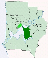
The area broadly forms a peninsula, being bounded on three sides by the waters of the Swan
Swan River (Western Australia)
The Swan River estuary flows through the city of Perth, in the south west of Western Australia. Its lower reaches are relatively wide and deep, with few constrictions, while the upper reaches are usually quite narrow and shallow....
and Canning
Canning River (Western Australia)
The Canning River is a major tributary of the Swan River in south western Western Australia.-Source and route:With headwaters on the Darling Scarp, the Canning meanders through suburbs of Perth on the Swan Coastal Plain, including Cannington, Thornlie, Riverton, Shelley, Rossmoyne and Mount...
rivers.
History
The South Perth Road District was formed on 9 June 1892 and the district became a municipalityMunicipality
A municipality is essentially an urban administrative division having corporate status and usually powers of self-government. It can also be used to mean the governing body of a municipality. A municipality is a general-purpose administrative subdivision, as opposed to a special-purpose district...
on 21 February 1902. It then reverted to a road district on 1 March 1922, but regained municipality status on 1 March 1956. It was granted City status on 1 July 1959.
Wards
The City of South Perth is divided into six wards, each of whom elect two councillors. The mayor is directly elected.- Civic Ward
- Como Beach Ward
- Manning Ward
- McDougall Ward
- Mill Point Ward
- Moresby Ward
Suburbs
- ComoComo, Western AustraliaComo is a suburb of Perth, Western Australia. Its Local Government Area is the City of South Perth. The suburb has a population of 12,423. Canning Highway divides the suburb.-History:...
- KarawaraKarawara, Western AustraliaKarawara is a suburb of Perth, Western Australia.-History:Formerly the southern portion of the Collier Pine Plantation, Karawara is an Aboriginal word meaning green. The suburb name was approved in 1973.-Geography:...
- KensingtonKensington, Western AustraliaKensington is an inner southern suburb of Perth. While mostly within the City of South Perth local government area, a small section is within the Town of Victoria Park....
- ManningManning, Western AustraliaManning is a suburb of Perth, Western Australia.The land was originally purchased by Henry Manning in 1856, with Manning's grandson, John Daniel Manning having a dairy farm in the area...
- Salter PointSalter Point, Western AustraliaSalter Point is a suburb of Perth, Western Australia, located in the City of South Perth local government area.Around 1880, Samuel August Salter worked as a sawyer and timber contractor on the peninsula...
- South PerthSouth Perth, Western AustraliaSouth Perth is a residential suburb 3 kilometres south of the central business district of Perth, the capital of Western Australia, which adjoins the southern shore of Perth Water on the Swan River...
- WaterfordWaterford, Western AustraliaWaterford is a suburb of Perth, Western Australia. Its Local Government Area is the City of South Perth.Waterford is situated on the Canning River.-History:...
Education
The City of South Perth is home to numerous primary schools, and five major secondary schools.Secondary
- Aquinas CollegeAquinas College, PerthAquinas College is a Catholic independent, day and boarding school for boys, located in Salter Point, Western Australia. Its sister school is Santa Maria Ladies College located in Attadale...
- Como Secondary College
- Penrhos CollegePenrhos College, PerthPenrhos College is an independent, Uniting Church, day and boarding school for girls, located in Como, a southern suburb of Perth, Western Australia....
- Wesley CollegeWesley College, PerthWesley College, informally known as Wesley, is an independent, day and boarding school for boys and girls , situated in South Perth, a suburb of Perth, Western Australia....
- Clontarf Aboriginal CollegeClontarf Aboriginal CollegeClontarf Aboriginal College is the current name of a former orphanage for boys operated by the Christian Brothers organisation in the Perth suburb of Waterford in Western Australia. Opening in 1901, the facility has been used for a number of purposes since, most notably as an orphanage but also as...
Primary
- Collier Primary School
- Como Primary School
- Kensington Primary School
- Manning Primary School
- Saint Columba's College
- Saint Pius X Primary School
- South Kensington Primary School
- South Perth Primary School
Library
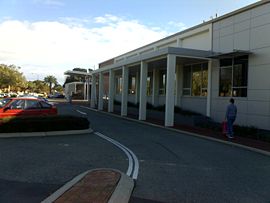
The City of South Perth has two libraries with branches in ManningManning, Western Australia
Manning is a suburb of Perth, Western Australia.The land was originally purchased by Henry Manning in 1856, with Manning's grandson, John Daniel Manning having a dairy farm in the area...
and South Perth
South Perth, Western Australia
South Perth is a residential suburb 3 kilometres south of the central business district of Perth, the capital of Western Australia, which adjoins the southern shore of Perth Water on the Swan River...
. The two libraries have in excess of 60,000 items including; books, magazines, music CD’s and DVD’s. http://www.southperth.wa.gov.au/library Website
Population
| Year | Population |
|---|---|
| 1903 | 947 |
| 1911 | 1,197 |
| 1921 | 2,960 |
| 1933 | 8,731 |
| 1947 | 15,266 |
| 1954 | 21,214 |
| 1961 | 29,941 |
| 1966 | 32,042 |
| 1971 | 31,702 |
| 1976 | 30,388 |
| 1981 | 31,524 |
| 1986 | 32,626 |
| 1991 | 34,007 |
| 1996 | 34,819 |
| 2001 | 35,228 |
| 2006 | 38,361 |

