
Choctaw County, Oklahoma
Encyclopedia
Choctaw County is a county located in the U.S. state
of Oklahoma
. As of 2000, the population was 15,342. Its county seat
is Hugo
.
, the county has a total area of 801 square miles (2,074.6 km²), of which 774 square miles (2,004.7 km²) is land and 27 square miles (69.9 km²) (3.34%) is water.
of 2000, there were 15,342 people, 6,220 households, and 4,285 families residing in the county. The population density
was 20 people per square mile (8/km²). There were 7,539 housing units at an average density of 10 per square mile (4/km²). The racial makeup of the county was 68.55% White
, 10.94% Black
or African American
, 14.96% Native American
, 0.16% Asian
, 0.02% Pacific Islander
, 0.48% from other races
, and 4.90% from two or more races. 1.60% of the population were Hispanic
or Latino
of any race. 97.1% spoke English
, 1.6% Spanish
and 1.3% Choctaw
as their first language.
There were 6,220 households out of which 30.00% had children under the age of 18 living with them, 51.30% were married couples
living together, 14.40% had a female householder with no husband present, and 31.10% were non-families. 28.30% of all households were made up of individuals and 14.90% had someone living alone who was 65 years of age or older. The average household size was 2.43 and the average family size was 2.96.
In the county, the population was spread out with 26.00% under the age of 18, 7.80% from 18 to 24, 24.70% from 25 to 44, 24.10% from 45 to 64, and 17.40% who were 65 years of age or older. The median age was 39 years. For every 100 females there were 90.40 males. For every 100 females age 18 and over, there were 85.00 ma
The median income for a household in the county was $22,743, and the median income for a family was $28,331. Males had a median income of $25,777 versus $18,805 for females. The per capita income
for the county was $12,296. About 20.40% of families and 24.30% of the population were below the poverty line, including 32.50% of those under age 18 and 21.70% of those age 65 or over....
U.S. state
A U.S. state is any one of the 50 federated states of the United States of America that share sovereignty with the federal government. Because of this shared sovereignty, an American is a citizen both of the federal entity and of his or her state of domicile. Four states use the official title of...
of Oklahoma
Oklahoma
Oklahoma is a state located in the South Central region of the United States of America. With an estimated 3,751,351 residents as of the 2010 census and a land area of 68,667 square miles , Oklahoma is the 28th most populous and 20th-largest state...
. As of 2000, the population was 15,342. Its county seat
County seat
A county seat is an administrative center, or seat of government, for a county or civil parish. The term is primarily used in the United States....
is Hugo
Hugo, Oklahoma
Hugo is a city in the southeastern part of the U.S. state of Oklahoma, bordering Texas. Hugo is the county seat for Choctaw County and has a population of 5,395 as of 2009 estimates. The city serves as winter quarters for some circus performers...
.
Geography
According to the U.S. Census BureauUnited States Census Bureau
The United States Census Bureau is the government agency that is responsible for the United States Census. It also gathers other national demographic and economic data...
, the county has a total area of 801 square miles (2,074.6 km²), of which 774 square miles (2,004.7 km²) is land and 27 square miles (69.9 km²) (3.34%) is water.
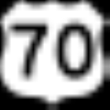
Major highways
 U.S. Highway 70
 U.S. Highway 271
 State Highway 93
- Indian Nation TurnpikeIndian Nation TurnpikeThe Indian Nation Turnpike is a toll road in southeastern Oklahoma. It is the longest tollway in the state.-Route description:The Indian Nation turnpike is built to parkway-like design standards, omitting a center barrier and left-hand shoulders for a slightly mounded grassy median that is flush...
Adjacent counties
- Pushmataha CountyPushmataha County, Oklahoma-Administrative History:* Ca. 1000-1500: Caddoan Mississippian civilization at Spiro Mounds* 1492-1718: Spain* 1718-1763: France* 1763-1800: Spain* 1800-1803: France* 1803–present: United States...
(north) - McCurtain CountyMcCurtain County, OklahomaMcCurtain County is a county located in the U.S. state of Oklahoma. As of 2010, the population was 33,151. Its county seat is Idabel.-Geography:...
(east) - Red River County, Texas (southeast)
- Lamar County, Texas (south)
- Bryan CountyBryan County, OklahomaBryan County is a county located in the U.S. state of Oklahoma. The population was 36,534 at the 2000 census. Its county seat is Durant. The county shares the same boundaries as the Durant Micropolitan Area. It is also home to the headquarters of the Choctaw Nation of Oklahoma located in Durant...
(west) - Atoka CountyAtoka County, OklahomaAtoka County is a county located in the U.S. state of Oklahoma, and was formed in 1907 from Choctaw Lands. As of 2000, the population is 13,879. Its county seat is Atoka.-Geography:...
(northwest)
Demographics
As of the censusCensus
A census is the procedure of systematically acquiring and recording information about the members of a given population. It is a regularly occurring and official count of a particular population. The term is used mostly in connection with national population and housing censuses; other common...
of 2000, there were 15,342 people, 6,220 households, and 4,285 families residing in the county. The population density
Population density
Population density is a measurement of population per unit area or unit volume. It is frequently applied to living organisms, and particularly to humans...
was 20 people per square mile (8/km²). There were 7,539 housing units at an average density of 10 per square mile (4/km²). The racial makeup of the county was 68.55% White
Race (United States Census)
Race and ethnicity in the United States Census, as defined by the Federal Office of Management and Budget and the United States Census Bureau, are self-identification data items in which residents choose the race or races with which they most closely identify, and indicate whether or not they are...
, 10.94% Black
Race (United States Census)
Race and ethnicity in the United States Census, as defined by the Federal Office of Management and Budget and the United States Census Bureau, are self-identification data items in which residents choose the race or races with which they most closely identify, and indicate whether or not they are...
or African American
Race (United States Census)
Race and ethnicity in the United States Census, as defined by the Federal Office of Management and Budget and the United States Census Bureau, are self-identification data items in which residents choose the race or races with which they most closely identify, and indicate whether or not they are...
, 14.96% Native American
Race (United States Census)
Race and ethnicity in the United States Census, as defined by the Federal Office of Management and Budget and the United States Census Bureau, are self-identification data items in which residents choose the race or races with which they most closely identify, and indicate whether or not they are...
, 0.16% Asian
Race (United States Census)
Race and ethnicity in the United States Census, as defined by the Federal Office of Management and Budget and the United States Census Bureau, are self-identification data items in which residents choose the race or races with which they most closely identify, and indicate whether or not they are...
, 0.02% Pacific Islander
Race (United States Census)
Race and ethnicity in the United States Census, as defined by the Federal Office of Management and Budget and the United States Census Bureau, are self-identification data items in which residents choose the race or races with which they most closely identify, and indicate whether or not they are...
, 0.48% from other races
Race (United States Census)
Race and ethnicity in the United States Census, as defined by the Federal Office of Management and Budget and the United States Census Bureau, are self-identification data items in which residents choose the race or races with which they most closely identify, and indicate whether or not they are...
, and 4.90% from two or more races. 1.60% of the population were Hispanic
Race (United States Census)
Race and ethnicity in the United States Census, as defined by the Federal Office of Management and Budget and the United States Census Bureau, are self-identification data items in which residents choose the race or races with which they most closely identify, and indicate whether or not they are...
or Latino
Race (United States Census)
Race and ethnicity in the United States Census, as defined by the Federal Office of Management and Budget and the United States Census Bureau, are self-identification data items in which residents choose the race or races with which they most closely identify, and indicate whether or not they are...
of any race. 97.1% spoke English
English language
English is a West Germanic language that arose in the Anglo-Saxon kingdoms of England and spread into what was to become south-east Scotland under the influence of the Anglian medieval kingdom of Northumbria...
, 1.6% Spanish
Spanish language
Spanish , also known as Castilian , is a Romance language in the Ibero-Romance group that evolved from several languages and dialects in central-northern Iberia around the 9th century and gradually spread with the expansion of the Kingdom of Castile into central and southern Iberia during the...
and 1.3% Choctaw
Choctaw language
The Choctaw language, traditionally spoken by the Native American Choctaw people of the southeastern United States, is a member of the Muskogean family...
as their first language.
There were 6,220 households out of which 30.00% had children under the age of 18 living with them, 51.30% were married couples
Marriage
Marriage is a social union or legal contract between people that creates kinship. It is an institution in which interpersonal relationships, usually intimate and sexual, are acknowledged in a variety of ways, depending on the culture or subculture in which it is found...
living together, 14.40% had a female householder with no husband present, and 31.10% were non-families. 28.30% of all households were made up of individuals and 14.90% had someone living alone who was 65 years of age or older. The average household size was 2.43 and the average family size was 2.96.
In the county, the population was spread out with 26.00% under the age of 18, 7.80% from 18 to 24, 24.70% from 25 to 44, 24.10% from 45 to 64, and 17.40% who were 65 years of age or older. The median age was 39 years. For every 100 females there were 90.40 males. For every 100 females age 18 and over, there were 85.00 ma
The median income for a household in the county was $22,743, and the median income for a family was $28,331. Males had a median income of $25,777 versus $18,805 for females. The per capita income
Per capita income
Per capita income or income per person is a measure of mean income within an economic aggregate, such as a country or city. It is calculated by taking a measure of all sources of income in the aggregate and dividing it by the total population...
for the county was $12,296. About 20.40% of families and 24.30% of the population were below the poverty line, including 32.50% of those under age 18 and 21.70% of those age 65 or over....
Cities and towns
|
Hugo, Oklahoma Hugo is a city in the southeastern part of the U.S. state of Oklahoma, bordering Texas. Hugo is the county seat for Choctaw County and has a population of 5,395 as of 2009 estimates. The city serves as winter quarters for some circus performers... Nelson, Oklahoma Nelson is a community in northwestern Choctaw County, Oklahoma, six miles north of Soper, Oklahoma.Spencer Academy, a Choctaw Nation school, was moved here from Spencerville, Oklahoma. A United States Post Office was established at Nelson, Indian Territory on March 10, 1881 and operated until... Ringold, Oklahoma Ringold is a community in western McCurtain County, Oklahoma, 12 miles northwest of Wright City, Oklahoma. It was formerly called Burwell.A United States Post Office opened at Burwell, Indian Territory on October 31, 1906. It was named for William P. Burwell, first postmaster. Its name was... |
Rufe, Oklahoma Rufe is a community in western McCurtain County, Oklahoma, 10 miles northwest of Wright City, Oklahoma.A United States Post Office was established at Rufe, Indian Territory on February 13, 1903. It was named for Rufus Wilson, son of Mattie Wilson, first postmaster... Sawyer, Oklahoma Sawyer is a town in Choctaw County, Oklahoma, United States. The population was 274 at the 2000 census.-Geography:Sawyer is located at .... Slim, Oklahoma Slim was an unincorporated community in western McCurtain County, Oklahoma, United States, six miles north of Valliant.A post office operated in Slim from January 15, 1916 to July 31, 1933... |
Soper, Oklahoma Soper is a town in Choctaw County, Oklahoma, United States. The population was 600 at the 2000 census. The town was named for P.L. Soper, who was a U.S. attorney in northern district of Indian territory, when the Frisco railroad came through the area in the early 20th century, and the community... Spencerville, Oklahoma Spencerville is a community in northern Choctaw County, Oklahoma, 12 miles northeast of Hugo, Oklahoma, adjacent to the Pushmataha County border.... Swink, Oklahoma Swink is an unincorporated community in Choctaw County, Oklahoma, United States. The population was 83 at the 2000 census, at which time it was a town; the community disincorporated on December 1, 2000.-Geography:Swink is located at .... |