
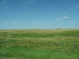
Cheyenne River Indian Reservation
Encyclopedia
The Cheyenne River Indian Reservation was created by the United States
United States
The United States of America is a federal constitutional republic comprising fifty states and a federal district...
in 1889 by breaking up the Great Sioux Reservation
Great Sioux reservation
The Great Sioux Reservation was established in the Fort Laramie Treaty of 1868, and includes all of modern western South Dakota and modern Boyd County, Nebraska...
, following its victory over the Lakota in a series of wars in the 1870s. The reservation covers almost all of Dewey
Dewey County, South Dakota
As of the census of 2000, there were 5,972 people, 1,863 households, and 1,386 families residing in the county. The population density was 3 people per square mile . There were 2,133 housing units at an average density of 1 per square mile...
and Ziebach
Ziebach County, South Dakota
As of the census of 2000, there were 2,519 people, 741 households, and 594 families residing in the county. The population density was 1.3 people per square mile . There were 879 housing units at an average density of 0.4 per square mile...
counties in South Dakota
South Dakota
South Dakota is a state located in the Midwestern region of the United States. It is named after the Lakota and Dakota Sioux American Indian tribes. Once a part of Dakota Territory, South Dakota became a state on November 2, 1889. The state has an area of and an estimated population of just over...
. In addition, many small parcels of off-reservation trust land are located in Stanley
Stanley County, South Dakota
As of the census of 2000, there were 2,772 people, 1,111 households, and 775 families residing in the county. The population density was 2 people per square mile . There were 1,277 housing units at an average density of 1 per square mile...
, Haakon
Haakon County, South Dakota
As of the census of 2000, there were 2,196 people, 870 households, and 620 families residing in the county. The population density was 1 person per square mile . There were 1,002 housing units at an average density of 1 per square mile . The racial makeup of the county was 96.40% White,...
, and Meade
Meade County, South Dakota
As of the census of 2000, there were 24,253 people, 8,805 households, and 6,700 families residing in the county. The population density was 7 people per square mile . There were 10,149 housing units at an average density of 3 per square mile...
counties.
The total land area is 4,266.987 sq mi (11,051.447 km²), making it the fourth-largest Indian reservation
Indian reservation
An American Indian reservation is an area of land managed by a Native American tribe under the United States Department of the Interior's Bureau of Indian Affairs...
in land area in the United States. Its largest community is North Eagle Butte
North Eagle Butte, South Dakota
North Eagle Butte is a census-designated place in Dewey County, South Dakota, United States, along the 45th parallel. The population was 1,954 at the 2010 census.-Geography:North Eagle Butte is located at ....
.
History
The terms of the Treaty of Fort LaramieTreaty of Fort Laramie (1868)
The Treaty of Fort Laramie was an agreement between the United States and the Oglala, Miniconjou, and Brulé bands of Lakota people, Yanktonai Dakota, and Arapaho Nation signed in 1868 at Fort Laramie in the Wyoming Territory, guaranteeing to the Lakota ownership of the Black Hills, and further...
concluded in 1868 granted the Lakota a single large reservation that covered parts of North Dakota
North Dakota
North Dakota is a state located in the Midwestern region of the United States of America, along the Canadian border. The state is bordered by Canada to the north, Minnesota to the east, South Dakota to the south and Montana to the west. North Dakota is the 19th-largest state by area in the U.S....
, South Dakota
South Dakota
South Dakota is a state located in the Midwestern region of the United States. It is named after the Lakota and Dakota Sioux American Indian tribes. Once a part of Dakota Territory, South Dakota became a state on November 2, 1889. The state has an area of and an estimated population of just over...
, and four other states. After conclusion of the Indian Wars in the 1870s, the US government confiscated about one half of this reservation and assigned bands to five distinct reservations in the area. Many notable Lakota chiefs settled here, most notably Touch the Clouds
Touch the Clouds
Touch the Clouds was a chief of the Minneconjou Teton Lakota known for his bravery and skill in battle, physical strength and for his diplomacy in counsel. The youngest son of Lone Horn, he was brother to Spotted Elk, Frog, and Roman Nose...
, who lived here until his death in 1905.
The government dammed the Missouri River
Missouri River
The Missouri River flows through the central United States, and is a tributary of the Mississippi River. It is the longest river in North America and drains the third largest area, though only the thirteenth largest by discharge. The Missouri's watershed encompasses most of the American Great...
for electrical power and flood control. Started in 1948, the project resulted in the submerging of an additional 8 percent of the land area of the Reservation.
Current conditions
The CRIR is the home of the federally recognized Cheyenne River Sioux Tribe (CRST) or Cheyenne River Lakota Nation (Oyate). The members include representatives from four of the traditional seven bands of the Lakota, also known as Teton Sioux: the Minnecojou, Sans ArcSans Arc
The Sans Arc, or Itázipčho in Lakota, are a subdivision of the Lakota people. Sans Arc is the French translation of the Lakota name which means, "Without bows." The translator of Wooden Leg: A Warrior Who Fought Custer renders the name as Arrows all Gone...
, Blackfoot
Blackfoot
The Blackfoot Confederacy or Niitsítapi is the collective name of three First Nations in Alberta and one Native American tribe in Montana....
and Two Kettles
Two Kettles
Two Kettles or “Two Boilings” was a sub division of the Lakota Sioux tribe of Native Americans.# Wah-nee-wack-ata-o-ne-lar # Oohe Noⁿpa# Ma Waqota...
.
The CRIR is bordered on the north by the Standing Rock Indian Reservation
Standing Rock Indian Reservation
The Standing Rock Indian Reservation is a Lakota, Yanktonai and Dakota Indian reservation in North Dakota and South Dakota in the United States...
, on the west by Meade
Meade County, South Dakota
As of the census of 2000, there were 24,253 people, 8,805 households, and 6,700 families residing in the county. The population density was 7 people per square mile . There were 10,149 housing units at an average density of 3 per square mile...
and Perkins
Perkins County, South Dakota
As of the census of 2000, there were 3,363 people, 1,429 households, and 937 families residing in the county. The population density was 1.2 people per square mile . There were 1,854 housing units at an average density of 0.6 per square mile...
Counties; on the south by the Cheyenne River
Cheyenne River
The Cheyenne River is a tributary of the Missouri River in the U.S. states of Wyoming and South Dakota. It is approximately 295 mi long and drains an area of...
; and on the east by the Missouri River in Lake Oahe. Much of the land inside the boundaries is privately owned. The CRST headquarters and BIA agency are located at Eagle Butte, South Dakota
Eagle Butte, South Dakota
Eagle Butte is a city in Dewey and Ziebach counties in the U.S. state of South Dakota. The population was 1,318 at the 2010 census.It is the tribal headquarters of the Cheyenne River Sioux Tribe on the Cheyenne River Indian Reservation.-Geography:...
. The reservation is reached via US-212.
The 2000 census
United States Census, 2000
The Twenty-second United States Census, known as Census 2000 and conducted by the Census Bureau, determined the resident population of the United States on April 1, 2000, to be 281,421,906, an increase of 13.2% over the 248,709,873 persons enumerated during the 1990 Census...
reported a population of 8,470 persons. Many of the 13 small communities on the Cheyenne River Reservation do not have water systems, making it difficult for people to live in sanitary conditions. In recent years, water systems have been constructed that tap the Missouri Main Stem reservoirs, such as Lake Oahe
Lake Oahe
Lake Oahe is a large reservoir behind Oahe Dam on the Missouri River beginning in central South Dakota and continuing north into North Dakota in the United States. The lake has an area of and a maximum depth of . By volume, it is the fourth-largest reservoir in the US. Lake Oahe has a length of...
, which forms the eastern edge of the Reservation.
With few jobs available on the reservation or in nearby towns, many tribal members are unemployed. Two-thirds of the population survives on much less than one-third of the American average income. Such dismal living conditions have contributed to feelings of hopelessness and despair among the youth. Indian Country Today
Indian Country Today
Indian Country Today Media Network is a weekly U.S. newsmagazine that is the primary national news source for Natives, American Indians, and Tribes in the U.S. and Alaska. The ICT Media Network revealed their new online multi-media news platform in January 2011; it is a daily, hourly, or "as news...
reports than one in five girls on the Cheyenne River Reservation has contemplated suicide and more than one in ten has attempted it. As of 2009, a modern medical center was under construction in Eagle Butte to replace an outdated facility.
Beginning on January 22, 2010, a blizzard and ice storm swept across the reservation, downing as many as 3,000 power lines and leaving thousands of residents without power, heat or water. Response to the disaster was slow. Although the state government declared a state of emergency, the situation did not initially receive much attention in the media or from legislators. Power was finally restored to most residents as of February 12, 2010, but overall conditions were still grim.
On February 14, 2010, the TV commentator Keith Olbermann
Keith Olbermann
Keith Theodore Olbermann is an American political commentator and writer. He has been the chief news officer of the Current TV network and the host of Current TV's weeknight political commentary program, Countdown with Keith Olbermann, since June 20, 2011...
highlighted the situation on his program Countdown with Keith Olbermann
Countdown with Keith Olbermann
Countdown with Keith Olbermann is an hour-long weeknight news and political commentary program that airs on Current TV, where it began airing on June 20, 2011. The program was broadcast on MSNBC from March 31, 2003, to January 21, 2011. On MSNBC, the show presented five selected news stories of...
. Within 48 hours more than $250,000 in donations was raised for the reservation. As of February 24, 2010, more than $400,000 in donations had been raised. No deaths had been reported as a result of the disaster. Several elderly residents dependent on dialysis
Dialysis
In medicine, dialysis is a process for removing waste and excess water from the blood, and is primarily used to provide an artificial replacement for lost kidney function in people with renal failure...
treatment were evacuated to nearby towns. As of February 26, 2010, tribal representatives are turning attention to raising awareness about the reservation's damaged water infrastructure.
Communities
- DupreeDupree, South DakotaDupree is a city in Ziebach County, South Dakota, United States. The population was 525 at the 2010 census. It is the county seat of Ziebach County.-Geography:Dupree is located at ....
- Green GrassGreen Grass, South DakotaGreen Grass is a census-designated place in Dewey County, South Dakota, United States. The population was 35 at the 2010 census.-Geography:Green Grass is located at ....
- IsabelIsabel, South DakotaIsabel is a town in Dewey County, South Dakota, United States. The population was 135 at the 2010 census.-Geography:Isabel is located at .According to the United States Census Bureau, the town has a total area of , all of it land....
- La PlantLa Plant, South DakotaLa Plant is a census-designated place in Dewey County, South Dakota, United States. The population was 171 at the 2010 census.-Geography:La Plant is located at ....
- North Eagle ButteNorth Eagle Butte, South DakotaNorth Eagle Butte is a census-designated place in Dewey County, South Dakota, United States, along the 45th parallel. The population was 1,954 at the 2010 census.-Geography:North Eagle Butte is located at ....
- Timber LakeTimber Lake, South DakotaTimber Lake is a city in Dewey County, South Dakota, United States. The population was 443 at the 2010 census. It is the county seat of Dewey County.-Geography:Timber Lake is located at ....
- WhitehorseWhitehorse, South DakotaWhitehorse is a census-designated place in Dewey County, South Dakota, United States. The population was 141 at the 2010 census.-Geography:Whitehorse is located at ....
- Swiftbird
- Cherry CreekCherry Creek, South DakotaCherry Creek is an unincorporated community in Ziebach County, South Dakota, United States. Although not tracked by the Census Bureau, Cherry Creek has been assigned the ZIP code of 57622....
- Red Scaffold
- Bridger
See also
- Great Sioux ReservationGreat Sioux reservationThe Great Sioux Reservation was established in the Fort Laramie Treaty of 1868, and includes all of modern western South Dakota and modern Boyd County, Nebraska...
- Sue (dinosaur)Sue (dinosaur)"Sue" is the nickname given to FMNH PR 2081, which is the largest, most extensive and best preserved Tyrannosaurus rex specimen ever found. It was discovered in the summer of 1990 by Sue Hendrickson, a paleontologist, and was named after her...
- Thunder ButteThunder ButteThunder Butte is a prominent butte landmark located in the northwest corner of Ziebach County, South Dakota, in the United States...
- Madonna SwanMadonna SwanMadonna Mary Swan-Abdalla was an American Indian woman Lakota. Born on the Cheyenne River Sioux Reservation in South Dakota, Madonna Swan prevailed over extreme difficulties including the Native American tuberculosis epidemic of the 20th century to lead a fulfilled life...
, Lakota author from Cheyenne River Indian Reservation