

Chesapeake Country Scenic Byway
Encyclopedia
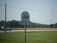
National Scenic Byway
A National Scenic Byway is a road recognized by the United States Department of Transportation for its archeological, cultural, historic, natural, recreational, and/or scenic qualities. The program was established by Congress in 1991 to preserve and protect the nation's scenic but often...
on Maryland's
Maryland
Maryland is a U.S. state located in the Mid Atlantic region of the United States, bordering Virginia, West Virginia, and the District of Columbia to its south and west; Pennsylvania to its north; and Delaware to its east...
Eastern Shore region. The byway runs from Stevensville
Stevensville, Maryland
Stevensville is a census-designated place in Queen Anne's County, Maryland, and is the county's most populous place among both CDPs and municipalities. The Stevensville Historic District is one of only two registered historic districts in the county, the other being the Centreville Historic...
, near the Chesapeake Bay Bridge
Chesapeake Bay Bridge
The Chesapeake Bay Bridge is a major dual-span bridge in the U.S. state of Maryland. Spanning the Chesapeake Bay, it connects the state's rural Eastern Shore region with the more urban Western Shore. The original span opened in 1952 and, at the time, with a length of , it was the world's longest...
to the Chesapeake and Delaware Canal
Chesapeake and Delaware Canal
The Chesapeake and Delaware Canal is a 14-mile long, 450-foot wide and 40-foot deep ship canal that cuts across the states of Maryland and Delaware, in the United States. It connects the waters of the Delaware River with those of the Chesapeake Bay and the Port of Baltimore...
in Chesapeake City
Chesapeake City, Maryland
Chesapeake City is a town in Cecil County, Maryland, United States. The population was 787 at the 2000 census.The town was originally named by Bohemian colonist Augustine Herman the Village of Bohemia , but the name was changed in 1839 when the Chesapeake and Delaware Canal was built...
and has a spur to Eastern Neck Island in the Chester River
Chester River
The Chester River is a major tributary of the Chesapeake Bay on the Delmarva Peninsula. It is about long, and its watershed encompasses , which includes of land. Thus the total watershed area is 20% water. It forms the border between Kent County and Queen Anne's County, Maryland, with its...
. The main route runs mostly along Maryland Routes 18
Maryland Route 18
Maryland Route 18 is a state highway in the U.S. state of Maryland. The state highway runs from the beginning of state maintenance at Love Point east to MD 213 in Centreville...
and 213
Maryland Route 213
Maryland Route 213 is a state highway located on the Eastern Shore of Maryland in the United States. The route runs from Maryland Route 662 in Wye Mills, Queen Anne's County north to the Pennsylvania border in Cecil County, where it continues into that state as Pennsylvania Route 841...
, former main roads that have since been bypassed by US 50
U.S. Route 50 in Maryland
U.S. Route 50 is a major east–west route of the U.S. Highway system, stretching just over from Ocean City, Maryland on the Atlantic Ocean to West Sacramento, California. In the U.S. state of Maryland, US 50 exists in two sections. The longer of these serves as a major route connecting...
and US 301
U.S. Route 301 in Maryland
U.S. Route 301 in Maryland is a major highway that runs from Delaware to the Governor Harry W. Nice Memorial Bridge into Virginia. It passes through three of Maryland's four main regions: the Eastern Shore, the Baltimore-Washington Metropolitan Area, and Southern Maryland...
. The spur runs along Maryland Routes 20
Maryland Route 20
Maryland Route 20 is a state highway in the U.S. state of Maryland. The state highway runs from Beach Road and Lawton Avenue in Rock Hall east to MD 291 in Chestertown. MD 20, which connects Chestertown with several villages in western Kent County, was designated one of the original state roads...
and 445
Maryland Route 445
Maryland Route 445 is a state highway in the U.S. state of Maryland. The state highway runs from Eastern Neck Island in the southwest corner of Kent County north to MD 21 in Tolchester Beach. MD 445 connects Rock Hall with the Tolchester Beach area as well as Eastern Neck National Wildlife Refuge...
. A state-designated extension of the national byway continues across the Bay Bridge, into Annapolis
Annapolis, Maryland
Annapolis is the capital of the U.S. state of Maryland, as well as the county seat of Anne Arundel County. It had a population of 38,394 at the 2010 census and is situated on the Chesapeake Bay at the mouth of the Severn River, south of Baltimore and about east of Washington, D.C. Annapolis is...
, then back onto the Eastern Shore into St. Michaels
St. Michaels, Maryland
Saint Michaels is a town in Talbot County, Maryland, United States. The population was 1,193 at the 2000 census. Saint Michaels derives its name from the Episcopal Parish established here in 1677...
. Both the national and state-designated sections of the byway run past many towns and buildings that remain preserved from the 18th and 19th centuries.
External links
- Official website
- Chesapeake Country Byway, including a map, from the America's Byways website