
Charlestown Township, Clark County, Indiana
Encyclopedia
Charlestown Township is one of twelve townships
in Clark County, Indiana
. As of the 2000 census
, its population was 11,457.
Township (United States)
A township in the United States is a small geographic area. Townships range in size from 6 to 54 square miles , with being the norm.The term is used in three ways....
in Clark County, Indiana
Clark County, Indiana
Clark County is a county located in the U.S. state of Indiana, located directly across the Ohio River from Louisville, Kentucky. At the 2010 Census, the population was 110,232. The county seat is Jeffersonville. Clarksville is also a major city in the county...
. As of the 2000 census
United States Census, 2000
The Twenty-second United States Census, known as Census 2000 and conducted by the Census Bureau, determined the resident population of the United States on April 1, 2000, to be 281,421,906, an increase of 13.2% over the 248,709,873 persons enumerated during the 1990 Census...
, its population was 11,457.
Geography
Charlestown Township covers an area of 64.65 square miles (167.4 km²); 0.15 square mile (0.3884982165 km²) (0.23 percent) of this is water.Unincorporated towns
- OtiscoOtisco, IndianaOtisco is an unincorporated town in Charlestown Township, Clark County, Indiana....
- Rolling HillsRolling Hills, IndianaRolling Hills, Indiana is a neighborhood in the southwest of Fort Wayne, Indiana. Originally a suburban rural development in unincorporated Allen County, the area was incorporated inside the Fort Wayne city limts as part of Fort Wayne's Southwest Extended Annexation of parts of Wayne and Aboite...
- SpringvilleSpringville, IndianaSpringville was a small town that existed from 1798-1811 in Charlestown Township, Clark County, Indiana, United States. It was named for the springs in the area that provided a good fresh water supply. A Frenchman had established a trading post at the site in 1799, Indians called it Tullytown...
(extinct)
Adjacent townships
- Oregon TownshipOregon Township, Clark County, IndianaOregon Township is one of twelve townships in Clark County, Indiana. As of the 2000 census, its population was 1,540.-Unincorporated towns:* Marysville* Runyantown-Adjacent townships:...
(north) - Owen TownshipOwen Township, Clark County, IndianaOwen Township is one of twelve townships in Clark County, Indiana. As of the 2000 census, its population was 865.-Geography:Owen Township covers an area of ; of this is water.-Unincorporated towns:* Hibernia* Owen* Sunset Village* Vesta...
(east) - Utica TownshipUtica Township, Clark County, IndianaUtica Township is one of twelve townships in Clark County, Indiana. As of the 2000 census, its population was 3,085.-Geography:Utica Township covers an area of ; of this is water.-Cities and towns:* Jeffersonville...
(south) - Silver Creek TownshipSilver Creek Township, Clark County, IndianaSilver Creek Township is one of twelve townships in Clark County, Indiana. As of the 2000 census, its population was 9,399.-Geography:Silver Creek Township covers an area of ; of this is water.-Cities and towns:* Clarksville...
(southwest) - Union TownshipUnion Township, Clark County, IndianaUnion Township is one of twelve townships in Clark County, Indiana, United States. As of the 2000 census, its population was 2,021.-Unincorporated towns:* Perry Crossing* Slatecut* Sylvan Grove...
(west) - Monroe TownshipMonroe Township, Clark County, IndianaMonroe Township is one of twelve townships in Clark County, Indiana. As of the 2000 census, its population was 4,688.-Geography:Monroe Township covers an area of ; of this is water.-Adjacent townships:* Vienna Township, Scott County...
(northwest)
Major highways
-
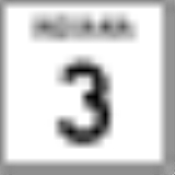
 Indiana State Road 3Indiana State Road 3State Road 3 in the U.S. State of Indiana is a discontinuous state road running through east central Indiana from near the Michigan state line to near the Ohio River...
 -
 Indiana State Road 62Indiana State Road 62State Road 62 in the U.S. State of Indiana is an east–west route that runs from the Illinois state line in the southwest corner of Indiana to the Louisville, Kentucky area, then northeast toward the Cincinnati, Ohio area.-Route description:...
 -
 Indiana State Road 160Indiana State Road 160State Road 160 in the U.S. State of Indiana is a narrow two-lane road that crosses the scenic hill country of Washington, Scott and Clark counties.-Route description:The western terminus of State Road 160 is in Salem at its parent route, State Road 60...
 -
 Indiana State Road 403Indiana State Road 403State Road 403 is a six-mile northeast-to-southwest route that lies entirely within Clark County.-Route description:State Road 403 begins in the north end of Sellersburg at U.S. Route 31, just south of the community of Speed. The road runs northeast in a straight line toward central Charlestown...