
Charles Mix County, South Dakota
Encyclopedia
Charles Mix County is a county located in the U.S. state
of South Dakota
. As of the 2010 census, the population
was 9,129. Its county seat
is Lake Andes
. The county was named after Charles Eli Mix
, an official of the Bureau of Indian Affairs
influential in signing a peace treaty with the local Lakota Indian tribes.
, the county has a total area of 1150 square miles (2,978.5 km²), of which 1098 square miles (2,843.8 km²) is land and 53 square miles (137.3 km²) (4.57%) is water. It is also noted for being shaped like California, including having a body of water on its western border.
: Bryan, Carroll, Choteau Creek, Darlington, Forbes, Goose Lake, Hamilton, Highland, Howard, Jackson, Kennedy, La Roche, Lake George, Lawrence, Lone Tree, Moore, Platte, Plain Center, Rhoda, Roe, Rouse, Signal, Waheheh, White Swan; and one area of unorganized territory: Castalia.
of 2000, there were 9,350 people, 3,343 households, and 2,326 families residing in the county. The population density
was 8 people per square mile (3/km²). There were 3,853 housing units at an average density of 4 per square mile (1/km²). The racial makeup of the county was 69.65% White
, 0.13% Black
or African American
, 28.28% Native American
, 0.10% Asian
, 0.01% Pacific Islander
, 0.47% from other races
, and 1.37% from two or more races. 1.89% of the population were Hispanic
or Latino
of any race. 23.9% were of German, 10.2% Czech
, 10.1% Dutch
and 5.5% Norwegian ancestry.
There were 3,343 households out of which 34.20% had children under the age of 18 living with them, 53.10% were married couples
living together, 11.70% had a female householder with no husband present, and 30.40% were non-families. 28.30% of all households were made up of individuals and 15.10% had someone living alone who was 65 years of age or older. The average household size was 2.74 and the average family size was 3.37.
In the county, the population was spread out with 32.00% under the age of 18, 7.10% from 18 to 24, 23.20% from 25 to 44, 20.40% from 45 to 64, and 17.30% who were 65 years of age or older. The median age was 36 years. For every 100 females there were 96.60 males. For every 100 females age 18 and over, there were 94.10 males.
The median income for a household in the county was $26,060, and the median income for a family was $30,688. Males had a median income of $24,747 versus $19,688 for females. The per capita income
for the county was $11,502. About 20.80% of families and 26.90% of the population were below the poverty line, including 35.50% of those under age 18 and 21.00% of those age 65 or over.
U.S. state
A U.S. state is any one of the 50 federated states of the United States of America that share sovereignty with the federal government. Because of this shared sovereignty, an American is a citizen both of the federal entity and of his or her state of domicile. Four states use the official title of...
of South Dakota
South Dakota
South Dakota is a state located in the Midwestern region of the United States. It is named after the Lakota and Dakota Sioux American Indian tribes. Once a part of Dakota Territory, South Dakota became a state on November 2, 1889. The state has an area of and an estimated population of just over...
. As of the 2010 census, the population
Population
A population is all the organisms that both belong to the same group or species and live in the same geographical area. The area that is used to define a sexual population is such that inter-breeding is possible between any pair within the area and more probable than cross-breeding with individuals...
was 9,129. Its county seat
County seat
A county seat is an administrative center, or seat of government, for a county or civil parish. The term is primarily used in the United States....
is Lake Andes
Lake Andes, South Dakota
Lake Andes is a city in, and the county seat of, Charles Mix County, South Dakota, United States. The population was 879 at the 2010 census.-Geography:Lake Andes is located at ....
. The county was named after Charles Eli Mix
Charles Eli Mix
Charles Eli Mix was an American civil servant. He served as Chief Clerk of the Bureau of Indian Affairs from 1838 to 1868. For a brief period in 1858, Mix was Commissioner of the Bureau of Indian Affairs...
, an official of the Bureau of Indian Affairs
Bureau of Indian Affairs
The Bureau of Indian Affairs is an agency of the federal government of the United States within the US Department of the Interior. It is responsible for the administration and management of of land held in trust by the United States for Native Americans in the United States, Native American...
influential in signing a peace treaty with the local Lakota Indian tribes.
Geography
According to the U.S. Census BureauUnited States Census Bureau
The United States Census Bureau is the government agency that is responsible for the United States Census. It also gathers other national demographic and economic data...
, the county has a total area of 1150 square miles (2,978.5 km²), of which 1098 square miles (2,843.8 km²) is land and 53 square miles (137.3 km²) (4.57%) is water. It is also noted for being shaped like California, including having a body of water on its western border.
Townships
The county is divided into twenty-four townshipsCivil township
A civil township is a widely used unit of local government in the United States, subordinate to, and geographic divisions of, a county. Specific responsibilities and the degree of autonomy vary based on each state. Civil townships are distinct from survey townships, but in states that have both,...
: Bryan, Carroll, Choteau Creek, Darlington, Forbes, Goose Lake, Hamilton, Highland, Howard, Jackson, Kennedy, La Roche, Lake George, Lawrence, Lone Tree, Moore, Platte, Plain Center, Rhoda, Roe, Rouse, Signal, Waheheh, White Swan; and one area of unorganized territory: Castalia.
Major highways
|
 South Dakota Highway 46 South Dakota Highway 46South Dakota Highway 46 South Dakota Highway 46 is a state route that runs west to east across southeastern South Dakota. It begins at the junction of U.S. Highway 18 and U.S. Highway 281 in Pickstown, and runs due east to nearly the Iowa border, before curving south to cross the border and meeting Iowa Highway 10...  South Dakota Highway 50 South Dakota Highway 50South Dakota Highway 50 South Dakota Highway 50 is a state route serving south central and southeast South Dakota. The current alignment begins at the junction of South Dakota Highway 34 at "Lee's Corner" east of Fort Thompson, and ends at the Iowa border near Richland, where it continues as Iowa Highway 3...  South Dakota Highway 1804 South Dakota Highway 1804 |
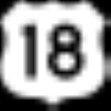
 U.S. Highway 18
 U.S. Highway 281
 South Dakota Highway 44
Adjacent counties
- Brule County, South DakotaBrule County, South DakotaAs of the census of 2000, there were 5,364 people, 1,998 households, and 1,328 families residing in the county. The population density was 6 people per square mile . There were 2,272 housing units at an average density of 3 per square mile...
- north - Aurora County, South DakotaAurora County, South DakotaAurora County is a county located in the U.S. state of South Dakota. As of the 2010 census, the population is 2,710. It's county seat is Plankinton.-History:...
- northeast - Douglas County, South DakotaDouglas County, South DakotaAs of the census of 2000, there were 3,458 people, 1,321 households, and 947 families residing in the county. The population density was 8 people per square mile . There were 1,453 housing units at an average density of 3 per square mile...
- northeast - Hutchinson County, South DakotaHutchinson County, South DakotaAs of the census of 2000, there were 8,075 people, 3,190 households, and 2,191 families residing in the county. The population density was 10 people per square mile . There were 3,517 housing units at an average density of 4 per square mile...
- east - Bon Homme County, South DakotaBon Homme County, South DakotaAs of the census of 2000, there were 7,260 people, 2,635 households, and 1,786 families residing in the county. The population density was 13 people per square mile . There were 3,007 housing units at an average density of 5 per square mile...
- east - Knox County, NebraskaKnox County, Nebraska-History:The Lewis and Clark Expedition passed through the area on 4 September 1804.The US Treaty with the Ponca tribe was signed at White Paint Creek on 9 June 1825.Knox County was formed in 1854. It was named after Major General Henry Knox.-Demographics:...
- southeast - Boyd County, NebraskaBoyd County, NebraskaBoyd County is a county located in the U.S. state of Nebraska. As of 2010, the population is 2,099. Its county seat is Butte.In the Nebraska license plate system, Boyd County is represented by the prefix 63 .-Geography:According to the U.S...
- southwest - Gregory County, South DakotaGregory County, South DakotaAs of the census of 2000, there were 4,792 people, 2,022 households, and 1,290 families residing in the county. The population density was 5 people per square mile . There were 2,405 housing units at an average density of 2 per square mile...
- west
National protected areas
- Lake Andes National Wildlife RefugeLake Andes National Wildlife RefugeLake Andes National Wildlife Refuge is located in the U.S. state of South Dakota and includes 5,638 acres . The refuge is managed by the U.S. Fish and Wildlife Service and is part of the Lake Andes National Wildlife Refuge Complex. Only 938 acres is under U.S...
- Missouri National Recreational RiverMissouri National Recreational RiverThe Missouri National Recreational River is located on the border between Nebraska and South Dakota. The designation was first applied in 1978 to a 59-mile section of the Missouri River between Gavins Point Dam and Ponca State Park. In 1991, an additional 39-mile section between Fort Randall Dam...
(part)
Demographics
As of the censusCensus
A census is the procedure of systematically acquiring and recording information about the members of a given population. It is a regularly occurring and official count of a particular population. The term is used mostly in connection with national population and housing censuses; other common...
of 2000, there were 9,350 people, 3,343 households, and 2,326 families residing in the county. The population density
Population density
Population density is a measurement of population per unit area or unit volume. It is frequently applied to living organisms, and particularly to humans...
was 8 people per square mile (3/km²). There were 3,853 housing units at an average density of 4 per square mile (1/km²). The racial makeup of the county was 69.65% White
Race (United States Census)
Race and ethnicity in the United States Census, as defined by the Federal Office of Management and Budget and the United States Census Bureau, are self-identification data items in which residents choose the race or races with which they most closely identify, and indicate whether or not they are...
, 0.13% Black
Race (United States Census)
Race and ethnicity in the United States Census, as defined by the Federal Office of Management and Budget and the United States Census Bureau, are self-identification data items in which residents choose the race or races with which they most closely identify, and indicate whether or not they are...
or African American
Race (United States Census)
Race and ethnicity in the United States Census, as defined by the Federal Office of Management and Budget and the United States Census Bureau, are self-identification data items in which residents choose the race or races with which they most closely identify, and indicate whether or not they are...
, 28.28% Native American
Race (United States Census)
Race and ethnicity in the United States Census, as defined by the Federal Office of Management and Budget and the United States Census Bureau, are self-identification data items in which residents choose the race or races with which they most closely identify, and indicate whether or not they are...
, 0.10% Asian
Race (United States Census)
Race and ethnicity in the United States Census, as defined by the Federal Office of Management and Budget and the United States Census Bureau, are self-identification data items in which residents choose the race or races with which they most closely identify, and indicate whether or not they are...
, 0.01% Pacific Islander
Race (United States Census)
Race and ethnicity in the United States Census, as defined by the Federal Office of Management and Budget and the United States Census Bureau, are self-identification data items in which residents choose the race or races with which they most closely identify, and indicate whether or not they are...
, 0.47% from other races
Race (United States Census)
Race and ethnicity in the United States Census, as defined by the Federal Office of Management and Budget and the United States Census Bureau, are self-identification data items in which residents choose the race or races with which they most closely identify, and indicate whether or not they are...
, and 1.37% from two or more races. 1.89% of the population were Hispanic
Race (United States Census)
Race and ethnicity in the United States Census, as defined by the Federal Office of Management and Budget and the United States Census Bureau, are self-identification data items in which residents choose the race or races with which they most closely identify, and indicate whether or not they are...
or Latino
Race (United States Census)
Race and ethnicity in the United States Census, as defined by the Federal Office of Management and Budget and the United States Census Bureau, are self-identification data items in which residents choose the race or races with which they most closely identify, and indicate whether or not they are...
of any race. 23.9% were of German, 10.2% Czech
Czech people
Czechs, or Czech people are a western Slavic people of Central Europe, living predominantly in the Czech Republic. Small populations of Czechs also live in Slovakia, Austria, the United States, the United Kingdom, Chile, Argentina, Canada, Germany, Russia and other countries...
, 10.1% Dutch
Dutch people
The Dutch people are an ethnic group native to the Netherlands. They share a common culture and speak the Dutch language. Dutch people and their descendants are found in migrant communities worldwide, notably in Suriname, Chile, Brazil, Canada, Australia, South Africa, New Zealand, and the United...
and 5.5% Norwegian ancestry.
There were 3,343 households out of which 34.20% had children under the age of 18 living with them, 53.10% were married couples
Marriage
Marriage is a social union or legal contract between people that creates kinship. It is an institution in which interpersonal relationships, usually intimate and sexual, are acknowledged in a variety of ways, depending on the culture or subculture in which it is found...
living together, 11.70% had a female householder with no husband present, and 30.40% were non-families. 28.30% of all households were made up of individuals and 15.10% had someone living alone who was 65 years of age or older. The average household size was 2.74 and the average family size was 3.37.
In the county, the population was spread out with 32.00% under the age of 18, 7.10% from 18 to 24, 23.20% from 25 to 44, 20.40% from 45 to 64, and 17.30% who were 65 years of age or older. The median age was 36 years. For every 100 females there were 96.60 males. For every 100 females age 18 and over, there were 94.10 males.
The median income for a household in the county was $26,060, and the median income for a family was $30,688. Males had a median income of $24,747 versus $19,688 for females. The per capita income
Per capita income
Per capita income or income per person is a measure of mean income within an economic aggregate, such as a country or city. It is calculated by taking a measure of all sources of income in the aggregate and dividing it by the total population...
for the county was $11,502. About 20.80% of families and 26.90% of the population were below the poverty line, including 35.50% of those under age 18 and 21.00% of those age 65 or over.
Cities and towns
- DanteDante, South DakotaDante is a town in Charles Mix County, South Dakota, United States. The population was 84 at the 2010 census.-Geography:Dante is located at ....
- GeddesGeddes, South DakotaGeddes is a city in Charles Mix County, South Dakota, United States. The population was 208 at the 2010 census.-Geography:Geddes is located at .According to the United States Census Bureau, the city has a total area of , all of it land....
- Lake AndesLake Andes, South DakotaLake Andes is a city in, and the county seat of, Charles Mix County, South Dakota, United States. The population was 879 at the 2010 census.-Geography:Lake Andes is located at ....
- MartyMarty, South DakotaMarty is a census-designated place in Charles Mix County, South Dakota, United States. The population was 402 at the 2010 census.-Geography:Marty is located at ....
- PickstownPickstown, South DakotaPickstown is a town in Charles Mix County, South Dakota, United States. The population was 201 at the 2010 census. It was named after Lewis A. Pick, director of the Missouri River office of the United States Army Corps of Engineers.-Geography:...
- PlattePlatte, South DakotaPlatte is a city in Charles Mix County, South Dakota, United States. The population was 1,230 at the 2010 census. The community is named after the Platte Creek.- History :Settlement began in the area in the early 1880s....
- RaviniaRavinia, South DakotaRavinia is a town in Charles Mix County, South Dakota, United States. The population was 61 at the 2010 census.-Geography:Ravinia is located at .According to the United States Census Bureau, the town has a total area of , all land....
- WagnerWagner, South DakotaWagner is a city in Charles Mix County, South Dakota, United States. The population was 1,566 at the 2010 census.-Geography:Wagner is located at ....