

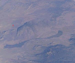
Carrizozo Malpais
Encyclopedia
Malpaís (landform)
A malpaís is a landform characterized by eroded rocks of volcanic origin in an arid environment. This describes many xeric places, but is strongly connected to Spanish-speaking countries and the Southwestern United States because of the Spanish settlers that gave the landform its name.-Badlands...
is a large lava flow on the west side of Carrizozo, New Mexico
Carrizozo, New Mexico
Carrizozo is a town in and the county seat of Lincoln County, New Mexico, United States. The population was 1,036 at the 2000 census.-Geography:Carrizozo is located at ....
, on the northern part of the Tularosa Basin
Tularosa Basin
The Tularosa Basin is a graben basin in the Basin and Range Province and within the Chihuahuan Desert, east of the Rio Grande in southern New Mexico, in the Southwestern United States.-Geography:...
between Sierra Blanca
Sierra Blanca
Sierra Blanca is a range of volcanic mountains in Lincoln and Otero counties of south-central New Mexico. The range is about from north to south and wide, and is dominated by Sierra Blanca Peak, whose highest point is at...
to the southeast and the Oscura Mountains to the west.
The lava
Lava
Lava refers both to molten rock expelled by a volcano during an eruption and the resulting rock after solidification and cooling. This molten rock is formed in the interior of some planets, including Earth, and some of their satellites. When first erupted from a volcanic vent, lava is a liquid at...
making up the flow came from Little Black Peak, about 10 miles north-northwest of Carrizozo, and went about 40 miles south-southwest down the bottom of Tularosa Basin
Tularosa Basin
The Tularosa Basin is a graben basin in the Basin and Range Province and within the Chihuahuan Desert, east of the Rio Grande in southern New Mexico, in the Southwestern United States.-Geography:...
in a series of recent (the last 1,000-1,500 years ago ) active flows. At their southern end, the lava flows are about 12 miles north of the dune fields of White Sands National Monument
White Sands National Monument
The White Sands National Monument is a U.S. National Monument located about southwest of Alamogordo in western Otero County and northeastern Dona Ana County in the state of New Mexico, at an elevation of 4235 feet...
.
The Valley of Fires Recreation Area provides access to the malpais on its east edge, about 3 miles west of Carrizozo
Carrizozo, New Mexico
Carrizozo is a town in and the county seat of Lincoln County, New Mexico, United States. The population was 1,036 at the 2000 census.-Geography:Carrizozo is located at ....
on U.S. Route 380
U.S. Route 380
U.S. Route 380 is an east–west United States highway. The highway's eastern terminus is in Greenville, Texas at an intersection with Interstate 30, of which the easternmost 3–4 miles are co-located with US 69 in a loop around the west and south sides of Greenville. Its western terminus is at...
. There are several scenic overlooks through the area where the highway crosses the malpaís, and entire extent of the flow can be seen from higher elevations to the east on U.S. Route 380
U.S. Route 380
U.S. Route 380 is an east–west United States highway. The highway's eastern terminus is in Greenville, Texas at an intersection with Interstate 30, of which the easternmost 3–4 miles are co-located with US 69 in a loop around the west and south sides of Greenville. Its western terminus is at...
.
See also
- Jornada del MuertoJornada del MuertoThe Jornada del Muerto in the U.S. state of New Mexico was the name given by the Spanish conquistadors to the Jornada del Muerto Desert basin, and the particularly dry stretch of a route through it.The trail lead northward from central Spanish colonial New Spain, present-day Mexico, to the farthest...
- Jornada del Muerto VolcanoJornada del Muerto VolcanoThe Jornada del Muerto Volcano is a small shield volcano and lava field in central New Mexico, about in size and reaching an elevation of . Jornada del Muerto means ""Journey of the Dead Man" in Spanish, referring to the desolate colonial era trail from New Spain through this Malpaís...
- Lava plainLava plainA lava plain, also called a lava field or lava bed, is a large expanse of nearly flat-lying lava flows. Such features are generally composed of highly-fluid basalt lava, and can extend for tens or even hundreds of miles across the underlying terrain...
- Malpaís (landform)Malpaís (landform)A malpaís is a landform characterized by eroded rocks of volcanic origin in an arid environment. This describes many xeric places, but is strongly connected to Spanish-speaking countries and the Southwestern United States because of the Spanish settlers that gave the landform its name.-Badlands...