
Caribou County, Idaho
Encyclopedia
Caribou County is a county located in the U.S. state
of Idaho
. As of the 2010 Census the county had a population of 6,963. The county seat
and largest city is Soda Springs
, followed by Grace
and Bancroft
.
. It was the last county formed in the state, three days after Jerome County
, and was named for the Caribou Mountains
.
of 2000, there were 7,304 people, 2,560 households, and 1,978 families residing in the county. The population density
was 4 people per square mile (2/km²). There were 3,188 housing units at an average density of 2 per square mile (1/km²). The racial makeup of the county was 96.14% White
, 0.05% Black
or African American
, 0.21% Native American
, 0.08% Asian
, 0.12% Pacific Islander
, 2.20% from other races
, and 1.19% from two or more races. 3.96% of the population were Hispanic
or Latino
of any race. 29.7% were of English
, 12.2% German, 11.0% American
, 8.2% Danish and 5.5% Irish
ancestry according to Census 2000.
There were 2,560 households out of which 39.60% had children under the age of 18 living with them, 69.30% were married couples
living together, 5.20% had a female householder with no husband present, and 22.70% were non-families. 20.40% of all households were made up of individuals and 10.30% had someone living alone who was 65 years of age or older. The average household size was 2.83 and the average family size was 3.29.
In the county the population was spread out with 31.70% under the age of 18, 8.20% from 18 to 24, 24.50% from 25 to 44, 22.00% from 45 to 64, and 13.60% who were 65 years of age or older. The median age was 35 years. For every 100 females there were 99.20 males. For every 100 females age 18 and over, there were 98.60 males.
The median income for a household in the county was $37,609, and the median income for a family was $42,630. Males had a median income of $38,575 versus $20,085 for females. The per capita income
for the county was $15,179. About 7.00% of families and 9.60% of the population were below the poverty line, including 10.60% of those under age 18 and 9.90% of those age 65 or over.
U.S. state
A U.S. state is any one of the 50 federated states of the United States of America that share sovereignty with the federal government. Because of this shared sovereignty, an American is a citizen both of the federal entity and of his or her state of domicile. Four states use the official title of...
of Idaho
Idaho
Idaho is a state in the Rocky Mountain area of the United States. The state's largest city and capital is Boise. Residents are called "Idahoans". Idaho was admitted to the Union on July 3, 1890, as the 43rd state....
. As of the 2010 Census the county had a population of 6,963. The county seat
County seat
A county seat is an administrative center, or seat of government, for a county or civil parish. The term is primarily used in the United States....
and largest city is Soda Springs
Soda Springs, Idaho
Soda Springs is a city in Caribou County, Idaho, United States. The population was 3,381 at the 2000 census. The city is the county seat of Caribou County....
, followed by Grace
Grace, Idaho
Grace is a city in Caribou County, Idaho, in the United States. The population was 990 at the 2000 census.-History:The area of Grace was once inhabited by the Shoshone Indians. White settlement dates back to the mid-to-late 19th century. The Oregon Trail passed within of Grace...
and Bancroft
Bancroft, Idaho
Bancroft is a city in the Gem Valley of Caribou County, Idaho, United States. The population was 382 at the 2000 census.-Geography:Bancroft is located at , in the Portneuf Valley. It is a railroad town and lies on the historic route of old U.S. Highway 30...
.
History
Caribou County was formed on February 11, 1919, by the Idaho Legislature by a partition of Bannock CountyBannock County, Idaho
Bannock County is a county located in the southeastern part of the U.S. state of Idaho. It was established in 1893 and named after the local Bannock tribe. It is part of the Pocatello, Idaho Metropolitan Statistical Area, which encompasses all of Bannock and Power counties. As of the 2000 Census...
. It was the last county formed in the state, three days after Jerome County
Jerome County, Idaho
Jerome County is a county in the U.S. state of Idaho. As of the 2000 Census the county had a population of 18,342 . The county seat and largest city is Jerome....
, and was named for the Caribou Mountains
Caribou Mountains (Idaho)
Caribou Mountains are a mountain range in the Rocky Mountains in Idaho, United States.The mountains are in the Caribou National Forest in Bonneville and Caribou counties, near the Wyoming border....
.
Geography
According to the 2000 census, the county has a total area of 1798.62 square miles (4,658.4 km²), of which 1766.01 square miles (4,573.9 km²) (or 98.19%) is land and 32.61 square miles (84.5 km²) (or 1.81%) is water.Adjacent counties
- Bonneville CountyBonneville County, IdahoBonneville County is a county located in the U.S. state of Idaho. As of the 2010 census, the county had a population of 104,234. Its county seat and largest city is Idaho Falls...
- north - Lincoln County, WyomingWyomingWyoming is a state in the mountain region of the Western United States. The western two thirds of the state is covered mostly with the mountain ranges and rangelands in the foothills of the Eastern Rocky Mountains, while the eastern third of the state is high elevation prairie known as the High...
- east - Bear Lake CountyBear Lake County, IdahoBear Lake County is a county located in the U.S. state of Idaho. As of the 2000 Census the county had a population of 6,411 . The county seat is Paris, and Montpelier is the largest city....
- south - Franklin CountyFranklin County, IdahoFranklin County is a county located in the U.S. state of Idaho. As of the 2000 Census the county had a population of 11,329 . The county seat and largest city is Preston. Franklin County is part of the Logan, Utah-Idaho Metropolitan Statistical Area.Established in 1913, Franklin County was named...
- south - Bannock CountyBannock County, IdahoBannock County is a county located in the southeastern part of the U.S. state of Idaho. It was established in 1893 and named after the local Bannock tribe. It is part of the Pocatello, Idaho Metropolitan Statistical Area, which encompasses all of Bannock and Power counties. As of the 2000 Census...
- west - Bingham CountyBingham County, IdahoBingham County is a county located in the U.S. state of Idaho. As of the 2000 Census the county had a population of 41,735 . The county seat and largest city is Blackfoot. Bingham County comprises the Blackfoot, ID, Micropolitan Statistical Area.Bingham County was created January 13, 1885, and...
- northwest
National protected areas
- Cache National ForestCache National ForestCache National Forest was established by the U.S. Forest Service in Idaho and Utah on July 1, 1908 with , the majority in Utah, from part of Bear River National Forest. On July 1, 1915 all of Pocatello National Forest was added...
(part) - Caribou National Forest (part)
- Grays Lake National Wildlife RefugeGrays Lake National Wildlife RefugeGrays Lake National Wildlife Refuge has the largest hardstem bulrush marsh in North America. Located in a high mountain valley near Soda Springs in southeastern Idaho, the refuge and surrounding mountains offer incredible scenic vistas, wildflowers, and fall foliage displays. Lands adjacent to the ...
(part)
Highways
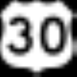
 - US 30
 - SH-34
Demographics
As of the censusCensus
A census is the procedure of systematically acquiring and recording information about the members of a given population. It is a regularly occurring and official count of a particular population. The term is used mostly in connection with national population and housing censuses; other common...
of 2000, there were 7,304 people, 2,560 households, and 1,978 families residing in the county. The population density
Population density
Population density is a measurement of population per unit area or unit volume. It is frequently applied to living organisms, and particularly to humans...
was 4 people per square mile (2/km²). There were 3,188 housing units at an average density of 2 per square mile (1/km²). The racial makeup of the county was 96.14% White
Race (United States Census)
Race and ethnicity in the United States Census, as defined by the Federal Office of Management and Budget and the United States Census Bureau, are self-identification data items in which residents choose the race or races with which they most closely identify, and indicate whether or not they are...
, 0.05% Black
Race (United States Census)
Race and ethnicity in the United States Census, as defined by the Federal Office of Management and Budget and the United States Census Bureau, are self-identification data items in which residents choose the race or races with which they most closely identify, and indicate whether or not they are...
or African American
Race (United States Census)
Race and ethnicity in the United States Census, as defined by the Federal Office of Management and Budget and the United States Census Bureau, are self-identification data items in which residents choose the race or races with which they most closely identify, and indicate whether or not they are...
, 0.21% Native American
Race (United States Census)
Race and ethnicity in the United States Census, as defined by the Federal Office of Management and Budget and the United States Census Bureau, are self-identification data items in which residents choose the race or races with which they most closely identify, and indicate whether or not they are...
, 0.08% Asian
Race (United States Census)
Race and ethnicity in the United States Census, as defined by the Federal Office of Management and Budget and the United States Census Bureau, are self-identification data items in which residents choose the race or races with which they most closely identify, and indicate whether or not they are...
, 0.12% Pacific Islander
Race (United States Census)
Race and ethnicity in the United States Census, as defined by the Federal Office of Management and Budget and the United States Census Bureau, are self-identification data items in which residents choose the race or races with which they most closely identify, and indicate whether or not they are...
, 2.20% from other races
Race (United States Census)
Race and ethnicity in the United States Census, as defined by the Federal Office of Management and Budget and the United States Census Bureau, are self-identification data items in which residents choose the race or races with which they most closely identify, and indicate whether or not they are...
, and 1.19% from two or more races. 3.96% of the population were Hispanic
Race (United States Census)
Race and ethnicity in the United States Census, as defined by the Federal Office of Management and Budget and the United States Census Bureau, are self-identification data items in which residents choose the race or races with which they most closely identify, and indicate whether or not they are...
or Latino
Race (United States Census)
Race and ethnicity in the United States Census, as defined by the Federal Office of Management and Budget and the United States Census Bureau, are self-identification data items in which residents choose the race or races with which they most closely identify, and indicate whether or not they are...
of any race. 29.7% were of English
English people
The English are a nation and ethnic group native to England, who speak English. The English identity is of early mediaeval origin, when they were known in Old English as the Anglecynn. England is now a country of the United Kingdom, and the majority of English people in England are British Citizens...
, 12.2% German, 11.0% American
United States
The United States of America is a federal constitutional republic comprising fifty states and a federal district...
, 8.2% Danish and 5.5% Irish
Irish people
The Irish people are an ethnic group who originate in Ireland, an island in northwestern Europe. Ireland has been populated for around 9,000 years , with the Irish people's earliest ancestors recorded having legends of being descended from groups such as the Nemedians, Fomorians, Fir Bolg, Tuatha...
ancestry according to Census 2000.
There were 2,560 households out of which 39.60% had children under the age of 18 living with them, 69.30% were married couples
Marriage
Marriage is a social union or legal contract between people that creates kinship. It is an institution in which interpersonal relationships, usually intimate and sexual, are acknowledged in a variety of ways, depending on the culture or subculture in which it is found...
living together, 5.20% had a female householder with no husband present, and 22.70% were non-families. 20.40% of all households were made up of individuals and 10.30% had someone living alone who was 65 years of age or older. The average household size was 2.83 and the average family size was 3.29.
In the county the population was spread out with 31.70% under the age of 18, 8.20% from 18 to 24, 24.50% from 25 to 44, 22.00% from 45 to 64, and 13.60% who were 65 years of age or older. The median age was 35 years. For every 100 females there were 99.20 males. For every 100 females age 18 and over, there were 98.60 males.
The median income for a household in the county was $37,609, and the median income for a family was $42,630. Males had a median income of $38,575 versus $20,085 for females. The per capita income
Per capita income
Per capita income or income per person is a measure of mean income within an economic aggregate, such as a country or city. It is calculated by taking a measure of all sources of income in the aggregate and dividing it by the total population...
for the county was $15,179. About 7.00% of families and 9.60% of the population were below the poverty line, including 10.60% of those under age 18 and 9.90% of those age 65 or over.
Cities
- BancroftBancroft, IdahoBancroft is a city in the Gem Valley of Caribou County, Idaho, United States. The population was 382 at the 2000 census.-Geography:Bancroft is located at , in the Portneuf Valley. It is a railroad town and lies on the historic route of old U.S. Highway 30...
- GraceGrace, IdahoGrace is a city in Caribou County, Idaho, in the United States. The population was 990 at the 2000 census.-History:The area of Grace was once inhabited by the Shoshone Indians. White settlement dates back to the mid-to-late 19th century. The Oregon Trail passed within of Grace...
- Soda SpringsSoda Springs, IdahoSoda Springs is a city in Caribou County, Idaho, United States. The population was 3,381 at the 2000 census. The city is the county seat of Caribou County....
Unincorporated communities
- Conda
- FreedomFreedom, Idaho and WyomingFreedom is an unincorporated community in both northeastern Caribou County, Idaho, and northwestern Lincoln County, Wyoming in the United States. Located on U.S. Route 89 and Idaho State Highway 34, it sits on the Idaho/Wyoming state line...
- Henry
- WayanWayan, IdahoWayan is a small unincorporated town located 35 miles north of Soda Springs in Caribou County, Idaho, United States. Located on State Highway 34, it is part of a valley known as Grays Lake, and its zip code is 83285. Wayan is located at 42.978 N and 111.376 W. The community was named after its...