
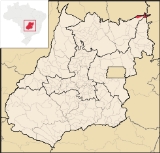
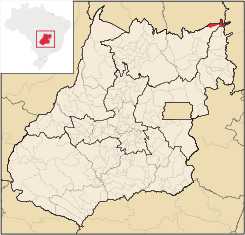
Campos Belos
Encyclopedia
| Campos Belos | |
|---|---|
| State | Goiás Goiás Goiás is a state of Brazil, located in the central part of the country. The name Goiás comes from the name of an indigenous community... |
| Coordinates: | 13°02′13"S 46°46′19"W |
| Area: | 724.06 km² |
| Population: | 18,238(IBGE 2007) |
| Population density | 25.19 inhab/km² |
| Urban population | 15,926 (2007) |
| Rural population | 2,312 (2007) |
| Elevation: | 640m |
| Postcode (CEP): | 73840-000 |
| IBGE statistical microregion: | 018 Chapada dos Veadeiros Chapada dos Veadeiros Microregion The Chapada dos Veadeiros Microregion is an IBGE statistical region in north-central Goiás state, Brazil. It includes 8 cities with a population of 60,267 in a total area of 21,476 km²... |
| Became a city: | 1989 |
| Mayor: | Aurolino José dos Santos Ninha |
| Distance to Goiânia Goiânia -Climate:The city has a tropical wet and dry climate with an average temperature of . There's a wet season, from October to April, and a dry one, from May to September. Annual rainfall is around 1,520 mm.... : |
601 km. |
| Website: | n/a |
Municipality
A municipality is essentially an urban administrative division having corporate status and usually powers of self-government. It can also be used to mean the governing body of a municipality. A municipality is a general-purpose administrative subdivision, as opposed to a special-purpose district...
in northeastern Goiás
Goiás
Goiás is a state of Brazil, located in the central part of the country. The name Goiás comes from the name of an indigenous community...
state, Brazil
Brazil
Brazil , officially the Federative Republic of Brazil , is the largest country in South America. It is the world's fifth largest country, both by geographical area and by population with over 192 million people...
. It is a commercial center for a vast area in the northeast of the state.
Location
Campos Belos is in the extreme northeast of GoiásGoiás
Goiás is a state of Brazil, located in the central part of the country. The name Goiás comes from the name of an indigenous community...
and borders the state of Tocantins
Tocantins (state)
Tocantins is one of the states of Brazil. . The state was formed in 1988 out of the northern part of Goiás, and construction began on the capital, Palmas, in 1989, in contrast to most of the other cities in the state which date back to the Portuguese colonial period...
on the north, Bahia
Bahia
Bahia is one of the 26 states of Brazil, and is located in the northeastern part of the country on the Atlantic coast. It is the fourth most populous Brazilian state after São Paulo, Minas Gerais and Rio de Janeiro, and the fifth-largest in size...
on the east and the municipalities of Monte Alegre de Goiás
Monte Alegre de Goiás
Monte Alegre de Goiás is a small town and municipality in northeastern Goiás state, Brazil.-Location:Monte Alegre is located in the statistical micro-region of Chapada dos Veadeiros and is 31 kilometers south of the border with Tocantins. G0-118 connects it with Teresina de Goiás and Campos Belos...
, Divinópolis
Divinópolis
Divinópolis is a city and municipality located in the centre-west of Minas Gerais state, Brazil. The estimated population in 2007 was 201,921 inhabitants. The total area of the municipality is 709 km² and the elevation is 712 metres. It is located at 120 km from state capital Belo Horizonte...
, and São Domingos
São Domingos
São Domingos can refer to many places in the world:*In Brazil:**São Domingos, Bahia**São Domingos, Goiás**São Domingos, Santa Catarina**São Domingos, Sergipe**São Domingos do Araguaia, Pará**São Domingos do Azeitão, Maranhão...
on the south and southwest.
It is 601 km. to the state capital, Goiânia
Goiânia
-Climate:The city has a tropical wet and dry climate with an average temperature of . There's a wet season, from October to April, and a dry one, from May to September. Annual rainfall is around 1,520 mm....
. Highway connections are made by BR-153 / Anápolis
Anápolis
Anápolis is the third largest city in the State of Goiás in Brazil. It lies in the center of a rich agricultural region and has become a leader in food processing and pharmaceutical plants.-Location and population:...
/ Alexânia
Alexânia
Alexânia is a small town and municipality in central Goiás state, Brazil. Alexânia is known for its alleged extraterrestrial sightings in the late sixties and early seventies. The Areias River passes through the municipality.-Location:...
/ BR-060 / Planaltina
Planaltina
Planaltina is one of the administrative districts of the Federal District of Brazil, with an area of 1,534 kmª and a population of 147,114 in 2000, of whom 134,663 were classified as urban and 12,451 as rural...
/ GO-430 / GO-118 / BR-010 / São João da Aliança / Alto Paraíso de Goiás
Alto Paraíso de Goiás
Alto Paraíso de Goiás is a small town and a municipality in northeastern Goiás state, Brazil. It has become known for its ecological and New Age tourism.-Location:...
/ Teresina de Goiás
Teresina de Goiás
Teresina de Goiás is a small town and municipality in northern Goiás state, Brazil.-Location:It is part of the region of the statistical micro-region of Chapada dos Veadeiros and is located north of the Federal District and Brasília. It is 67 km north of Alto Paraíso de Goiás. The nearest...
/ Monte Alegre de Goiás
Monte Alegre de Goiás
Monte Alegre de Goiás is a small town and municipality in northeastern Goiás state, Brazil.-Location:Monte Alegre is located in the statistical micro-region of Chapada dos Veadeiros and is 31 kilometers south of the border with Tocantins. G0-118 connects it with Teresina de Goiás and Campos Belos...
. There are connections with Arraias
Arraias
Arraias is a municipality located in the Brazilian state of Tocantins. Its population was 10,964 and its area is 5,787 km².The city is served by Arraias Airport....
in the state of Tocantins
Tocantins (state)
Tocantins is one of the states of Brazil. . The state was formed in 1988 out of the northern part of Goiás, and construction began on the capital, Palmas, in 1989, in contrast to most of the other cities in the state which date back to the Portuguese colonial period...
to the north, taking highway BR-242.
Campos Belos lies in a region with a mixture of cerrado
Cerrado
The Cerrado, is a vast tropical savanna ecoregion of Brazil, particularly in the states of Gioas and Minas Gerais...
vegetation and the semi-arid caatinga
Caatinga
Caatinga is a type of vegetation, and an ecoregion characterized by this vegetation in the northeastern part of Brazil. The name "Caatinga" is a Tupi word meaning "white forest" or "white vegetation"...
. The town is surrounded by low mountains.
Economy
The main economic activity is cattle raising (55,700 head in 2006), but it was minerals that brought the first settlers to this region. There are deposits of crystal, calciterite, iron, gold, and uranium. In recent years Campos Belos has become a commercial center for a vast area taking in the northeast of GoiásGoiás
Goiás is a state of Brazil, located in the central part of the country. The name Goiás comes from the name of an indigenous community...
and the southeast of Tocantins
Tocantins
Tocantins may refer to:* Tocantins, a state in Brazil* Tocantins River, a river in Brazil* Survivor: Tocantins, a reality show set in Tocantins, Brazil* Tocantins Esporte Clube, a Brazilian football club...
. The main agricultural products in planted area were rice, sugarcane, and corn. There were three banking institutions represented—BRADESCO S.A., Banco do Brasil S.A., and - Banco Itaú S.A. (2007) Source: http://www.seplan.go.gov.br/sepin/Seplan/Sepin
Agricultural data 2006
- Farms: 265
- Total area: 47,987 ha.
- Area of permanent crops: 42 ha.
- Area of perennial crops: 684 ha.
- Area of natural pasture: 19,286 ha.
- Area of woodland and forests: 27,417 ha.
- Persons dependent on farming: 920
- Number of tractors: 38
- Cattle herd: 55,700
- Main crop: corn with 1,500 ha planted (2006) Source: IBGE
Health and education
In the health sector there were 02 hospitals with 55 beds (2007).- Municipal Human Development IndexHuman Development IndexThe Human Development Index is a composite statistic used to rank countries by level of "human development" and separate "very high human development", "high human development", "medium human development", and "low human development" countries...
: 0.708 - State ranking: 201 (out of 242 municipalities)
- National ranking: 2,866 (out of 5,507 municipalities) Source: Frigoletto
- Literacy rate in 2000: 82.4%
- Infant mortality rate in 2000: 26.56
The state university of Goiás (UEG)opened a campus in Campos Belos in 2000, initially to offer a course in Letters. In a short time it tripled the number of students and now has approximately 800. See UEG Today the campus offers courses in Letters, Pedagogy, Geography, and Mathematics.
History
Campos Belos began around the small chapel dedicated to Our Lady of the Conception in 1881. Lands were donated by local cattle ranchers for the foundation of the new town. In 1889 the settlement was elevated to district, belonging to ArraiasArraias
Arraias is a municipality located in the Brazilian state of Tocantins. Its population was 10,964 and its area is 5,787 km².The city is served by Arraias Airport....
, which is now part of the state of Tocantins
Tocantins (state)
Tocantins is one of the states of Brazil. . The state was formed in 1988 out of the northern part of Goiás, and construction began on the capital, Palmas, in 1989, in contrast to most of the other cities in the state which date back to the Portuguese colonial period...
. In 1953 Campos Belos became a city.
Development took off with the construction of Brasília
Brasília
Brasília is the capital city of Brazil. The name is commonly spelled Brasilia in English. The city and its District are located in the Central-West region of the country, along a plateau known as Planalto Central. It has a population of about 2,557,000 as of the 2008 IBGE estimate, making it the...
in the 1950s and its inauguration in 1960. By the end of the 1970s the city had its first banking agencies and in the 1980s it was integrated into the national telephone system.
A major change occurred in 1988 when the state of Goiás was divided. Campos Belos became an inter-state municipality. Growth was substantial in the decade of the 1990s since the city began to supply the population of the new state of Tocantins
Tocantins
Tocantins may refer to:* Tocantins, a state in Brazil* Tocantins River, a river in Brazil* Survivor: Tocantins, a reality show set in Tocantins, Brazil* Tocantins Esporte Clube, a Brazilian football club...
, which did not have an adequate commercial infrastructure. With the construction of Palmas
Palmas
Palmas may refer to:* Palmas, one of the two sectors of Cataño, Puerto Rico* Palmas, Tocantins, the capital of the state of Tocantins in Brazil* Palmas, Paraná, a centenary small city in the south of the state of Paraná in Brazil...
, the city acquired an alternative route of access to the north of the country.