Cairneyhill
Encyclopedia

Fife
Fife is a council area and former county of Scotland. It is situated between the Firth of Tay and the Firth of Forth, with inland boundaries to Perth and Kinross and Clackmannanshire...
, Scotland
Scotland
Scotland is a country that is part of the United Kingdom. Occupying the northern third of the island of Great Britain, it shares a border with England to the south and is bounded by the North Sea to the east, the Atlantic Ocean to the north and west, and the North Channel and Irish Sea to the...
. It is 3 miles west of Dunfermline
Dunfermline
Dunfermline is a town and former Royal Burgh in Fife, Scotland, on high ground from the northern shore of the Firth of Forth. According to a 2008 estimate, Dunfermline has a population of 46,430, making it the second-biggest settlement in Fife. Part of the town's name comes from the Gaelic word...
, on the A994, and has a population of around 2,600.
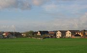
The village's architecture is a mix of old weavers' cottages and modern suburban housing estates. Most residents work either locally or commute to Edinburgh
Edinburgh
Edinburgh is the capital city of Scotland, the second largest city in Scotland, and the eighth most populous in the United Kingdom. The City of Edinburgh Council governs one of Scotland's 32 local government council areas. The council area includes urban Edinburgh and a rural area...
, Glasgow
Glasgow
Glasgow is the largest city in Scotland and third most populous in the United Kingdom. The city is situated on the River Clyde in the country's west central lowlands...
, Stirling
Stirling
Stirling is a city and former ancient burgh in Scotland, and is at the heart of the wider Stirling council area. The city is clustered around a large fortress and medieval old-town beside the River Forth...
or Kirkcaldy
Kirkcaldy
Kirkcaldy is a town and former royal burgh in Fife, on the east coast of Scotland. The town lies on a shallow bay on the northern shore of the Firth of Forth; SSE of Glenrothes, ENE of Dunfermline, WSW of Dundee and NNE of Edinburgh...
. The village is located north and west of the A985, a major trunk road that
provides fast travel by car or bus to the Kincardine Bridge
Kincardine Bridge
The Kincardine Bridge is a road bridge crossing the Firth of Forth from Falkirk council area to Kincardine-on-Forth, Fife, Scotland.-History:The bridge was constructed between 1932 and 1936, designed by Donald Watson...
, the M90
M90 motorway
The M90 is a motorway in Scotland. It runs from Inverkeithing, at the north end of the Forth Road Bridge, to Perth, passing Dunfermline, Cowdenbeath and Kinross on the way...
Motorway and the Forth Road Bridge
Forth Road Bridge
The Forth Road Bridge is a suspension bridge in east central Scotland. The bridge, opened in 1964, spans the Firth of Forth, connecting the capital city Edinburgh, at South Queensferry, to Fife, at North Queensferry...
. The Firth of Forth
Firth of Forth
The Firth of Forth is the estuary or firth of Scotland's River Forth, where it flows into the North Sea, between Fife to the north, and West Lothian, the City of Edinburgh and East Lothian to the south...
is located 1.5 miles south of Cairneyhill.
Amenities
Cairneyhill hosts a number of local businesses and other amenities. There are two shops (one is a post office), a garden centre, a petrol station, a number of housing estates, a guest house (The Maltings), a local pub (the Cairneyhill Inn), a primary school, a Scout hall, and a small industrial estate. There is also a golf course, "The Forrester Park Resort," which has two restaurants and a driving range.History
The name is unusual in that the village is not actually on any noticeable hill, and is in fact about 3 miles south of the local landmark of Cairneil Hill. Why a settlement some miles away should be named after the hill is difficult to understand - there are much closer settlements. Old maps before 1800 make little mention of the name, the area usually being marked as Pitdinny or Pitdinnie, which is still found in a local farm on the eastern edge.The village grew in the 18th century as a settlement for local weavers and was served by the parish church that was built in 1752 and is still used today. This was a hotbed of dissenter
Dissenter
The term dissenter , labels one who disagrees in matters of opinion, belief, etc. In the social and religious history of England and Wales, however, it refers particularly to a member of a religious body who has, for one reason or another, separated from the Established Church.Originally, the term...
s and the village was a central point for the religious disputes in Scotland in the early 19th Century.
There is a small bridge over the Torry Burn at the west end of the village known as the "Conscience Bridge". This name arises from local legend, in which a murderer was caught and confessed to his crime on the bridge and hanged himself. The line of the road has been straightened and widened over the years, with only the original north parapet remaining, but the name of the bridge is carved into a plaque which can be seen by leaning over the wall.

