

Boundaries in landscape history
Encyclopedia
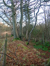
Boundaries—particularly field boundaries—are among the oldest features in an English rural landscape. Although a boundary itself is an abstract concept, the boundary can often be seen by differences in land use on either side.
of the previous open fields in the 18th or 19th centuries. In a few instances, current field boundaries (particularly in the west country) have been shown to have originated in the Bronze Age or Iron Age. With a few exceptions, however, the attempt to establish pre-Saxon boundaries has been "largely fruitless".
in a hedge is often an indicator of an early hedge. It has been proposed that boundary hedges can be dated by hedgerow dating. This involves counting the number of species in a 27 metre section of hedge. In its simplest form each separate species suggests an age of 100 years. A variety of additional complexities have been suggested, but results have been mixed and the technique remains controversial.
, since they are often inherited from land holdings that date back to the middle Saxon period or earlier. The coincidence of another landscape feature with a parish boundary can be used to date that feature—for example in the Time Team
episode screened on 11 March 2007, a mill leat was determined to pre-date the Norman conquest
because it coincided with a parish boundary.
The boundaries of a few Anglo-Saxon estates were described in the boundary clauses of Anglo-Saxon Charters
. These boundary clauses can sometimes be used to characterise the landscape at the time. In some cases, it has been possible to show that the boundaries of these Anglo-Saxon estates correspond to the boundaries of the subsequent parish.
Parish boundaries are shown on the old "1 inch" Ordnance Survey
maps, although these are the boundaries of the civil parish which may be different. Parish boundaries are not shown on the modern "Landranger" maps. Tithe maps
, from the early 19th century, usually show the parish boundary at the time they were drawn.
 In Scotland a march dyke is the boundary between farms or previously baronies.
s are often marked by pronounced earthworks
and for early parks, they can coincide with parish boundaries.
or as a result of earthworks (lumps and bumps) or cropmark
s. Cropmarks and earthworks are often visible in aerial photographs
. Earthworks are more easily seen on photographs taken when the sun is low in the sky and as a result, shadows are more pronounced. They can also become more easily seen when the ground has a slight dusting of snow.
Longevity of boundaries
Boundaries- a real or imagined line that marks the limit of something. Many field boundaries in the central region of England originated with the enclosureEnclosure
Enclosure or inclosure is the process which ends traditional rights such as mowing meadows for hay, or grazing livestock on common land. Once enclosed, these uses of the land become restricted to the owner, and it ceases to be common land. In England and Wales the term is also used for the...
of the previous open fields in the 18th or 19th centuries. In a few instances, current field boundaries (particularly in the west country) have been shown to have originated in the Bronze Age or Iron Age. With a few exceptions, however, the attempt to establish pre-Saxon boundaries has been "largely fruitless".
Hedgerow dating
The presence of bluebellsCommon Bluebell
Hyacinthoides non-scripta, commonly known as the common bluebell, is a spring-flowering bulbous perennial plant. -Taxonomy:...
in a hedge is often an indicator of an early hedge. It has been proposed that boundary hedges can be dated by hedgerow dating. This involves counting the number of species in a 27 metre section of hedge. In its simplest form each separate species suggests an age of 100 years. A variety of additional complexities have been suggested, but results have been mixed and the technique remains controversial.
Parish boundaries
Parish boundaries are of particular interest to landscape historiansLandscape history
Landscape history is the study of the way in which humanity has changed the physical appearance of the environment - both present and past. It is sometimes referred to as landscape archaeology...
, since they are often inherited from land holdings that date back to the middle Saxon period or earlier. The coincidence of another landscape feature with a parish boundary can be used to date that feature—for example in the Time Team
Time Team
Time Team is a British television series which has been aired on Channel 4 since 1994. Created by television producer Tim Taylor and presented by actor Tony Robinson, each episode features a team of specialists carrying out an archaeological dig over a period of three days, with Robinson explaining...
episode screened on 11 March 2007, a mill leat was determined to pre-date the Norman conquest
Norman conquest of England
The Norman conquest of England began on 28 September 1066 with the invasion of England by William, Duke of Normandy. William became known as William the Conqueror after his victory at the Battle of Hastings on 14 October 1066, defeating King Harold II of England...
because it coincided with a parish boundary.
The boundaries of a few Anglo-Saxon estates were described in the boundary clauses of Anglo-Saxon Charters
Anglo-Saxon Charters
Anglo-Saxon charters are documents from the early medieval period in Britain which typically make a grant of land or record a privilege. The earliest surviving charters were drawn up in the 670s; the oldest surviving charters granted land to the Church, but from the eighth century surviving...
. These boundary clauses can sometimes be used to characterise the landscape at the time. In some cases, it has been possible to show that the boundaries of these Anglo-Saxon estates correspond to the boundaries of the subsequent parish.
Parish boundaries are shown on the old "1 inch" Ordnance Survey
Ordnance Survey
Ordnance Survey , an executive agency and non-ministerial government department of the Government of the United Kingdom, is the national mapping agency for Great Britain, producing maps of Great Britain , and one of the world's largest producers of maps.The name reflects its creation together with...
maps, although these are the boundaries of the civil parish which may be different. Parish boundaries are not shown on the modern "Landranger" maps. Tithe maps
Tithe maps
The term Tithe map is usually applied to a map of an English or Welsh parish or township, prepared following the Tithe Commutation Act 1836. This act allowed tithes to be paid in cash rather than goods. The map and its accompanying schedule gave the names of all owners and occupiers of land in the...
, from the early 19th century, usually show the parish boundary at the time they were drawn.
March dyke
Deer park boundaries
The boundaries of medieval deer parkMedieval deer park
A medieval deer park was an enclosed area containing deer. It was bounded by a ditch and bank with a wooden park pale on top of the bank. The ditch was typically on the inside, thus allowing deer to enter the park but preventing them from leaving.-History:...
s are often marked by pronounced earthworks
Earthworks (archaeology)
In archaeology, earthwork is a general term to describe artificial changes in land level. Earthworks are often known colloquially as 'lumps and bumps'. Earthworks can themselves be archaeological features or they can show features beneath the surface...
and for early parks, they can coincide with parish boundaries.
Former boundaries
Boundaries that have fallen out of use, may still be traceable by using geophysicsArchaeological geophysics
Geophysical survey in archaeology most often refers to ground-based physical sensing techniques used for archaeological imaging or mapping. Remote sensing and marine surveys are also used in archaeology, but are generally considered separate disciplines...
or as a result of earthworks (lumps and bumps) or cropmark
Cropmark
Cropmarks or Crop marks are a means through which sub-surface archaeological, natural and recent features may be visible from the air or a vantage point on higher ground or a temporary platform...
s. Cropmarks and earthworks are often visible in aerial photographs
Aerial photography
Aerial photography is the taking of photographs of the ground from an elevated position. The term usually refers to images in which the camera is not supported by a ground-based structure. Cameras may be hand held or mounted, and photographs may be taken by a photographer, triggered remotely or...
. Earthworks are more easily seen on photographs taken when the sun is low in the sky and as a result, shadows are more pronounced. They can also become more easily seen when the ground has a slight dusting of snow.