
.gif)
Black Friday (1939)
Encyclopedia
The Black Friday fires of 13 January 1939, in Victoria, Australia, were considered one of the worst natural bushfires (wildfires) in the world, and certainly the single worst in Australian history as a measure of land affected. Almost 20,000 km² (4,942,000 acres, 2,000,000 ha) of land was burnt, 71 people died, several towns were entirely destroyed and the Royal Commission
that resulted from it led to major changes in forest management. Over 1,300 homes and 69 sawmills were burnt and a total of 3,700 buildings were destroyed. It was calculated that three quarters of the State of Victoria
was directly or indirectly affected by the disaster. The Royal Commission into the fires was to note, "it appeared the whole State was alight on Friday, 13 January 1939".
The summer of 1938–39 had been hot and dry, and several fires had broken out. By early January, fires were burning in a number of locations across the state. Then, on Friday 13 January, a strong northerly wind hit the state, causing several of the fires to combine into one massive front.
, were also hit. Five townships – Hill End
, Narbethong, Nayook West, Noojee (apart from the Hotel), Woods Point – were completely destroyed and not all were rebuilt afterwards. The towns of Omeo, Pomonal, Warrandyte
(though this is now a suburb of Melbourne, it was not in 1939) and Yarra Glen
were also badly damaged.
Around the same time, mid January, bushfires burnt through the Adelaide Hills
, precipitated by the same heatwave. Ash from the fires fell as far away as New Zealand
. The fires came under control two days later, when rain fell on the night of Sunday the 15th.
, Mount Macedon
, Mallee
and the Mornington Peninsula
. The major fires, listed roughly in order of size, included;
 The subsequent Royal Commission, under Judge L.E.B Stretton (known as the Stretton Inquiry), attributed blame for the fires to careless burning, such as for campfires and land clearing. It made a number of recommendations to improve forest management and safety, such as the construction of fire towers and access trails. It also encouraged the creation of a regime of supervised burning, which still exists today.
The fires contributed directly to the passing of the Forests Act, which gave the Forests Commission responsibility for forest fire protection on public land. They were also a key factor in the founding of the Country Fire Authority
in 1944.
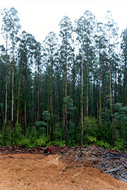
The environmental effects from the fires continued for many years and some of the burnt dead trees still remain today. Large amounts of animal habitat was destroyed. In affected areas, the soil took decades to recover from the damage of the fires. In some areas, water supplies were contaminated for some years afterwards due to ash and debris washing into catchment areas.
in 1983 and the Black Saturday bushfires in 2009 have resulted in more deaths. In terms of the total area burnt, the Black Friday fires are the second largest, burning 2 million hectares, with the Black Thursday
fires of 1851 having burnt an estimated 5 million hectares.
Royal Commission
In Commonwealth realms and other monarchies a Royal Commission is a major ad-hoc formal public inquiry into a defined issue. They have been held in various countries such as the United Kingdom, Australia, Canada, New Zealand, and Saudi Arabia...
that resulted from it led to major changes in forest management. Over 1,300 homes and 69 sawmills were burnt and a total of 3,700 buildings were destroyed. It was calculated that three quarters of the State of Victoria
Victoria (Australia)
Victoria is the second most populous state in Australia. Geographically the smallest mainland state, Victoria is bordered by New South Wales, South Australia, and Tasmania on Boundary Islet to the north, west and south respectively....
was directly or indirectly affected by the disaster. The Royal Commission into the fires was to note, "it appeared the whole State was alight on Friday, 13 January 1939".
Conditions
In the days preceding the fires, the state capital Melbourne experienced some of its hottest temperatures on record at the time: 43.8 °C (110.8 °F) on 8 January and 44.7 °C (112.5 °F) on 10 January. On 13 January, the day of the fires, temperatures reached 45.6 °C (114.1 °F), which stood as the hottest day officially recorded in Melbourne for the next 70 years. (Unofficial records show temperatures of around 47 °C (116.6 °F) were reported on the Black Thursday fires of 6 February 1851).The summer of 1938–39 had been hot and dry, and several fires had broken out. By early January, fires were burning in a number of locations across the state. Then, on Friday 13 January, a strong northerly wind hit the state, causing several of the fires to combine into one massive front.
Effects
The most damage was felt in the mountain and alpine areas in the northeast and around the southwest coast. The Acheron, Tanjil and Thomson Valleys and the GrampiansGrampians National Park
The Grampians National Park is a national park in Victoria, Australia, 235 kilometres west of Melbourne. The Park was listed on the Australian National Heritage List on 15 December 2006 for its outstanding natural beauty and being one of the richest indigenous rock art sites in south-eastern...
, were also hit. Five townships – Hill End
Hill End, Victoria
Hill End is a town in the West Gippsland region of Victoria, Australia. The town is in the Shire of Baw Baw Local government area, east of the state capital, Melbourne. At the 2006 census, Hill End and the surrounding area had a population of 448...
, Narbethong, Nayook West, Noojee (apart from the Hotel), Woods Point – were completely destroyed and not all were rebuilt afterwards. The towns of Omeo, Pomonal, Warrandyte
Warrandyte, Victoria
Warrandyte is a suburb in Melbourne, Victoria, Australia, 24 km north-east from Melbourne's central business district. Its Local Government Area is the City of Manningham...
(though this is now a suburb of Melbourne, it was not in 1939) and Yarra Glen
Yarra Glen, Victoria
Yarra Glen is a town in Victoria, Australia, 40 km north-east from Melbourne's central business district. Its Local Government Area is the Shire of Yarra Ranges...
were also badly damaged.
Around the same time, mid January, bushfires burnt through the Adelaide Hills
Adelaide Hills bushfires (1939)
The Adelaide Hills bushfires of 1939 were a series of bushfires in the Adelaide Hills, South Australia, which burned from 10-14 January. There had been ample rain during the winter of 1938 resulting in heavy understorey, but drought set in toward the end of the year. A heatwave in early January...
, precipitated by the same heatwave. Ash from the fires fell as far away as New Zealand
New Zealand
New Zealand is an island country in the south-western Pacific Ocean comprising two main landmasses and numerous smaller islands. The country is situated some east of Australia across the Tasman Sea, and roughly south of the Pacific island nations of New Caledonia, Fiji, and Tonga...
. The fires came under control two days later, when rain fell on the night of Sunday the 15th.
Major fires
There were 5 major fire areas. Smaller fires included; East GippslandEast Gippsland
East Gippsland is the eastern region of Gippsland, Australia covering 31,740 square kilometres of Victoria. It has a population of 80,114....
, Mount Macedon
Mount Macedon, Victoria
Mount Macedon is a small town located northwest of Melbourne in the Australian state of Victoria. It is situated on the side of the mountain of the same name, known as Geboor by the indigenous Wurundjeri people, which rises to above sea level. At the 2006 census, Mount Macedon had a population...
, Mallee
The Mallee
The Mallee is the most northwesterly district in the state of Victoria, and also encompasses the agricultural district of South Australia. Definitions vary, however all are based on the Victorian distribution of mallee eucalypts...
and the Mornington Peninsula
Mornington Peninsula
The Mornington Peninsula is a peninsula located south-east of Melbourne in Victoria, Australia. It is surrounded by Port Phillip to the west, Western Port to the east and Bass Strait to the south, and is connected to the mainland in the north. Geographically, the peninsula begins its protrusion...
. The major fires, listed roughly in order of size, included;
- Victorian Alps/Yarra Ranges
- PortlandPortland, VictoriaThe city of Portland is the oldest European settlement in what is now the state of Victoria, Australia. It is the main urban centre of the Shire of Glenelg. It is located on Portland Bay.-History:...
- Otway Ranges
- GrampiansGrampians National ParkThe Grampians National Park is a national park in Victoria, Australia, 235 kilometres west of Melbourne. The Park was listed on the Australian National Heritage List on 15 December 2006 for its outstanding natural beauty and being one of the richest indigenous rock art sites in south-eastern...
- Strzelecki RangesStrzelecki RangesStrzelecki Ranges, also known as Strzelecki Hills is a low mountain range in the Gippsland region of south-eastern Australia between the Latrobe Valley to the north and Bass Strait to the south...
Central
- DromanaDromana, VictoriaDromana is a suburb south of Melbourne, the capital city of Victoria, Australia, and is located on the Mornington Peninsula. Its Local Government Area is the Shire of Mornington Peninsula.-Geography:...
- HealesvilleHealesville, VictoriaHealesville is a town in Victoria, Australia, 52 km north-east from Melbourne's central business district. Its Local Government Area is the Shire of Yarra Ranges...
- KinglakeKinglake, VictoriaKinglake is a town in Victoria, Australia situated in the Shire of Murrindindi local government area. At the 2006 Census, Kinglake had a population of 1482...
- MarysvilleMarysville, VictoriaMarysville is a small town, 34 kilometres north-east of Healesville, in the Shire of Murrindindi in Victoria, Australia. The town, which previously had a population of around 500 people, was devastated by the Murrindindi Mill bushfire on 7 February 2009. On 19 February 2009 the official death toll...
- Narbethong - destroyed
- WarburtonWarburton, VictoriaWarburton is a town in Victoria, Australia, 72 km east from Melbourne's central business district. Its Local Government Area is the Shire of Yarra Ranges. At the 2006 Census, Warburton had a population of 2288....
- Warrandyte
- Yarra GlenYarra Glen, VictoriaYarra Glen is a town in Victoria, Australia, 40 km north-east from Melbourne's central business district. Its Local Government Area is the Shire of Yarra Ranges...
East
- Hill EndHill End, VictoriaHill End is a town in the West Gippsland region of Victoria, Australia. The town is in the Shire of Baw Baw Local government area, east of the state capital, Melbourne. At the 2006 census, Hill End and the surrounding area had a population of 448...
- destroyed - Nayook West - destroyed
- MatlockMatlock, VictoriaMatlock is a town in Victoria, Australia, located on the Warburton - Woods Point Road, in the Shire of Mansfield.The town began after gold was discovered in 1863...
- 15 died at a sawmill - Noojee - destroyed
- Omeo
- Woods Point - destroyed
Long-term consequences
The fires contributed directly to the passing of the Forests Act, which gave the Forests Commission responsibility for forest fire protection on public land. They were also a key factor in the founding of the Country Fire Authority
Country Fire Authority
Country Fire Authority, or CFA, is the name of the fire service that provides firefighting and other emergency services to all of the country areas and regional townships within the state of Victoria, Australia, as well as large portions of the outer suburban areas and growth corridors of Melbourne...
in 1944.
The environmental effects from the fires continued for many years and some of the burnt dead trees still remain today. Large amounts of animal habitat was destroyed. In affected areas, the soil took decades to recover from the damage of the fires. In some areas, water supplies were contaminated for some years afterwards due to ash and debris washing into catchment areas.
Comparison with other major Australian bushfires
Considered in terms of both loss of property and loss of life, the 1939 fires were one of the worst disasters to have occurred in Australia and certainly the worst bushfire, up to that time. Only the subsequent Ash Wednesday bushfiresAsh Wednesday fires
The Ash Wednesday bushfires, known in South Australia as Ash Wednesday II, were a series of bushfires that occurred in south-eastern Australia on 16 February 1983. Within twelve hours, more than 180 fires fanned by winds of up to 110 km per hour caused widespread destruction across the states...
in 1983 and the Black Saturday bushfires in 2009 have resulted in more deaths. In terms of the total area burnt, the Black Friday fires are the second largest, burning 2 million hectares, with the Black Thursday
Black Thursday (1851)
The Black Thursday bushfires were a devastating series of fires that swept the state of Victoria, Australia on 6 February 1851. They are considered the largest Australian bushfires in a populous region in recorded history, with approximately 5 million hectares, or a quarter of Victoria, being burnt...
fires of 1851 having burnt an estimated 5 million hectares.
See also
- List of disasters in Australia by death toll
- Ash Wednesday bushfiresAsh Wednesday firesThe Ash Wednesday bushfires, known in South Australia as Ash Wednesday II, were a series of bushfires that occurred in south-eastern Australia on 16 February 1983. Within twelve hours, more than 180 fires fanned by winds of up to 110 km per hour caused widespread destruction across the states...
- Black Saturday bushfires
- Black Thursday bushfiresBlack Thursday (1851)The Black Thursday bushfires were a devastating series of fires that swept the state of Victoria, Australia on 6 February 1851. They are considered the largest Australian bushfires in a populous region in recorded history, with approximately 5 million hectares, or a quarter of Victoria, being burnt...
- Country Fire ServiceCountry Fire ServiceThe SA Country Fire Service is a volunteer based fire service in the state of South Australia in Australia. Many parts of Australia are sparsely populated whilst at the same time they are under significant risk of bushfire. Due to economics, it is prohibitively expensive for each Australian town...
(South Australia) - Country Fire AuthorityCountry Fire AuthorityCountry Fire Authority, or CFA, is the name of the fire service that provides firefighting and other emergency services to all of the country areas and regional townships within the state of Victoria, Australia, as well as large portions of the outer suburban areas and growth corridors of Melbourne...
(Victoria, Australia) - New South Wales Rural Fire ServiceNew South Wales Rural Fire ServiceThe New South Wales Rural Fire Service is a volunteer-based firefighting agency and statutory body of the NSW Government. The NSW RFS is responsible for the general administration of rural fire management affairs including administration of the Rural Fire Fighting Fund, co-ordination with local...
(Australia) - Adelaide Hills bushfires (1939)Adelaide Hills bushfires (1939)The Adelaide Hills bushfires of 1939 were a series of bushfires in the Adelaide Hills, South Australia, which burned from 10-14 January. There had been ample rain during the winter of 1938 resulting in heavy understorey, but drought set in toward the end of the year. A heatwave in early January...
- Book: Forests of Ash by Tom Griffiths, published in 2002
External links
- Black Friday site on the ABC ABC site with comprehensive coverage of all aspects of the fires.
- Map of the area burnt by the 1939 bushfires
- State Library of Victoria's Bushfires in Victoria Research Guide Guide to locating books, government reports, websites, statistics, newspaper reports and images about the Black Friday fires.
- Royal Commission to Inquire into the Causes of and Measures Taken to Prevent the Bush Fires of January 1939 Digitised copy of the Royal Commission report, available from the State Library of Victoria's catalogue.