

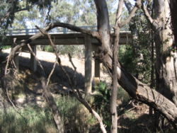
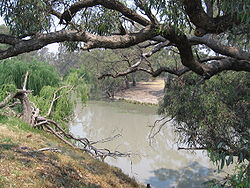
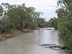
Billabong Creek
Encyclopedia
Stream
A stream is a body of water with a current, confined within a bed and stream banks. Depending on its locale or certain characteristics, a stream may be referred to as a branch, brook, beck, burn, creek, "crick", gill , kill, lick, rill, river, syke, bayou, rivulet, streamage, wash, run or...
in the Riverina
Riverina
The Riverina is an agricultural region of south-western New South Wales , Australia. The Riverina is distinguished from other Australian regions by the combination of flat plains, warm to hot climate and an ample supply of water for irrigation. This combination has allowed the Riverina to develop...
region in New South Wales
New South Wales
New South Wales is a state of :Australia, located in the east of the country. It is bordered by Queensland, Victoria and South Australia to the north, south and west respectively. To the east, the state is bordered by the Tasman Sea, which forms part of the Pacific Ocean. New South Wales...
, Australia
Australia
Australia , officially the Commonwealth of Australia, is a country in the Southern Hemisphere comprising the mainland of the Australian continent, the island of Tasmania, and numerous smaller islands in the Indian and Pacific Oceans. It is the world's sixth-largest country by total area...
. The creek is part of the Murray-Darling River system
Murray-Darling Basin
The Murray-Darling basin is a large geographical area in the interior of southeastern Australia, whose name is derived from its two major rivers, the Murray River and the Darling River. It drains one-seventh of the Australian land mass, and is currently by far the most significant agricultural...
. It is held to be the longest creek in New South Wales.
The creek headwaters are east of Holbrook
Holbrook, New South Wales
Holbrook is a small town in Southern New South Wales, Australia. It is on the Hume Highway, 356 km North-East of Melbourne and 491 km south-west of Sydney between Tarcutta and Albury. The town is in the Greater Hume Shire Council area which was established in May 2004 from the merger of...
in the foothills of the Great Dividing Range
Great Dividing Range
The Great Dividing Range, or the Eastern Highlands, is Australia's most substantial mountain range and the third longest in the world. The range stretches more than 3,500 km from Dauan Island off the northeastern tip of Queensland, running the entire length of the eastern coastline through...
and from there it flows in a generally easterly direction across the flat Riverina plain.
It passes through the towns of
- MorvenMorven, New South WalesMorven is a small village about 7 kilometres west of Culcairn in the eastern Riverina district of New South Wales, Australia. At the 2006 census, Morven had a population of 464 people.-History:Morven commenced its existence as a Cobb and Co Staging Post...
- CulcairnCulcairn, New South WalesCulcairn is a town in the south east Riverina region of New South Wales, Australia. Culcairn is located in the Greater Hume Shire Council Local government area on the Olympic Highway between Albury and Wagga Wagga...
, (where it lends its name to the local High School) - WalbundrieWalbundrie, New South WalesWalbundrie is a village in the eastern Riverina district of New South Wales, Australia. The village is located south-west of the state capital, Sydney and north of Melbourne. Situated on the bank of the Billabong Creek, at the 2006 census, Walbundrie had a population of 190. Walbundrie is in...
- RandRand, New South WalesRand is a town in the Riverina district of New South Wales, Australia. It is located in the Urana Shire Local Government Area. At the 2006 census, Rand had a population of 210....
- JerilderieJerilderie, New South WalesJerilderie is a town of 768 people in the southern Riverina region of New South Wales, Australia. It is the only town in the Jerilderie Shire Local Government Area....
- ConargoConargo, New South WalesConargo is a small rural town located in the Riverina region of New South Wales, Australia and is the seat of Conargo Shire. It is situated on the Billabong Creek, a tributary of the Murrumbidgee River. The nearest towns are Jerilderie and Deniliquin...
- WanganellaWanganella, New South WalesWanganella is a village community on the Billabong Creek in New South Wales, Australia. The settlement is on the Cobb Highway, located between Hay and Deniliquin . Wanganella is within the Conargo Shire Council local government area...
before emptying into the Edward River
Edward River
The Edward River is a river in the south west Riverina region of New South Wales, Australia. The river is an anabranch of the Murray River, the longest river in Australia....
at Moulamein, New South Wales
Moulamein, New South Wales
Moulamein is a small town in New South Wales, Australia, in the Wakool Shire. At the 2006 census, Moulamein had a population of 349 people. Moulamein is the oldest town in the Riverina....
.
The creek has a catchment area of 791 square kilometres (305 sq mi) and is the main present drainange line between the Murray
Murray River
The Murray River is Australia's longest river. At in length, the Murray rises in the Australian Alps, draining the western side of Australia's highest mountains and, for most of its length, meanders across Australia's inland plains, forming the border between New South Wales and Victoria as it...
and the Murrumbidgee River
Murrumbidgee River
The Murrumbidgee River is a major river in the state of New South Wales, Australia, and the Australian Capital Territory . A major tributary of the Murray River, the Murrumbidgee flows in a west-northwesterly direction from the foot of Peppercorn Hill in the Fiery Range of the Snowy Mountains,...
s. Alluvial deposits from the system fill a long narrow paleovalley that extends for about 150 kilometres (93 mi) between Garryowen to Walla Walla
Walla Walla, New South Wales
Walla Walla is a town in Greater Hume Shire Council in New South Wales, Australia. It is about north of Albury-Wodonga and south of Wagga Wagga.Walla Walla had a population of 581 people in 2006 and has the largest Lutheran church in New South Wales....
.
External links
- Map of the Billabong Creek NSW Murray Wetlands Working Group