
Beauregard Parish, Louisiana
Encyclopedia
Beauregard Parish [p] is a parish located in the U.S. state
of Louisiana
. Beauregard Parish was formed on 1 January 1913. The parish seat is DeRidder. As of 2000, the population was 32,986. Beauregard Parish is part of the DeRidder Micropolitan Statistical Area as well as the Fort Polk South
–DeRidder Combined Statistical Area
. The governing body is by the police jury
system.
general and one of the designers of the Confederate Battle Flag.
, the new territory was quickly opened to settlement by the United States government
; but those who settled in the No Man's Land
of Louisiana were considered squatters. During this period, the armies in the area—those of the U.S. and Spain—allowed the running of a ferry, enabling places such as Burr's Ferry
in Vernon Parish, to prosper. The rest of the area was lawless—except for the occasional joint military venture
to rid the area of "undesirables". The Adams-Onís Treaty
, signed in 1819 and ratified in 1821, recognized the U.S. claim, setting the final Louisiana western border at the Sabine River
. This did not stop the lawlessness, however, which lasted well into the 1840s.
in the northeast. By 1807 the counties were reorganized into parishes. St. Landry
was one of the original nineteen civil parishes established by the Louisiana Legislature. St. Landry was the largest parish in Louisiana, called the Imperial St. Landry Parish. For a short period after the fall of New Orleans
during the Civil War
, Opelousas
was not just the county seat but was the state capitol (until it was permanently moved to Shreveport
). Calcasieu Parish
was created 24 March 1840 from the western portion of Saint Landry Parish. Calcasieu Parish has since been divided into five smaller parishes. The original area of Calcasieu Parish was called Imperial Calcasieu Parish. Beauregard Parish was formed out of the northern area of Imperial Calasieu Parish.
, store, and school.) The parish was organized with a police jury as the governing body. Interim, county-wide police jury, judge
and justice
were appointed. However, on 3 December 1912, an election was held for the offices of sheriff, clerk of court, assessor
, coroner
, superintendent of public education, police juror, justice of the peace, constable
, and members of the school board in each of the wards in the parish.
s in Beauregard Parish around the time it was founded. One was about six miles south of Sugartown
on Indian Branch, another was just north of the old W.B. Welborn home on Bundick Creek, another was along the mouth of Anacoco Creek and another at Merryville
, just across the street from where Merryville High School now stands.
(USO) was opened in DeRidder. (Of the more than 500 USO's opened during WW II, this was the first off-post USO to open in the U.S.) 89,000 soldiers visited the DeRidder USO; 15,000 took showers; and 27,000 viewed movies. The building was entered into the National Register of Historic Places
on 25 February 1992.
August through September 1941 saw the locally stationed military engaged in the Louisiana Maneuvers
—the largest military maneuver in United States history (with more than 500,000 soldiers training for war). The rapid influx of so many military personnel created a lot of problems concerning alcohol, so Beauregard Parish voted at that time to become a dry parish
.
As of the census
of 2000, there were 32,986 people, 12,104 households, and 9,078 families residing in the parish. The population density
was 28 people per square mile (11/km²). There were 14,501 housing units at an average density of 12 per square mile (5/km²). The racial makeup of the parish was 84.25% White
, 12.92% Black
or African American
, 0.66% Native American
, 0.60% Asian
, 0.05% Pacific Islander
, 0.30% from other races
, and 1.23% from two or more races. 1.42% of the population were Hispanic
or Latino
of any race.
There were 12,104 households, out of which 36.20% had children under the age of 18 living with them, 60.60% were married couples
living together, 10.90% had a female householder with no husband present, and 25.00% were non-families. 22.20% of all households were made up of individuals and 9.10% had someone living alone who was 65 years of age or older. The average household size was 2.63 and the average family size was 3.07.
In the parish, 27.50% of the population are under the age of 18; 8.60% aged from 18 to 24; 28.70% aged from 25 to 44; 23.30% aged from 45 to 64; and 11.90% who were 65 years of age or older. The median age was 36 years. For every 100 females, there were 100.60 males. For every 100 females age 18 and over, there were 98.90 males.
The median income for a household in the parish was $32,582, and the median income for a family was $37,886. Males had a median income of $35,268 versus $19,639 for females. The per capita income
for the parish was $15,514. About 13.00% of families and 15.60% of the population were below the poverty line, including 19.50% of those under age 18 and 15.50% of those age 65 or over.
operates the C. Paul Phelps Correctional Center
in unincorporated
Beauregard Parish, about 3 miles (4.8 km) north of DeQuincy
.
, the Beauregard Parish Jail
, the Beauregard Parish Training School
, the DeRidder Commercial Historic District
and the Burks House
. See National Register of Historic Places listings in Beauregard Parish, Louisiana.
Geology
U.S. state
A U.S. state is any one of the 50 federated states of the United States of America that share sovereignty with the federal government. Because of this shared sovereignty, an American is a citizen both of the federal entity and of his or her state of domicile. Four states use the official title of...
of Louisiana
Louisiana
Louisiana is a state located in the southern region of the United States of America. Its capital is Baton Rouge and largest city is New Orleans. Louisiana is the only state in the U.S. with political subdivisions termed parishes, which are local governments equivalent to counties...
. Beauregard Parish was formed on 1 January 1913. The parish seat is DeRidder. As of 2000, the population was 32,986. Beauregard Parish is part of the DeRidder Micropolitan Statistical Area as well as the Fort Polk South
Fort Polk South, Louisiana
Fort Polk South is a census-designated place in Vernon Parish, Louisiana, United States. The population was 11,000 at the 2000 census.Fort Polk South is the larger principal city of the Fort Polk South-DeRidder CSA, a Combined Statistical Area that includes the Fort Polk South and DeRidder ...
–DeRidder Combined Statistical Area
Fort Polk South-DeRidder combined statistical area
The Fort Polk South-DeRidder Combined Statistical Area is made up of two parishes in central Louisiana. The statistical area consists of the Fort Polk South Micropolitan Statistical Area and the DeRidder Micropolitan Statistical Area...
. The governing body is by the police jury
Police Jury
In the U.S. state of Louisiana, the typical governing body of the parish is called the Police Jury. Not every parish is governed by a Police Jury, but 41 of the 64 parishes use this system....
system.
History
The Parish was named after P.G.T. Beauregard, a ConfederateConfederate States of America
The Confederate States of America was a government set up from 1861 to 1865 by 11 Southern slave states of the United States of America that had declared their secession from the U.S...
general and one of the designers of the Confederate Battle Flag.
Neutral Ground
The area which was to become Beauregard Parish was part of the Neutral Ground—the eastern boundary of which was the Calcasieu River—from 1806 to 1821. After the Louisiana PurchaseLouisiana Purchase
The Louisiana Purchase was the acquisition by the United States of America of of France's claim to the territory of Louisiana in 1803. The U.S...
, the new territory was quickly opened to settlement by the United States government
Federal government of the United States
The federal government of the United States is the national government of the constitutional republic of fifty states that is the United States of America. The federal government comprises three distinct branches of government: a legislative, an executive and a judiciary. These branches and...
; but those who settled in the No Man's Land
No Man's Land
No man's land is an unoccupied area between two opposing positions.No Man's Land may also refer to:-Places:In the United Kingdom* No Man's Land, Cornwall, England* No Man's Land Fort, off the coast of England* Nomansland, Devon, England...
of Louisiana were considered squatters. During this period, the armies in the area—those of the U.S. and Spain—allowed the running of a ferry, enabling places such as Burr's Ferry
Burr Ferry, Louisiana
Burr Ferry is a community at the junction of LA 8 and LA 111 south, in Vernon Parish, Louisiana, United States. This is only a couple of miles from the site of the old Burr’s Ferry on the Sabine River, at the Texas line...
in Vernon Parish, to prosper. The rest of the area was lawless—except for the occasional joint military venture
Military operation
Military operation is the coordinated military actions of a state in response to a developing situation. These actions are designed as a military plan to resolve the situation in the state's favor. Operations may be of combat or non-combat types, and are referred to by a code name for the purpose...
to rid the area of "undesirables". The Adams-Onís Treaty
Adams-Onís Treaty
The Adams–Onís Treaty of 1819, also known as the Transcontinental Treaty or the Purchase of Florida, was a treaty between the United States and Spain in 1819 that gave Florida to the U.S. and set out a boundary between the U.S. and New Spain . It settled a standing border dispute between the two...
, signed in 1819 and ratified in 1821, recognized the U.S. claim, setting the final Louisiana western border at the Sabine River
Sabine River (Texas-Louisiana)
The Sabine River is a river, long, in the U.S. states of Texas and Louisiana. In its lower course, it forms part of the boundary between the two states and empties into Sabine Lake, an estuary of the Gulf of Mexico. The river formed part of the United States-Mexican international boundary during...
. This did not stop the lawlessness, however, which lasted well into the 1840s.
Parish origin
In 1804 the United States organized present-day Louisiana as the Territory of Orleans. In 1805 the territory was further divided into 12 counties. Opelousas County included the entire southwestern section of the state, and extending almost to the Mississippi RiverMississippi River
The Mississippi River is the largest river system in North America. Flowing entirely in the United States, this river rises in western Minnesota and meanders slowly southwards for to the Mississippi River Delta at the Gulf of Mexico. With its many tributaries, the Mississippi's watershed drains...
in the northeast. By 1807 the counties were reorganized into parishes. St. Landry
St. Landry Parish, Louisiana
St. Landry Parish is a parish located in the U.S. state of Louisiana. It is at the heart of Acadian/Cajun culture and heritage in Louisiana. The parish seat is Opelousas. According to the 2010 census, the population of St. Landry Parish is 83,384.St...
was one of the original nineteen civil parishes established by the Louisiana Legislature. St. Landry was the largest parish in Louisiana, called the Imperial St. Landry Parish. For a short period after the fall of New Orleans
New Orleans, Louisiana
New Orleans is a major United States port and the largest city and metropolitan area in the state of Louisiana. The New Orleans metropolitan area has a population of 1,235,650 as of 2009, the 46th largest in the USA. The New Orleans – Metairie – Bogalusa combined statistical area has a population...
during the Civil War
American Civil War
The American Civil War was a civil war fought in the United States of America. In response to the election of Abraham Lincoln as President of the United States, 11 southern slave states declared their secession from the United States and formed the Confederate States of America ; the other 25...
, Opelousas
Opelousas, Louisiana
Opelousas is a city in and the parish seat of St. Landry Parish, Louisiana, United States. It lies at the junction of Interstate 49 and U.S. Route 190. The population was 22,860 at the 2000 census. Although the 2006 population estimate was 23,222, a 2004 annexation should put the city's...
was not just the county seat but was the state capitol (until it was permanently moved to Shreveport
Shreveport, Louisiana
Shreveport is the third largest city in Louisiana. It is the principal city of the fourth largest metropolitan area in the state of Louisiana and is the 109th-largest city in the United States....
). Calcasieu Parish
Calcasieu Parish, Louisiana
Calcasieu Parish[p] is a parish located in the U.S. state of Louisiana. The parish seat is Lake Charles. As of 2010, the parish population was 192,768...
was created 24 March 1840 from the western portion of Saint Landry Parish. Calcasieu Parish has since been divided into five smaller parishes. The original area of Calcasieu Parish was called Imperial Calcasieu Parish. Beauregard Parish was formed out of the northern area of Imperial Calasieu Parish.
Parish organization
Although there was a faction that wanted the town of Singer to be the parish seat, DeRidder was chosen by a majority of voters on 15 October 1912. (Today, the unincorporated community of Singer still exists, including a post officePost office
A post office is a facility forming part of a postal system for the posting, receipt, sorting, handling, transmission or delivery of mail.Post offices offer mail-related services such as post office boxes, postage and packaging supplies...
, store, and school.) The parish was organized with a police jury as the governing body. Interim, county-wide police jury, judge
Judge
A judge is a person who presides over court proceedings, either alone or as part of a panel of judges. The powers, functions, method of appointment, discipline, and training of judges vary widely across different jurisdictions. The judge is supposed to conduct the trial impartially and in an open...
and justice
Justice of the Peace
A justice of the peace is a puisne judicial officer elected or appointed by means of a commission to keep the peace. Depending on the jurisdiction, they might dispense summary justice or merely deal with local administrative applications in common law jurisdictions...
were appointed. However, on 3 December 1912, an election was held for the offices of sheriff, clerk of court, assessor
Assessor (property)
An assessor is a specialist who calculates the value of property. The value calculated by the assessor is then used as the basis for determining the amounts to be paid or assessed for tax or insurance purposes....
, coroner
Coroner
A coroner is a government official who* Investigates human deaths* Determines cause of death* Issues death certificates* Maintains death records* Responds to deaths in mass disasters* Identifies unknown dead* Other functions depending on local laws...
, superintendent of public education, police juror, justice of the peace, constable
Constable
A constable is a person holding a particular office, most commonly in law enforcement. The office of constable can vary significantly in different jurisdictions.-Etymology:...
, and members of the school board in each of the wards in the parish.
Native Americans
There were at least 4 tribeTribe
A tribe, viewed historically or developmentally, consists of a social group existing before the development of, or outside of, states.Many anthropologists use the term tribal society to refer to societies organized largely on the basis of kinship, especially corporate descent groups .Some theorists...
s in Beauregard Parish around the time it was founded. One was about six miles south of Sugartown
Sugartown, Louisiana
Sugartown is an unincorporated community in Beauregard Parish, Louisiana, United States, approximately 16 miles from DeRidder. The geographical center of Sugartown today is posted as the intersection of LA 112 and La 113...
on Indian Branch, another was just north of the old W.B. Welborn home on Bundick Creek, another was along the mouth of Anacoco Creek and another at Merryville
Merryville, Louisiana
Merryville is a town in Beauregard Parish, Louisiana, United States. The population was 1,126 at the 2000 census. It is part of the DeRidder Micropolitan Statistical Area.-Geography:Merryville is located at ....
, just across the street from where Merryville High School now stands.
Law enforcement
The parish level police agency is the Beauregard Parish Sheriff's Office. The current Sheriff (2010) is Ricky Moses.The 1941 military build-up
On November 28, 1941 a United Service OrganizationsUnited Service Organizations
The United Service Organizations Inc. is a private, nonprofit organization that provides morale and recreational services to members of the U.S. military, with programs in 160 centers worldwide. Since 1941, it has worked in partnership with the Department of Defense , and has provided support and...
(USO) was opened in DeRidder. (Of the more than 500 USO's opened during WW II, this was the first off-post USO to open in the U.S.) 89,000 soldiers visited the DeRidder USO; 15,000 took showers; and 27,000 viewed movies. The building was entered into the National Register of Historic Places
National Register of Historic Places
The National Register of Historic Places is the United States government's official list of districts, sites, buildings, structures, and objects deemed worthy of preservation...
on 25 February 1992.
August through September 1941 saw the locally stationed military engaged in the Louisiana Maneuvers
Louisiana Maneuvers
The Louisiana Maneuvers were a series of military exercises held all over north and west-central Louisiana, including Fort Polk, Camp Claiborne and Camp Livingston, in August and September 1941...
—the largest military maneuver in United States history (with more than 500,000 soldiers training for war). The rapid influx of so many military personnel created a lot of problems concerning alcohol, so Beauregard Parish voted at that time to become a dry parish
Dry county
A dry county is a county in the United States whose government forbids the sale of alcoholic beverages. Some prohibit off-premises sale, some prohibit on-premises sale, and some prohibit both. Hundreds of dry counties exist across the United States, almost all of them in the South...
.
Geography
The parish has a total area of 1166 square miles (3,019.9 km²), of which 1160 square miles (3,004.4 km²) is land and 6 square miles (15.5 km²) (0.51%) is water.Major highways
 U.S. Highway 171
 U.S. Highway 190
 Louisiana Highway 12Louisiana Highway 12Louisiana Highway 12 is a state highway that serves Calcasieu Parish and Beauregard Parish in southwestern Louisiana. It spans from its western terminus at the Texas state line to its eastern terminus at an interchange with U.S. Route 171 and U.S...
 Louisiana Highway 26Louisiana Highway 26Louisiana Highway 26 is a state highway that serves Beauregard Parish, Allen Parish, and Jefferson Davis Parish. It spans , running in a northwest/southeast direction-Route description:...
 Louisiana Highway 27Louisiana Highway 27Louisiana Highway 27 is a state highway that serves Beauregard Parish, Calcasieu Parish, and Cameron Parish. It spans as a north south road with running west to east...
Adjacent parishes
- Vernon ParishVernon Parish, LouisianaVernon Parish is a parish located in the U.S. state of Louisiana. The parish seat is Leesville and as of 2000, the population was 52,531....
(north) - Allen ParishAllen Parish, LouisianaAllen Parish is a parish located in the U.S. state of Louisiana. The parish seat is Oberlin. As of the 2000 census, the population was 25,440. Allen Parish is in southwestern Louisiana, southwest of Alexandria....
(east) - Jefferson Davis ParishJefferson Davis Parish, LouisianaJefferson Davis Parish is a parish located in the U.S. state of Louisiana. The parish seat is Jennings. As of 2000, its population was 31,435. Jefferson Davis Parish is named after the president of the Confederacy during the American Civil War, Jefferson Davis. It is located in southwestern...
(southeast) - Calcasieu ParishCalcasieu Parish, LouisianaCalcasieu Parish[p] is a parish located in the U.S. state of Louisiana. The parish seat is Lake Charles. As of 2010, the parish population was 192,768...
(south) - Newton CountyNewton County, TexasNewton County is the easternmost county in the U.S. state of Texas. In of 2000, its population was 15,072. Its county seat is Newton. Newton county is named for John Newton, a veteran of the American Revolutionary War...
, TexasTexasTexas is the second largest U.S. state by both area and population, and the largest state by area in the contiguous United States.The name, based on the Caddo word "Tejas" meaning "friends" or "allies", was applied by the Spanish to the Caddo themselves and to the region of their settlement in...
(west)
Demographics
As of the census
Census
A census is the procedure of systematically acquiring and recording information about the members of a given population. It is a regularly occurring and official count of a particular population. The term is used mostly in connection with national population and housing censuses; other common...
of 2000, there were 32,986 people, 12,104 households, and 9,078 families residing in the parish. The population density
Population density
Population density is a measurement of population per unit area or unit volume. It is frequently applied to living organisms, and particularly to humans...
was 28 people per square mile (11/km²). There were 14,501 housing units at an average density of 12 per square mile (5/km²). The racial makeup of the parish was 84.25% White
Race (United States Census)
Race and ethnicity in the United States Census, as defined by the Federal Office of Management and Budget and the United States Census Bureau, are self-identification data items in which residents choose the race or races with which they most closely identify, and indicate whether or not they are...
, 12.92% Black
Race (United States Census)
Race and ethnicity in the United States Census, as defined by the Federal Office of Management and Budget and the United States Census Bureau, are self-identification data items in which residents choose the race or races with which they most closely identify, and indicate whether or not they are...
or African American
Race (United States Census)
Race and ethnicity in the United States Census, as defined by the Federal Office of Management and Budget and the United States Census Bureau, are self-identification data items in which residents choose the race or races with which they most closely identify, and indicate whether or not they are...
, 0.66% Native American
Race (United States Census)
Race and ethnicity in the United States Census, as defined by the Federal Office of Management and Budget and the United States Census Bureau, are self-identification data items in which residents choose the race or races with which they most closely identify, and indicate whether or not they are...
, 0.60% Asian
Race (United States Census)
Race and ethnicity in the United States Census, as defined by the Federal Office of Management and Budget and the United States Census Bureau, are self-identification data items in which residents choose the race or races with which they most closely identify, and indicate whether or not they are...
, 0.05% Pacific Islander
Race (United States Census)
Race and ethnicity in the United States Census, as defined by the Federal Office of Management and Budget and the United States Census Bureau, are self-identification data items in which residents choose the race or races with which they most closely identify, and indicate whether or not they are...
, 0.30% from other races
Race (United States Census)
Race and ethnicity in the United States Census, as defined by the Federal Office of Management and Budget and the United States Census Bureau, are self-identification data items in which residents choose the race or races with which they most closely identify, and indicate whether or not they are...
, and 1.23% from two or more races. 1.42% of the population were Hispanic
Race (United States Census)
Race and ethnicity in the United States Census, as defined by the Federal Office of Management and Budget and the United States Census Bureau, are self-identification data items in which residents choose the race or races with which they most closely identify, and indicate whether or not they are...
or Latino
Race (United States Census)
Race and ethnicity in the United States Census, as defined by the Federal Office of Management and Budget and the United States Census Bureau, are self-identification data items in which residents choose the race or races with which they most closely identify, and indicate whether or not they are...
of any race.
There were 12,104 households, out of which 36.20% had children under the age of 18 living with them, 60.60% were married couples
Marriage
Marriage is a social union or legal contract between people that creates kinship. It is an institution in which interpersonal relationships, usually intimate and sexual, are acknowledged in a variety of ways, depending on the culture or subculture in which it is found...
living together, 10.90% had a female householder with no husband present, and 25.00% were non-families. 22.20% of all households were made up of individuals and 9.10% had someone living alone who was 65 years of age or older. The average household size was 2.63 and the average family size was 3.07.
In the parish, 27.50% of the population are under the age of 18; 8.60% aged from 18 to 24; 28.70% aged from 25 to 44; 23.30% aged from 45 to 64; and 11.90% who were 65 years of age or older. The median age was 36 years. For every 100 females, there were 100.60 males. For every 100 females age 18 and over, there were 98.90 males.
The median income for a household in the parish was $32,582, and the median income for a family was $37,886. Males had a median income of $35,268 versus $19,639 for females. The per capita income
Per capita income
Per capita income or income per person is a measure of mean income within an economic aggregate, such as a country or city. It is calculated by taking a measure of all sources of income in the aggregate and dividing it by the total population...
for the parish was $15,514. About 13.00% of families and 15.60% of the population were below the poverty line, including 19.50% of those under age 18 and 15.50% of those age 65 or over.
Cities and Towns
|
Unincorporated Areas
|
Longville, Louisiana Longville is a census-designated place in Beauregard Parish, Louisiana. As of the 2010 census, its population is 635. It has 3 schools, South Beauregard Elementary, South Beauregard Junior High, and South Beauregard High school, which are all combined in one school.-References:... |
Sugartown, Louisiana Sugartown is an unincorporated community in Beauregard Parish, Louisiana, United States, approximately 16 miles from DeRidder. The geographical center of Sugartown today is posted as the intersection of LA 112 and La 113... |
|
Government and infrastructure
The Louisiana Department of Public Safety & CorrectionsLouisiana Department of Public Safety & Corrections
The Department of Public Safety and Corrections is a state agency of Louisiana, headquartered in Baton Rouge. The agency comprises two major areas: Public Safety Services and Corrections Services. The Secretary, who is appointed by the Governor, serves as the Department's chief executive officer...
operates the C. Paul Phelps Correctional Center
C. Paul Phelps Correctional Center
C. Paul Phelps Correctional Center is a Louisiana Department of Public Safety & Corrections prison for men, located in unincorporated Beauregard Parish, Louisiana, about north of DeQuincy and northwest of Lake Charles. The center is located on Louisiana Highway 27.-External links:* "." Louisiana...
in unincorporated
Unincorporated area
In law, an unincorporated area is a region of land that is not a part of any municipality.To "incorporate" in this context means to form a municipal corporation, a city, town, or village with its own government. An unincorporated community is usually not subject to or taxed by a municipal government...
Beauregard Parish, about 3 miles (4.8 km) north of DeQuincy
DeQuincy, Louisiana
DeQuincy is the northernmost city in Calcasieu Parish, Louisiana, United States. The population was 3,398 at the 2000 census. DeQuincy is part of the Lake Charles Metropolitan Statistical Area.-Geography:DeQuincy is located at ....
.
National Register of Historic Places
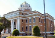
There are 12 places listed on the National Register of Historic Places including the Beauregard Parish CourthouseBeauregard Parish Courthouse
The Beauregard Parish Courthouse was the answer to a need for a new Parish. DeRidder beat out Singer for the location of the parish seat. The courthouse was built at the same time as the Beauregard Parish Jail, by the same people, and completed around the same time in 1915, as directed by the...
, the Beauregard Parish Jail
Beauregard Parish Jail
Beauregard Parish Jail is a former jailhouse in DeRidder, Louisiana built in 1914 in the Gothic Revival architecture style. It is often referred to as the Gothic jail or the Hanging jail. It was listed on the National Register of Historic Places on December 17, 1981. The jail is owned by the...
, the Beauregard Parish Training School
Beauregard Parish Training School
The Beauregard Parish Training School in DeRidder, Louisiana, was a school for education of black students and for training of black teachers...
, the DeRidder Commercial Historic District
DeRidder Commercial Historic District
The DeRidder Commercial Historic District covers an area from the Railroad tracks at Washington street and includes Second, Stewart, and Port street. In 1983 the buildings were added to the National Register of Historic Places.-History:...
and the Burks House
Burks House (Merryville, Louisiana)
Burks House, is a log cabin with a mud daub chimney built in 1883. The house is typical of those built in the 19th century when the area was officially open to homesteading....
. See National Register of Historic Places listings in Beauregard Parish, Louisiana.
External links
Geology
- Snead, J., P. V. Heinrich, and R. P. McCulloh, 2002, De Ridder 30 x 60 minute geologic quadrangle. Louisiana Geological Survey, Baton Rouge, Louisiana.