
Bathurst-Ilford Road
Encyclopedia
Bathurst to Ilford Road is a 72 kilometre New South Wales
country road linking the Castlereagh Highway
at Ilford
to the regional highway hub of Bathurst
, where several roads including the Great Western Highway
, Mid-Western Highway
and Mitchell Highway
s and O'Connell Road
to Oberon
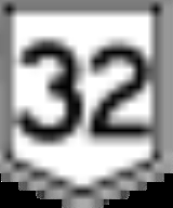
join. The road is designated as Main Road 54 but the road signs do not generally show this number.
It is fully sealed over its entire length, but many road maps still show sections of it as unsealed.
The historic town of Sofala
is just off the road, while the road passes through Wattle Flat and Peel.
In conjunction with the Bylong Valley Way
from the Castlereagh Highway near Ilford to the Golden Highway
near Sandy Hollow
, this very quiet and scenic route provides a leisurely alternative to going through Sydney
to travel between the Hunter Valley
and Bathurst.
New South Wales
New South Wales is a state of :Australia, located in the east of the country. It is bordered by Queensland, Victoria and South Australia to the north, south and west respectively. To the east, the state is bordered by the Tasman Sea, which forms part of the Pacific Ocean. New South Wales...
country road linking the Castlereagh Highway
Castlereagh Highway
The Castlereagh Highway is a state highway in New South Wales, Australia, also extending some kilometres into Queensland. It has been given the route number 55. The highway was recently extended past Gilgandra to include state route 86...
at Ilford
Ilford, New South Wales
Ilford is a small town in New South Wales, Australia, in the Mid-Western Regional Council. It is named after the small English town of Ilford , where the founders of this town came from. It is situated around 220 km north west of Sydney. It is located on the Castlereagh Highway, which is...
to the regional highway hub of Bathurst
Bathurst, New South Wales
-CBD and suburbs:Bathurst's CBD is located on William, George, Howick, Russell, and Durham Streets. The CBD is approximately 25 hectares and surrounds two city blocks. Within this block layout is banking, government services, shopping centres, retail shops, a park* and monuments...
, where several roads including the Great Western Highway
Great Western Highway
The Great Western Highway is a highway in New South Wales, Australia. It runs 210 km from Sydney to Bathurst.Starting as Broadway at the intersection of City Road near the fringe of the Sydney CBD, and becoming Parramatta Road to Parramatta itself, the Great Western Highway heads due west from...
, Mid-Western Highway
Mid-Western Highway
The Mid-Western Highway starts at Bathurst New South Wales, where it joins with the Great Western Highway over the Blue Mountains from Sydney.It proceeds via Blayney, Carcoar and Cowra. It then heads west through Grenfell to West Wyalong where it crosses the Newell Highway...
and Mitchell Highway
Mitchell Highway
The Mitchell Highway is a major rural highway in Australia, travelling through central and northern New South Wales and south central Queensland. The highway starts from its northern end in Queensland with the Landsborough Highway near Augathella and continues south to Charleville and Cunnamulla...
s and O'Connell Road
O'Connell Road
O'Connell Road is a New South Wales rural road linking Oberon to the regional highway hub of Bathurst, where several roads including the Great Western Highway, Mid-Western Highway, Mitchell Highway and Bathurst-Ilford Road join...
to Oberon
Oberon, New South Wales
-See also:*Oberon Correctional Centre*Mount Trickett*Mount Bindo*Shooters Hill-External links:***...
join. The road is designated as Main Road 54 but the road signs do not generally show this number.
It is fully sealed over its entire length, but many road maps still show sections of it as unsealed.
The historic town of Sofala
Sofala, New South Wales
Sofala is a village located approximately 250 km north-west of Sydney, New South Wales, within Bathurst Regional Council. It is located beside the Turon River. Sofala is just off the Bathurst-Ilford Road, with only local traffic through the town itself...
is just off the road, while the road passes through Wattle Flat and Peel.
In conjunction with the Bylong Valley Way
Bylong Valley Way
Bylong Valley Way is a New South Wales country road linking the Golden Highway near Sandy Hollow to the Castlereagh Highway near Ilford. It is named after the Bylong Valley, through which the road passes.- Connections :...
from the Castlereagh Highway near Ilford to the Golden Highway
Golden Highway
The Golden Highway is a highway in New South Wales, Australia.Designated as State Highway 84, it runs eastwards from Dubbo towards Newcastle on the coast and enables road transport to avoid travelling over the Blue Mountains to Sydney....
near Sandy Hollow
Sandy Hollow, New South Wales
Sandy Hollow is a small rural town in New South Wales, Australia in Muswellbrook Shire. The town is located on the Golden Highway in the far west of the Upper Hunter Valley region, about 260 km north of Sydney....
, this very quiet and scenic route provides a leisurely alternative to going through Sydney
Sydney
Sydney is the most populous city in Australia and the state capital of New South Wales. Sydney is located on Australia's south-east coast of the Tasman Sea. As of June 2010, the greater metropolitan area had an approximate population of 4.6 million people...
to travel between the Hunter Valley
Hunter Valley
The Hunter Region, more commonly known as the Hunter Valley, is a region of New South Wales, Australia, extending from approximately to north of Sydney with an approximate population of 645,395 people. Most of the population of the Hunter Region lives within of the coast, with 55% of the entire...
and Bathurst.
List of towns on the Bathurst to Ilford Road
- IlfordIlford, New South WalesIlford is a small town in New South Wales, Australia, in the Mid-Western Regional Council. It is named after the small English town of Ilford , where the founders of this town came from. It is situated around 220 km north west of Sydney. It is located on the Castlereagh Highway, which is...
- SofalaSofala, New South WalesSofala is a village located approximately 250 km north-west of Sydney, New South Wales, within Bathurst Regional Council. It is located beside the Turon River. Sofala is just off the Bathurst-Ilford Road, with only local traffic through the town itself...
- Wattle Flat
- Peel
- BathurstBathurst, New South Wales-CBD and suburbs:Bathurst's CBD is located on William, George, Howick, Russell, and Durham Streets. The CBD is approximately 25 hectares and surrounds two city blocks. Within this block layout is banking, government services, shopping centres, retail shops, a park* and monuments...