

Baseline (sea)
Encyclopedia
A baseline is the line from which the seaward limits of a State's territorial sea and certain other maritime
zones of jurisdiction
are measured. Normally, a sea baseline follows the low-water line of a coastal State. When the coastline is deeply indented, has fringing islands or is highly unstable, straight baselines may be used.
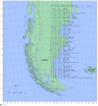 The following methods are used to measure a baseline under United Nations Convention on the Law of the Sea
1982.
Ocean
An ocean is a major body of saline water, and a principal component of the hydrosphere. Approximately 71% of the Earth's surface is covered by ocean, a continuous body of water that is customarily divided into several principal oceans and smaller seas.More than half of this area is over 3,000...
zones of jurisdiction
Jurisdiction
Jurisdiction is the practical authority granted to a formally constituted legal body or to a political leader to deal with and make pronouncements on legal matters and, by implication, to administer justice within a defined area of responsibility...
are measured. Normally, a sea baseline follows the low-water line of a coastal State. When the coastline is deeply indented, has fringing islands or is highly unstable, straight baselines may be used.
Measurement of baseline
United Nations Convention on the Law of the Sea
The United Nations Convention on the Law of the Sea , also called the Law of the Sea Convention or the Law of the Sea treaty, is the international agreement that resulted from the third United Nations Conference on the Law of the Sea , which took place from 1973 through 1982...
1982.
Normal baseline
Except where otherwise provided in this Convention, the normal baseline for measuring the breadth of the territorial sea is the low-water line along the coast as marked on large-scale charts officially recognized by the coastal State.Article 5 (UNCLOS 1982)Reefs
In the case of islands situated on atolls or of islands having fringing reefs, the baseline for measuring the breadth of the territorial sea is the seaward low-water line of the reef, as shown by the appropriate symbol on charts officially recognized by the coastal State.Article 6 (UNCLOS 1982)Straight baselines
- In localities where the coastline is deeply indented and cut into, or if there is a fringe of islands along the coast in its immediate vicinity, the method of straight baselines joining appropriate points may be employed in drawing the baseline from which the breadth of the territorial sea is measured.
- Where because of the presence of a delta and other natural conditions the coastline is highly unstable, the appropriate points may be selected along the furthest seaward extent of the low-water line and, notwithstanding subsequent regression of the low-water line, the straight baselines shall remain effective until changed by the coastal State in accordance with this Convention.
- The drawing of straight baselines must not depart to any appreciable extent from the general direction of the coast, and the sea areas lying within the lines must be sufficiently closely linked to the land domain to be subject to the regime of internal waters.
- Straight baselines shall not be drawn to and from low-tide elevations,unless lighthouses or similar installations which are permanently above sea level have been built on them or except in instances where the drawing of baselines to and from such elevations has received general international recognition.
- Where the method of straight baselines is applicable under paragraph 1, account may be taken, in determining particular baselines, of economic interests peculiar to the region concerned, the reality and the importance of which are clearly evidenced by long usage.
- The system of straight baselines may not be applied by a State in such a manner as to cut off the territorial sea of another State from the high seas or an exclusive economic zone.Article 7 (UNCLOS 1982)
See also
- Territorial watersTerritorial watersTerritorial waters, or a territorial sea, as defined by the 1982 United Nations Convention on the Law of the Sea, is a belt of coastal waters extending at most from the baseline of a coastal state...
- Exclusive economic zoneExclusive Economic ZoneUnder the law of the sea, an exclusive economic zone is a seazone over which a state has special rights over the exploration and use of marine resources, including production of energy from water and wind. It stretches from the seaward edge of the state's territorial sea out to 200 nautical...
- Continental shelfContinental shelfThe continental shelf is the extended perimeter of each continent and associated coastal plain. Much of the shelf was exposed during glacial periods, but is now submerged under relatively shallow seas and gulfs, and was similarly submerged during other interglacial periods. The continental margin,...
- International watersInternational watersThe terms international waters or trans-boundary waters apply where any of the following types of bodies of water transcend international boundaries: oceans, large marine ecosystems, enclosed or semi-enclosed regional seas and estuaries, rivers, lakes, groundwater systems , and wetlands.Oceans,...
- United Nations Convention on the Law of the SeaUnited Nations Convention on the Law of the SeaThe United Nations Convention on the Law of the Sea , also called the Law of the Sea Convention or the Law of the Sea treaty, is the international agreement that resulted from the third United Nations Conference on the Law of the Sea , which took place from 1973 through 1982...