

Barnsley Canal
Encyclopedia
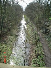
The Barnsley Canal is a canal
that ran from Barnby Basin, through Barnsley
, South Yorkshire
, England
to a junction with the Aire and Calder Navigation
near Wakefield
. It was 14.5 miles (23.3 km) long and included 15 locks. It was taken over by the Aire and Calder Navigation in 1854, and despite competition from the railways, and structural damage from subsidence, remained profitable until 1942. It was abandoned in 1953, after major breaches occurred in 1945 and 1946, and is currently disused, although there are proposals from the Barnsley Canal Consortium to restore and reopen it.
, but no transport links to distribute it to the region. In July 1792, the Aire and Calder Canal Company asked William Martin, who was the manager of the canal, to prepare plans for a link from near Wakefield
to the Barnsley mines. Hearing of the plans, the River Don Navigation
Company proposed an alternative, which involved the canalisation of the River Dearne
, to reach the same destination. The Aire and Calder scheme foresaw a healthy trade in coal and manufactured goods from Barnsley to the Aire and Calder, and agricultural lime from Knottingley
in the reverse direction.
Martin and the Aire and Calder's resident engineers surveyed the route, and at a public meeting held on 20 September 1792, the canal engineer William Jessop
suggested that the line from just below Wakefield to Barnsley and Silkstone
could be built for approximately £50,000. The Aire and Calder decided to subscribe £20,000 for shares, to ensure that they held a majority shareholding. A further meeting in mid October reported that the cost was now £60,000, and that 86 people had subscibed to it. The River Don company attended the meeting, as they were keen to use the Barnsley to Silkstone route for their Dearne and Dove Canal
, but an agreement was reached, whereby the Barnsley Canal company would build the Barnby to Barnsley section, but no water would be taken from the River Dearne, which was needed to supply the Dearne and Dove canal. A 2.5 miles (4 km) branch from Barugh
to Haigh Bridge, including an extra seven locks, was added to the scheme.
The Aire and Calder proposed to pump all the water for the canal from the River Calder, using steam-driven pumps at Agbrigg
, Walton
and Barugh. The Haigh branch would have required a fourth engine, but the Haigh furnace closed and the branch was never built. The pumps at Walton and Agbrigg were replaced by a reservoir at Cold Hiendley, which increased the construction costs by £3,000, but reduced running costs by £350 per year. An Act of Parliament
was obtained on 3 June 1793, which created the company and authorised them to raise £72,000 by the issuing of shares, with an additional £25,000 by shares or by mortgage if it was required. The Dearne and Dove canal was authorised on the same day.
The cost of construction was £95,000. The original scheme envisaged a number of tramways to connect to the coal mines, but none of these were built initially. Major engineering features included a five-arched aqueduct where the canal crossed the River Dearne, a long cutting at Cold Hiendley, five locks at Barugh, another twelve at Walton, two at Agbrigg and the final one near Heath. This lock was situated at the end of a cut, which frequently filled with rubbish, and so it was replaced in 1816 by a new lock much closer to the Aire and Calder. The Wintersett reservoir covered an area of 80 acres (32.4 ha) when first built, which increased to 127 acres (51.4 ha) when its banks were raised by 4 feet (1.2 m) in 1807. In 1803, a pumping station was built at Ryhill, using a Cornish beam engine obtained from Harveys of Hayle, which pumped surplus water from the canal up into the reservoir. Land for a second reservoir at Cold Hiendley was obtained in 1840, and it was built in 1854. It was located between Wintersett Reservoir and the canal, but was at a lower level, and the pumping station was modified so that water could also be pumped from the new reservoir into the canal. The Cold Hiendley reservoir was enlarged to cover 55 acres (22.3 ha) in 1874. The beam engine, which was probably second-hand in 1803, gave good service and lasted until the closure of the canal in 1946.
 The canal was principally designed to carry coal from collieries in the Barnby region. The Low Moor Company had a colliery at Barnby Furnace, and constructed a 0.5 mile (0.80467 km) tramway between there and Barnby basin, which was carrying coal by 1802. By 1804, around 10,000 tons was leaving the colliery, although the Dearne and Dove Canal
had opened in late 1803, and only about half of the trade travelled the full length of the canal to the Aire and Calder. Coal from the Silkstone
collieries was sporadic, as the tramway which had been authorised by the Act of Parliament was not built due to financial constraints. The Barnby Furnace mine failed in 1806, and the company found itself with no money and little traffic. It obtained a new Act of Parliament on 28 March 1808, authorising it to raise another £43,000 in share capital, and £10,000 by mortgage. They were also able to raise the tolls.
The tramway to Silkstone was completed in 1810. Barnby basin was enlarged to cope with the expected trade, which grew steadily. Coal accounted for just 23 per cent of the 22,270 tons carried in 1800, but had risen to 109,945 tons out of a total of 181,063 tons by 1821. The other main cargoes were corn and limestone. Receipts also rose, from £2,028 in 1803 to 7,649 in 1821, the latter figure being supplemented by a further £2,094 raised from tramway tolls. Profits were sufficient to pay dividends from 1810. In order to keep the boats moving, the Barnsley Canal Company attempted to take water from the River Dearne on several occasions, and were ordered to remove the works which diverted the water by the River Don Navigation
Company, who had sponsored the Dearne and Dove Canal
. A compromise was reached in 1812, which allowed some of the Dearne water to be used by the Barnsley canal. Between 1828 and 1830, a number of bridges were raised, to allow larger vessels, called "Billy-boys" to use the canal.
 Competition in the form of railways started to affect the canal from the 1840s. The canal company initially welcomed some of the schemes, but the Don Navigation Company proposed to lease the canal for a year in 1845 and then to buy it, in order to prevent the railways gaining access to the Silkstone coal resources, and to protect the water supplies. They quickly offered to pass the canal on to the Aire and Calder Company, and to buy the Dearne and Dove Canal, but although they took over the Dearne and Dove Canal from 1 January 1846, they dropped their ideas for the Barnsley Canal. The Barnsley Canal Company then tried to arrange a lease with the Aire and Calder, but negotiations foundered. A series of negotiations took place with the Yorkshire Railway Company, the Manchester, Sheffield and Lincolnshire Railway
and the Aire and Calder Navigation between 1846 and 1853. It was not until 1854 that the company finally agreed to a lease from the Aire and Calder, by which time traffic was falling rapidly. The takeover was ratified by an Act of Parliament in 1856, although the Barnsley Canal Company was not wound up, as it continued to collect the rent from the lease.
By reducing tolls, the Aire and Calder managed to increase traffic from 179,295 tons in 1855 to 291,313 tons in 1863, but traffic gradually reduced after that, as railway links to the coalfields were built. The canal structures were increasingly affected by subsidence from the mining, and an inspection of the aqueduct in 1866 revealed "fissures in the rock and cracks in the arches". In 1870, Barnsley
Corporation ordered the canal company to stop extracting water from the River Dearne, as they needed the supply. Faced with a dilemma, the Barnsley and the Aire and Calder companies negotiated, and the result was the Barnsley Canal Transfer Act of 1871, which authorised the takeover of the canal by the Aire and Calder, the replacing of ten of the twelve Walton locks by an inclined plane
, and protection of the water supply at Barugh.
The locks below Cold Hiendley were lengthened from 66 feet (20.1 m) to 84 feet (25.6 m) between 1879 and 1881, but by this time there was little traffic on the upper section. The final 1.3 miles (2.1 km) section to Barnby, including the five locks at Barugh were abandoned under the terms of the Aire and Calder Act 1893. Powers to build the inclined plane were renewed in 1889, but no construction took place. Despite railway competition, the canal still carried in excess of 200,000 tons per year between 1885 and 1909.
 A major breach of the canal occurred on 20 November 1911, when subsidence
caused part of the aqueduct and the adjacent embankment to fail. Repairs were not completed until 10 July 1912, when the canal was reopened. The canal had to close for four months at the end of 1922 due to drought conditions. In 1934, the County Council installed an electric lift bridge at Royston. Traffic continued to fall, and maintenance costs increased as the effects of subsidence damaged the infrastructure, but the canal remained profitable until 1942. The following year, the Royston bridge was operated 856 times to allow boats to pass. Mottram Wood colliery was flooded on 13 June 1945, when another leak occurred near the aqueduct, and in 1946, 53 million impgals (240,942.8 m³) of water escaped from the canal on 22 November, flooding a housing estate and the surrounding countryside. The Aire and Calder applied to abandon the canal in May 1947, and althought the fledgeling Inland Waterways Association
campaigned for its retention, the Docks and Inland Waterways Executive (DIWE) expressed "grave doubts as to whether it would be in the national interest to reinstate the waterway." The DIWE then offered compensation to carriers who were affected by the closure, and the abandonment order was finally granted in 1953. The aqueduct was demolished immediately, as it was deemed to be unsafe.
and the Canal Trust, was formed. The Consortium employed professional engineers to carry out a feasibility study on the reopening of both the Barnsley Canal and the Dearne and Dove Canal in August 2004, and the report, which was published in November 2006 confirmed that restoration was possible.
The restored canal would follow the original line from the Aire and Calder Navigation to Barnsley, where a new marina would be built near to the location of Barugh locks. Three diversions would be required, one at the foot of the Walton locks, one near Cold Hiendley reservoir, and one where the canal crosses the River Dearne, where the original aqueduct has been demolished.
Canal
Canals are man-made channels for water. There are two types of canal:#Waterways: navigable transportation canals used for carrying ships and boats shipping goods and conveying people, further subdivided into two kinds:...
that ran from Barnby Basin, through Barnsley
Barnsley
Barnsley is a town in South Yorkshire, England. It lies on the River Dearne, north of the city of Sheffield, south of Leeds and west of Doncaster. Barnsley is surrounded by several smaller settlements which together form the Metropolitan Borough of Barnsley, of which Barnsley is the largest and...
, South Yorkshire
South Yorkshire
South Yorkshire is a metropolitan county in the Yorkshire and the Humber region of England. It has a population of 1.29 million. It consists of four metropolitan boroughs: Barnsley, Doncaster, Rotherham, and City of Sheffield...
, England
England
England is a country that is part of the United Kingdom. It shares land borders with Scotland to the north and Wales to the west; the Irish Sea is to the north west, the Celtic Sea to the south west, with the North Sea to the east and the English Channel to the south separating it from continental...
to a junction with the Aire and Calder Navigation
Aire and Calder Navigation
The Aire and Calder Navigation is a river and canal system of the River Aire and the River Calder in the metropolitan county of West Yorkshire, England. The first improvements to the rivers above Knottingley were completed in 1704 when the Aire was made navigable to Leeds and the Calder to...
near Wakefield
Wakefield
Wakefield is the main settlement and administrative centre of the City of Wakefield, a metropolitan district of West Yorkshire, England. Located by the River Calder on the eastern edge of the Pennines, the urban area is and had a population of 76,886 in 2001....
. It was 14.5 miles (23.3 km) long and included 15 locks. It was taken over by the Aire and Calder Navigation in 1854, and despite competition from the railways, and structural damage from subsidence, remained profitable until 1942. It was abandoned in 1953, after major breaches occurred in 1945 and 1946, and is currently disused, although there are proposals from the Barnsley Canal Consortium to restore and reopen it.
History
The early 1790s were a time when there was an increasing demand for coal, but a shortage in many places because much of the coal being produced was being consumed by industries close to the mines. There were coal reserves near BarnsleyBarnsley
Barnsley is a town in South Yorkshire, England. It lies on the River Dearne, north of the city of Sheffield, south of Leeds and west of Doncaster. Barnsley is surrounded by several smaller settlements which together form the Metropolitan Borough of Barnsley, of which Barnsley is the largest and...
, but no transport links to distribute it to the region. In July 1792, the Aire and Calder Canal Company asked William Martin, who was the manager of the canal, to prepare plans for a link from near Wakefield
Wakefield
Wakefield is the main settlement and administrative centre of the City of Wakefield, a metropolitan district of West Yorkshire, England. Located by the River Calder on the eastern edge of the Pennines, the urban area is and had a population of 76,886 in 2001....
to the Barnsley mines. Hearing of the plans, the River Don Navigation
River Don Navigation
The River Don Navigation was the result of early efforts to make the River Don in South Yorkshire, England, navigable between Fishlake and Sheffield...
Company proposed an alternative, which involved the canalisation of the River Dearne
River Dearne
The River Dearne is a river in South Yorkshire, England. It flows roughly east for more than , from its source just inside West Yorkshire, through Denby Dale, Clayton West, Darton, Barnsley, Darfield, Wath upon Dearne, Bolton on Dearne, Adwick upon Dearne and Mexborough to its confluence with the...
, to reach the same destination. The Aire and Calder scheme foresaw a healthy trade in coal and manufactured goods from Barnsley to the Aire and Calder, and agricultural lime from Knottingley
Knottingley
Knottingley is a town within the metropolitan borough of the City of Wakefield in West Yorkshire, England on the River Aire and the A1 road. It has a population of 13,503....
in the reverse direction.
Martin and the Aire and Calder's resident engineers surveyed the route, and at a public meeting held on 20 September 1792, the canal engineer William Jessop
William Jessop
William Jessop was an English civil engineer, best known for his work on canals, harbours and early railways in the late 18th and early 19th centuries.-Early life:...
suggested that the line from just below Wakefield to Barnsley and Silkstone
Silkstone
Silkstone is a village and civil parish in the Metropolitan Borough of Barnsley in South Yorkshire, England. It is situated in the foothills of the Pennines, between the towns of Barnsley and Penistone, and includes the village of Silkstone Common...
could be built for approximately £50,000. The Aire and Calder decided to subscribe £20,000 for shares, to ensure that they held a majority shareholding. A further meeting in mid October reported that the cost was now £60,000, and that 86 people had subscibed to it. The River Don company attended the meeting, as they were keen to use the Barnsley to Silkstone route for their Dearne and Dove Canal
Dearne and Dove Canal
The Dearne and Dove Canal ran for almost ten miles through South Yorkshire, England from Swinton to Barnsley through nineteen locks, rising 127 yards. The canal also had two short branches, the Worsbrough branch and the Elsecar branch, both about two miles long with reservoirs at the head of each....
, but an agreement was reached, whereby the Barnsley Canal company would build the Barnby to Barnsley section, but no water would be taken from the River Dearne, which was needed to supply the Dearne and Dove canal. A 2.5 miles (4 km) branch from Barugh
Barugh, South Yorkshire
Barugh is a village in the metropolitan borough of Barnsley in South Yorkshire, England....
to Haigh Bridge, including an extra seven locks, was added to the scheme.
The Aire and Calder proposed to pump all the water for the canal from the River Calder, using steam-driven pumps at Agbrigg
Agbrigg
Agbrigg is a village in West Yorkshire, England. It forms part of the metropolitan district of the City of Wakefield....
, Walton
Walton, Wakefield
Walton is a village and civil parish in the county of West Yorkshire, England, near Wakefield. It has a population of 3,377. It is on the Barnsley Canal and includes Walton Hall, West Yorkshire, the home of Charles Waterton, the man who made Walton Hall into the first nature reserve in the country...
and Barugh. The Haigh branch would have required a fourth engine, but the Haigh furnace closed and the branch was never built. The pumps at Walton and Agbrigg were replaced by a reservoir at Cold Hiendley, which increased the construction costs by £3,000, but reduced running costs by £350 per year. An Act of Parliament
Act of Parliament
An Act of Parliament is a statute enacted as primary legislation by a national or sub-national parliament. In the Republic of Ireland the term Act of the Oireachtas is used, and in the United States the term Act of Congress is used.In Commonwealth countries, the term is used both in a narrow...
was obtained on 3 June 1793, which created the company and authorised them to raise £72,000 by the issuing of shares, with an additional £25,000 by shares or by mortgage if it was required. The Dearne and Dove canal was authorised on the same day.
Construction
Construction work started on 27 September 1793, at Heath Common, near the junction with the Aire and Calder Canal. Samual Hartley was the engineer, and John Pinkerton was contracted to build the canal. Construction was difficult, with Pinkerton unexpectedly encountering rock in the cutting at Cold Hiendley, and inflation pushed up the costs. There were disputes between Hartley and Pinkerton, which lasted until long after the canal was opened, and were finally settled in 1812, after a lawsuit. The northern section to Barnsley opened on 8 June 1799, while the Barnsley to Barnby section was not started until late 1798, and did not open until early 1802. The Dearne and Dove Canal was completed in late 1804.The cost of construction was £95,000. The original scheme envisaged a number of tramways to connect to the coal mines, but none of these were built initially. Major engineering features included a five-arched aqueduct where the canal crossed the River Dearne, a long cutting at Cold Hiendley, five locks at Barugh, another twelve at Walton, two at Agbrigg and the final one near Heath. This lock was situated at the end of a cut, which frequently filled with rubbish, and so it was replaced in 1816 by a new lock much closer to the Aire and Calder. The Wintersett reservoir covered an area of 80 acres (32.4 ha) when first built, which increased to 127 acres (51.4 ha) when its banks were raised by 4 feet (1.2 m) in 1807. In 1803, a pumping station was built at Ryhill, using a Cornish beam engine obtained from Harveys of Hayle, which pumped surplus water from the canal up into the reservoir. Land for a second reservoir at Cold Hiendley was obtained in 1840, and it was built in 1854. It was located between Wintersett Reservoir and the canal, but was at a lower level, and the pumping station was modified so that water could also be pumped from the new reservoir into the canal. The Cold Hiendley reservoir was enlarged to cover 55 acres (22.3 ha) in 1874. The beam engine, which was probably second-hand in 1803, gave good service and lasted until the closure of the canal in 1946.
Traffic
Dearne and Dove Canal
The Dearne and Dove Canal ran for almost ten miles through South Yorkshire, England from Swinton to Barnsley through nineteen locks, rising 127 yards. The canal also had two short branches, the Worsbrough branch and the Elsecar branch, both about two miles long with reservoirs at the head of each....
had opened in late 1803, and only about half of the trade travelled the full length of the canal to the Aire and Calder. Coal from the Silkstone
Silkstone
Silkstone is a village and civil parish in the Metropolitan Borough of Barnsley in South Yorkshire, England. It is situated in the foothills of the Pennines, between the towns of Barnsley and Penistone, and includes the village of Silkstone Common...
collieries was sporadic, as the tramway which had been authorised by the Act of Parliament was not built due to financial constraints. The Barnby Furnace mine failed in 1806, and the company found itself with no money and little traffic. It obtained a new Act of Parliament on 28 March 1808, authorising it to raise another £43,000 in share capital, and £10,000 by mortgage. They were also able to raise the tolls.
The tramway to Silkstone was completed in 1810. Barnby basin was enlarged to cope with the expected trade, which grew steadily. Coal accounted for just 23 per cent of the 22,270 tons carried in 1800, but had risen to 109,945 tons out of a total of 181,063 tons by 1821. The other main cargoes were corn and limestone. Receipts also rose, from £2,028 in 1803 to 7,649 in 1821, the latter figure being supplemented by a further £2,094 raised from tramway tolls. Profits were sufficient to pay dividends from 1810. In order to keep the boats moving, the Barnsley Canal Company attempted to take water from the River Dearne on several occasions, and were ordered to remove the works which diverted the water by the River Don Navigation
River Don Navigation
The River Don Navigation was the result of early efforts to make the River Don in South Yorkshire, England, navigable between Fishlake and Sheffield...
Company, who had sponsored the Dearne and Dove Canal
Dearne and Dove Canal
The Dearne and Dove Canal ran for almost ten miles through South Yorkshire, England from Swinton to Barnsley through nineteen locks, rising 127 yards. The canal also had two short branches, the Worsbrough branch and the Elsecar branch, both about two miles long with reservoirs at the head of each....
. A compromise was reached in 1812, which allowed some of the Dearne water to be used by the Barnsley canal. Between 1828 and 1830, a number of bridges were raised, to allow larger vessels, called "Billy-boys" to use the canal.
Competition
Manchester, Sheffield and Lincolnshire Railway
The Manchester, Sheffield and Lincolnshire Railway was formed by amalgamation in 1847. The MS&LR changed its name to the Great Central Railway in 1897 in anticipation of the opening in 1899 of its London Extension.-Origin:...
and the Aire and Calder Navigation between 1846 and 1853. It was not until 1854 that the company finally agreed to a lease from the Aire and Calder, by which time traffic was falling rapidly. The takeover was ratified by an Act of Parliament in 1856, although the Barnsley Canal Company was not wound up, as it continued to collect the rent from the lease.
By reducing tolls, the Aire and Calder managed to increase traffic from 179,295 tons in 1855 to 291,313 tons in 1863, but traffic gradually reduced after that, as railway links to the coalfields were built. The canal structures were increasingly affected by subsidence from the mining, and an inspection of the aqueduct in 1866 revealed "fissures in the rock and cracks in the arches". In 1870, Barnsley
Barnsley
Barnsley is a town in South Yorkshire, England. It lies on the River Dearne, north of the city of Sheffield, south of Leeds and west of Doncaster. Barnsley is surrounded by several smaller settlements which together form the Metropolitan Borough of Barnsley, of which Barnsley is the largest and...
Corporation ordered the canal company to stop extracting water from the River Dearne, as they needed the supply. Faced with a dilemma, the Barnsley and the Aire and Calder companies negotiated, and the result was the Barnsley Canal Transfer Act of 1871, which authorised the takeover of the canal by the Aire and Calder, the replacing of ten of the twelve Walton locks by an inclined plane
Canal inclined plane
An inclined plane is a system used on some canals for raising boats between different water levels. Boats may be conveyed afloat, in caissons, or may be carried in cradles or slings. It can be considered as a specialised type of cable railway....
, and protection of the water supply at Barugh.
The locks below Cold Hiendley were lengthened from 66 feet (20.1 m) to 84 feet (25.6 m) between 1879 and 1881, but by this time there was little traffic on the upper section. The final 1.3 miles (2.1 km) section to Barnby, including the five locks at Barugh were abandoned under the terms of the Aire and Calder Act 1893. Powers to build the inclined plane were renewed in 1889, but no construction took place. Despite railway competition, the canal still carried in excess of 200,000 tons per year between 1885 and 1909.
Decline
Subsidence
Subsidence is the motion of a surface as it shifts downward relative to a datum such as sea-level. The opposite of subsidence is uplift, which results in an increase in elevation...
caused part of the aqueduct and the adjacent embankment to fail. Repairs were not completed until 10 July 1912, when the canal was reopened. The canal had to close for four months at the end of 1922 due to drought conditions. In 1934, the County Council installed an electric lift bridge at Royston. Traffic continued to fall, and maintenance costs increased as the effects of subsidence damaged the infrastructure, but the canal remained profitable until 1942. The following year, the Royston bridge was operated 856 times to allow boats to pass. Mottram Wood colliery was flooded on 13 June 1945, when another leak occurred near the aqueduct, and in 1946, 53 million impgals (240,942.8 m³) of water escaped from the canal on 22 November, flooding a housing estate and the surrounding countryside. The Aire and Calder applied to abandon the canal in May 1947, and althought the fledgeling Inland Waterways Association
Inland Waterways Association
The Inland Waterways Association was formed in 1946 as a registered charity in the United Kingdom to campaign for the conservation, use, maintenance, restoration and sensitive development of British Canals and river navigations....
campaigned for its retention, the Docks and Inland Waterways Executive (DIWE) expressed "grave doubts as to whether it would be in the national interest to reinstate the waterway." The DIWE then offered compensation to carriers who were affected by the closure, and the abandonment order was finally granted in 1953. The aqueduct was demolished immediately, as it was deemed to be unsafe.
Restoration
The line of the canal below Barugh has remained largely intact, and in April 1984, the Barnsley Canal Group was formed, with the aim of campaigning for the restoration of the canal. Their first task was to undertake a detailed survey of the canal, to confirm that restoration was at least realistic. Having become a Limited Company and obtaining charitable status in April 1991, the group reformed as the Barnsley, Dearne and Dove Canal Trust in June 2000. In May 2001, the Barnsley Canal Consortium, consisting of a working group which includes local authorities, the Inland Waterways AssociationInland Waterways Association
The Inland Waterways Association was formed in 1946 as a registered charity in the United Kingdom to campaign for the conservation, use, maintenance, restoration and sensitive development of British Canals and river navigations....
and the Canal Trust, was formed. The Consortium employed professional engineers to carry out a feasibility study on the reopening of both the Barnsley Canal and the Dearne and Dove Canal in August 2004, and the report, which was published in November 2006 confirmed that restoration was possible.
The restored canal would follow the original line from the Aire and Calder Navigation to Barnsley, where a new marina would be built near to the location of Barugh locks. Three diversions would be required, one at the foot of the Walton locks, one near Cold Hiendley reservoir, and one where the canal crosses the River Dearne, where the original aqueduct has been demolished.
Points of interest
See also
- Canals of Great Britain
- History of the British canal systemHistory of the British canal systemThe British canal system of water transport played a vital role in the United Kingdom's Industrial Revolution at a time when roads were only just emerging from the medieval mud and long trains of pack horses were the only means of "mass" transit by road of raw materials and finished products The...
- WaterscapeWaterscapeWaterscape was set up in the summer of 2003 and is British Waterways leisure website, supported by the Environment Agency and the Broads Authority as an official information and leisure resource for inland waterways within the UK....