
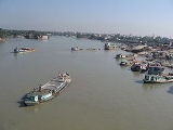
Bangshi River
Overview
Bangladesh
Bangladesh , officially the People's Republic of Bangladesh is a sovereign state located in South Asia. It is bordered by India on all sides except for a small border with Burma to the far southeast and by the Bay of Bengal to the south...
. It originates in Jamalpur
Jamalpur District
Jamalpur is a district in Dhaka Division, Bangladesh. The main Jamalpur town consists of 12 wards and 80 mahallas. The municipality was established in 1869. The area of the town is 53.28 km². The town has a population of 116754; male 51.06%, female 48.94%. Density of population is 2191 per...
, from the course of the old Brahmaputra
Brahmaputra River
The Brahmaputra , also called Tsangpo-Brahmaputra, is a trans-boundary river and one of the major rivers of Asia. It is the only Indian river that is attributed the masculine gender and thus referred to as a in Indo-Aryan languages and languages with Indo-Aryan influence...
and flows past the Madhupur tract
Madhupur tract
Madhupur tract a large upland area of 4,244 km² in north central of Bangladesh, stretching from east of Jamalpur in the north, to Fatullah and Narayanganj, in the south. The tract is mostly one large tract, unlike the Barind Tract. It is approximately one to ten metres above the nearby...
. It flows through Tangail
Tangail District
Tangail is a district in central region of Bangladesh. It is a part of the Dhaka division. The population of Tangail zilla is about 3.2 million and its surface area is 3,414.39 km². The main town of Tangail District is the district town Tangail...
and meets the Tongi in Ghazipur
Ghazipur District
Ghazipur District is a district of Uttar Pradesh state in northern India. The city of Ghazipur is the district headquarters. The district is part of Varanasi Division...
. It passes near Jatiyo Smriti Soudho
Jatiyo Smriti Soudho
Jatiyo Sriti Soudho or National Martyrs' Memorial is a monument in Bangladesh. It is the symbol of the valour and the sacrifice of those killed in the Bangladesh Liberation War of 1971, which brought the independence of Bangladesh from Pakistani rule. The monument is located in Savar, about...
in Savar
Sävar
Sävar is a locality situated in Umeå Municipality, Västerbotten County, Sweden with 2,672 inhabitants in 2005.It is located by E4 about 15 km north of Umeå, Sweden. Sävar is mostly known for being the last battlefield of the Finnish War....
and falls into the Dhaleshwari
Dhaleshwari River
The Dhaleshwari River is a 160-km-long distributary of the Jamuna River in central Bangladesh. It starts off the Jamuna near the northwestern tip of Tangail District. After that it divides into two branches: the north branch retains the name Dhaleshwari and merges with the other branch, the...
. 238km in length, it is not navigable for most of the year except when swelled by the rains of the Monsoon
Monsoon
Monsoon is traditionally defined as a seasonal reversing wind accompanied by corresponding changes in precipitation, but is now used to describe seasonal changes in atmospheric circulation and precipitation associated with the asymmetric heating of land and sea...
.
Louhajang
Louhajang River
Louhajang River is located in central Bangladesh. It branches out from the Jamuna at Baisnabbari in Tangail District. Thereafter it splits into two parts before the parts meet up again...
is a tribuatry of thr Bangshi
The river's average depth is 30 feet (9.1 m) and maximum depth is 80 feet (24.4 m).
Dhamrai on the banks of the Bangshi is still famous for its muslin
Muslin
Muslin |sewing patterns]], such as for clothing, curtains, or upholstery. Because air moves easily through muslin, muslin clothing is suitable for hot, dry climates.- Etymology and history :...
weaving.
A report on wetlend protection and enhancement says, “The Turag
Turag River
The Turag River is the upper tributary of the Buriganga, a major river in Bangladesh. The Turag originates from the Bangshi River, the latter an important tributary of the Dhaleshwari River, flows through Gazipur and joins the Buriganga at Mirpur in Dhaka District...
-Bangshi floodplain is located in Kaliakair Upazila
Kaliakair Upazila
Kaliakair is an Upazila of Gazipur District in the Division of Dhaka, Bangladesh.-Geography:Kaliakair is located at . It has 45565 units of house hold and total area 314.14 km².-Demographics:...
of Gazipur District
Gazipur District
Gazipur District is a district of Dhaka Division, it has an area of 1741.53 km2 and is bounded by Mymensingh and Kishoreganj districts on the north, Dhaka, Narayanganj and Narsingdi districts on the south, Narsingdi on the east, Dhaka and Tangail districts on the west. Annual average...
.