

Baldwin Hills (mountain range)
Encyclopedia
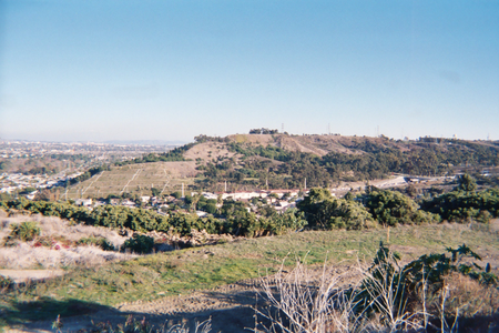
The Baldwin Hills are a low mountain range surrounded by and rising above the Los Angeles Basin
plain in central Los Angeles County
, California
. The Pacific Ocean
is to the west, the Santa Monica Mountains
to the north, Downtown Los Angeles
to the northeast, and the Palos Verdes Hills
to the south - with all easily viewed from the Baldwin Hills.
are in the hills, which then flows west into the Santa Monica Bay
. La Cienega Boulevard
goes through a pass in the hills between the Westside and the Southwestern area towns and LAX. It passes the oil well
s of the Blair Hills Oil field
in the southern Baldwin Hills.
Los Angeles Basin
The Los Angeles Basin is the coastal sediment-filled plain located between the Peninsular and Transverse ranges in southern California in the United States containing the central part of the city of Los Angeles as well as its southern and southeastern suburbs...
plain in central Los Angeles County
Los Angeles County, California
Los Angeles County is a county in the U.S. state of California. As of 2010 U.S. Census, the county had a population of 9,818,605, making it the most populous county in the United States. Los Angeles County alone is more populous than 42 individual U.S. states...
, California
California
California is a state located on the West Coast of the United States. It is by far the most populous U.S. state, and the third-largest by land area...
. The Pacific Ocean
Pacific Ocean
The Pacific Ocean is the largest of the Earth's oceanic divisions. It extends from the Arctic in the north to the Southern Ocean in the south, bounded by Asia and Australia in the west, and the Americas in the east.At 165.2 million square kilometres in area, this largest division of the World...
is to the west, the Santa Monica Mountains
Santa Monica Mountains
The Santa Monica Mountains are a Transverse Range in Southern California, along the coast of the Pacific Ocean in the United States.-Geography:...
to the north, Downtown Los Angeles
Downtown Los Angeles
Downtown Los Angeles is the central business district of Los Angeles, California, United States, located close to the geographic center of the metropolitan area...
to the northeast, and the Palos Verdes Hills
Palos Verdes Hills
The Palos Verdes Hills are a mountain range on the south coast of Los Angeles County, California.They are the landed end of the Channel Islands of California Transverse Ranges formation, and are the location of Palos Verdes Estates, Rolling Hills, and other communities.The South Coast Botanic...
to the south - with all easily viewed from the Baldwin Hills.
Geography
The headwaters of Ballona CreekBallona Creek
Ballona Creek is an waterway in southwestern Los Angeles County, California, whose watershed drains the Los Angeles basin, from the Santa Monica Mountains on the north, the Harbor Freeway on the east, and the Baldwin Hills on the south...
are in the hills, which then flows west into the Santa Monica Bay
Santa Monica Bay
Santa Monica Bay is a bight of the Pacific Ocean in southern California, United States. Its boundaries are slightly ambiguous, but it is generally considered to be the part of the Pacific within an imaginary line drawn between Point Dume, in Malibu, and the Palos Verdes Peninsula. Its eastern...
. La Cienega Boulevard
La Cienega Boulevard
La Cienega Boulevard is a major, well-known north–south arterial road that runs between El Segundo Boulevard in El Segundo, California on the south and the Sunset Strip/Sunset Boulevard in West Hollywood....
goes through a pass in the hills between the Westside and the Southwestern area towns and LAX. It passes the oil well
Oil well
An oil well is a general term for any boring through the earth's surface that is designed to find and acquire petroleum oil hydrocarbons. Usually some natural gas is produced along with the oil. A well that is designed to produce mainly or only gas may be termed a gas well.-History:The earliest...
s of the Blair Hills Oil field
Oil field
An oil field is a region with an abundance of oil wells extracting petroleum from below ground. Because the oil reservoirs typically extend over a large area, possibly several hundred kilometres across, full exploitation entails multiple wells scattered across the area...
in the southern Baldwin Hills.
History
- Rancho La Cienega o Paso de la TijeraRancho La Cienega o Paso de la TijeraRancho La Cienega o Paso de la Tijera was a Mexican land grant in present day Los Angeles County, California given in 1843 by Governor Manuel Micheltorena to Vicente Sánchez...
- eastern area - Sanchez Adobe de Rancho La Cienega o Paso de la Tijera. The adobeAdobeAdobe is a natural building material made from sand, clay, water, and some kind of fibrous or organic material , which the builders shape into bricks using frames and dry in the sun. Adobe buildings are similar to cob and mudbrick buildings. Adobe structures are extremely durable, and account for...
was once the center of the rancho. In the 1920s, an addition was built linking the structures and the building was converted into a larger clubhouse for the Sunset Golf Course. - Rancho Rincon de los BueyesRancho Rincon de los BueyesRancho Rincon de los Bueyes was a land grant in present day Los Angeles County, California given in 1821 to Bernardo Higuera and Cornelio Lopez by Pablo Vicente de Sola, the Spanish Governor of Alta California. In 1843, this Spanish grant was confirmed by Mexican Governor Manuel Micheltorena...
- western area - The hills are the location of the Baldwin Hills Dam failure and subsequent 1963 Baldwin Hills ReservoirBaldwin Hills ReservoirThe Baldwin Hills Reservoir was a water storage basin located on a low hilltop in Baldwin Hills, Los Angeles, California. It was constructed between 1947 and 1951 by the Los Angeles Department of Water and Power directly on an active fault line which was subsidiary to the well known nearby...
flooding disaster.
Recreation
- Kenneth Hahn State Regional ParkKenneth Hahn State Recreation AreaKenneth Hahn State Recreation Area or "Hahn Park" is a state park and recreation area in the California Department of Parks and Recreation system...
- recreation and sports areas, and preservation of the open-space lands and native habitatHabitat* Habitat , a place where a species lives and grows*Human habitat, a place where humans live, work or play** Space habitat, a space station intended as a permanent settlement...
s: entrance on South La Cienega Boulevard. - official Baldwin Hills Scenic Overlook Park website - entrance on Jefferson Boulevard; trail map
- Norman O Houston Park website
- Jim Gilliam Recreation Center website
Communities
- Baldwin Hills district
- Ladera HeightsLadera Heights, CaliforniaLadera Heights is a census-designated place and unincorporated area in southwestern Los Angeles County, California. The population was 6,498 at the 2010 census, down from 6,568 at the 2000 census...
- Fox Hills, Culver CityFox Hills, Culver City, CaliforniaFox Hills is a neighborhood of Culver City, California, USA. It is roughly triangular in shape, bounded by West Slauson Avenue to the north, the San Diego Freeway to the southwest, and Wooster Avenue to the southeast....
- Culver CrestCulver Crest, Culver City, CaliforniaThe Culver Crest is a neighborhood in Culver City, California. It is bordered on the south by the Beverlywood West condominiums, located at Sawtelle Boulevard and Overland Avenue, by West Los Angeles College on the north, by Overland Avenue on the west, and by the Holy Cross Cemetery and the...
- Blair Hills, Culver CityBlair Hills, Culver City, CaliforniaBlair Hills is a small, quiet, predominately African American neighborhood of Culver City, California estimated at with a population density of 2956 people per sq. mile...
- Leimert Park
- View Park-Windsor HillsView Park-Windsor Hills, CaliforniaView Park-Windsor Hills is a census-designated place in Los Angeles County, California, United States. The population was 11,075 at the 2010 census, up from 10,958 at the 2000 census...
- West Los Angeles CollegeWest Los Angeles CollegeWest Los Angeles College is a community college located in Culver City, California. It opened in 1969 and serves approximately 10,000 students....