

B5470 road
Encyclopedia
England
England is a country that is part of the United Kingdom. It shares land borders with Scotland to the north and Wales to the west; the Irish Sea is to the north west, the Celtic Sea to the south west, with the North Sea to the east and the English Channel to the south separating it from continental...
, running from Chapel-en-le-Frith
Chapel-en-le-Frith
Chapel-en-le-Frith is a small town in Derbyshire, England, on the edge of the Peak District near the border with Cheshire, from Manchester. Dubbed "The Capital of the Peak District", the settlement was established by the Normans in the 12th century, originally as a hunting lodge within the Forest...
, Derbyshire
Derbyshire
Derbyshire is a county in the East Midlands of England. A substantial portion of the Peak District National Park lies within Derbyshire. The northern part of Derbyshire overlaps with the Pennines, a famous chain of hills and mountains. The county contains within its boundary of approx...
to Macclesfield
Macclesfield
Macclesfield is a market town within the unitary authority of Cheshire East, the county palatine of Chester, also known as the ceremonial county of Cheshire, England. The population of the Macclesfield urban sub-area at the time of the 2001 census was 50,688...
, Cheshire
Cheshire
Cheshire is a ceremonial county in North West England. Cheshire's county town is the city of Chester, although its largest town is Warrington. Other major towns include Widnes, Congleton, Crewe, Ellesmere Port, Runcorn, Macclesfield, Winsford, Northwich, and Wilmslow...
via Whaley Bridge
Whaley Bridge
Whaley Bridge is a small town and civil parish in the High Peak district of Derbyshire, England, situated on the River Goyt. Whaley Bridge is approximately south of Manchester, north of Buxton , east of Macclesfield and west of Sheffield, and had a population of 6,226 at the 2001 census. This...
, Derbyshire. The hilly and winding section between Whaley Bridge and Macclesfield is often called ‘The Highwayman’ after a prominent roadside pub. It runs through a scenic area of the Peak District National Park.
Route
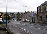
The B5470 starts in Town End on the eastern side of Chapel-en-le-Frith at a junction with the A624, which connects it to the A6. It then runs westwards, forming the main street of Chapel-en-le-Frith. It then continues to the hamlet of Tunstead MiltonTunstead Milton
Tunstead Milton is a village in Derbyshire, England.It is situated on the B5470 road west of, and in the parish of, Chapel en le Frith near the northern edge of the Combs Reservoir....
after which it runs along the valley of the Randall Carr
Randall Carr
The Randall Carr brook is a river in Derbyshire, England. It starts at Combs and flows to Whaley Bridge where it ends in the river Goyt. Its headwaters were dammed to create Combs Reservoir which supplies the Peak Forest Canal....
in a series of sweeping bends to Whaley Bridge. This length of the road is generally level and prone to flooding in wet weather.
In Whaley Bridge the B5470 crosses the A5004 at the Horwich End traffic lights. It then climbs rapidly out of Whaley Bridge to the village of Kettleshulme
Kettleshulme
Kettleshulme is a small village and civil parish in the unitary authority of Cheshire East and the ceremonial county of Cheshire, England. The village is close to the border with Derbyshire, on the B5470 road from Whaley Bridge to Macclesfield, in the valley of the Todd Brook, a tributary of the...
, Cheshire. From Kettleshulme it descends into the valley of the Todd Brook before climbing via a sharp hairpin bend to its highest point of 341 metres (1,118.8 ft) at Charles Head. The descent from Charles Head to the Harrop Brook is one of the few straight portions of the road. It then climbs again to the Highwayman Inn on a section that is particularly prone to accidents due to misjudged overtaking.
From the Highwayman the road descends through the village of Rainow
Rainow
Rainow is a village and civil parish in the unitary authority of Cheshire East, located, mostly, on the eastern side of the River Dean valley next to the B5470 road, between Macclesfield and Kettleshulme in the ceremonial county of Cheshire, England. It straddles the eastern side of the Peak...
, Cheshire, and then climbs the south edge of Kerridge Hill
Kerridge
Kerridge is a village in Cheshire, England, part of the parish of Bollington. Kerridge borders the neighbouring parish of Rainow.It gives its name to Kerridge Ridge – one of the western foothills of the Pennines – by which it stands. It is overlooked by the local landmark of White Nancy...
before beginning its final descent to Macclesfield, where it terminates at a junction with the A523.
Use
The B5470 is one of only two routes entering Macclesfield from the east. As well as being used as a main commuter route from the towns of northwest Derbyshire it also carries a high number of heavy goods vehicles and tourist traffic into the Peak District National Park, the last including cyclists and walkers. The road also forms part of the well-known 'Cat And FiddleCat and Fiddle Road
The Cat and Fiddle is a road in England running between Buxton, Derbyshire and Macclesfield, Cheshire, named after the public house at its summit. Formed by parts of the A537, A54 and A53 it is famous for its scenic views across the Greater Manchester conurbation, Peak District National Park and...
– Long Hill – Highwayman’ triangle, which is particularly attractive to motorcyclists because of the frequency and severity of the bends. Given this mix of usage, the number and sharpness of the bends and the fact that it is not uncommon to encounter straying livestock on the road it is necessary to employ a great deal of caution. Severe winter weather can also make the road extremely hazardous.