

Autopistas of Puerto Rico
Encyclopedia
Puerto Rico
Puerto Rico , officially the Commonwealth of Puerto Rico , is an unincorporated territory of the United States, located in the northeastern Caribbean, east of the Dominican Republic and west of both the United States Virgin Islands and the British Virgin Islands.Puerto Rico comprises an...
, Autopista
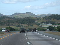
Autopista
Autopista refers to a controlled-access highway in various Spanish-speaking countries*Autopistas and autovías of Spain*Autopistas of Mexico*Autopistas of Puerto Rico*Autopistas of Chile...
s (in Spanish) or Expressways are usually tollway
Toll road
A toll road is a privately or publicly built road for which a driver pays a toll for use. Structures for which tolls are charged include toll bridges and toll tunnels. Non-toll roads are financed using other sources of revenue, most typically fuel tax or general tax funds...
s. Funding for these expressways is collected by a system of tolls rather than the Interstate Highway System
Interstate Highway System
The Dwight D. Eisenhower National System of Interstate and Defense Highways, , is a network of limited-access roads including freeways, highways, and expressways forming part of the National Highway System of the United States of America...
, although not all Autopistas are tolled. On most tollbooths, AutoExpreso, an electronic toll collection
Electronic toll collection
Electronic toll collection , an adaptation of military "identification friend or foe" technology, aims to eliminate the delay on toll roads by collecting tolls electronically. It is thus a technological implementation of a road pricing concept...
system, is accepted.
Autopistas are also locally known as Expressways, or Expresos (Spanish), or referred to by an individual name.
List of freeways in Puerto Rico
| Route | Name | Terminus | Maximum speed limit | Comments |
|---|---|---|---|---|
| PR-2 Puerto Rico Highway 2 Puerto Rico Highway 2, the longest highway in the Commonwealth of Puerto Rico at about 156 miles long, connects San Juan to Ponce.... |
Expreso Kennedy | Starts from San Patricio Plaza San Patricio Plaza San Patricio Plaza is an enclosed shopping mall located in Guaynabo, Puerto Rico. The mall is located at the intersection of PR-2, PR-23, and PR-20. The mall has over 145 stores and is anchored by Kmart, T.J. Maxx, Bed, Bath & Beyond, Capri, Walgreens, PetSmart, Caribbean Cinemas and Office Depot.... (Guaynabo) to Santurce (San Juan, aka Parada 18). |
50 mph (80 km/h) | Bayamon Bayamón, Puerto Rico Bayamón is a municipality of Puerto Rico located on the northern coastal valley, north of Aguas Buenas and Comerío; south of Toa Baja and Cataño; west of Guaynabo; and east of Toa Alta and Naranjito. Bayamón is spread over 11 wards and Bayamón Pueblo... to San Juan San Juan, Puerto Rico San Juan , officially Municipio de la Ciudad Capital San Juan Bautista , is the capital and most populous municipality in Puerto Rico, an unincorporated territory of the United States. As of the 2010 census, it had a population of 395,326 making it the 46th-largest city under the jurisdiction of... section only. |
| PR-2 | Roberto Sanchez Vilella | Starts from Mayagüez Mall (Mayagüez) to PR-52 in Ponce | 55 mph (90 km/h) | Segments from Mayagüez Mall to Intersection with PR-122, and Ponce still in process of conversion to expressway |
| PR-5 Puerto Rico Highway 5 Puerto Rico Highway 5 is a main highway in the San Juan Metropolitan area which connects the cities of Cataño to Bayamón and is being extended and converted to a tollway to access the municipalities of Naranjito and Comerío. It is a short freeway from south Cataño to the business area in Bayamón... |
Expreso Río Hondo | Bayamón Bayamón, Puerto Rico Bayamón is a municipality of Puerto Rico located on the northern coastal valley, north of Aguas Buenas and Comerío; south of Toa Baja and Cataño; west of Guaynabo; and east of Toa Alta and Naranjito. Bayamón is spread over 11 wards and Bayamón Pueblo... , PR-22 to Bayamón Bayamón, Puerto Rico Bayamón is a municipality of Puerto Rico located on the northern coastal valley, north of Aguas Buenas and Comerío; south of Toa Baja and Cataño; west of Guaynabo; and east of Toa Alta and Naranjito. Bayamón is spread over 11 wards and Bayamón Pueblo... , PR-167 |
50 mph (80 km/h) | Tolled |
| PR-18 Puerto Rico Highway 18 PR-18 is a freeway in Puerto Rico, which is also known as Expreso Las Américas. It runs from its north end in at its intersection with PR-22 in San Juan to its south end in Río Piedras where it intersects with PR-1. At this point PR-18 becomes PR-52, known as Autopista Luis A... |
Expreso Las Américas | PR-22 San Juan San Juan, Puerto Rico San Juan , officially Municipio de la Ciudad Capital San Juan Bautista , is the capital and most populous municipality in Puerto Rico, an unincorporated territory of the United States. As of the 2010 census, it had a population of 395,326 making it the 46th-largest city under the jurisdiction of... and PR-52 San Juan San Juan, Puerto Rico San Juan , officially Municipio de la Ciudad Capital San Juan Bautista , is the capital and most populous municipality in Puerto Rico, an unincorporated territory of the United States. As of the 2010 census, it had a population of 395,326 making it the 46th-largest city under the jurisdiction of... |
55 mph (90 km/h) | |
| PR-20 Puerto Rico Highway 20 Puerto Rico Highway 20 or PR-20 is a short freeway entirely located in Guaynabo, Puerto Rico. It used to be divided highway with traffic signals, which even turned into a rural road near its south end, but due to the traffic congestion in parallel freeway PR-18, and also in PR-1 and PR-52, it had... |
Expreso R. Martínez Nadal | PR-2 in the San Patricio San Patricio San Patricio is Spanish for "Saint Patrick". As a name it may have several meanings:Places:* San Patricio, a barrio in Ponce, Puerto Rico* San Patricio, New Mexico, a community in Lincoln County, in the U.S. state of New Mexico... area in Guaynabo to PR-1 in La Muda sector in Caguas |
55 mph (90 km/h) | Tolled |
| PR-22 Puerto Rico Highway 22 PR-22 is a 51-mile long toll road in the north coast of Puerto Rico that connects the cities of San Juan and Hatillo. The road is also known as the José de Diego Expressway , and is part of unsigned Interstate PR-2... |
Autopista José de Diego | Hatillo Hatillo, Puerto Rico Hatillo is a municipality located on Puerto Rico's north coast, bordered by the Atlantic Ocean to the north, Lares and Utuado to the south, Camuy to the west, and Arecibo to the east. According to the 2000 US Census Hatillo is spread over 9 wards and Hatillo Pueblo... , PR-2 to San Juan San Juan, Puerto Rico San Juan , officially Municipio de la Ciudad Capital San Juan Bautista , is the capital and most populous municipality in Puerto Rico, an unincorporated territory of the United States. As of the 2010 census, it had a population of 395,326 making it the 46th-largest city under the jurisdiction of... , PR-26 |
65 mph (105 km/h) | Extension to Aguadilla under planification+. Tolled |
| PR-26 Puerto Rico Highway 66 Puerto Rico Highway 66 is a main tollway which parallels Puerto Rico Highway 3 going from the city of Carolina, Puerto Rico via a cloverleaf interchange with PR-26 and PR-3 and ending in the municipality of Canóvanas, Puerto Rico with an intersection of PR-3... |
Expreso Román Baldorioty de Castro | San Antonio Bridge (Bridge to Old San Juan Island) to PR-3 in Carolina Carolina, Puerto Rico Carolina is a city located in the northern part of Puerto Rico, bordering the Atlantic Ocean; it lies north of Gurabo and Juncos; east of Trujillo Alto and San Juan; and west of Canóvanas and Loíza. Carolina is spread over 12 wards plus Carolina Pueblo... . |
65 mph (105 km/h) | |
| PR-30 Puerto Rico Highway 30 Puerto Rico Highway 30, or PR-30 is a main freeway in Puerto Rico which connects the city of Caguas to the town of Humacao.-Exits:It is 30 kilometers long, and has several exits :CAGUAS... |
Expreso Cruz Ortiz Stella | Caguas Caguas, Puerto Rico Caguas , founded in 1775, is a city and municipality of Puerto Rico located in the Central Mountain Range of Puerto Rico, south of San Juan and Trujillo Alto, west of Gurabo and San Lorenzo, east of Aguas Buenas, Cidra, and Cayey.... , PR-1 to Humacao Humacao, Puerto Rico Humacao is a city in Puerto Rico located in the eastern coast of the island, north of Yabucoa; south of Naguabo; east of Las Piedras; and west of Vieques Passage. Humacao is spread over 10 wards and Humacao Pueblo... , PR-53 |
55 mph (90 km/h) | |
| PR-52 | Autopista Luis A. Ferré | Ponce Ponce, Puerto Rico Ponce is both a city and a municipality in the southern part of Puerto Rico. The city is the seat of the municipal government.The city of Ponce, the fourth most populated in Puerto Rico, and the most populated outside of the San Juan metropolitan area, is named for Juan Ponce de León y Loayza, the... , PR-2 to San Juan San Juan, Puerto Rico San Juan , officially Municipio de la Ciudad Capital San Juan Bautista , is the capital and most populous municipality in Puerto Rico, an unincorporated territory of the United States. As of the 2010 census, it had a population of 395,326 making it the 46th-largest city under the jurisdiction of... , PR-1 and PR-18 |
65 mph (105 km/h) | Tolled |
| PR-53 Puerto Rico Highway 53 Puerto Rico Highway 53 is a main tollway that is parallel to Puerto Rico Highway 3, which goes from Fajardo to Salinas. Some segments are still under construction, but when finished it will have about of length. Two tunnels, about 1 km long each, in the towns of Yabucoa and Maunabo were... |
Autopista Dr. José Celso Barbosa | Fajardo to Humacao, and then Guayama to Salinas Salinas, Puerto Rico Salinas is a small municipality in the southern part of Puerto Rico located in the southern coast of the island, south of Aibonito and Cayey; southeast of Coamo, east of Santa Isabel; and west of Guayama... . |
65 mph (105 km/h) | Yabucoa - Maunabo segment completed in October 2008. Tolled. |
| PR-60 Puerto Rico Highway 60 Puerto Rico Highway 60 or PR-60 is a 3 km long freeway entirely located in Humacao, Puerto Rico. It connects Puerto Rico Highway 30 to Puerto Rico Highway 3 and has two exits:... |
Unknown | Humacao, PR-30 to Humacao, PR-3 | 55 mph (90 km/h) | |
| PR-66 Puerto Rico Highway 66 Puerto Rico Highway 66 is a main tollway which parallels Puerto Rico Highway 3 going from the city of Carolina, Puerto Rico via a cloverleaf interchange with PR-26 and PR-3 and ending in the municipality of Canóvanas, Puerto Rico with an intersection of PR-3... |
Autopista Roberto Sánchez Vilella | PR-3 in Carolina Carolina, Puerto Rico Carolina is a city located in the northern part of Puerto Rico, bordering the Atlantic Ocean; it lies north of Gurabo and Juncos; east of Trujillo Alto and San Juan; and west of Canóvanas and Loíza. Carolina is spread over 12 wards plus Carolina Pueblo... and Canóvanas |
65 mph (105 km/h) | First half opened in March 2006 second half under construction. Tolled. |
| PR-165 Puerto Rico Highway 165 Puerto Rico Highway 165, or PR-165, is the road that goes from Naranjito to Guaynabo. The highway passes by Toa Alta, Toa Baja, Dorado, Levittown, Cataño and Guaynabo.... |
Unknown | Guaynabo, PR-2 and PR-23 to Cataño | 50 mph (80 km/h) |
See also
- Transportation in Puerto RicoTransportation in Puerto RicoTransportation in Puerto Rico includes a system of roads, highways, freeways, airports, ports and harbors, and railway systems, serving a population of approximately 4 million inhabitants year-round...
- Interstate Highways in Puerto Rico