
Puerto Rico Highway 66
Encyclopedia
Puerto Rico Highway 66 (unsigned Interstate PRI-3) is a main tollway
which parallels Puerto Rico Highway 3
going from the city of Carolina, Puerto Rico
via a cloverleaf interchange
with PR-26 and PR-3 and ending in the municipality of Canóvanas, Puerto Rico
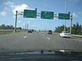
with an intersection of PR-3. It is only 6.2 miles (10 km) long and has very few exits, which work mainly to minimize traffic in the congested Carolina area of PR-3.
The highway is called the Roberto Sánchez Vilella Expressway, which is also the name given to the much larger PR-2
freeway segment from Hormigueros to Ponce. Current proposals expect to extend the PR-66 freeway further to the municipality of Rio Grande
.
in the United States.
and at the beginning caused problems between developers and environmental activists. Several actions of disobedience took place, including beams already installed being removed. The expressway was planned to be extended to Fajardo but due to the close presence of the forest reserve, it was accorded to be extended to Río Grande and connect to PR-3 which has several exits between that municipality and Fajardo, and it might be possible that PR-3 is converted into a complete freeway in that segment as it approaches PR-53.
The short expressway is very expensive and many people still go through PR-3 as a consequence. There are no plans to turn the toll down or lower the current fee of $1.50. This makes this small freeway the second most expensive tollway in the US (excluding bridges and tunnels), after the Dulles Greenway in Virginia
in terms of its small length (about 30 cents per mile). This results beneficial in the effect that PR-66 has low traffic almost all the time (including rush hours).
and is connected to PR-66. It was converted to a freeway to minimize the traffic in PR-3 and PR-17, to grant better access to the Airport. Several exits exist to provide access to PR-187 (the main route to the Piñones area), PR-37 (Isla Verde) and PR-22 (José de Diego). The combined routes of PR-26 and PR-66 is about 17 miles (27.4 km) long.
Toll road
A toll road is a privately or publicly built road for which a driver pays a toll for use. Structures for which tolls are charged include toll bridges and toll tunnels. Non-toll roads are financed using other sources of revenue, most typically fuel tax or general tax funds...
which parallels Puerto Rico Highway 3
Puerto Rico Highway 3
Puerto Rico Highway 3 ' at nearly 101 miles long, is the second longest highway on Puerto Rico . It connects the San Juan neighborhood of Rio Piedras to downtown Salinas indirectly around the eastern coast of the island...
going from the city of Carolina, Puerto Rico
Carolina, Puerto Rico
Carolina is a city located in the northern part of Puerto Rico, bordering the Atlantic Ocean; it lies north of Gurabo and Juncos; east of Trujillo Alto and San Juan; and west of Canóvanas and Loíza. Carolina is spread over 12 wards plus Carolina Pueblo...
via a cloverleaf interchange
Cloverleaf interchange
A cloverleaf interchange is a two-level interchange in which left turns, reverse direction in left-driving regions, are handled by ramp roads...
with PR-26 and PR-3 and ending in the municipality of Canóvanas, Puerto Rico
Canóvanas, Puerto Rico
Canóvanas is a municipality in Puerto Rico, located in the northeastern region, north of Juncos and Las Piedras; south of Loíza; east of Carolina; and west of Río Grande. Canóvanas is spread over 7 wards and Canóvanas Pueblo...
with an intersection of PR-3. It is only 6.2 miles (10 km) long and has very few exits, which work mainly to minimize traffic in the congested Carolina area of PR-3.
The highway is called the Roberto Sánchez Vilella Expressway, which is also the name given to the much larger PR-2
Puerto Rico Highway 2
Puerto Rico Highway 2, the longest highway in the Commonwealth of Puerto Rico at about 156 miles long, connects San Juan to Ponce....
freeway segment from Hormigueros to Ponce. Current proposals expect to extend the PR-66 freeway further to the municipality of Rio Grande
Río Grande, Puerto Rico
Río Grande is a municipality of Puerto Rico located in the Northern Coastal Valley, North of Las Piedras, Naguabo and Ceiba; east of Loíza and Canóvanas and west of Luquillo. Río Grande is spread over eight wards and Río Grande Pueblo...
.
Naming
PR-66 is, in reality, an extension of older expressway PR-26, as both expressways are attached (that is, there is no need to take an exit to enter the other expressway, much like PR-18 and PR-52). PR-66 was assigned that number after U.S. Route 66U.S. Route 66
U.S. Route 66 was a highway within the U.S. Highway System. One of the original U.S. highways, Route 66 was established on November 11, 1926 -- with road signs erected the following year...
in the United States.
Issues
PR-66 is very close to the El Yunque National ForestEl Yunque National Forest
El Yunque National Forest, formerly known as the Luquillo National Forest, and the Caribbean National Forest, is a forest located in northeastern Puerto Rico. It is the only tropical rain forest in the United States...
and at the beginning caused problems between developers and environmental activists. Several actions of disobedience took place, including beams already installed being removed. The expressway was planned to be extended to Fajardo but due to the close presence of the forest reserve, it was accorded to be extended to Río Grande and connect to PR-3 which has several exits between that municipality and Fajardo, and it might be possible that PR-3 is converted into a complete freeway in that segment as it approaches PR-53.
The short expressway is very expensive and many people still go through PR-3 as a consequence. There are no plans to turn the toll down or lower the current fee of $1.50. This makes this small freeway the second most expensive tollway in the US (excluding bridges and tunnels), after the Dulles Greenway in Virginia
Virginia
The Commonwealth of Virginia , is a U.S. state on the Atlantic Coast of the Southern United States. Virginia is nicknamed the "Old Dominion" and sometimes the "Mother of Presidents" after the eight U.S. presidents born there...
in terms of its small length (about 30 cents per mile). This results beneficial in the effect that PR-66 has low traffic almost all the time (including rush hours).
Puerto Rico Highway 26
Puerto Rico Highway 26, called the Román Baldorioty de Castro Expressway, is the main highway to the Luis Muñoz Marín International AirportLuis Muñoz Marín International Airport
Luis Muñoz Marín International Airport is a joint civil-military public airport located in Carolina, Puerto Rico, three miles southeast of San Juan. Over 4 million passengers board a plane at the airport per year according to FAA reports . It is owned and managed by the Puerto Rico Ports...
and is connected to PR-66. It was converted to a freeway to minimize the traffic in PR-3 and PR-17, to grant better access to the Airport. Several exits exist to provide access to PR-187 (the main route to the Piñones area), PR-37 (Isla Verde) and PR-22 (José de Diego). The combined routes of PR-26 and PR-66 is about 17 miles (27.4 km) long.
External links
- Hawaii Highways – Puerto Rico Interstate Photographs (2002)