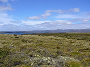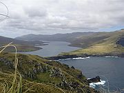
Auckland Island
Encyclopedia


Auckland Islands
The Auckland Islands are an archipelago of the New Zealand Sub-Antarctic Islands and include Auckland Island, Adams Island, Enderby Island, Disappointment Island, Ewing Island, Rose Island, Dundas Island and Green Island, with a combined area of...
, an uninhabited archipelago
Archipelago
An archipelago , sometimes called an island group, is a chain or cluster of islands. The word archipelago is derived from the Greek ἄρχι- – arkhi- and πέλαγος – pélagos through the Italian arcipelago...
in the south Pacific Ocean
Pacific Ocean
The Pacific Ocean is the largest of the Earth's oceanic divisions. It extends from the Arctic in the north to the Southern Ocean in the south, bounded by Asia and Australia in the west, and the Americas in the east.At 165.2 million square kilometres in area, this largest division of the World...
belonging to New Zealand
New Zealand
New Zealand is an island country in the south-western Pacific Ocean comprising two main landmasses and numerous smaller islands. The country is situated some east of Australia across the Tasman Sea, and roughly south of the Pacific island nations of New Caledonia, Fiji, and Tonga...
. It is inscribed in the UNESCO World Heritage list together with the other subantarctic
Subantarctic
The Subantarctic is a region in the southern hemisphere, located immediately north of the Antarctic region. This translates roughly to a latitude of between 46° – 60° south of the Equator. The subantarctic region includes many islands in the southern parts of the Indian Ocean, Atlantic Ocean and...
New Zealand islands in the region as follows: 877-004 Auckland Isls, New Zealand S50.29 E165.52 62560Ha 1998
The island has an approximate land area of 510 square kilometres (196.9 sq mi), and is 42 kilometres (26.1 mi) long. It is notable for its steep cliffs and rugged terrain, which rises to over 600 m (1,969 ft). Prominent peaks include Cavern Peak (650 m (2,133 ft)), Mount Raynal (635 m (2,083 ft)), Mount D'Urville
Mount D'Urville
Mount D'Urville is the highest point on Auckland Island, one of New Zealand's subantarctic outlying islands, and is named after French explorer Jules Dumont d'Urville. It rises to a height of 630 m . It stands in the southeast of the main island, overlooking the mouth of Carnley Harbour...
(630 m (2,067 ft)), Mount Easton (610 m (2,001 ft)), and the Tower of Babel (550 m (1,804 ft)).
The southern end of the island broadens to a width of 26 km (16.2 mi). Here, a narrow channel known as Carnley Harbour
Carnley Harbour
Carnley Harbour is a large natural harbour in the south of the Auckland Islands, a subantarctic part of the New Zealand Outlying Islands. Formed from the drowned crater of an extinct volcano, the harbour separates the mainland of Auckland Island from the smaller Adams Island...
(on some maps the Adams Straits) separates the main island from the smaller Adams Island
Adams Island, New Zealand
Adams Island is part of Auckland Islands archipelago. The southern end of Auckland Island broadens to a width of where a narrow channel, known as Carnley Harbour or the Adams Straits, separates it from the roughly triangular Adams Island , which is even more mountainous, reaching a height of at...
. The channel is the remains of the crater of an extinct volcano
Volcano
2. Bedrock3. Conduit 4. Base5. Sill6. Dike7. Layers of ash emitted by the volcano8. Flank| 9. Layers of lava emitted by the volcano10. Throat11. Parasitic cone12. Lava flow13. Vent14. Crater15...
, Adams Island and the southern part of the main island form the crater rim. 3 km (1.9 mi) north of Carnley Harbour's mouth lies Cape Lovitt
Cape Lovitt
Cape Lovitt is the westernmost point of New Zealand. It is located on the west coast of Auckland Island, one of New Zealand's subantarctic outlying islands, 3 kilometres north of the mouth of Western Arm, a channel leading into Carnley Harbour and separating Auckland Island from Adams Island....
, the westernmost point
Extreme points of New Zealand
This article discusses the extreme points of New Zealand: the points that lie farther north, south, east or west than any other equivalent location in the country....
of New Zealand.
See also
- Composite Antarctic Gazetteer
- List of Antarctic and sub-Antarctic islands
- List of sub-Antarctic islands
- List of islands of New Zealand
- New Zealand sub-antarctic islandsNew Zealand sub-antarctic islandsThe five southernmost groups of the New Zealand Outlying Islands form the New Zealand Sub-Antarctic islands. These islands are collectively designated as an UNESCO World Heritage Site....
- SCARScientific Committee on Antarctic ResearchThe Scientific Committee on Antarctic Research is an interdisciplinary body of the International Council for Science . It was established in February 1958 to continue the international coordination of Antarctic scientific activities that had begun during the International Geophysical Year of 1957-58...
- Territorial claims in Antarctica

