

Apiary, Oregon
Encyclopedia
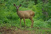
Unincorporated area
In law, an unincorporated area is a region of land that is not a part of any municipality.To "incorporate" in this context means to form a municipal corporation, a city, town, or village with its own government. An unincorporated community is usually not subject to or taxed by a municipal government...
community in Columbia County
Columbia County, Oregon
Columbia County is a county located in the U.S. state of Oregon. It was named for the Columbia River, which forms its eastern and northern borders. As of 2010, its population was 49,351. The county seat is St. Helens.-Economy:...
, Oregon
Oregon
Oregon is a state in the Pacific Northwest region of the United States. It is located on the Pacific coast, with Washington to the north, California to the south, Nevada on the southeast and Idaho to the east. The Columbia and Snake rivers delineate much of Oregon's northern and eastern...
, United States
United States
The United States of America is a federal constitutional republic comprising fifty states and a federal district...
that takes its name from a post office established by David M. Dorsey. The post office operated from August 28, 1889 until March 24, 1924. It is reported that Dorsey was a beekeeper, which provided the source of the name for the Post Office and thus the community.
The community was served by Apiary School District #38, which operated a two-room school providing education services for grades 1 through 8. When operational, it operated in conjunction with the Rainier Union High School District which provided education services for grades 9 through 12. (The high school district also included a number of other grade school districts in the area: Delena, Hudson, Fern Hill, Rainier
Rainier, Oregon
Rainier is a city in Columbia County, Oregon, United States. The population was 1,687 at the 2000 census. Rainier is located on the south bank of the Columbia River across from Kelso and Longview, Washington-History:...
, Goble
Goble, Oregon
Goble is an unincorporated community in Columbia County, Oregon, United States. It is located on U.S. Route 30 and the Columbia River.-History:The Goble area was most likely a stop for the Lewis and Clark Expedition....
, Shiloh Basin, and Neer City districts. In the 1960s, the districts were consolidated into a single district, and the rural schools were closed over the next 10 to 15 years.) The community and the school are located along the road now known as Apiary Road near the headwaters of the North Fork of the Clatskanie River
Clatskanie River
The Clatskanie River is a tributary of the Columbia River, approximately long, in northwestern Oregon in the United States. It drains a timber-producing area in the foothills of the Northern Oregon Coast Range north-northwest of Portland....
. At this writing, the school building still exists but has been converted to a private home. The community also includes a pioneer cemetery but has never contained a community center such as a church, Grange hall, or even a fire station.
Currently, Apiary Road is a popular freight route for forest products
Logging
Logging is the cutting, skidding, on-site processing, and loading of trees or logs onto trucks.In forestry, the term logging is sometimes used in a narrow sense concerning the logistics of moving wood from the stump to somewhere outside the forest, usually a sawmill or a lumber yard...
moving from the Northern Oregon Coast Range
Northern Oregon Coast Range
The Northern Oregon Coast Range is the northern section of the Oregon Coast Range, in the Pacific Coast Ranges physiographic region, located in the northwest portion of the state of Oregon, United States. This section of the mountain range, part of the Pacific Coast Ranges, contains peaks as high...
(particularly areas drained by the Nehalem River
Nehalem River
The Nehalem River is a river on the Pacific coast of northwest Oregon in the United States, approximately long. It drains part of the Northern Oregon Coast Range northwest of Portland, originating on the east side of the mountains and flowing in a loop around the north end of the range near the...
) to markets in Longview, Washington
Longview, Washington
Longview is a city in Cowlitz County, Washington, United States. It is the principal city of the "Longview, Washington Metropolitan Statistical Area", which encompasses all of Cowlitz County. Longview's population was 36,648 at the time of the 2010 census and is the largest city in Cowlitz County...
. The Apiary Road interconnects the Nehalem Highway
Nehalem Highway
The Nehalem Highway No. 102 is a state highway in the U.S. state of Oregon that passes through the Nehalem River valley. It runs from U.S. Route 101 in Astoria southeast to Oregon Route 8 in Forest Grove. Between Astoria and the Mist-Clatskanie Highway in Mist, it is signed as Oregon Route 202;...
north of Pittsburg
Pittsburg, Oregon
Pittsburg is an unincorporated community in Columbia County, Oregon, United States. Pittsburg is located on the Nehalem River near its confluence with the East Fork Nehalem River. The Scappose-Vernonia road and the St. Helens-Pittsburg road join Oregon Route 47 near Pittsburg...
signed as Oregon Route 47 with U.S. Route 30 west of Rainier. However, the intersection with U.S. Route 30 is signed as Larson Road, because Apiary Road technically ends at Old Rainier Road, a former route of U.S. Route 30 just to the south of the present U.S. Route 30.