

Amphoe U Thong
Encyclopedia
U Thong is the district (Amphoe
) in the western part of Suphanburi Province
, central Thailand
.
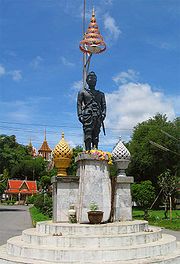 U Thong is an ancient city. Archaeologists found many pre-historic instruments and human skeletons in many parts of the district. It was one of the center cities of Dvaravati
culture. Later, it also became the origin of Ayutthaya kingdom
, as the first King of Ayutthaya Ramathibodi was prince of U Thong before.
U Thong district was created with the name Chorakhe Sam Phan in 1905. 1939 the district was renamed to U Thong. In 1944, the government moved the central of district from Ban Chorakhe Sam Phan to the area of the ancient city.
, Mueang Suphanburi
, Bang Pla Ma
, Song Phi Nong
of Suphanburi Province, Lao Khwan
, Huai Krachao
and Phanom Thuan
of Kanchanaburi Province
.
), which are further subdivided into 151 villages (muban
). There are two townships (thesaban tambon) in the district - U Thong and Sa Yai Som each cover parts of the same-named tambon.
Amphoe
An amphoe is the second level administrative subdivision of Thailand. Usually translated as district, amphoe make up the provinces, and are analogous to a county seat...
) in the western part of Suphanburi Province
Suphanburi Province
Suphan Buri is one of the central provinces of Thailand. Neighboring provinces are Uthai Thani, Chai Nat, Sing Buri, Ang Thong, Phra Nakhon Si Ayutthaya, Nakhon Pathom and Kanchanaburi.- Etymology :...
, central Thailand
Thailand
Thailand , officially the Kingdom of Thailand , formerly known as Siam , is a country located at the centre of the Indochina peninsula and Southeast Asia. It is bordered to the north by Burma and Laos, to the east by Laos and Cambodia, to the south by the Gulf of Thailand and Malaysia, and to the...
.
History
Dvaravati
The Dvaravati period lasted from the 6th to the 13th centuries. Dvaravati refers to both a culture and a disparate conglomerate of principalities.- History :...
culture. Later, it also became the origin of Ayutthaya kingdom
Ayutthaya kingdom
Ayutthaya was a Siamese kingdom that existed from 1350 to 1767. Ayutthaya was friendly towards foreign traders, including the Chinese, Vietnamese , Indians, Japanese and Persians, and later the Portuguese, Spanish, Dutch and French, permitting them to set up villages outside the walls of the...
, as the first King of Ayutthaya Ramathibodi was prince of U Thong before.
U Thong district was created with the name Chorakhe Sam Phan in 1905. 1939 the district was renamed to U Thong. In 1944, the government moved the central of district from Ban Chorakhe Sam Phan to the area of the ancient city.
Geography
Neighboring districts are (from the north clockwise) Don ChediAmphoe Don Chedi
-Geography:Neighboring districts are Nong Ya Sai, Sam Chuk, Si Prachan, Mueang Suphanburi and U Thong, and in Kanchanaburi Province the district Lao Khwan.-History:...
, Mueang Suphanburi
Amphoe Mueang Suphanburi
Mueang Suphanburi is the capital district of Suphanburi Province, central Thailand.-History:Suphan Buri is an old city. In the era of Ankorian king Jayavarman VII, inscription called Prasat Phra Khan was made and which mentions the name of Suvarnapura. Later Suphan Buri become important city of...
, Bang Pla Ma
Amphoe Bang Pla Ma
Bang Pla Ma is a district in the southern part of Suphanburi Province, central Thailand.-History:The district was established in 1897 by the governor Phra Samut Khana Nurak ....
, Song Phi Nong
Amphoe Song Phi Nong
Song Phi Nong is the southernmost district of Suphanburi Province, central Thailand.-History:The district was established in 1896. In the past the area of the district included U Thong district...
of Suphanburi Province, Lao Khwan
Amphoe Lao Khwan
Lao Khwan is a district in the northeastern part of Kanchanaburi Province, central Thailand.-History:Laotian people moved to establish new village in the area of Ban Ko Ban Kao. Later people from Bo Phloi moved to the area too...
, Huai Krachao
Amphoe Huai Krachao
Huai Krachao is a district in the eastern part of Kanchanaburi Province, central Thailand.-History:Tambon Huai Krachao, Wang Phai, Sa Long Ruea and Don Salaep were separated from Phanon Thuan district and formed the minor district Huai Krachao on April 30, 1994...
and Phanom Thuan
Amphoe Phanom Thuan
Phanom Thuan is a district in the eastern part of Kanchanaburi Province, central Thailand.-History:The area of Phanom Thuan was already occupied in prehistoric times...
of Kanchanaburi Province
Kanchanaburi Province
- History :Archaeology found in Kanchanaburi dates back to the 4th century which proves of trade with surrounding countries even in that time. Very little is also historically known about the actual Khmer influence in Kanchanaburi but there is evidence of their occupation with Prasat Muang Singh –...
.
Administration
The district is subdivided into 13 subdistricts (tambonTambon
Tambon is a local government unit in Thailand. Below district and province , they form the third administrative subdivision level. As of the 2009 there are 7255 tambon, not including the 169 khwaeng of Bangkok, which are set at the same administrative level, thus every district contains 8-10 tambon...
), which are further subdivided into 151 villages (muban
Muban
Muban is the lowest administrative subdivision of Thailand. Usually translated as village, they are the subdivision of tambon. As of 2008, there are 74944 administrative villages in Thailand. As of the 1990 census, the average village consisted of 144 households or 746 persons.A muban does not...
). There are two townships (thesaban tambon) in the district - U Thong and Sa Yai Som each cover parts of the same-named tambon.
| No. | Name | Thai | Pop. Population A population is all the organisms that both belong to the same group or species and live in the same geographical area. The area that is used to define a sexual population is such that inter-breeding is possible between any pair within the area and more probable than cross-breeding with individuals... |
|||||||
|---|---|---|---|---|---|---|---|---|---|---|
| 1. | U Thong | อู่ทอง | 19,412 | 8. | Don Kha | ดอนคา | 12,698 | |||
| 2. | Sa Yai Som | สระยายโสม | 5,448 | 9. | Phlapphla Chai | พลับพลาไชย | 11,947 | |||
| 3. | Chorakhe Sam Phan | จรเข้สามพัน | 13,009 | 10. | Ban Khong | บ้านโข้ง | 8,865 | |||
| 4. | Ban Don | บ้านดอน | 7,899 | 11. | Chedi | เจดีย์ | 3,006 | |||
| 5. | Yung Thalai | ยุ้งทะลาย | 4,457 | 12. | Sa Phang Lan | สระพังลาน | 4,866 | |||
| 6. | Don Makluea | ดอนมะเกลือ | 4,603 | 13. | Kra Chan | กระจัน | 6,786 | |||
| 7. | Nong Ong | หนองโอ่ง | 8,700 |