
Alouette Lake
Encyclopedia
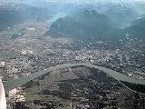
Alouette Lake, originally Lillooet Lake and not to be confused with the lake of that name
farther north, is a lake
and reservoir
in Maple Ridge
, British Columbia
, Canada
. It is located at the southeast foot of the mountain group known as the Golden Ears
and is about 8 km in length on a northeast-southwest axis. It and the Alouette River
, formerly the Lillooet River, were renamed in 1914 to avoid confusion with the larger river and lake farther north, with "Alouette", the French
word for "lark
", being chosen as being melodious and reminiscent of the original name in tone.
Most of the basin of Alouette Lake has never been logged and its north flank is protected as part of Golden Ears Provincial Park
(formerly part of Garibaldi Provincial Park
until that park's division). A small portion of the lake and its largely inaccessible northwestern shore, near its narrows, are actually part of the District of Mission
due to the rectangular shape of that district's boundary. North of the portion of the lake that is in Mission, the rest of its northern end is not in either municipality.
. A 1067 m (3,501 ft) long tunnel connects Alouette Lake and Stave Lake. At the end of the tunnel is a penstock which feeds the small Alouette Powerhouse, an 8 MW power station operated by BC Hydro
, which lies midway along the west shore of Stave Lake
.49°22′16"N 122°18′47"W There is no powerhouse at the dam, however, as the point of the reservoir is to feed the tunnel through the flank of the ridge between Mounts Crickmer
and Robie Reid
. A former railway grade leading to the dam along the river was also used as a logging railway.
Lillooet Lake
Lillooet Lake is a lake in British Columbia, Canada about 25 km in length and about 33.5 square kilometres in area. It is about 95 km downstream from the source of the Lillooet River, which resumes its course after leaving Little Lillooet Lake, aka Tenas Lake...
farther north, is a lake
Lake
A lake is a body of relatively still fresh or salt water of considerable size, localized in a basin, that is surrounded by land. Lakes are inland and not part of the ocean and therefore are distinct from lagoons, and are larger and deeper than ponds. Lakes can be contrasted with rivers or streams,...
and reservoir
Reservoir
A reservoir , artificial lake or dam is used to store water.Reservoirs may be created in river valleys by the construction of a dam or may be built by excavation in the ground or by conventional construction techniques such as brickwork or cast concrete.The term reservoir may also be used to...
in Maple Ridge
Maple Ridge, British Columbia
Maple Ridge is a District Municipality in British Columbia, located in the northeastern section of Metro Vancouver. Maple Ridge has a population of approximately 68,949.-History:...
, British Columbia
British Columbia
British Columbia is the westernmost of Canada's provinces and is known for its natural beauty, as reflected in its Latin motto, Splendor sine occasu . Its name was chosen by Queen Victoria in 1858...
, Canada
Canada
Canada is a North American country consisting of ten provinces and three territories. Located in the northern part of the continent, it extends from the Atlantic Ocean in the east to the Pacific Ocean in the west, and northward into the Arctic Ocean...
. It is located at the southeast foot of the mountain group known as the Golden Ears
Golden Ears
Golden Ears may refer to:* Golden ear, a term for a person with an above-standard sense of hearing* Golden Ears a mountain in British Columbia** Golden Ears Provincial Park, a provincial park in British Columbia, Canada...
and is about 8 km in length on a northeast-southwest axis. It and the Alouette River
Alouette River
The Alouette River is a river in the Canadian province of British Columbia.The Alouette River was known as the Lillooet River until 1914, at which time its name was changed to avoid confusion with the much larger Lillooet River...
, formerly the Lillooet River, were renamed in 1914 to avoid confusion with the larger river and lake farther north, with "Alouette", the French
French language
French is a Romance language spoken as a first language in France, the Romandy region in Switzerland, Wallonia and Brussels in Belgium, Monaco, the regions of Quebec and Acadia in Canada, and by various communities elsewhere. Second-language speakers of French are distributed throughout many parts...
word for "lark
Lark
Larks are passerine birds of the family Alaudidae. All species occur in the Old World, and in northern and eastern Australia; only one, the Shore Lark, has spread to North America, where it is called the Horned Lark...
", being chosen as being melodious and reminiscent of the original name in tone.
Most of the basin of Alouette Lake has never been logged and its north flank is protected as part of Golden Ears Provincial Park
Golden Ears Provincial Park
Golden Ears Provincial Park is a Provincial Park in British Columbia, Canada at 555.9 km². It is named after the prominent twin peaks which are commonly referred to as Golden Ears...
(formerly part of Garibaldi Provincial Park
Garibaldi Provincial Park
Garibaldi Provincial Park, also called Garibaldi Park, is a wilderness park located in British Columbia, Canada, about 70 kilometres north of Vancouver. The park is located to the east of the Sea to Sky Highway between Squamish and Whistler and covers an area of over 1,950 square kilometres...
until that park's division). A small portion of the lake and its largely inaccessible northwestern shore, near its narrows, are actually part of the District of Mission
Mission, British Columbia
Mission, the core of which was formerly known as Mission City, is a district municipality in the province of British Columbia, Canada. It is situated on the north bank of the Fraser River overlooking the City of Abbotsford and with that city is part of the Central Fraser Valley. Mission is the...
due to the rectangular shape of that district's boundary. North of the portion of the lake that is in Mission, the rest of its northern end is not in either municipality.
Alouette Dam
Originally only 2 km in length, the lake was considerably expanded by the construction of the Alouette Dam at 49°17′10"N 122°29′12"W, which is 11.5 km (7 mi) along the upper reaches of the South Alouette RiverAlouette River
The Alouette River is a river in the Canadian province of British Columbia.The Alouette River was known as the Lillooet River until 1914, at which time its name was changed to avoid confusion with the much larger Lillooet River...
. A 1067 m (3,501 ft) long tunnel connects Alouette Lake and Stave Lake. At the end of the tunnel is a penstock which feeds the small Alouette Powerhouse, an 8 MW power station operated by BC Hydro
BC Hydro
The BC Hydro and Power Authority is a Canadian electric utility in the province of British Columbia generally known simply as BC Hydro. It is the main electric distributor, serving 1.8 million customers in most areas, with the exception of the Kootenay region, where FortisBC, a subsidiary of Fortis...
, which lies midway along the west shore of Stave Lake
Stave Lake
Stave Lake is a hydroelectric reservoir in the Stave River system, located on the northern edge of the District of Mission, about 65 km east of Vancouver, British Columbia. The main arm of the lake is just over 20 km long, and there is a southwest arm ending at Stave Falls Dam about...
.49°22′16"N 122°18′47"W There is no powerhouse at the dam, however, as the point of the reservoir is to feed the tunnel through the flank of the ridge between Mounts Crickmer
Mount Crickmer
Mount Crickmer is one of the southernmost summits of the Garibaldi Ranges of the Coast Mountains, overlooking the Central Fraser Valley in the Lower Mainland of British Columbia, Canada...
and Robie Reid
Mount Robie Reid
Mount Robie Reid is a mountain in the southern end of the Garibaldi Ranges overlooking the Lower Mainland region of British Columbia, Canada. It lies to the north of Mission, British Columbia, Canada and on the west side of the upper end of Stave Lake, and to the northeast of the group of summits...
. A former railway grade leading to the dam along the river was also used as a logging railway.