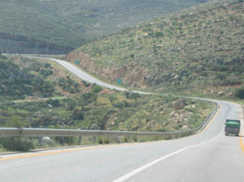
Allon Road
Encyclopedia

Israel
The State of Israel is a parliamentary republic located in the Middle East, along the eastern shore of the Mediterranean Sea...
is to routes #578, #508, and #458 in the West Bank
West Bank
The West Bank ) of the Jordan River is the landlocked geographical eastern part of the Palestinian territories located in Western Asia. To the west, north, and south, the West Bank shares borders with the state of Israel. To the east, across the Jordan River, lies the Hashemite Kingdom of Jordan...
, running roughly north-south between Mehola
Mehola
Mehola is a religious moshav and Israeli settlement in the West Bank. Located in the Jordan Valley near the Green Line with an area of 5,000 dunams, it falls under the jurisdiction of Bik'at HaYarden Regional Council. In 2006 it had a population of 351...
in the central Jordan Valley
Jordan Valley (Middle East)
The Jordan Valley forms part of the larger Jordan Rift Valley. It is 120 kilometers long and 15 kilometers wide, where it runs from Lake Tiberias in the north to northern Dead Sea in the south. It runs for an additional 155 kilometer south of the Dead Sea to Aqaba, an area also known as Wadi...
and east of Ma'ale Adummim
Ma'ale Adummim
Ma'ale Adumim is an Israeli settlement and a city in the West Bank, seven kilometers from Jerusalem. Ma'ale Adumim achieved city status in 1991. In 2011, the population was 39,000. Ma'ale Adumim is the third largest Israeli settlement in the West Bank after Modi'in Illit, and Beitar Illit. The...
on the eastern outskirts of Jerusalem.


The road was the first immediate step in implementing the Allon Plan
Allon Plan
The Allon Plan was an Israeli proposal of the late 1960s to partition the West Bank, captured from Jordan in the Six-Day War of June 1967, between Israel and Jordan...
which was perhaps one of the earliest Israeli initiatives to deal with the territory west of Jordan
Jordan
Jordan , officially the Hashemite Kingdom of Jordan , Al-Mamlaka al-Urduniyya al-Hashemiyya) is a kingdom on the East Bank of the River Jordan. The country borders Saudi Arabia to the east and south-east, Iraq to the north-east, Syria to the north and the West Bank and Israel to the west, sharing...
that was newly occupied in the 1967 Six-Day War
Six-Day War
The Six-Day War , also known as the June War, 1967 Arab-Israeli War, or Third Arab-Israeli War, was fought between June 5 and 10, 1967, by Israel and the neighboring states of Egypt , Jordan, and Syria...
. The plan called for the Israeli annexation of the narrow corridor of land along the west of the Jordan River up to the eastern slopes of the Samarian mountains in order to assure minimal strategical depth while relinquishing the rest of the West Bank to Arab-Jordanian control.
The next step was to establish residential and agricultural settlements as well as military outposts along this strip of land in order to assure a minimal buffer zone that would hold up in the event of a Jordanian attack until Israeli Army reserve units could mobilize to the area. Between 1967 and 1977, the Israeli Labour governments created 21 settlements, mostly agricultural cooperatives in this area.
The effects of this plan can be easily seen from the fact that almost all the settlements on the Allon Road (Eg: Alon, Rimonim
Rimonim
Rimonim , is an Israeli settlement located on the Allon Road in the West Bank in the jurisdiction of the Matte Binyamin Regional Council about a twenty minute drive east from Jerusalem. As of 2011, the population of the village was about 150 families...
, Gitit
Gitit
Gitit is a moshav and Israeli settlement in the West Bank. Located in the Jordan Valley with an area of 1,500 dunams, it falls under the jurisdiction of Bik'at HaYarden Regional Council. In 2006 it had a population of 214....
) are on the east side. The major exception to the rule is Ma'ale Mikhmas
Ma'ale Mikhmas
Ma'ale Mikhmas is an Israeli settlement and a village in the Binyamin region of the northern West Bank and under the municipal responsibility of the Mateh Binyamin Regional Council...
.

