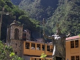
Aguas Calientes, Peru
Encyclopedia
Aguas Calientes is the colloquial name for "Hot Springs", a town in Peru
on the Urubamba (Vilcanota) River
. It is best known as the closest access point to the sacred historical site of Machu Picchu
(in Quechua: old mountain), which is 6 kilometres (3.7 mi) away, about 1.5 hours walk. There are many hotels and restaurants for tourists, as well as natural hot baths, which give the town its name. The baths were destroyed by floods several years ago, but have been rebuilt.
passenger train service from Cusco
. Trains serve locals and tourists arriving from Cusco and Ollantaytambo
to visit Machu Picchu. A sheltered souvenir market is adjacent to the train station. Avenue Pachacutec is the town's main and only thoroughfare, connecting the baths to the town's main square.
is nearby on the Vilcanota. It generates about 90 MW for the regions of Cusco, Puno and Apurimac. It was first constructed between 1958 and 1965 and expanded between 1981 and 1985. The plant was damaged by a landslide on February 28, 1998 and ceased operations until July 13, 2001.
Peru
Peru , officially the Republic of Peru , is a country in western South America. It is bordered on the north by Ecuador and Colombia, on the east by Brazil, on the southeast by Bolivia, on the south by Chile, and on the west by the Pacific Ocean....
on the Urubamba (Vilcanota) River
Urubamba River
The Urubamba River is a river in Peru. A partially navigable headwater of the Amazon River, it rises in the Andes to the south-east of Cuzco near the Puno Region border, where it is called the Vilcanota River . In the Sacred Valley, between Písac and Ollantaytambo, it is also called the Wilcamayu...
. It is best known as the closest access point to the sacred historical site of Machu Picchu
Machu Picchu
Machu Picchu is a pre-Columbian 15th-century Inca site located above sea level. It is situated on a mountain ridge above the Urubamba Valley in Peru, which is northwest of Cusco and through which the Urubamba River flows. Most archaeologists believe that Machu Picchu was built as an estate for...
(in Quechua: old mountain), which is 6 kilometres (3.7 mi) away, about 1.5 hours walk. There are many hotels and restaurants for tourists, as well as natural hot baths, which give the town its name. The baths were destroyed by floods several years ago, but have been rebuilt.
History
Originally settled by a few farm families in 1901, the tiny settlement was transformed into a busy railway worker's camp, called Camp Maquinachayoq, during the construction of the railroad through there in the late 1920s. The town was the central hub for worker lodging and their equipment up until the railway was finished in 1931.Transport
Aguas Calientes serves as a terminal for the PeruRailPeruRail
PeruRail is a railway operator working tourist, freight, and charter services in southern Peru.The main line between the port of Matarani, Arequipa , Cuzco and Puno on Lake Titicaca was formerly known as the Ferrocarril del Sur , and was for a time owned and operated by the ENAFER state company...
passenger train service from Cusco
Cusco
Cusco , often spelled Cuzco , is a city in southeastern Peru, near the Urubamba Valley of the Andes mountain range. It is the capital of the Cusco Region as well as the Cuzco Province. In 2007, the city had a population of 358,935 which was triple the figure of 20 years ago...
. Trains serve locals and tourists arriving from Cusco and Ollantaytambo
Ollantaytambo
Ollantaytambo is a town and an Inca archaeological site in southern Peru some 60 kilometers northwest of the city of Cusco. It is located at an altitude of 2,792 meters above sea level in the district of Ollantaytambo, province of Urubamba, Cusco region...
to visit Machu Picchu. A sheltered souvenir market is adjacent to the train station. Avenue Pachacutec is the town's main and only thoroughfare, connecting the baths to the town's main square.
Industry
The Central Machupicchu Hydroelectric PlantHydroelectricity
Hydroelectricity is the term referring to electricity generated by hydropower; the production of electrical power through the use of the gravitational force of falling or flowing water. It is the most widely used form of renewable energy...
is nearby on the Vilcanota. It generates about 90 MW for the regions of Cusco, Puno and Apurimac. It was first constructed between 1958 and 1965 and expanded between 1981 and 1985. The plant was damaged by a landslide on February 28, 1998 and ceased operations until July 13, 2001.

