
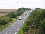
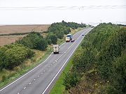
A605 road
Encyclopedia
The A605 road is a main road in the English counties of Northamptonshire
and Cambridgeshire
.
, skirts the village of Thorpe Waterville
, bypasses Oundle
to its east, crosses the River Nene
, reaches the eastern limit of the A427
at a roundabout, skirts to the west of Eaglethorpe, crosses into Cambridgeshire near Elton Hall
, to reach the A1(M)'s junction 17 whereupon it overlaps the A1 road. It then continues north east through Whittlesey
before terminating at a junction with the A141 between March, Cambridgeshire
and Guyhirn
. Basically, except for a short section at Oundle, its route follows the south bank of the River Nene.
and run to Thrapston
and Peterborough
, following the line of the Roman Road between Irchester and Durobrivae (Wansford). The road split in two just before the A6 with one branch joining the A6 by the Irthlingborough
Viaduct and the other at the top of the hill as the A6 enters Higham Ferrers. The later branch survives as a local access but the former has been returned to field.
In the early 1980s, development of the route from Northampton
to Thrapston saw the building of a new section of the A605 mostly on line between Chown's Mill roundabout and the Stanwick
roundabout. This was later dualled. A year later the Stanwick and Raunds
Bypass was opened with land for dualling which, as of 2009, has not been carried out. In the mid 1980s, the Ringstead
and Denford
Bypass was constructed from the Raunds roundabout to a grade separated interchange at Thrapston with the A14. With the completion of the route, the Chowns Mill roundabout to Thrapston roundabout section of the A605 was renumbered the A45 and the A45 to the east of Higham Ferrers was renumbered A4500. Thrapston is now the terminus of the A45 and the start of the A605.
Just before the A14 was built, a short section of the A605 was built bypassing Thrapston to the east to the A604 (as it was then known). This section began approximately 0.25 miles (402.3 m) northeast of Thrapston and terminated at a new roundabout on the A604, now merely an access to Thrapston industrial estate. The Thrapston Eastern Bypass was opened a few years later running northeast from this roundabout to a new junction with the old A605, just south of the Titchmarsh turn. Excavation of a Roman way station on the site of the junction proved disappointing, with no significant finds. The junction at the northeast end of Thrapston was converted to a roundabout around 2005. A bend was also eased between Titchmarsh
turn and Thorpe Waterville
. Around 2000 the A605 was widened between Thorpe Waterville and a new Lilford
roundabout was constructed. An original milestone was unearthed and set on the side of the north east exit.
The road was improved from Barnwell
turn to a new roundabout northeast of Oundle
as the Oundle Bypass. This used the alignment of the former BR Northampton to Peterborough railway and crosses the River Nene
twice in quick succession. The road was opened on 12 December 1985 by Princess Alice, Duchess of Gloucester
and is commemorated by a plinth and brass plaque at the roundabout. A minor alignment change took place beyond here through the hamlet of Elmington. Beyond Elmington a curve was eased as the road climbed out of the valley and a new straightened section was constructed to a new roundabout for Warmington
. The old road enters the garage just south of the roundabout. The Warmington Bypass was one of the last improvements on the A605 and was completed in the late 1990s, including a section to the county boundary. The old road south of Warmington roundabout is now a garage access and the old road into Warmington can be seen on the right a short distance after the roundabout.
The Elton
Bypass takes the A605 onto a new more southerly route to join the A1(M) at its northern terminus at Junction 17. This route then overlaps the A1 for 1 miles (1.6 km) to Alwalton
where it regains its original route, heading northeast through Orton towards Peterbrough. The bypassed section from Elton to Orton suffered from poor alignment and is now the B671 and a C road. The Elton Bypass climbs two hills and benefits from crawler lanes on both sections from both east and west.
 East of the A1 the route approaching Peterborough has, in effect, become a local distributor as traffic for the A605 onward to Whittlesey/March etc. will use the parallel A1139 Peterborough Southern Bypass from Junction 17 on the A1(M). There are four new roundabouts between Alwalton and Orton. A diversion cuts a sharp corner between the third and fourth roundabouts. There is a limited access junction onto the A1260 Peterborough Western Bypass. The road passes under the East Coast Main Line
and has a roundabout junction with the A15 immediately south of Peterborough city's Nene Bridge. The road turns south and overlaps the A15 for a short way before originally diverging to the left and passing under the Peterborough Southern Bypass (the A1139) at Stanground. Finally, there is junction with the A1139 access road and the A605 turns east towards Whittlesey on what was once an old toll road.
In December 2009 a Stanground Bypass (mostly dual carriageway) was opened on the eastern approaches to Peterborough. This actually lengthens the route of the A605, although those using the A605 and Peterborough Bypass towards Whittlesey will find it shorter.
but this stretch has been renumbered as the A45 road
that terminates at the same A14 junction as the A605 now starts from. It is a matter of speculation why the whole of the A605 was not similarly renumbered.
Northamptonshire
Northamptonshire is a landlocked county in the English East Midlands, with a population of 629,676 as at the 2001 census. It has boundaries with the ceremonial counties of Warwickshire to the west, Leicestershire and Rutland to the north, Cambridgeshire to the east, Bedfordshire to the south-east,...
and Cambridgeshire
Cambridgeshire
Cambridgeshire is a county in England, bordering Lincolnshire to the north, Norfolk to the northeast, Suffolk to the east, Essex and Hertfordshire to the south, and Bedfordshire and Northamptonshire to the west...
.
Route (west to east)
The A605 strikes north from junction 13 of the trunk A14 road through the eastern parts of ThrapstonThrapston
Thrapston is a small town in Northamptonshire, England. It is the headquarters of the East Northamptonshire district, and in 2001 had a population of 4,855. By 2006, this was estimated to be over 5,700....
, skirts the village of Thorpe Waterville
Thorpe Waterville
Thorpe Waterville is a village in the English county of Northamptonshire. It is combined with Achurch to form the ecclesiastical parish of 'Thorpe Achurch'; in turn this is added to another combined parish, Lilford-cum-Wigsthorpe, to form the civil parish of Lilford-cum-Wigsthorpe and Thorpe Achurch...
, bypasses Oundle
Oundle
Oundle is an ancient market town on the River Nene in Northamptonshire, England, with a population of 5,345 or 5,674 . It lies some north of London and south-west of Peterborough...
to its east, crosses the River Nene
River Nene
The River Nene is a river in the east of England that rises from three sources in the county of Northamptonshire. The tidal river forms the border between Cambridgeshire and Norfolk for about . It is the tenth longest river in the United Kingdom, and is navigable for from Northampton to The...
, reaches the eastern limit of the A427
A427 road
The A427 road is a major road in the English Midlands. It connects the Leicestershire town of Market Harborough and the A6 with the Northamptonshire town of Oundle and the A605.-History:...
at a roundabout, skirts to the west of Eaglethorpe, crosses into Cambridgeshire near Elton Hall
Elton Hall
Elton Hall is a baronial hall in Elton, Cambridgeshire. It has been the ancestral home of the Proby family since 1660.The hall lies in an estate through which the River Nene runs...
, to reach the A1(M)'s junction 17 whereupon it overlaps the A1 road. It then continues north east through Whittlesey
Whittlesey
Whittlesey, historically known as Whittlesea as the name of the railway station is still spelt, or Witesie, is an ancient Fenland market town around six miles east of Peterborough in the county of Cambridgeshire in England...
before terminating at a junction with the A141 between March, Cambridgeshire
March, Cambridgeshire
March is a Fenland market town and civil parish in the Isle of Ely area of Cambridgeshire, England. March was the county town of the Isle of Ely, a separate administrative county between 1889 and 1965, and is now the administrative centre of Fenland District Council.The town was an important...
and Guyhirn
Guyhirn
Guyhirn is a small village near the town of Wisbech in Cambridgeshire, England. The village sits on the northern bank of the River Nene.Guyhirn is found at a junction of two sizeable "A" roads, where the A141 leaves the A47.-Origin of the name:...
. Basically, except for a short section at Oundle, its route follows the south bank of the River Nene.
History and Improvements
The road used to start at the A6 just north of Higham FerrersHigham Ferrers
Higham Ferrers is a market town in the Nene Valley in East Northamptonshire, England, close to the Cambridgeshire and Bedfordshire borders. It forms a single urban area with Rushden to the south and has an estimated population of 6,086...
and run to Thrapston
Thrapston
Thrapston is a small town in Northamptonshire, England. It is the headquarters of the East Northamptonshire district, and in 2001 had a population of 4,855. By 2006, this was estimated to be over 5,700....
and Peterborough
Peterborough
Peterborough is a cathedral city and unitary authority area in the East of England, with an estimated population of in June 2007. For ceremonial purposes it is in the county of Cambridgeshire. Situated north of London, the city stands on the River Nene which flows into the North Sea...
, following the line of the Roman Road between Irchester and Durobrivae (Wansford). The road split in two just before the A6 with one branch joining the A6 by the Irthlingborough
Irthlingborough
Irthlingborough , originally called Artleborough, is a small town on the River Nene in Northamptonshire, England with a population of 6,179 people according to the 2001 census. It is the smallest town in England to have possessed a league association football team, Rushden & Diamonds. The parish...
Viaduct and the other at the top of the hill as the A6 enters Higham Ferrers. The later branch survives as a local access but the former has been returned to field.
In the early 1980s, development of the route from Northampton
Northampton
Northampton is a large market town and local government district in the East Midlands region of England. Situated about north-west of London and around south-east of Birmingham, Northampton lies on the River Nene and is the county town of Northamptonshire. The demonym of Northampton is...
to Thrapston saw the building of a new section of the A605 mostly on line between Chown's Mill roundabout and the Stanwick
Stanwick, Northamptonshire
Stanwick is a village and civil parish in East Northamptonshire, England. It is approximately 15 miles north-east of Northampton and is the largest village in the East Northamptonshire district. At the time of the 2001 census, the parish population was 1,924 people.-History:There has been a...
roundabout. This was later dualled. A year later the Stanwick and Raunds
Raunds
Raunds is a small market town in rural Northamptonshire, England. It has a population of 8,275 , is a civil parish, and is part of the East Northamptonshire district.- Geography :Raunds is situated 21 miles north-east of Northampton...
Bypass was opened with land for dualling which, as of 2009, has not been carried out. In the mid 1980s, the Ringstead
Ringstead, Northamptonshire
Ringstead is a small village and civil parish in Northamptonshire, England approximately 15 miles north-east of Northampton. At the time of the 2001 census, the parish's population was 1,428 people....
and Denford
Denford
Denford is a small village and civil parish situated in East Northamptonshire, England. At the time of the 2001 census, the parish population was 250 people....
Bypass was constructed from the Raunds roundabout to a grade separated interchange at Thrapston with the A14. With the completion of the route, the Chowns Mill roundabout to Thrapston roundabout section of the A605 was renumbered the A45 and the A45 to the east of Higham Ferrers was renumbered A4500. Thrapston is now the terminus of the A45 and the start of the A605.
Just before the A14 was built, a short section of the A605 was built bypassing Thrapston to the east to the A604 (as it was then known). This section began approximately 0.25 miles (402.3 m) northeast of Thrapston and terminated at a new roundabout on the A604, now merely an access to Thrapston industrial estate. The Thrapston Eastern Bypass was opened a few years later running northeast from this roundabout to a new junction with the old A605, just south of the Titchmarsh turn. Excavation of a Roman way station on the site of the junction proved disappointing, with no significant finds. The junction at the northeast end of Thrapston was converted to a roundabout around 2005. A bend was also eased between Titchmarsh
Titchmarsh, Northamptonshire
Titchmarsh is a village and civil parish in East Northamptonshire, England. At the time of the 2001 census, the parish's population was 543 people....
turn and Thorpe Waterville
Thorpe Waterville
Thorpe Waterville is a village in the English county of Northamptonshire. It is combined with Achurch to form the ecclesiastical parish of 'Thorpe Achurch'; in turn this is added to another combined parish, Lilford-cum-Wigsthorpe, to form the civil parish of Lilford-cum-Wigsthorpe and Thorpe Achurch...
. Around 2000 the A605 was widened between Thorpe Waterville and a new Lilford
Lilford Hall
Lilford Hall is a Grade 1 listed stately 100-room home having a Jacobean exterior and Georgian interior with a floor area, located in the eastern part of the County of Northamptonshire in the United Kingdom, south of Oundle and north of Thrapston. A Grade 1 listed building is considered by the UK...
roundabout was constructed. An original milestone was unearthed and set on the side of the north east exit.
The road was improved from Barnwell
Barnwell, Northamptonshire
Barnwell is a village in the district of East Northamptonshire in England, south of the town of Oundle, north of London and south-west of Peterborough...
turn to a new roundabout northeast of Oundle
Oundle
Oundle is an ancient market town on the River Nene in Northamptonshire, England, with a population of 5,345 or 5,674 . It lies some north of London and south-west of Peterborough...
as the Oundle Bypass. This used the alignment of the former BR Northampton to Peterborough railway and crosses the River Nene
River Nene
The River Nene is a river in the east of England that rises from three sources in the county of Northamptonshire. The tidal river forms the border between Cambridgeshire and Norfolk for about . It is the tenth longest river in the United Kingdom, and is navigable for from Northampton to The...
twice in quick succession. The road was opened on 12 December 1985 by Princess Alice, Duchess of Gloucester
Princess Alice, Duchess of Gloucester
Princess Alice, Duchess of Gloucester was a member of the British Royal Family, the wife and then widow of Prince Henry, Duke of Gloucester, the third son of George V and Queen Mary.The daughter of the 7th Duke of Buccleuch & Queensberry, Scotland’s largest landowner, her brothers Walter and...
and is commemorated by a plinth and brass plaque at the roundabout. A minor alignment change took place beyond here through the hamlet of Elmington. Beyond Elmington a curve was eased as the road climbed out of the valley and a new straightened section was constructed to a new roundabout for Warmington
Warmington, Northamptonshire
Warmington is a village and civil parish in East Northamptonshire, England with a population of 874.The Nene Way footpath runs through it and is well signposted. It is 2½ miles east of the town of Oundle near the Cambridgeshire border and is 10 miles south west of the city of Peterborough. It has...
. The old road enters the garage just south of the roundabout. The Warmington Bypass was one of the last improvements on the A605 and was completed in the late 1990s, including a section to the county boundary. The old road south of Warmington roundabout is now a garage access and the old road into Warmington can be seen on the right a short distance after the roundabout.
The Elton
Elton, Cambridgeshire
Elton is a small village within the historic boundaries of Huntingdonshire , England. It lies on the B671 road. Elton Hall and the hamlet of Over End are located on the same road a mile south of the village....
Bypass takes the A605 onto a new more southerly route to join the A1(M) at its northern terminus at Junction 17. This route then overlaps the A1 for 1 miles (1.6 km) to Alwalton
Alwalton
Alwalton is a village in Huntingdonshire in the United Kingdom, five miles to the west of the city of Peterborough....
where it regains its original route, heading northeast through Orton towards Peterbrough. The bypassed section from Elton to Orton suffered from poor alignment and is now the B671 and a C road. The Elton Bypass climbs two hills and benefits from crawler lanes on both sections from both east and west.
East Coast Main Line
The East Coast Main Line is a long electrified high-speed railway link between London, Peterborough, Doncaster, Wakefield, Leeds, York, Darlington, Newcastle and Edinburgh...
and has a roundabout junction with the A15 immediately south of Peterborough city's Nene Bridge. The road turns south and overlaps the A15 for a short way before originally diverging to the left and passing under the Peterborough Southern Bypass (the A1139) at Stanground. Finally, there is junction with the A1139 access road and the A605 turns east towards Whittlesey on what was once an old toll road.
In December 2009 a Stanground Bypass (mostly dual carriageway) was opened on the eastern approaches to Peterborough. This actually lengthens the route of the A605, although those using the A605 and Peterborough Bypass towards Whittlesey will find it shorter.
Numbering
At no point in its route does the A605 meet another A-road with a 6-series number. This apparent isolation is the result of it being truncated at its southern end, and the renumbering of the A604 (crossing at Thrapston) to the A14. It used to leave the A6 road at a junction north of Higham FerrersHigham Ferrers
Higham Ferrers is a market town in the Nene Valley in East Northamptonshire, England, close to the Cambridgeshire and Bedfordshire borders. It forms a single urban area with Rushden to the south and has an estimated population of 6,086...
but this stretch has been renumbered as the A45 road
A45 road
The A45 is a major road in England. It runs east from Birmingham past the National Exhibition Centre and the M42, then bypasses Coventry and Rugby, where it briefly merges with the M45 until it continues to Daventry...
that terminates at the same A14 junction as the A605 now starts from. It is a matter of speculation why the whole of the A605 was not similarly renumbered.