

2011 Thailand floods
Encyclopedia
Major floods are occurring during the 2011 monsoon
season in Thailand
, most severely in the Chao Phraya
but also in the Mekong River basin. Beginning in late July and continuing for over three months, the floods have caused 602 reported deaths by early November, affected over 2.3 million people, and caused damages estimated at up to 156.7 billion baht (5.1 billion USD) as of 18 October. The flooding has inundated about six million hectares of land, over 300,000 hectares of which is farmland, in 58 provinces, from Chiang Mai
in the North to parts of the capital city of Bangkok
near the mouth of the Chao Phraya. It has been described as "the worst flooding yet in terms of the amount of water and people affected". Seven major industrial estates have been inundated by as much 3 meters (10 feet) and estimated it will be around for 40 days.
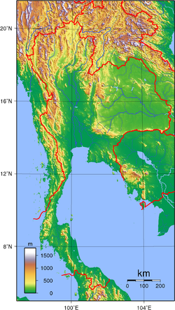 Various regions of Thailand
are prone to seasonal flash-flooding due to their tropical savanna climate
. The floods often occur in the North
and spread down the Chao Phraya River
through the central
plains, in the Northeast along the Chi
and Mun
Rivers flowing into the Mekong
, or in the coastal hillsides of the East
and South
. Remnants of tropical storms that strike Vietnam
or the peninsular south commonly increase precipitation, resulting in further risk of flooding. Drainage control systems, including multiple dams, irrigation canals and flood detention basins, have been implemented, but are inadequate to prevent flood damage, especially to rural areas. A lot of effort, including a system of drainage tunnels begun in 2001, has been put into preventing the enormous flooding of the capital city, which lies near the mouth of the Chao Phraya and is prone to flooding, with considerable success, Bangkok having seen only brief and minor flooding since the major flood of 1995. Other regions, however, have experienced severe flooding as recently as 2010
.
Ominously, rainfall for March over the area of northern Thailand
was an extraordinary 344% above the mean
. Bhumibol Dam
in particular got 242.8 mm of rain, 224.7 mm above the normal 25.2 mm; since 1 January the dam had accumulated 245.9 mm, 216.0 mm or 186% above normal.
made landfall in Northern Vietnam, causing heavy precipitation in Northern and Northeastern Thailand and flash flooding in many provinces beginning 31 July. Within one week thirteen had been reported dead, with ongoing flooding in the provinces of Chiang Mai, Lampang, Lamphun, Mae Hong Son, Nan, Phrae, and Uttaradit in the North, and Bung Kan, Nakhon Phanom, Nong Khai, Sakon Nakhon and Udon Thani in the upper Northeast. The upper-central provinces of Phichit, Phitsanulok, Sukhothai were also flooded as the flooding spread down the overflowing Yom
and Nan
Rivers. Prachuap Khiri Khan on the gulf coast was also affected.
Flooding was still ongoing by late August, as heavy rains were expected to continue further than usual due to the effect of La Niña
. Floodwaters reached 50 cm in downtown Nan
and already became the highest recorded in 16 years in Phitsanulok Province, while large areas in the downstream provinces of Nakhon Sawan, Ang Thong, Ayutthaya and Nakhon Nayok were being increasingly affected and the death toll continued to rise to 37 by 22 August. The Bhumibol
and Sirikit
Dams were increasing discharge rates to compensate for incoming flow.
By 19 September almost all lower central provinces were being affected by flood, i.e. Uthai Thani, Chai Nat, Sing Buri, Ang Thong, Suphan Buri, Ayutthaya, Pathum Thani and Nonthaburi, the last two of which sit on the northern border of Bangkok. Broken floodgates resulted in water from the Chao Phraya flowing through irrigation canals and inundating large areas of paddy fields in Singburi, Ang Thong and Ayutthaya, but lessening the strain on Bangkok as the fields served as water retention areas. Boats were employed to run against the river flow while anchored in an attempt to increase the river's discharge rate.
By the beginning of October, most dams were already near- or over-capacity and being forced to increase their rates of discharge, potentially worsening downstream flooding. Flooding in Ayutthaya worsened as flood water entered the city proper, inundating the Ayutthaya Historical Park
and forcing evacuations. Barriers protecting industrial estates failed, resulting in flooding of dozens of major factories and country-wide disruption of manufacturing supply chains. In Nakhon Sawan
, the sandbag barrier protecting the city was breached, resulting in rapid flooding of the city. Hundreds of patients had to be transferred out of Ayutthaya and Nakhon Sawan Regional Hospitals by boat as water levels rose over the hospital floors and power supplies and life support systems were disrupted.
, and tributaries
Mae Mun
and Mae Chi
, which have all experienced flooding this year. In centrally located Khon Kaen Province
alone, floods destroyed close to 350,000 rai
(56000 hectares; over 200 square miles) of land, stranding 315 families of Mai Si Wilai village in the middle of the swollen Nong Kong Kaew Lake in Chonnabot District, while in Phra Lap municipality on the outskirts of Khon Kaen
city, over 700 displaced residents of Phra Kheu village called the shoulder of a provincial highway home. The provincial Department of Disaster Prevention and Mitigation, normally allocated 50 million Thai baht
, was granted an extra 50 million this year and has spent over 80 million to date.
As flood barriers in Pathum Thani failed, even more industrial estates as well as suburban residential areas became flooded. Parts of the Phahon Yothin Highway leading out of Bangkok became inaccessible, causing severe traffic jams on alternative routes. Disruption of a barrier protecting the Khlong Prapa water supply canal early on 20 October allowed floodwaters to enter the canal and rapidly flow down to Sam Sen in central Bangkok, overflowing and flooding several areas along the banks. Although the breach was controlled, residents panicked and have illegally parked cars on flyovers and parts of the elevated expressway.
The entire Rangsit Campus of Thammasat University
in Pathum Thani, north of Bangkok, serving as the largest evacuation centre, has incurred 2-metre-high inundation. Water forced its final examinations scheduled to be held in the last week of September, and the next semester expected to be started in November, to be postponed for three times. It is announced on November 9 that the the said final examinations are rescheduled to the last week of January, 2012, while the next semester is to begin on and from January 9, 2012.
As the situation continued, several floodgates controlling the Rangsit/Raphiphat canal system became overwhelmed and were forced to release water towards more residential areas. Residents of several districts of Bangkok, especially those bordering Pathum Thani, have been told to prepare for flooding.
The Chao Phraya River
watershed
drains an area of 157924 square kilometres (60,974.8 sq mi). This entire area drains towards Bangkok
and eventually empties into the sea. The Chao Phraya River itself, and pumping stations around Bangkok drain approximately 420000000 square metres (502,315,819.4 sq yd) per day. However, the releases from the dams upstream of Bangkok coupled with additional rainfalls, led to estimates that 16000000000 cubic metres (565,034,659,402.6 cu ft) of flood waters must be drained. This flow that headed toward Bangkok equates to 16 cubic kilometres (3.8 cu mi). Thailand's Royal Irrigation Department predicted, provided there is no new rains, it would take 30 to 45 days for this amount of water to get to the sea.
Until the water flows out to sea, it must go somewhere. This meant flooding in any unprotected low lands. The amount of land inundated, and the height of peak flood waters has been difficult to project for three reasons.
November 27, 2011 - Many neighborhoods in outer Bangkok remained inundated. Residents in flooded areas were coping with stagnant waters that had become breeding grounds for swarms of insects.
November 22nd, 2011 - Siri Suparathit of the Rangsit University Center on Climate Change and Disaster reported steady decreasing levels of flood waters in most areas around Bangkok and that even if the big bag
wall was breached more there "will be no problem". However, an estimated 20 million cubic meters of water per day still overflow from the Chao Phraya river and will keep some areas north of downtown Bangkok flooded into December 2011. '
November 14th and 18th 2011 - More areas of big bag
walls protecting unflooded areas of Bangkok were torn down by up to 2000 residents tired of high flood waters in their area. Jate Sopitpongstorn, advisor to Bangkok's governor, said "It’s a big concern because there is such a large amount of water yet to come in."
November 14th, 2011 - In apparent direct defiance of Prime Minister Yingluck, Don Muang about 200 residents removed more sand bags from a barrier that was described as one of the last lines of defense preventing water from flowing into Bangkok's upper districts.
November 12th, 2011 - Thailand's Prime Minister Yingluck said overall the situation in Bangkok was improving. However, "she declined to say how far the flood water would stray into inner Bangkok and whether the Bangchan Industrial Estate will be safe." This question required more evaluation and that effectiveness of flood control efforts was not a certainty. Drainage in Western Bangkok required more improvement and the coming high tides of mid-November were still a concern.
November 10, 2011 - Public official Chavalit Chatararatt, in a live televised analysis, predicted that Bangkok will be dry by November 20, 2011 provided all conditions are right.
November 10th, 2011 - The Thai Irrigation Department reported Bangkok flood waters could be drained in 11 days. Spokesman Mr Boonsanong dismissed reports the city could be hit by more waters from the North. Floodwater was described as being 1 km from Rama 2 Road and the situation "hard to predict".
November 9th, 2011 - Flooding still had not reached downtown Bangkok, however, yet another dire prediction was made. This one was by Graham Catterwell in The National. While he concedes it is hard to get a clear picture and he hopes flooding will not occur, that a city-wide deluge is inevitable.
According to Catterwell's prediction made November 9th, 2011. Parts of central Eastern Bangkok -- notably (in sequence) Bangkapi, Ramkahhaeng Road, Srinakharin Road, and Phetburi Road -- look sure to be under water by early next week. After Phetburi Road goes under, it will not take long for these waters to flow to Sukhumvit and the rest of downtown Bangkok.
Also on November 9, 2011 Flood Relief Operations Command (FROC) director, Justice Minister Pracha Promnok stated water was moving underground through the city's sewers and he could not say if the heart of the capital and Rama 2 Road would be inundated. Rama 2 Road as of November 9, 2011 was the last remaining route open to Southern Thailand and vital to supply cities with goods made in the Bangkok area.
November 6, 2011 - Khomsan Maleesee, of the KMITL's Faculty of Engineering, stated The promise that the 20 districts in Bangkok that remain dry would not flood was now hardly credible.
Other experts have disagreed however, it is important that disagreements be noted by time and date since opinions may change. On November 1, 2011 flooding in downtown Bangkok was seen as
unlikely according to Dr Anond Snidvongs.
November 8, 2011 - Todd Pitman, writing for the Associated Press reported Top officials and experts have given varying estimates of how much Bangkok would flood and how long the threat would loom over the city.
, appointed early-August, made tours of flood provinces beginning 12 August and assigned cabinet members and members of parliament to visit affected people, pledging support to local administration organisations. The 24/7 Emergency Operation Center for Flood, Storm and Landslide was set up on 20 August under the Disaster Prevention and Mitigation Department of the Ministry of Interior to coordinate warning and relief efforts. The government also allocated extra flood-relief budgets to the affected provinces. The Prime Minister has also pledged to invest in long-term prevention projects, including the construction of drainage canals.
The armed forces have been mobilised to distribute aid to affected people, and civilian groups and organisations are also involved, with volunteers packing sustenance kits and delivering aid to some areas. A Flood Relief Operations Center (FROC) has been set up at Don Mueang Airport to coordinate the delivery of aid, superseding the Emergency Operation Center because it could not exercise adequate authority. The stadium at Rangsit Campus of Thammasat University is serving as a shelter for evacuees, mostly from Ayutthaya. However, many people in the flooded areas are refusing to leave their homes for fear of looting.
China
, Japan
, the Philippines, the United States
, and New Zealand
have pledged support and assistance for relief operations.
On 16 October 2011, the aircraft carrier, as well as several other United States Navy ships were deployed to Thailand to assist in relief work. It was not clear to the US government whether or not the Thai government required US naval assistance due to mixed signals from the Thai government. An anonymous US defense official said that they were "ready to help but we haven't got a request." Then Captain John Kirby of the USS Mustin
, docked at Port Laem Chabang
on a routine visit, said Thailand asked the warship to prolong its stay at the port for up to six days for assistance in aerial surveillance of the extent the flooding; the Pentagon said two Seahawk helicopters aboard would conduct the reconnaissance.
The size and scope of the 2011 flood can, in part, be attributed to the low rainfalls of the 2010 monsoon season. Dam levels hit record lows on June 2010. The evidence shows that early in the season the dams collected large amounts of water building reserves and buffering early flooding. The scale of the rainfalls of 2011 is evidenced by the amount of waters collected behind Bhumibol Dam
. Over 8 billion cubic meters of water were collected in 3 months filling this dam to 100%. Once at capacity, continuing rains forced officials to increase flows from the dams despite increasing flooding and this led to accusations that the dams were mismanaged early in the monsoon season. However, the counter argument is that had the monsoon season for 2011 been short and the dam levels not built, up that even lower levels than 2010 would have been mismanagement too.
As the flooding threat against Bangkok increased, discontent with the government response and the FROC has mounted. The government has been criticised for underestimating the extent of flooding, giving mixed or conflicting information, and not giving adequate warnings. Failure of government units to share data and cooperate have been reported as contributing to the problem. Administers of the FROC and the Bangkok Metropolitan Administration have been criticised for playing politics and refusing to cooperate at the expense of the general population.
Copying the technique suggested by King Bhumibol to help quicken the flow of water through the much shallower Khlong Lad Pho canal, Yingluck placed hundreds of boats in the Chao Phraya River to accelerate the flow and drainage of the basin. Yingluck was criticized for this by Democrat Party spokesman Chavanond Intarakomalyasut, who called the operation a "waste of time" as there were high sea tide at the time. Smith Dharmasarojana, former Director-General of the Meteorological Department and Chairman of the National Disaster Warning Council Foundation, also criticized the operation, claiming that "accelerating boats in the middle of the wide Chao Phraya River is a waste because they propel only the water on the surface." However, others have countered that boats wouldn't move forward unless they propelled water backwards. The middle ground to this dispute is that the overall power of the Chao Phraya River is tremendous compared to the additional power added to it by the engines of the boats.
Sukhumbhand Paribatra, a member of the opposition party to the current government and Democrat Governor of Bangkok, apparently seized the flood as an opportunity to grandstand
and made comments such as "please believe me and only me", and 800,000 sandbags provided by the federal government were of questionable construction. "Once I saw these paper bags I was in shock” he said, refusing the sandbags. In response, the government released photos of the bags, construction details, and suggested that the Governor was perhaps ill-advised by a third party in an attempt to allow him to save some face.
The use of flood barriers has resulted in multiple disputes between people on the different sides; those on the flooded side being angry that they were unfairly affected, and often attempting to sabotage the barriers, sometimes resulting in armed confrontation. Farmers in Phichit Province, among others, fought over the maintenance of sandbag barriers and sluice gates. Residents in areas outlying Bangkok are also dissatisfied that their homes are flooded while Bangkok is being protected. Arguments over the construction of the controversial Kaeng Suea Ten Dam have also risen.
Local resistance to the building and maintenance of flood barriers has disrupted government work in several instances. Residents in some areas have sabotaged barriers and threatened government workers with firearms.
Provinces which have been flooded. The flooding has been estimated to result in decrease 0.6 to 0.9 percent in economic growth. Schools, 1,053 of which have been affected as of 19 September, were forced to end the term early.
Employment has been hurt when factories flooded and workers were laid off or fired. Not all factories are expected to reopen causing significant long term job loss in Central Thailand.
Thailand accounts for about 30 percent of global trade in rice and 25 percent of the main crop is not expected to survive being flooded. On the other side of the world rice farmers in the Arkansas, that usually account for for 42 percent of U.S. output, also were flooded early this year, and then faced drought reducing their crop by 32 percent according to the USDA. Combined, these two events will have a global impact on rice prices for all. Within Thailand, where rice farmers do not typically have much reserve capital, effects on farmers will be felt the greatest since they lost both their investment in the current crop and must wait to earn money when flood waters recede before planting a new one.
Thailand is the world's 2nd largest producer of hard disk drives accounting for approximately 25% of the world's production. Many of the factories that make hard disk drives have been flooded, including Western Digital's
, leading some industry analysts to predict future worldwide shortages of hard disk drives.
For some firms and countries the impact may not be all negative. For example Thailand is a major exporter of seafood and countries like India will have firms that gain as they step to fill in the void.
Tourism numbers had been running higher than 2010 up till the end of October 2011. Arrives at Bangkok's airport were up 6.7 per cent compared to the October 2010 and same month last year, Phuket arrivals were up 28.5 per cent.
The TAT wanted tourists to know tourist destinations such as Chiang Rai
, Chiang Mai
, Mae Hong Son
, Pai
, Kanchanaburi
, Ratchaburi
,Pattaya
, Sattahip, Chonburi
, Chantaburi, Petchburi, Hua Hin
, Cha-Am, Phuket
, Krabi
, Phang Nga
, Surat Thani
, Trang
, Satun
, Hat Yai
, Rayong
, Trat
, Chumphon
, Ranong
, Koh Pha Ngan and Koh Samui had not been affected by flood at all. If a section of Bangkok became temporarily inaccessible, visitors still had other options.
This said, concerns about the ability to continue food supplies to some areas was evident in the papers. Some retailers in Phuket were scrambling in October 2011 to establish alternatives when their regular distribution centers were flooded.
An added concern became even more pressing when it became clear on November 7, 2011 that Rama II Road, the last open link to the South, was expected to flood. To off set this risk, plans were announced to mobilize teams to reclaim Highway 340 that in parts was under up to a meter of water.
Monsoon
Monsoon is traditionally defined as a seasonal reversing wind accompanied by corresponding changes in precipitation, but is now used to describe seasonal changes in atmospheric circulation and precipitation associated with the asymmetric heating of land and sea...
season in Thailand
Thailand
Thailand , officially the Kingdom of Thailand , formerly known as Siam , is a country located at the centre of the Indochina peninsula and Southeast Asia. It is bordered to the north by Burma and Laos, to the east by Laos and Cambodia, to the south by the Gulf of Thailand and Malaysia, and to the...
, most severely in the Chao Phraya
Chao Phraya River
The Chao Phraya is a major river in Thailand, with its low alluvial plain forming the centre of the country. It runs through Bangkok, the capital city, and then empties into the Gulf of Thailand.-Etymology:...
but also in the Mekong River basin. Beginning in late July and continuing for over three months, the floods have caused 602 reported deaths by early November, affected over 2.3 million people, and caused damages estimated at up to 156.7 billion baht (5.1 billion USD) as of 18 October. The flooding has inundated about six million hectares of land, over 300,000 hectares of which is farmland, in 58 provinces, from Chiang Mai
Chiang Mai Province
Chiang Mai is the second-largest province of Thailand, located in the north of the country. Neighboring provinces are Chiang Rai, Lampang, Lamphun, Tak, and Mae Hong Son. In the north it borders Shan State of Burma...
in the North to parts of the capital city of Bangkok
Bangkok
Bangkok is the capital and largest urban area city in Thailand. It is known in Thai as Krung Thep Maha Nakhon or simply Krung Thep , meaning "city of angels." The full name of Bangkok is Krung Thep Mahanakhon Amon Rattanakosin Mahintharayutthaya Mahadilok Phop Noppharat Ratchathani Burirom...
near the mouth of the Chao Phraya. It has been described as "the worst flooding yet in terms of the amount of water and people affected". Seven major industrial estates have been inundated by as much 3 meters (10 feet) and estimated it will be around for 40 days.
Background
Thailand
Thailand , officially the Kingdom of Thailand , formerly known as Siam , is a country located at the centre of the Indochina peninsula and Southeast Asia. It is bordered to the north by Burma and Laos, to the east by Laos and Cambodia, to the south by the Gulf of Thailand and Malaysia, and to the...
are prone to seasonal flash-flooding due to their tropical savanna climate
Tropical savanna climate
Tropical savanna climate or tropical wet and dry climate is a type of climate that corresponds to the Köppen climate classification categories "Aw" and '"As."...
. The floods often occur in the North
Northern Thailand
Thailand's northern region is geographically characterised by multiple mountain ranges which continue from the Shan Hills in bordering Myanmar and Laos, and the river valleys which cut through them...
and spread down the Chao Phraya River
Chao Phraya River
The Chao Phraya is a major river in Thailand, with its low alluvial plain forming the centre of the country. It runs through Bangkok, the capital city, and then empties into the Gulf of Thailand.-Etymology:...
through the central
Central Thailand
Central Thailand is a region of Thailand, covering the broad alluvial plain of the Chao Phraya River. It is separated from North-East Thailand by the Phetchabun mountain range, and another mountain range separates it from Myanmar to the west. In the north it gently changes into the more hilly...
plains, in the Northeast along the Chi
Chi River
The Chi River is the longest river in Thailand; it extends 765 km, but carries less water than the second longest river, the Mun. In the Isan dialect of this region, and also in the adjacent language Lao, the name of the river is actually pronounced "Nam Si" but the transliteration Chi...
and Mun
Mun River
The Mun River , sometimes spelled Moon River, is a tributary of the Mekong river. It carries approximately 21,000 cubic kilometres of water per year.-Geography:...
Rivers flowing into the Mekong
Mekong
The Mekong is a river that runs through China, Burma, Laos, Thailand, Cambodia and Vietnam. It is the world's 10th-longest river and the 7th-longest in Asia. Its estimated length is , and it drains an area of , discharging of water annually....
, or in the coastal hillsides of the East
Eastern Thailand
Eastern Thailand is a region of Thailand bordering Cambodia on the east and Central Thailand on the west.-Geography:Eastern Thailand lies between the Sankamphaeng Range, which forms the border of the Northeastern plateau to the north and the Gulf of Thailand to the south...
and South
Southern Thailand
Southern Thailand is a distinct region of Thailand, connected with the Central region by the narrow Kra Isthmus.-Geography:Southern Thailand is located on the Malay Peninsula, with an area around 70,713 km², bounded to the north by Kra Isthmus as the narrowest part of the peninsula. The...
. Remnants of tropical storms that strike Vietnam
Vietnam
Vietnam – sometimes spelled Viet Nam , officially the Socialist Republic of Vietnam – is the easternmost country on the Indochina Peninsula in Southeast Asia. It is bordered by China to the north, Laos to the northwest, Cambodia to the southwest, and the South China Sea –...
or the peninsular south commonly increase precipitation, resulting in further risk of flooding. Drainage control systems, including multiple dams, irrigation canals and flood detention basins, have been implemented, but are inadequate to prevent flood damage, especially to rural areas. A lot of effort, including a system of drainage tunnels begun in 2001, has been put into preventing the enormous flooding of the capital city, which lies near the mouth of the Chao Phraya and is prone to flooding, with considerable success, Bangkok having seen only brief and minor flooding since the major flood of 1995. Other regions, however, have experienced severe flooding as recently as 2010
2010 Thai floods
The 2010 Thai floods were a series of flash floods that hit different areas in Thailand. Separate but related floods began in the Northeast and Central Thailand early October due to abnormally late monsoon moisture over the Bay of Bengal, overflowed the Chao Phraya where the rivers meet, and...
.
Ominously, rainfall for March over the area of northern Thailand
Northern Thailand
Thailand's northern region is geographically characterised by multiple mountain ranges which continue from the Shan Hills in bordering Myanmar and Laos, and the river valleys which cut through them...
was an extraordinary 344% above the mean
Arithmetic mean
In mathematics and statistics, the arithmetic mean, often referred to as simply the mean or average when the context is clear, is a method to derive the central tendency of a sample space...
. Bhumibol Dam
Bhumibol Dam
The Bhumibol Dam is a concrete arch dam on the Ping River, a tributary of the Chao Phraya River, in Amphoe Sam Ngao district of Tak Province, Thailand. It is located about north of Bangkok and was built for the purposes of water storage, hydroelectric power production, flood control, fisheries...
in particular got 242.8 mm of rain, 224.7 mm above the normal 25.2 mm; since 1 January the dam had accumulated 245.9 mm, 216.0 mm or 186% above normal.
Flooding time line
With the monsoon season well underway in 2011, with noticeable rainfalls started from May, major flooding began as Tropical Storm Nock-tenTropical Storm Nock-ten (2011)
Severe Tropical Storm Nock-ten was a powerful tropical storm which made a total of three landfalls in Southeast Asia wreaking havoc, killing more than 100 people and causing damage worth US$126 million...
made landfall in Northern Vietnam, causing heavy precipitation in Northern and Northeastern Thailand and flash flooding in many provinces beginning 31 July. Within one week thirteen had been reported dead, with ongoing flooding in the provinces of Chiang Mai, Lampang, Lamphun, Mae Hong Son, Nan, Phrae, and Uttaradit in the North, and Bung Kan, Nakhon Phanom, Nong Khai, Sakon Nakhon and Udon Thani in the upper Northeast. The upper-central provinces of Phichit, Phitsanulok, Sukhothai were also flooded as the flooding spread down the overflowing Yom
Yom River
The Yom River is the dime main tributary of the Nan River . The Yom originates in Pong district, Phayao Province, Thailand...
and Nan
Nan River
The Nan River is a river in Thailand. It is one of the most important tributaries of the Chao Phraya River.-Geography:The Nan River originates in Nan Province. The provinces along the river after Nan Province are Uttaradit, Phitsanulok and Phichit. The Yom River joins the Nan River at Chum Saeng...
Rivers. Prachuap Khiri Khan on the gulf coast was also affected.
Flooding was still ongoing by late August, as heavy rains were expected to continue further than usual due to the effect of La Niña
La Niña
La Niña is a coupled ocean-atmosphere phenomenon that is the counterpart of El Niño as part of the broader El Niño-Southern Oscillation climate pattern. During a period of La Niña, the sea surface temperature across the equatorial Eastern Central Pacific Ocean will be lower than normal by 3–5 °C...
. Floodwaters reached 50 cm in downtown Nan
Nan, Thailand
Nan is a town in Northern Thailand. It is located some 668 km north of Bangkok. Its population exceeds 24.000. It is situated in the centre of the province which bears its name, and of which it is the administrative capital. It covers the whole tambon Nai Wiang of Mueang Nan district, an area...
and already became the highest recorded in 16 years in Phitsanulok Province, while large areas in the downstream provinces of Nakhon Sawan, Ang Thong, Ayutthaya and Nakhon Nayok were being increasingly affected and the death toll continued to rise to 37 by 22 August. The Bhumibol
Bhumibol Dam
The Bhumibol Dam is a concrete arch dam on the Ping River, a tributary of the Chao Phraya River, in Amphoe Sam Ngao district of Tak Province, Thailand. It is located about north of Bangkok and was built for the purposes of water storage, hydroelectric power production, flood control, fisheries...
and Sirikit
Sirikit Dam
The Queen Sirikit Dam is an embankment dam on the Nan River, a tributary of the Chao Phraya River, in Uttaradit Province, Thailand. The dam was built for the purpose of irrigation, flood control and hydroelectric power production...
Dams were increasing discharge rates to compensate for incoming flow.
By 19 September almost all lower central provinces were being affected by flood, i.e. Uthai Thani, Chai Nat, Sing Buri, Ang Thong, Suphan Buri, Ayutthaya, Pathum Thani and Nonthaburi, the last two of which sit on the northern border of Bangkok. Broken floodgates resulted in water from the Chao Phraya flowing through irrigation canals and inundating large areas of paddy fields in Singburi, Ang Thong and Ayutthaya, but lessening the strain on Bangkok as the fields served as water retention areas. Boats were employed to run against the river flow while anchored in an attempt to increase the river's discharge rate.
By the beginning of October, most dams were already near- or over-capacity and being forced to increase their rates of discharge, potentially worsening downstream flooding. Flooding in Ayutthaya worsened as flood water entered the city proper, inundating the Ayutthaya Historical Park
Ayutthaya historical park
The Ayutthaya historical park covers the ruins of the old city of Ayutthaya, Thailand, which was founded by King Ramathibodi I in 1350 and was the capital of the country until its destruction by the Burmese army in 1767....
and forcing evacuations. Barriers protecting industrial estates failed, resulting in flooding of dozens of major factories and country-wide disruption of manufacturing supply chains. In Nakhon Sawan
Nakhon Sawan
Nakhon Sawan is a city in Thailand, the name literally means "Heavenly City". The city is the capital of Nakhon Sawan Province, and covers the complete subdistrict Pak Nam Pho and parts of Khwae Yai, Nakhon Sawan Tok, Nakhon Sawan Ok and Wat Sai, all of Mueang Nakhon Sawan district...
, the sandbag barrier protecting the city was breached, resulting in rapid flooding of the city. Hundreds of patients had to be transferred out of Ayutthaya and Nakhon Sawan Regional Hospitals by boat as water levels rose over the hospital floors and power supplies and life support systems were disrupted.
Northeast
Thailand's northeast has three major rivers, the MekongMekong
The Mekong is a river that runs through China, Burma, Laos, Thailand, Cambodia and Vietnam. It is the world's 10th-longest river and the 7th-longest in Asia. Its estimated length is , and it drains an area of , discharging of water annually....
, and tributaries
Tributary
A tributary or affluent is a stream or river that flows into a main stem river or a lake. A tributary does not flow directly into a sea or ocean...
Mae Mun
Mun River
The Mun River , sometimes spelled Moon River, is a tributary of the Mekong river. It carries approximately 21,000 cubic kilometres of water per year.-Geography:...
and Mae Chi
Chi River
The Chi River is the longest river in Thailand; it extends 765 km, but carries less water than the second longest river, the Mun. In the Isan dialect of this region, and also in the adjacent language Lao, the name of the river is actually pronounced "Nam Si" but the transliteration Chi...
, which have all experienced flooding this year. In centrally located Khon Kaen Province
Khon Kaen Province
-History:The first city of the area was established in 1783 when Rajakruluang settled there with 330 people. King Rama I made Rajakruluang the first governor of the area when establishing tighter connections with the Isan area. The main city was moved six times until in 1879 it reached its modern...
alone, floods destroyed close to 350,000 rai
Rai (area)
A rai is a unit of area, equal to 1,600 square metres , used for measuring land area. Its current size is precisely derived from the metre, but is neither part of nor recognized by the modern metric system, the International System ....
(56000 hectares; over 200 square miles) of land, stranding 315 families of Mai Si Wilai village in the middle of the swollen Nong Kong Kaew Lake in Chonnabot District, while in Phra Lap municipality on the outskirts of Khon Kaen
Khon Kaen
Khon Kaen is a city in Isan, Thailand. It is also the capital of Khon Kaen province and the Khon Kaen district.-Geography and demography:Khon Kaen is located in the Khorat Plateau, in the central-northwestern area of Isaan...
city, over 700 displaced residents of Phra Kheu village called the shoulder of a provincial highway home. The provincial Department of Disaster Prevention and Mitigation, normally allocated 50 million Thai baht
Thai baht
The baht is the currency of Thailand. It is subdivided into 100 satang . The issuance of currency is the responsibility of the Bank of Thailand.-History:The baht, like the pound, originated from a traditional unit of mass...
, was granted an extra 50 million this year and has spent over 80 million to date.
South
The drama of the flooding around the Bangkok area and its financial costs captured most of the headlines. However, significant flooding occurred in late 2011 in Thailand's southern provinces. Nine provinces were being affected by flash flooding owing to rains that occurred in November 2011. Saba Yoi, Khuan Niang, Rattaphum and Singha Nakhon districts were declared disaster zones after flood waters covered nearly all areas as high as 5 meters deep. More than 159 small and key roads were impassable. Ten other districts were feared at risk of inundation and more rains were expected. Southern coastal areas were also effected by high waves.Flooding in and around Bangkok
As floodwaters drained southwards from Ayutthaya, Bangkok was becoming seriously threatened by mid-October. In Pathum Thani Province bordering Bangkok to the north, continuous efforts to reinforce and repair sandbag flood walls were undertaken to prevent the Chao Phraya and Rangsit Canals from overflowing into Bangkok. Several districts in eastern Bangkok which lie outside Bangkok's flood wall, as well as parts of the surrounding Nonthaburi, Pathum Thani, Chachoengsao and Nakhon Pathom Provinces, became flooded as water was diverted from the Chao Phraya to the Nakhon Nayok River and outlying canals.As flood barriers in Pathum Thani failed, even more industrial estates as well as suburban residential areas became flooded. Parts of the Phahon Yothin Highway leading out of Bangkok became inaccessible, causing severe traffic jams on alternative routes. Disruption of a barrier protecting the Khlong Prapa water supply canal early on 20 October allowed floodwaters to enter the canal and rapidly flow down to Sam Sen in central Bangkok, overflowing and flooding several areas along the banks. Although the breach was controlled, residents panicked and have illegally parked cars on flyovers and parts of the elevated expressway.
The entire Rangsit Campus of Thammasat University
Thammasat University
Thammasat University , or in brief TU , is Thailand's second oldest university. Officially established on 27 June 1934, the university was originally named by founder Pridi Banomyong, University of Moral Science and Politics , reflecting the political fervor of the time...
in Pathum Thani, north of Bangkok, serving as the largest evacuation centre, has incurred 2-metre-high inundation. Water forced its final examinations scheduled to be held in the last week of September, and the next semester expected to be started in November, to be postponed for three times. It is announced on November 9 that the the said final examinations are rescheduled to the last week of January, 2012, while the next semester is to begin on and from January 9, 2012.
As the situation continued, several floodgates controlling the Rangsit/Raphiphat canal system became overwhelmed and were forced to release water towards more residential areas. Residents of several districts of Bangkok, especially those bordering Pathum Thani, have been told to prepare for flooding.
The Chao Phraya River
Chao Phraya River
The Chao Phraya is a major river in Thailand, with its low alluvial plain forming the centre of the country. It runs through Bangkok, the capital city, and then empties into the Gulf of Thailand.-Etymology:...
watershed
Watershed
-Hydrology and geomorphology:* Watershed: drainage divide - * Watershed: drainage basin - -Medical:* Watershed area , an area with overlapping blood supply...
drains an area of 157924 square kilometres (60,974.8 sq mi). This entire area drains towards Bangkok
Bangkok
Bangkok is the capital and largest urban area city in Thailand. It is known in Thai as Krung Thep Maha Nakhon or simply Krung Thep , meaning "city of angels." The full name of Bangkok is Krung Thep Mahanakhon Amon Rattanakosin Mahintharayutthaya Mahadilok Phop Noppharat Ratchathani Burirom...
and eventually empties into the sea. The Chao Phraya River itself, and pumping stations around Bangkok drain approximately 420000000 square metres (502,315,819.4 sq yd) per day. However, the releases from the dams upstream of Bangkok coupled with additional rainfalls, led to estimates that 16000000000 cubic metres (565,034,659,402.6 cu ft) of flood waters must be drained. This flow that headed toward Bangkok equates to 16 cubic kilometres (3.8 cu mi). Thailand's Royal Irrigation Department predicted, provided there is no new rains, it would take 30 to 45 days for this amount of water to get to the sea.
Until the water flows out to sea, it must go somewhere. This meant flooding in any unprotected low lands. The amount of land inundated, and the height of peak flood waters has been difficult to project for three reasons.
- The exact amount of flood water flowing towards Bangkok was an estimate.
- Flood waters into the Bangkok area don't arrive all at the same time.
- The amount of land area that flood waters can occupy before reaching the sea is variable depending on how well barriers hold.
Time-line of protecting downtown-Bangkok
November 28, 2011 - Downtown-Bangkok appears to have been successfully defended from inundation and flood waters in most areas were draining. This said, residents in areas that remained flooded were growing more impatient. Sandbag walls were being sabotaged and sluice gate levels changed. Residents in some areas were said to be "poised to revolt".November 27, 2011 - Many neighborhoods in outer Bangkok remained inundated. Residents in flooded areas were coping with stagnant waters that had become breeding grounds for swarms of insects.
November 22nd, 2011 - Siri Suparathit of the Rangsit University Center on Climate Change and Disaster reported steady decreasing levels of flood waters in most areas around Bangkok and that even if the big bag
Big Bag
Big Bag was a live action television puppet program for preschoolers that was produced by The Jim Henson Company and aired from 1996 to 1998 on the Cartoon Network. There were also localized versions for Canal J in France and Yorkshire Television in the UK.-Plot:The principle Muppet character was...
wall was breached more there "will be no problem". However, an estimated 20 million cubic meters of water per day still overflow from the Chao Phraya river and will keep some areas north of downtown Bangkok flooded into December 2011. '
November 14th and 18th 2011 - More areas of big bag
Big Bag
Big Bag was a live action television puppet program for preschoolers that was produced by The Jim Henson Company and aired from 1996 to 1998 on the Cartoon Network. There were also localized versions for Canal J in France and Yorkshire Television in the UK.-Plot:The principle Muppet character was...
walls protecting unflooded areas of Bangkok were torn down by up to 2000 residents tired of high flood waters in their area. Jate Sopitpongstorn, advisor to Bangkok's governor, said "It’s a big concern because there is such a large amount of water yet to come in."
November 14th, 2011 - In apparent direct defiance of Prime Minister Yingluck, Don Muang about 200 residents removed more sand bags from a barrier that was described as one of the last lines of defense preventing water from flowing into Bangkok's upper districts.
November 12th, 2011 - Thailand's Prime Minister Yingluck said overall the situation in Bangkok was improving. However, "she declined to say how far the flood water would stray into inner Bangkok and whether the Bangchan Industrial Estate will be safe." This question required more evaluation and that effectiveness of flood control efforts was not a certainty. Drainage in Western Bangkok required more improvement and the coming high tides of mid-November were still a concern.
November 10, 2011 - Public official Chavalit Chatararatt, in a live televised analysis, predicted that Bangkok will be dry by November 20, 2011 provided all conditions are right.
November 10th, 2011 - The Thai Irrigation Department reported Bangkok flood waters could be drained in 11 days. Spokesman Mr Boonsanong dismissed reports the city could be hit by more waters from the North. Floodwater was described as being 1 km from Rama 2 Road and the situation "hard to predict".
November 9th, 2011 - Flooding still had not reached downtown Bangkok, however, yet another dire prediction was made. This one was by Graham Catterwell in The National. While he concedes it is hard to get a clear picture and he hopes flooding will not occur, that a city-wide deluge is inevitable.
According to Catterwell's prediction made November 9th, 2011. Parts of central Eastern Bangkok -- notably (in sequence) Bangkapi, Ramkahhaeng Road, Srinakharin Road, and Phetburi Road -- look sure to be under water by early next week. After Phetburi Road goes under, it will not take long for these waters to flow to Sukhumvit and the rest of downtown Bangkok.
Also on November 9, 2011 Flood Relief Operations Command (FROC) director, Justice Minister Pracha Promnok stated water was moving underground through the city's sewers and he could not say if the heart of the capital and Rama 2 Road would be inundated. Rama 2 Road as of November 9, 2011 was the last remaining route open to Southern Thailand and vital to supply cities with goods made in the Bangkok area.
November 6, 2011 - Khomsan Maleesee, of the KMITL's Faculty of Engineering, stated The promise that the 20 districts in Bangkok that remain dry would not flood was now hardly credible.
Other experts have disagreed however, it is important that disagreements be noted by time and date since opinions may change. On November 1, 2011 flooding in downtown Bangkok was seen as
unlikely according to Dr Anond Snidvongs.
November 8, 2011 - Todd Pitman, writing for the Associated Press reported Top officials and experts have given varying estimates of how much Bangkok would flood and how long the threat would loom over the city.
Mitigation and relief efforts
Centralised flood monitoring and relief operations began in mid-August. Prime Minister Yingluck ShinawatraYingluck Shinawatra
Yingluck Shinawatra , or nickname Pu , is a Thai businesswoman and politician, member of the Pheu Thai Party, and the 28th Prime Minister of Thailand following the 2011 general election...
, appointed early-August, made tours of flood provinces beginning 12 August and assigned cabinet members and members of parliament to visit affected people, pledging support to local administration organisations. The 24/7 Emergency Operation Center for Flood, Storm and Landslide was set up on 20 August under the Disaster Prevention and Mitigation Department of the Ministry of Interior to coordinate warning and relief efforts. The government also allocated extra flood-relief budgets to the affected provinces. The Prime Minister has also pledged to invest in long-term prevention projects, including the construction of drainage canals.
The armed forces have been mobilised to distribute aid to affected people, and civilian groups and organisations are also involved, with volunteers packing sustenance kits and delivering aid to some areas. A Flood Relief Operations Center (FROC) has been set up at Don Mueang Airport to coordinate the delivery of aid, superseding the Emergency Operation Center because it could not exercise adequate authority. The stadium at Rangsit Campus of Thammasat University is serving as a shelter for evacuees, mostly from Ayutthaya. However, many people in the flooded areas are refusing to leave their homes for fear of looting.
China
China
Chinese civilization may refer to:* China for more general discussion of the country.* Chinese culture* Greater China, the transnational community of ethnic Chinese.* History of China* Sinosphere, the area historically affected by Chinese culture...
, Japan
Japan
Japan is an island nation in East Asia. Located in the Pacific Ocean, it lies to the east of the Sea of Japan, China, North Korea, South Korea and Russia, stretching from the Sea of Okhotsk in the north to the East China Sea and Taiwan in the south...
, the Philippines, the United States
United States
The United States of America is a federal constitutional republic comprising fifty states and a federal district...
, and New Zealand
New Zealand
New Zealand is an island country in the south-western Pacific Ocean comprising two main landmasses and numerous smaller islands. The country is situated some east of Australia across the Tasman Sea, and roughly south of the Pacific island nations of New Caledonia, Fiji, and Tonga...
have pledged support and assistance for relief operations.
On 16 October 2011, the aircraft carrier, as well as several other United States Navy ships were deployed to Thailand to assist in relief work. It was not clear to the US government whether or not the Thai government required US naval assistance due to mixed signals from the Thai government. An anonymous US defense official said that they were "ready to help but we haven't got a request." Then Captain John Kirby of the USS Mustin
USS Mustin (DDG-89)
The USS Mustin is an Arleigh Burke-class guided missile destroyer in the United States Navy. She was named in honor of the Mustin family. Mustin was the first Burke destroyer built with her funnels submerged into the superstructure, an additional stealth measure taken on the warships...
, docked at Port Laem Chabang
Laem Chabang
Laem Chabang is a city in Chonburi Province, Thailand. It covers the tambon Bang Lamung of Bang Lamung district, and the complete tambon Bueng, Sura Sak, Thung Su Khla and parts of Nong Kham of Si Racha district...
on a routine visit, said Thailand asked the warship to prolong its stay at the port for up to six days for assistance in aerial surveillance of the extent the flooding; the Pentagon said two Seahawk helicopters aboard would conduct the reconnaissance.
Disputes
On a national level the largest dispute is whether the dams that store waters upstream of Bangkok were mismanaged.The size and scope of the 2011 flood can, in part, be attributed to the low rainfalls of the 2010 monsoon season. Dam levels hit record lows on June 2010. The evidence shows that early in the season the dams collected large amounts of water building reserves and buffering early flooding. The scale of the rainfalls of 2011 is evidenced by the amount of waters collected behind Bhumibol Dam
Bhumibol Dam
The Bhumibol Dam is a concrete arch dam on the Ping River, a tributary of the Chao Phraya River, in Amphoe Sam Ngao district of Tak Province, Thailand. It is located about north of Bangkok and was built for the purposes of water storage, hydroelectric power production, flood control, fisheries...
. Over 8 billion cubic meters of water were collected in 3 months filling this dam to 100%. Once at capacity, continuing rains forced officials to increase flows from the dams despite increasing flooding and this led to accusations that the dams were mismanaged early in the monsoon season. However, the counter argument is that had the monsoon season for 2011 been short and the dam levels not built, up that even lower levels than 2010 would have been mismanagement too.
As the flooding threat against Bangkok increased, discontent with the government response and the FROC has mounted. The government has been criticised for underestimating the extent of flooding, giving mixed or conflicting information, and not giving adequate warnings. Failure of government units to share data and cooperate have been reported as contributing to the problem. Administers of the FROC and the Bangkok Metropolitan Administration have been criticised for playing politics and refusing to cooperate at the expense of the general population.
Copying the technique suggested by King Bhumibol to help quicken the flow of water through the much shallower Khlong Lad Pho canal, Yingluck placed hundreds of boats in the Chao Phraya River to accelerate the flow and drainage of the basin. Yingluck was criticized for this by Democrat Party spokesman Chavanond Intarakomalyasut, who called the operation a "waste of time" as there were high sea tide at the time. Smith Dharmasarojana, former Director-General of the Meteorological Department and Chairman of the National Disaster Warning Council Foundation, also criticized the operation, claiming that "accelerating boats in the middle of the wide Chao Phraya River is a waste because they propel only the water on the surface." However, others have countered that boats wouldn't move forward unless they propelled water backwards. The middle ground to this dispute is that the overall power of the Chao Phraya River is tremendous compared to the additional power added to it by the engines of the boats.
Sukhumbhand Paribatra, a member of the opposition party to the current government and Democrat Governor of Bangkok, apparently seized the flood as an opportunity to grandstand
Grandstand
A grandstand is a large and normally permanent structure for seating spectators, most often at a racetrack. This includes both auto racing and horse racing. The grandstand is in essence like a single section of a stadium, but differs from a stadium in that it does not wrap all or most of the way...
and made comments such as "please believe me and only me", and 800,000 sandbags provided by the federal government were of questionable construction. "Once I saw these paper bags I was in shock” he said, refusing the sandbags. In response, the government released photos of the bags, construction details, and suggested that the Governor was perhaps ill-advised by a third party in an attempt to allow him to save some face.
The use of flood barriers has resulted in multiple disputes between people on the different sides; those on the flooded side being angry that they were unfairly affected, and often attempting to sabotage the barriers, sometimes resulting in armed confrontation. Farmers in Phichit Province, among others, fought over the maintenance of sandbag barriers and sluice gates. Residents in areas outlying Bangkok are also dissatisfied that their homes are flooded while Bangkok is being protected. Arguments over the construction of the controversial Kaeng Suea Ten Dam have also risen.
Local resistance to the building and maintenance of flood barriers has disrupted government work in several instances. Residents in some areas have sabotaged barriers and threatened government workers with firearms.
Issues with car owners
Since the flood had arrived at Pathumthani province, the media presented flood-related news more frequently and made car owners in Bangkok and nearby precincts panic. Many designated car parks were full at that time. Therefore, a lot of them had chosen to park their vehicles on expressways, intersections or anywhere they perceived would not get flooded. This aggravated traffic problems and there were several unreported accidents. No deaths had been reported.Communication deficiencies
One notable error in communications between Thai medias and foreign companies was the lack of information in English. Japan's Toshiba says, "it is critical for the government to provide more accurate flood information and implement long-term prevention measures." The other foreign investors also shared this anxiety. Another notable example of insufficient communication was with Rohm Integrated Systems, one of the largest Japanese semiconductor manufacturers who had a manufacturing plant in Navanakorn. The company received very little information about the flood and could not move critical equipment in time.Damage
The flooding has been described as "the worst flooding yet in terms of the amount of water and people affected". As of 6 November, flooding has affected 3,151,224 people from 1,154,576 families, with 506 deaths and 2 missing persons reported by the 24/7 Emergency Operation Center for Flood, Storm and Landslide (EOC). Damage estimates of at least 185 billion Baht by the latest estimation by Federation of Thai Industry (Central region section) which includes 95 billion Baht damage on Thai industry, 25 billion Baht damage on Thai Agriculture and 65 billion Baht damage on the housing in the communities and suburb villages. A large part of the damage stems from the effect on the manufacturing industry, with 930 factories in 28 provinces affected, including multiple industrial estates in Ayutthaya and Pathum ThaniPathum Thani
Pathum Thani is a town in central Thailand, directly north of Bangkok. It is the capital of the Pathum Thani Province, Thailand as well as the Mueang Pathum Thani district. As of 2005, it has a population of 18,320, covering the complete subdistrict Bang Parok....
Provinces which have been flooded. The flooding has been estimated to result in decrease 0.6 to 0.9 percent in economic growth. Schools, 1,053 of which have been affected as of 19 September, were forced to end the term early.
Employment has been hurt when factories flooded and workers were laid off or fired. Not all factories are expected to reopen causing significant long term job loss in Central Thailand.
Thailand accounts for about 30 percent of global trade in rice and 25 percent of the main crop is not expected to survive being flooded. On the other side of the world rice farmers in the Arkansas, that usually account for for 42 percent of U.S. output, also were flooded early this year, and then faced drought reducing their crop by 32 percent according to the USDA. Combined, these two events will have a global impact on rice prices for all. Within Thailand, where rice farmers do not typically have much reserve capital, effects on farmers will be felt the greatest since they lost both their investment in the current crop and must wait to earn money when flood waters recede before planting a new one.
Damages to industrial estates and global supply shortages
On 8 October 2011 the 10 metre high water blockage in Nikom Rojna industrial estate, which housed many manufacturing plants, had collapsed. The strong current had interfered reconstruction effort and resulted in the whole area being non-operational. One of the major manufacturing plants, Honda, was left virtually inaccessible.Thailand is the world's 2nd largest producer of hard disk drives accounting for approximately 25% of the world's production. Many of the factories that make hard disk drives have been flooded, including Western Digital's
Western Digital
Western Digital Corporation is one of the largest computer hard disk drive manufacturers in the world. It has a long history in the electronics industry as an integrated circuit maker and a storage products company. Western Digital was founded on April 23, 1970 by Alvin B...
, leading some industry analysts to predict future worldwide shortages of hard disk drives.
Impacts of flood on other countries
The economies of other countries besides Thailand will be significantly impacted by the flood. The country that will be hardest hit is Japan. Japanese firms with plants in Thailand include Toyota, Honda, Hitachi, and Canon. One analyst predicted the just the profits of one firm, Toyota, may be cut by , , and this figure is only lost profit. Worker incomes in Thailand and Japan are also impacted.For some firms and countries the impact may not be all negative. For example Thailand is a major exporter of seafood and countries like India will have firms that gain as they step to fill in the void.
Damage to tourism
In early November 2011, the Governor of the Tourism Authority of Thailand (TAT), Suraphon Svetasreni, projected a combined loss as high as $825 million USD owing to reduced international and national tourism. TAT projected that between 220,000 and 300,000 visitors would cancel their trip.Tourism numbers had been running higher than 2010 up till the end of October 2011. Arrives at Bangkok's airport were up 6.7 per cent compared to the October 2010 and same month last year, Phuket arrivals were up 28.5 per cent.
The TAT wanted tourists to know tourist destinations such as Chiang Rai
Chiang Rai
-Demographics:Official Population count: According to the Thailand National Statistical Office, as of September 2010, Chiang Rai municipal district has a population of 199,699...
, Chiang Mai
Chiang Mai
Chiang Mai sometimes written as "Chiengmai" or "Chiangmai", is the largest and most culturally significant city in northern Thailand. It is the capital of Chiang Mai Province , a former capital of the Kingdom of Lanna and was the tributary Kingdom of Chiang Mai from 1774 until 1939. It is...
, Mae Hong Son
Mae Hong Son
Mae Hong Son ) is a town in north west Thailand, capital of the Mae Hong Son Province. It is located in the Shan Hills, near the border with Burma along the banks of the river Pai...
, Pai
Pai
-People:* Pai , includes Konkani region of India name origin, plus people with the name* Pai , includes Chinese name origin, plus people with the name...
, Kanchanaburi
Kanchanaburi
Kanchanaburi ) is a town in the west of Thailand and the capital of Kanchanaburi province. In 2006 it had a population of 31,327...
, Ratchaburi
Ratchaburi
Ratchaburi ) is a town in western Thailand, capital of the Ratchaburi Province. It covers the whole tambon Nai Mueang of Mueang Ratchaburi district. As of 2006 it has a population of 38,208.-External links:*...
,Pattaya
Pattaya
Pattaya is a city in Thailand, located on the east coast of the Gulf of Thailand, about 165 km southeast of Bangkok located within but not part of Amphoe Bang Lamung in the province of Chonburi....
, Sattahip, Chonburi
Chonburi
Chunburi may refer to*Chonburi *Chonburi Province*Amphoe Mueang Chonburi *Chonburi FC...
, Chantaburi, Petchburi, Hua Hin
Hua Hin
Hua Hin is a famous beach resort town in Thailand, in the northern part of the Malay Peninsula, some 200 km south of Bangkok. It has a population of 84,883 in an area of 911 km², and is one of eight districts of the Prachuap Khiri Khan province.Hua Hin is closely associated with the...
, Cha-Am, Phuket
Phuket Province
Phuket , formerly known as Thalang and, in Western sources, Junk Ceylon , is one of the southern provinces of Thailand...
, Krabi
Krabi
Krabi is a town on the west coast of southern Thailand at the mouth of the Krabi River where it empties in Phangnga Bay. As of 2005 the town has a population of 24,986. The town is the capital of Krabi Province and Krabi district...
, Phang Nga
Phang Nga
Phang Nga ) is a town in southern Thailand, capital of the Phang Nga Province. The town covers the whole tambon Thai Chang of Mueang Phang Nga district. As of 2005 it has a population of 9,559 and covers an area of 6.75 km²....
, Surat Thani
Surat Thani
Surat Thani is a city in Amphoe Mueang Surat Thani, Surat Thani Province, southern Thailand. It is the capital of the province Surat Thani. The city has a population of 128,179 , and an area of 68.97 square kilometers. The city's population density is 1,858.47 inhabitants per km².Suran Thani is...
, Trang
Trang
Trang is the capital of Trang Province, Thailand. The city has a population of 59,637 and covers the whole tambon Thap Thiang of Mueang Trang district....
, Satun
Satun
Satun is a town in southern Thailand, capital of the Satun Province. It covers the whole tambon Phiman of Mueang Satun district. As of 2005 it has a population of 21,498....
, Hat Yai
Hat Yai
Hat Yai is a city in southern Thailand near the Malaysian border. Located at , it has a population of 157,359 in the city itself and about 800,000 in the greater Hat Yai area. Hat Yai is the largest city of Songkhla Province, the largest metropolitan area in Southern, and third largest...
, Rayong
Rayong
Rayong is a city located on the shore of the Gulf of Thailand, in the east coast region of Thailand. It is the capital of Rayong Province, and covers the tambon Tha Pradu and Pak Nam and parts of tambon Choeng Noen and Noen Phra, all within Mueang Rayong district...
, Trat
Trat
Trat is a town in Thailand, capital of Trat Province and the Mueang Trat district. The town is located in the east of Thailand, at the mouth of the Trat River, near the border with Cambodia.-Travel and Accommodation:...
, Chumphon
Chumphon
Chumphon is a town in southern Thailand, capital of the Chumphon Province and the Mueang Chumphon district. The city is located about 463 kilometers away from Bangkok...
, Ranong
Ranong
Ranong ) is a town in southern Thailand, capital of the Ranong Province and the Mueang Ranong district. The town covers completely the area of the tambon Khao Niwet . As of 2005 it has a population of 16,163, and has town status .The town is located at the estuary of the Pak Chan River, opposite...
, Koh Pha Ngan and Koh Samui had not been affected by flood at all. If a section of Bangkok became temporarily inaccessible, visitors still had other options.
This said, concerns about the ability to continue food supplies to some areas was evident in the papers. Some retailers in Phuket were scrambling in October 2011 to establish alternatives when their regular distribution centers were flooded.
An added concern became even more pressing when it became clear on November 7, 2011 that Rama II Road, the last open link to the South, was expected to flood. To off set this risk, plans were announced to mobilize teams to reclaim Highway 340 that in parts was under up to a meter of water.
Sanitation concerns
Effects of the trash and sewage within the waters are expected to peak when waters subside leaving behind stagnant pools of water. A spokesman for UNICEF encouraged everyone to stay out of the waters as much as possible. Since a household sanitation system won't operate under flood water, individuals that remained in flooded areas, both exposed themselves to risks, and increased the risks for those living downstream by continuing to generate more sewage and trash in waters carried downstream.See also
- 2010 Thai floods2010 Thai floodsThe 2010 Thai floods were a series of flash floods that hit different areas in Thailand. Separate but related floods began in the Northeast and Central Thailand early October due to abnormally late monsoon moisture over the Bay of Bengal, overflowed the Chao Phraya where the rivers meet, and...
- 2011 Southeast Asian floods2011 Southeast Asian floodsThe 2011 monsoon season saw record flooding in Thailand, Cambodia and Myanmar and heavy flooding in Vietnam. The Philippines was hit by Typhoon Nesat in September, which was followed shortly after by Typhoon Nalgae. Meanwhile, Laos also sustained flood damage. Unrelated to the northern floods,...
- 2011 Southern Thailand floods