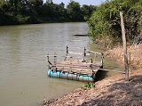
Chi River
Encyclopedia
The Chi River is the longest river
in Thailand
; it extends 765 km, but carries less water than the second longest river, the Mun
. In the Isan
dialect of this region, and also in the adjacent language Lao, the name of the river is actually pronounced "Nam Si" (sīː) but the transliteration Chi reflects Bangkok-Thai.
The river rises in the Phetchabun mountains
, then runs east through the central Isan provinces of Chaiyaphum
, Khon Kaen
and Maha Sarakham
, and turns south in Roi Et
, running through Yasothon
to meet the Mun in Kanthararom district
of Sisaket Province
. The river carries approximately 9,300 cubic kilometres of water per annum. It is riddled with leeches.
The river was an 18th century migration route for the expansion of the ethnic Lao people over the Isan plateau (a history recorded and remembered, largely in terms of the struggle to expand wet-rice cultivation in the river valley), who are now regarded as a separate ethnos
from the Lao to the North or the central Thai to the South-West.
River
A river is a natural watercourse, usually freshwater, flowing towards an ocean, a lake, a sea, or another river. In a few cases, a river simply flows into the ground or dries up completely before reaching another body of water. Small rivers may also be called by several other names, including...
in Thailand
Thailand
Thailand , officially the Kingdom of Thailand , formerly known as Siam , is a country located at the centre of the Indochina peninsula and Southeast Asia. It is bordered to the north by Burma and Laos, to the east by Laos and Cambodia, to the south by the Gulf of Thailand and Malaysia, and to the...
; it extends 765 km, but carries less water than the second longest river, the Mun
Mun River
The Mun River , sometimes spelled Moon River, is a tributary of the Mekong river. It carries approximately 21,000 cubic kilometres of water per year.-Geography:...
. In the Isan
Isan
Isan is the northeastern region of Thailand. It is located on the Khorat Plateau, bordered by the Mekong River to the north and east, by Cambodia to the southeast and the Prachinburi mountains south of Nakhon Ratchasima...
dialect of this region, and also in the adjacent language Lao, the name of the river is actually pronounced "Nam Si" (sīː) but the transliteration Chi reflects Bangkok-Thai.
The river rises in the Phetchabun mountains
Phetchabun Mountains
The Phetchabun mountains are a mountain range in Thailand.-Geography:It extends in a roughly north-south direction, and separates the broad Chao Phraya river valley of central Thailand from the Khorat Plateau of northeast Thailand...
, then runs east through the central Isan provinces of Chaiyaphum
Chaiyaphum Province
Chaiyaphum is one of the north-eastern provinces of Thailand. Neighboring provinces are Khon Kaen, Nakhon Ratchasima, Lopburi and Phetchabun.- Etymology :...
, Khon Kaen
Khon Kaen Province
-History:The first city of the area was established in 1783 when Rajakruluang settled there with 330 people. King Rama I made Rajakruluang the first governor of the area when establishing tighter connections with the Isan area. The main city was moved six times until in 1879 it reached its modern...
and Maha Sarakham
Maha Sarakham Province
Maha Sarakham is one of the provinces of Thailand, located in the northeastern region of Thailand. Neighboring provinces are Kalasin, Roi Et, Surin, Buriram and Khon Kaen....
, and turns south in Roi Et
Roi Et Province
Roi Et is one of the provinces of Thailand, located in the North-East of Thailand. Neighboring Provinces are Kalasin, Mukdahan, Yasothon, Sisaket, Surin and Maha Sarakham....
, running through Yasothon
Yasothon Province
Yasothon is one of the provinces of Thailand, located in the North-East of Thailand on the Chi River. Neighboring provinces are Mukdahan, Amnat Charoen, Ubon Ratchathani, Sisaket and Roi Et.-Geography:...
to meet the Mun in Kanthararom district
Amphoe Kanthararom
Kanthararom is a district in the northeastern part of Sisaket Province, northeastern Thailand.-History:The district was established in 1897, then named Uthai Sisaket . It was renamed to Kanthararom in 1913...
of Sisaket Province
Sisaket Province
Sisaket , is one of the north-eastern provinces of Thailand. Neighboring provinces are Surin, Roi Et, Yasothon and Ubon Ratchathani. To the south it borders Oddar Meancheay and Preah Vihear of Cambodia.-Geography:...
. The river carries approximately 9,300 cubic kilometres of water per annum. It is riddled with leeches.
The river was an 18th century migration route for the expansion of the ethnic Lao people over the Isan plateau (a history recorded and remembered, largely in terms of the struggle to expand wet-rice cultivation in the river valley), who are now regarded as a separate ethnos
Ethnos
Ethnos may refer to:*Ethnic group*Ethnos...
from the Lao to the North or the central Thai to the South-West.

