
1980 Pacific hurricane season
Encyclopedia
The 1980 Pacific hurricane season was an ongoing event in tropical cyclone
meteorology. This season may be described through a series of negatives: no one was killed; no damage was inflicted; and no tropical cyclones made landfall. Indeed, this season is mostly notable due to a lack of notable tropical cyclones.
The season officially started May 15, 1980 in the eastern Pacific, and June 1, 1980 in the central Pacific, and lasted until November 30, 1980. These dates conventionally delimit the period of each year when most tropical cyclones form in the northeastern and central Pacific Ocean
. However, due to an early system that crossed in from the western Pacific, this season actually began in April.
Excluding the storm that entered from the western Pacific basin and an unnamed tropical depression, fourteen tropical storms and hurricanes formed. This total is slightly below the long-term average. All eastern Pacific systems this year formed in the eastern Pacific proper.
during 1980, one was a tropical depression, eight were tropical storms, and seven were hurricanes, of which three were major hurricanes of Category or higher on the Saffir-Simpson Hurricane Scale
. Of these systems, all except one tropical storm formed east of 140°W in the eastern Pacific proper. These totals are below the long term average of fifteen tropical storms, nine hurricanes, and four major hurricanes. Two tropical cyclones existed in the central Pacific, both of which crossed in from other tropical cyclone basins. This total is below the average of four or five tropical cyclones per year.
relinquished responsibility to the Central Pacific Hurricane Center
. Carmen soon came nearly to a standstill and dissipated April 8.
Tropical Storm Carmen caused no deaths or damages in the Central Pacific Hurricane Center's area of responsibility
. It is the strongest April tropical cyclone in the central Pacific by virtue of being the only one to occur in that month. In addition, it was the first northern hemisphere tropical cyclone to cross the dateline from west to east since Tropical Storm Virginia in 1968.
developed a circulation and organized into a tropical depression on June 9. Later that day, it slowly edged north and intensified into a tropical storm. Agatha then went to the west northwest, and intensified into a hurricane. Agatha peaked in windspeed on June 12. After that, it slowly weakened, becoming a tropical storm on June 13 and a tropical depression on June 14. Agatha dissipated the next day. Agatha did not come near land and caused no casualties or damage.
developed a circulation and was designated Tropical Storm Blas, skipping the depression stage. Blas headed northwest, and intensified, peaking in windspeed on June 16. The cyclone then steadily weakened, and dissipated on June 19, twelve hours after weaking into a tropical depression. Blas stayed well away from land and caused no known impact.
. Celia weakened into a tropical storm on June 28, a depression on June 29, and dissipated just after that. It remnants remained, and cloudiness and moisture associated with the cyclone were carried into the Continental United States by an upper-level trough
.
Those remnants clouds and moisture brought rain to Santa Barbara County, California
on the last two days of June. Other than that, Celia caused no impact.
and the northern part of the Baja California Peninsula
, but in the end never approached land. Hence, Howard caused no impact.
at the time.
became a tropical storm on October 28. It headed northeast and approached the coast of Mexico. However, an area of high wind shear and cool waters destroyed the cyclone on October 29, before it could reach the coast. Newton was the tropical cyclone that came closest to making landfall
this season. No impact was reported.
. This was the first time these names were used since the modern lists began.
The central Pacific used names and numbers from the western Pacific's typhoon list. No names were required, as Carmen was named in the western Pacific.
Tropical cyclone
A tropical cyclone is a storm system characterized by a large low-pressure center and numerous thunderstorms that produce strong winds and heavy rain. Tropical cyclones strengthen when water evaporated from the ocean is released as the saturated air rises, resulting in condensation of water vapor...
meteorology. This season may be described through a series of negatives: no one was killed; no damage was inflicted; and no tropical cyclones made landfall. Indeed, this season is mostly notable due to a lack of notable tropical cyclones.
The season officially started May 15, 1980 in the eastern Pacific, and June 1, 1980 in the central Pacific, and lasted until November 30, 1980. These dates conventionally delimit the period of each year when most tropical cyclones form in the northeastern and central Pacific Ocean
Pacific Ocean
The Pacific Ocean is the largest of the Earth's oceanic divisions. It extends from the Arctic in the north to the Southern Ocean in the south, bounded by Asia and Australia in the west, and the Americas in the east.At 165.2 million square kilometres in area, this largest division of the World...
. However, due to an early system that crossed in from the western Pacific, this season actually began in April.
Excluding the storm that entered from the western Pacific basin and an unnamed tropical depression, fourteen tropical storms and hurricanes formed. This total is slightly below the long-term average. All eastern Pacific systems this year formed in the eastern Pacific proper.
Season summary
The 1980 Pacific hurricane season began on April 5, 1980 with the crossing of the dateline by Tropical Storm Carmen and ended with the dissipation of Tropical Depression Newton on October 29. Of the sixteen tropical cyclones that in the eastern north Pacific OceanPacific Ocean
The Pacific Ocean is the largest of the Earth's oceanic divisions. It extends from the Arctic in the north to the Southern Ocean in the south, bounded by Asia and Australia in the west, and the Americas in the east.At 165.2 million square kilometres in area, this largest division of the World...
during 1980, one was a tropical depression, eight were tropical storms, and seven were hurricanes, of which three were major hurricanes of Category or higher on the Saffir-Simpson Hurricane Scale
Saffir-Simpson Hurricane Scale
The Saffir–Simpson Hurricane Scale , or the Saffir–Simpson Hurricane Wind Scale , classifies hurricanes — Western Hemisphere tropical cyclones that exceed the intensities of tropical depressions and tropical storms — into five categories distinguished by the intensities of their sustained winds...
. Of these systems, all except one tropical storm formed east of 140°W in the eastern Pacific proper. These totals are below the long term average of fifteen tropical storms, nine hurricanes, and four major hurricanes. Two tropical cyclones existed in the central Pacific, both of which crossed in from other tropical cyclone basins. This total is below the average of four or five tropical cyclones per year.
Tropical Storm Carmen
A tropical low strengthened into a tropical depression just after crossing the dateline into the western Pacific. It was designated Tropical Depression 02. It strengthened into Tropical Storm Carmen as it moved generally northwards. It soon recurved and entered the Central Pacific on April 5, and the Joint Typhoon Warning CenterJoint Typhoon Warning Center
The Joint Typhoon Warning Center is a joint United States Navy – United States Air Force task force located at the Naval Maritime Forecast Center in Pearl Harbor, Hawaii...
relinquished responsibility to the Central Pacific Hurricane Center
Central Pacific Hurricane Center
The Central Pacific Hurricane Center of the United States National Weather Service is the official body responsible for tracking and issuing tropical cyclone warnings, watches, advisories, discussions, and statements for the Central North Pacific Basin...
. Carmen soon came nearly to a standstill and dissipated April 8.
Tropical Storm Carmen caused no deaths or damages in the Central Pacific Hurricane Center's area of responsibility
Area of responsibility
Area Of Responsibility is a pre-defined geographic region assigned to a Combatant commanders of the Unified Command Plan , that are used to define an area with specific geographic boundaries where they have the authority to plan and conduct operations; for which a force, or component commander...
. It is the strongest April tropical cyclone in the central Pacific by virtue of being the only one to occur in that month. In addition, it was the first northern hemisphere tropical cyclone to cross the dateline from west to east since Tropical Storm Virginia in 1968.
Hurricane Agatha
A disturbance southwest of Clipperton IslandClipperton Island
Clipperton Island is an uninhabited nine-square-kilometre coral atoll in the eastern Pacific Ocean, southwest of Mexico and west of Central America, at...
developed a circulation and organized into a tropical depression on June 9. Later that day, it slowly edged north and intensified into a tropical storm. Agatha then went to the west northwest, and intensified into a hurricane. Agatha peaked in windspeed on June 12. After that, it slowly weakened, becoming a tropical storm on June 13 and a tropical depression on June 14. Agatha dissipated the next day. Agatha did not come near land and caused no casualties or damage.
Tropical Storm Blas
A disturbance south-southwest of AcapulcoAcapulco
Acapulco is a city, municipality and major sea port in the state of Guerrero on the Pacific coast of Mexico, southwest from Mexico City. Acapulco is located on a deep, semi-circular bay and has been a port since the early colonial period of Mexico’s history...
developed a circulation and was designated Tropical Storm Blas, skipping the depression stage. Blas headed northwest, and intensified, peaking in windspeed on June 16. The cyclone then steadily weakened, and dissipated on June 19, twelve hours after weaking into a tropical depression. Blas stayed well away from land and caused no known impact.
Tropical Depression Three-E
A disturbance south of Acapulco developed into a tropical depression on June 17. It moved northwest and then west, and never strengthened much. The tropical cyclone dissipated on June 19 after moving over cooler waters. It caused no known impact.Hurricane Celia
A disturbance moving west-northwestward organized into a tropical depression on June 25. It quickly became a tropical storm. Celia intensified into a hurricane on June 26 and peaked in intensity from June 26 to June 28. Celia then curved to the northwest as it wheeled around the edge of a ridgeRidge (meteorology)
A ridge is an elongated region of relatively high atmospheric pressure, the opposite of a trough....
. Celia weakened into a tropical storm on June 28, a depression on June 29, and dissipated just after that. It remnants remained, and cloudiness and moisture associated with the cyclone were carried into the Continental United States by an upper-level trough
Trough (meteorology)
A trough is an elongated region of relatively low atmospheric pressure, often associated with fronts.Unlike fronts, there is not a universal symbol for a trough on a weather chart. The weather charts in some countries or regions mark troughs by a line. In the United States, a trough may be marked...
.
Those remnants clouds and moisture brought rain to Santa Barbara County, California
Santa Barbara County, California
Santa Barbara County is a county located in the southern portion of the U.S. state of California, on the Pacific coast. As of 2010 the county had a population of 423,895. The county seat is Santa Barbara and the largest city is Santa Maria.-History:...
on the last two days of June. Other than that, Celia caused no impact.
Tropical Storm Darby
On July 1, a westward-moving disturbance located to the southwest of Acapulco organized into a tropical depression. The next day, it intensified into a tropical storm as it briefly jogged to the north. Darby peaked in wind speed just after that. It then weakened into a depression on July 3 and dissipated later that day. Darby did not affect land, hence causing neither casualties or damage.Tropical Storm Estelle
An area of disturbed weather developed gale-force winds and a cyclonic circulation, and was upgraded directly to tropical storm status on July 12. Estelle's winds peaked in velocity just after that. The cyclone then steadily weakened as it curved to the west northwest. Estelle dissipated on July 13. Estelle did not affect land. No damage or casualties were attributed to this tropical cyclone.Tropical Storm Frank
A tropical disturbance northeast of Clipperton organized into a tropical depression on July 18. Heading northwestwards, it intensified into a tropical storm on July 20. Frank reached its maximum wind speed shortly after that. The cyclone then turned to the west and gradually weakened, dissipating on July 22. No reports of damage or casualties were attributed to Tropical Storm Frank.Hurricane Georgette
A tropical disturbance southwest of Acapulco became a tropical depression on July. The cyclone headed northwest. It intensified into a tropical storm on July 29. That same day, Georgette was briefly a hurricane. The cyclone turned to the west and weakened, dissipating on July 31. Georgette did not affect land. Consequently, it caused no known impact.Hurricane Howard
A tropical disturbance south of Acapulco developed into a tropical depression on July 31. It headed west, and then gradually curved to the northwest as it paralleled the coast of Mexico. The cyclone became a storm shortly after forming, a hurricane on August 2, and peaked in windspeed on August 4. It then steadily weakened after that, and dissipated over cool waters shortly after becoming a tropical depression on August 7. Howard threatened the coasts of Southern CaliforniaSouthern California
Southern California is a megaregion, or megapolitan area, in the southern area of the U.S. state of California. Large urban areas include Greater Los Angeles and Greater San Diego. The urban area stretches along the coast from Ventura through the Southland and Inland Empire to San Diego...
and the northern part of the Baja California Peninsula
Baja California Peninsula
The Baja California peninsula , is a peninsula in northwestern Mexico. Its land mass separates the Pacific Ocean from the Gulf of California. The Peninsula extends from Mexicali, Baja California in the north to Cabo San Lucas, Baja California Sur in the south.The total area of the Baja California...
, but in the end never approached land. Hence, Howard caused no impact.
Hurricane Isis
A tropical disturbance south of Acapulco developed into a tropical depression on August 5 and a tropical storm the next day. Isis headed generally west northwest and peaked as a Category 2 hurricane on August 8. Isis then weakened, becoming a tropical storm on August 10, turning to the west, and dissipating the next day. Isis never affected land, and for that reason it was responsible for no casualties or damage.Hurricane Javier
An area of disturbed weather south of the Gulf of Tehuantepec became a tropical depression on August 22 and a storm the next day. Javier became a hurricane on August 24, and peaked as a major hurricane on August 25. Javier then weakened, becoming a tropical storm on August 27 and a storm the next day. It dissipated on August 29, having moved west-northwest for almost its entire life. Hurricane Javier had no impact on land. Consequently, no one was killed and nothing was damaged by this hurricane.Hurricane Kay
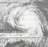
A tropical disturbance south of Acapulco developed into a tropical depression on September 16 and a tropical storm later that day. Kay headed in an irregular but generally west-northwest path out to sea. Kay strengthened into a hurricane on September 17. It continued strengthening and reached its peak as a Category 4 hurricane on the Saffir-Simpson Hurricane Scale on September 18. Kay then slowly weakened, and was a tropical storm by September 20. Kay's forward motion slowed as it neared the central Pacific. It restrengthened into a hurricane on September 23, and crossed 140°W and entered the Central Pacific Hurricane Center's area of responsibility the next day. Kay executed a small anticyclonic loop, and then began weakening again. It became a tropical storm again on September 27, and a depression two days later. The cyclone dissipated on September 30 while located north of the Hawaiian Islands. Kay had no effect on land, causing no damage or casualties. It was the strongest tropical cyclone of the season at 140 mph (63 m/s). Kay lasted for 14.5 days, enough to make it the fifth-longest lasting Pacific hurricanePacific hurricane
A Pacific hurricane or tropical storm is a tropical cyclone that develops in the northeastern part of the Pacific Ocean. For organizational purposes, the northern Pacific Ocean is divided into three regions: the eastern, , central , and western...
at the time.
Tropical Storm Lester
A westward-moving disturbance south of Acapulco strengthened into a tropical depression on September 21. Continuing on its path, it intensified into Tropical Storm Lester on September 23. Lester's motion then slowed down, and it spun about in the open ocean until it dissipated on September 25, having never affected land.Tropical Storm Madeline
A disturbance east of Clipperton became a tropical depression and then a tropical storm. It headed northwest and weakened into a depression on October 12. It dissipated shortly after that. Because Tropical Storm Madeline did not come near land, it caused no known damages or casualties.Tropical Storm Newton
An area of disturbed weather southeast of Socorro IslandSocorro Island
Socorro Island is a small volcanic island in the Revillagigedo Islands, a Mexican possession lying some 600 kilometers off the country's western coast at 18°48'N, 110°59'W. The size is 16.5 by 11.5 km, with an area of 132 km².- Geology :...
became a tropical storm on October 28. It headed northeast and approached the coast of Mexico. However, an area of high wind shear and cool waters destroyed the cyclone on October 29, before it could reach the coast. Newton was the tropical cyclone that came closest to making landfall
Landfall (meteorology)
Landfall is the event of a tropical cyclone or a waterspout coming onto land after being over water. When a waterspout makes landfall it is reclassified as a tornado, which can then cause damage inland...
this season. No impact was reported.
1980 storm names
The following names were used for named storms that formed in the eastern Pacific in 1980. No names were retired, so it was used again in the 1986 season1986 Pacific hurricane season
The 1986 Pacific hurricane season was less active than the 1985 Pacific hurricane season. It officially started May 15, 1986 in the eastern Pacific, and June 1, 1986 in the central Pacific, and lasted until November 30, 1986. These dates conventionally delimit the period of each year when almost...
. This was the first time these names were used since the modern lists began.
|
|
|
The central Pacific used names and numbers from the western Pacific's typhoon list. No names were required, as Carmen was named in the western Pacific.
See also
- List of Pacific hurricanes
- List of Pacific hurricane seasons
- 1980 Atlantic hurricane season1980 Atlantic hurricane seasonThe 1980 Atlantic hurricane season officially began on June 1, 1980, and lasted until November 30, 1980. These dates conventionally delimit the period of each year when most tropical cyclones form in the Atlantic basin. The season was fairly active, with eleven storms forming, of which nine reached...
- 1980 Pacific typhoon season1980 Pacific typhoon seasonThe 1980 Pacific typhoon season has no official bounds; it ran year-round in 1980, but most tropical cyclones tend to form in the northwestern Pacific Ocean between June and December. These dates conventionally delimit the period of each year when most tropical cyclones form in the northwestern...
- 1980 North Indian Ocean cyclone season
- Southern Hemisphere tropical cyclone seasons: 1979–80, 1980–81