
1898 Atlantic hurricane season
Encyclopedia
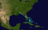
The 1898 Atlantic hurricane season ran through the summer and the first half of fall in 1898. The season was a fairly active one, with 11 storms forming, 5 of which became hurricanes.
. It crossed the state, and strengthened in the northeastern Gulf of Mexico to an 80 mph (128 km/h) hurricane. It went into Alabama and dissipated on August 3, causing flooding and minor damage.
At Port Royal, South Carolina
, this storm caused 10.82 in (275 mm) of rain over the course of a day, breaking the previous one-day record by 5.89 in (150 mm).
.
on September 12. It tracked northwestward, and hit the Yucatán Peninsula with 60 mph (97 km/h) winds. Later, the storm traveled north. It hit Louisiana
on September 20 with 60 mph (97 km/h) winds and dissipated over Illinois
on September 22.
on September 20. It followed a path similar to the fifth storm, tracking northwestward and hitting the Yucatán Peninsula with 60 mph (97 km/h) winds. Later, it traveled north. The system hit Texas
on September 28, and dissipated shortly thereafter.
, Georgia and northeast Florida with 135 mph (217 km/h) winds, causing heavy damage amounting to around $2.5 million, and 179 casualties. It dissipated after winding its way through Alabama, Tennessee, Kentucky, Indiana, Michigan, southern Canada, part of Maine and Newfoundland on October 6. , this is the last major hurricane to make landfall
in Georgia.
Hurricane One
The first storm of the season formed on August 2 east of FloridaFlorida
Florida is a state in the southeastern United States, located on the nation's Atlantic and Gulf coasts. It is bordered to the west by the Gulf of Mexico, to the north by Alabama and Georgia and to the east by the Atlantic Ocean. With a population of 18,801,310 as measured by the 2010 census, it...
. It crossed the state, and strengthened in the northeastern Gulf of Mexico to an 80 mph (128 km/h) hurricane. It went into Alabama and dissipated on August 3, causing flooding and minor damage.
Hurricane Two
The next storm formed off the northern coast of Florida on August 30. It hit near the border of South Carolina and Georgia with 85 mi/h winds, and dissipated on September 1, causing $400,000 in damage (1898 dollars).At Port Royal, South Carolina
Port Royal, South Carolina
Port Royal is a town in Beaufort County, South Carolina, United States. Largely because of annexation of surrounding areas , the population of Port Royal rose from 3,950 in 2000 to 10,678 in 2010, a 170% increase. As defined by the U.S...
, this storm caused 10.82 in (275 mm) of rain over the course of a day, breaking the previous one-day record by 5.89 in (150 mm).
Hurricane Three
A hurricane was first observed on September 3 over the northeastern Atlantic, likely having existed for several days prior. It headed northeastward, and became extratropical on September 5 north of the AzoresAzores
The Archipelago of the Azores is composed of nine volcanic islands situated in the middle of the North Atlantic Ocean, and is located about west from Lisbon and about east from the east coast of North America. The islands, and their economic exclusion zone, form the Autonomous Region of the...
.
Hurricane Four
The next storm formed on September 5 off the coast of Africa. It moved westward and hit the Lesser Antilles with 110 mi/h winds, where it caused heavy damage across the islands. The hurricane turned to the north, remaining a hurricane until becoming extratropical on September 19 near Newfoundland. The hurricane caused $2.5 million in damage and 383 deaths.Tropical Storm Five
The fifth storm formed over the western Caribbean SeaCaribbean Sea
The Caribbean Sea is a sea of the Atlantic Ocean located in the tropics of the Western hemisphere. It is bounded by Mexico and Central America to the west and southwest, to the north by the Greater Antilles, and to the east by the Lesser Antilles....
on September 12. It tracked northwestward, and hit the Yucatán Peninsula with 60 mph (97 km/h) winds. Later, the storm traveled north. It hit Louisiana
Louisiana
Louisiana is a state located in the southern region of the United States of America. Its capital is Baton Rouge and largest city is New Orleans. Louisiana is the only state in the U.S. with political subdivisions termed parishes, which are local governments equivalent to counties...
on September 20 with 60 mph (97 km/h) winds and dissipated over Illinois
Illinois
Illinois is the fifth-most populous state of the United States of America, and is often noted for being a microcosm of the entire country. With Chicago in the northeast, small industrial cities and great agricultural productivity in central and northern Illinois, and natural resources like coal,...
on September 22.
Tropical Storm Six
The sixth storm formed over the western Caribbean SeaCaribbean Sea
The Caribbean Sea is a sea of the Atlantic Ocean located in the tropics of the Western hemisphere. It is bounded by Mexico and Central America to the west and southwest, to the north by the Greater Antilles, and to the east by the Lesser Antilles....
on September 20. It followed a path similar to the fifth storm, tracking northwestward and hitting the Yucatán Peninsula with 60 mph (97 km/h) winds. Later, it traveled north. The system hit Texas
Texas
Texas is the second largest U.S. state by both area and population, and the largest state by area in the contiguous United States.The name, based on the Caddo word "Tejas" meaning "friends" or "allies", was applied by the Spanish to the Caddo themselves and to the region of their settlement in...
on September 28, and dissipated shortly thereafter.
Hurricane Seven
The seventh storm formed to the east of the Lesser Antilles on September 25 and traveled northwest, reaching 110 mph (177 km/h) winds but sparing the islands. On the 2nd, it hit Cumberland IslandCumberland Island
Cumberland Island is one of the Sea Islands. Cumberland is the largest in terms of continuously exposed land area of Georgia's barrier islands. It is located on the Atlantic Ocean off the coast of the U.S. state of Georgia and is part of Camden County...
, Georgia and northeast Florida with 135 mph (217 km/h) winds, causing heavy damage amounting to around $2.5 million, and 179 casualties. It dissipated after winding its way through Alabama, Tennessee, Kentucky, Indiana, Michigan, southern Canada, part of Maine and Newfoundland on October 6. , this is the last major hurricane to make landfall
Landfall (meteorology)
Landfall is the event of a tropical cyclone or a waterspout coming onto land after being over water. When a waterspout makes landfall it is reclassified as a tornado, which can then cause damage inland...
in Georgia.
Tropical Storm Eight
The eighth storm formed in the Western Caribbean, crossing to the northeast across Cuba, and dissipated over the Bahamas. It formed on September 25 and dissipated on September 28.Tropical Storm Nine
A tropical wave forms into a tropical depression on October 2 with winds of 45 MPH. The storm moved across Cuba causing minor flooding and crop damage killing 2,then nearly struck Florida.It then moved to the North Eastern sea and dissipated October 14.Tropical Storm Ten
The 10th storm of the season followed a path similar to the 8th storm, forming in the West Caribbean, crossing Cuba, and dissipating over the Bahamas. This storm lasted from October 21 to October 23Tropical Storm Eleven
The final storm of the season formed over the Northern Lesser Antilles on October 27 and took a nearly straight-lined path to the west, hitting the Yucatán Peninsula with 60 mph (97 km/h) winds, and disintegrated soon after on November 4.See also
- List of tropical cyclones
- List of Atlantic hurricane seasons